The West Rim trail begins at Lava Point or the West Rim Trailhead, and makes a great day hike or multi-day backpacking adventure. While most of the trail is level or downhill, it still makes for a rather grueling and lengthy trip.
Elevation gain – 3,600 feet (Heading North)
Duration (book time) – 9-12 hours
Distance – 16.2 miles from Lava Point to the Grotto (15 miles if starting from the West Rim Trailhead)
Difficulty – Strenuous
Trailhead ( Start point) – Begin at Lava Point or the West Rim Trailhead
Trailhead (End point) – End at the Grotto Trailhead (the 6th stop for the Zion Canyon Shuttle in Zion’s main canyon)
Seasons – Spring through fall. Access to Lava Point is typically blocked by snow in winter.
Trail Map
 View the entire map PDF here.
Do I need a permit to hike the West Rim trail?
No permit is needed when done as a day hike. All backpacking and overnight hiking trips require a permit.
Hike Features
Lava Point – The Lava Point Campground is located on the bluff above the trailhead. It is considered to be a ‘primitive’ campground and offers beautiful views of the Cedar Breaks National Monument to the north and endless canyons of Zion to the south.
Potato Hollow – The northernmost authorized camping area along the West Rim Trail. When starting at Lava Point, Potato Hollow is most popular for hikers or backpackers to come across. There is abundant wildlife in the area, so be respectful of their drinking supply.
Cabin Spring (West Rim Spring) – The southernmost authorized camping area along the West Rim Trail and is a heavily wooded section. It is the southern tip of the Horse Pasture Plateau, a formation that stretches all the way north to Lava Point, featuring canyons and valleys.
Little Siberia – This valley is known to have ice and snow even during the middle of summer. During the winter months it is dangerous and often considered impassable even with equipment.
Grotto Trailhead – The trail begins across the river from the Grotto Picnicking Area. It begins on mostly level terrain, and switchbacks until you reach Refrigerator Canyon. A water source is available here as well as the shuttle system that visitors can take to the park’s main entrance.
Camping and Overnight Hiking Options
Camping along the West Rim Trail is permitted only in the 9 designated campsites. For all multi-day hikes, you must acquire a wildness permit prior to your trip.
Campsite #1 – This is the only campsite along the Telephone Canyon Trail. Cabin Spring is only a short walk away, and there’s excellent views of the northern regions of Zion. The maximum group size for this site is 12 and is available for walk-up permit only.
Campsite #2 – This campsite is a small, secluded site near Cabin Spring. The maximum group size for this site is 2 and reservations are made online.
Campsite #3 – This site is approximately one mile from Cabin Spring and has great views. The maximum group size for this site is a group of 4 and is available for walk-up permit only.
Campsite #4 – This site is a larger one with excellent views of the deep canyons. The maximum group size for this site is 12 and reservations can be made online.
Campsite #5: This site is roughly 2 miles from Cabin Spring and offers great scenic views from both north and south. The maximum group size for this site is 4 and is available on a walk-up basis only.
Campsite #6 – This site is nearby the Telephone Canyon and the West Rim Trail, and is the last site before entering the Potato Hollow. The maximum group size for this site is 6 and reservations can be made online.
Campsite #7 – The perfect site for campers who wish to sleep out under the stars, site #7 provides fabulous views of the night sky! The site is just a few minutes walk from Potato Hollow Spring (which is not a reliable source of water). This site has a maximum group size of 4 and is available on a walk-up basis only.
Campsite #8 – This campsite is located behind Potato Hollow Spring and has great views to the east. The maximum group size for this site is 6 and reservations can be made online.
Campsite #9 – This site can be accessed from the West Rim trail to “Sawmill Spring”. This site is highly secluded and has maximum group size of 6, available on a walk-up basis only.
Water Sources
Cabin Spring: The spring is located at an elevation of 6,736′ and is nearby campsites #1 and #2 towards the edge of the canyon rim. A small pool from the ground usually has year-round water flow.
Sawmill Springs: The Sawmill spring is located at an elevation of 7,173′ and is nearby campsite #9 along with the West Rim Trailhead. There are a few small pools from the ground that usually dry up by early to mid summer. Not a reliable water source
Directions
Getting to Zion National Park:
From the North: Travel I-15 south, past Beaver. exit on Hwy 20. Follow US-89 to Mount Carmel Junction. Take SR-9 to Zion’s east entrance.
From the South: Travel I-15 north. Take exit 16 and travel through Hurricane to LaVerkin. Continue on SR-9 to the south entrance of the park. SR-9 through the Zion-Mt. Carmel Highway.
Additional Photos
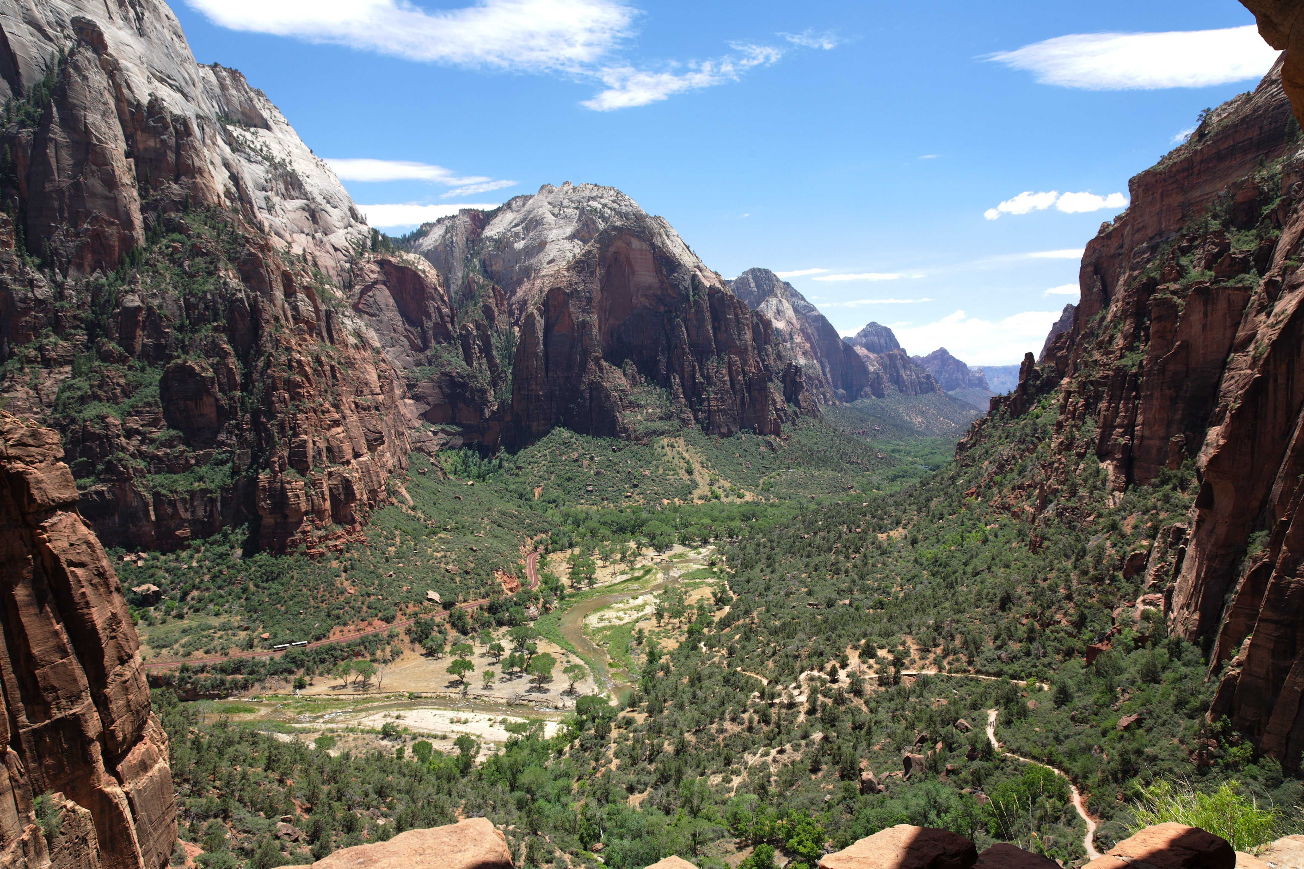
Photo credit: Michael W.
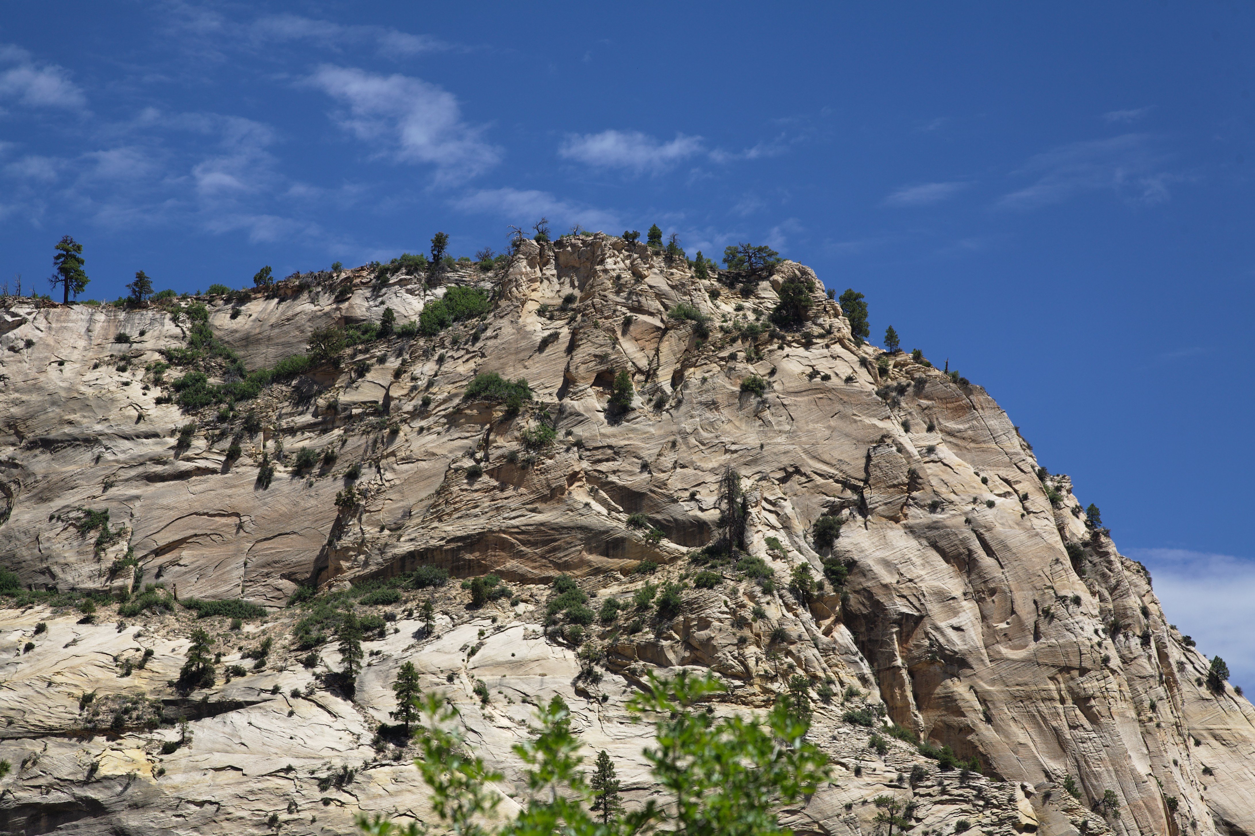
Photo credit: Michael W.

Andrea is a writer, hiker, and adventurer from New England. She enjoys snowboarding, sunrise hikes, winter, night hiking, traveling, and photography.