Arthur’s Rock is a beautiful hike located in Lory State Park in Fort Collins, Colorado. This is one of the more popular hikes in Fort Collins due to the close proximity to town, easy to intermediate ascent, and fantastic views. Below is all the information you’ll need to get out there and have a great time.
Distance – 3.4 miles round trip (5.47 km)
Height – 6,746 feet (2,056.22 m)
Elevation gain – 1,155 feet (352.0 m)
Duration – 2 to 3 hours (book time)
Difficulty – Intermediate
Dogs?: Allowed
Seasons – Year-round (caution and experience needed in winter – see below)
Trailhead Location – Arthur’s Rock Trailhead – Lory State Park – (directions below)
Trail Map
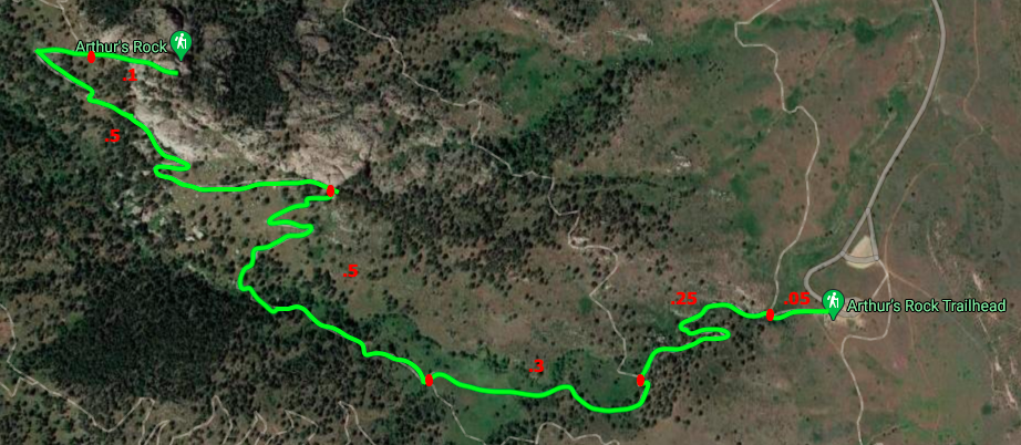
Arthur’s Rock Trail Map
Lory State Park Trails & Map
If you want to see the Lory State Park trail map with routes and descriptions, as well as a map of the Howard Trail and other options, check it out here.. We also included an image at the bottom of this post.
Trails
Arthur’s Rock Trail: 3.4 Miles Round Trip | 1,155 Feet Elevation Gain
This is the most common route up Arthur’s Rock and begins at the Arthur’s Rock Trailhead parking (directions below). This lot is open year round, and can fit quite a number of cars.
The trail is well marked, easy to follow. Hikers begin by quickly entering a small canyon where a gorgeous small waterfall resides during certain months.
Around .5 miles in, hikers will reach the Howard Trail junction. Another route that will take you to Arthur’s Rock. Stay on the Arthur’s Rock Trail (marked by sign).
Hikers will experience switchbacks and a few relatively steep sections on this hike. During cold weather months, ice build up can occur, which is why we highly recommend bringing microspikes for traction.
Howard Trail: 4.6 Miles Round Trip
This trail is often used for hikers that want to return a different way from Arthur’s Rock summit. It is a little bit longer, but also a well traveled and easy trail to follow. This loop will be just about 4.2 miles if they decide to do both Arthur’s Rock Trail and the Howard Trail.
Howard Trail & Arthurs Rock Trail Loop | 4.2 Miles Round Trip
Many hikers choose to ascend the Arthur’s Rock Trail and descend the Howard trail to add a little mileage and change the scenery a bit.
Hiking in Winter
This is a fantastic winter hike. Though significantly less popular in winter months, it is still very well traveled. Even during warm times, the well traveled trail often results in packed down ice and snow. Winter traction is highly recommended. Microspikes are your best option here. Slipping and falling on this trail is extremely common due to the icy conditions and many unprepared hikers. A little extra traction will go a long way.
Camping Information
Lory State Park has plenty of Backcountry campsites, including near Arthur’s Rock. Campers will need to acquire a backcountry permit, and a parking pass to do so. More information on Lory State Park camping can be found here: https://cpw.state.co.us/placestogo/parks/Lory/Pages/Fees.aspx
Current weather conditions:
Here is the detailed weather forecast for the next few days.
Laporte, CO
Overnight
A chance of snow showers. Cloudy, with a low around 28. East southeast wind around 5 mph. Chance of precipitation is 30%. New snow accumulation of less than half an inch possible. Little or no ice accumulation expected.
Friday
A chance of snow showers before 1pm, then a chance of rain and snow showers. Mostly cloudy. High near 43, with temperatures falling to around 40 in the afternoon. Northeast wind 3 to 10 mph, with gusts as high as 16 mph. Chance of precipitation is 50%. Little or no snow accumulation expected.
Friday Night
Rain and snow showers. Cloudy, with a low around 30. East wind 6 to 9 mph. Chance of precipitation is 80%. New snow accumulation of 2 to 4 inches possible.
Saturday
Snow showers likely before 1pm, then a chance of rain and snow showers. Cloudy, with a high near 44. East wind around 8 mph. Chance of precipitation is 60%. New snow accumulation of around one inch possible.
Saturday Night
Mostly cloudy, with a low around 31. South southeast wind 2 to 8 mph.
Sunday
A slight chance of rain showers after noon. Mostly sunny, with a high near 67. Chance of precipitation is 20%.
Sunday Night
A chance of rain showers. Mostly cloudy, with a low around 43. Chance of precipitation is 30%.
Directions & Parking
This trailhead is accessible year round. The road leading up to the trailhead is a well maintained dirt road within Lory State Park. This is an extremely popular hike, so parking can fill up. Hikers will need to park at the nearest parking lot if the lot is full.
Parking Permits
Parking permits are required. Individuals can purchase day passes (Currently $8), or year passes when entering the park area. Information on this can be found on the Lory State Park website: https://cpw.state.co.us/placestogo/parks/Lory
Directions to Arthur’s Rock Trailhead in Lory State Park:
Additional Pictures
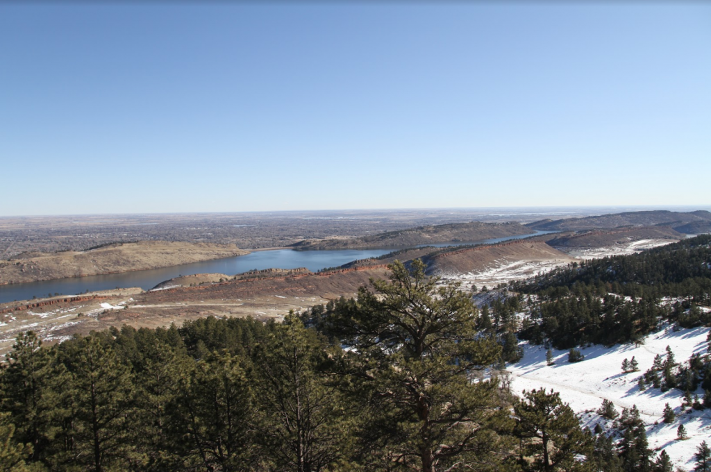
Views from Arthur’s Rock
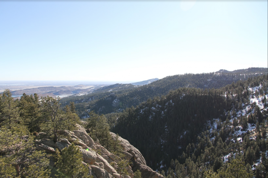
Arthurs Rock Summit Views
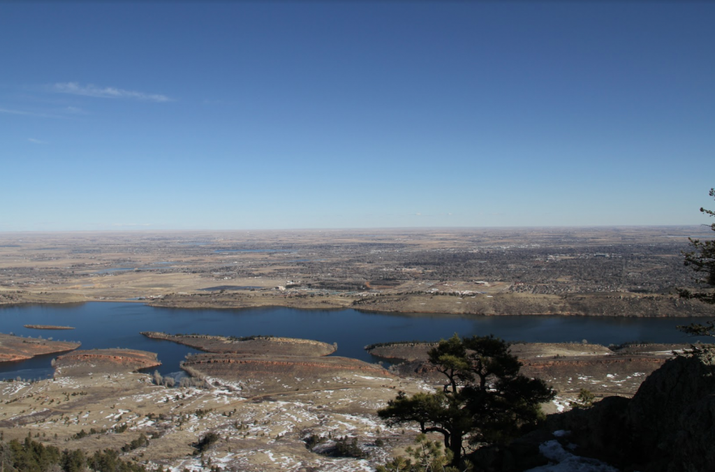
Horsetooth Reservoir From Arthur’s Rock
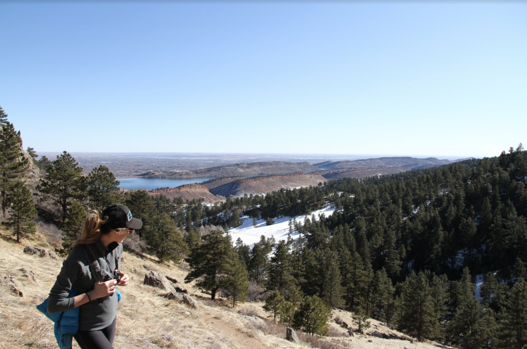
Arthur’s Rock Trail Views

Max DesMarais is the founder of hikingandfishing.com. He has a passion for the outdoors and making outdoor education and adventure more accessible. Max is a published author for various outdoor adventure, travel, and marketing websites. He is an experienced hiker, backpacker, fly fisherman, backcountry skier, trail runner, and spends his free time in the outdoors. These adventures allow him to test gear, learn new skills, and experience new places so that he can educate others. Max grew up hiking all around New Hampshire and New England. He became obsessed with the New Hampshire mountains, and the NH 48, where he guided hikes and trail runs in the White Mountains. Since moving out west, Max has continued climbed all of the Colorado 14ers, is always testing gear, learning skills, gaining experience, and building his endurance for outdoor sports. You can read more about his experience here: hikingandfishing/about