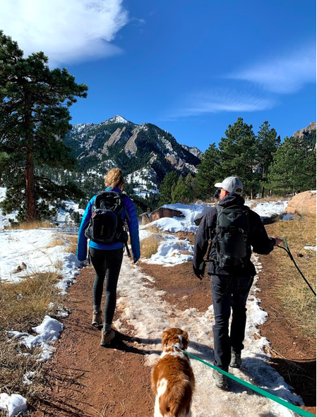
Bear Peak is a fantastic mountain hike in Boulder, Colorado that offers stunning 360 degree views with an exposed summit. While the trail is often considered medium-hard, it provides a fun day hike that is extremely popular among runners, hikers, and weekend warriors. Leashed dogs are welcome to join on this hike!
There are various ways to make your way up this mountain. We have maps highlighting some of the most popular routes so you can choose the best path for you.
Height: 8,352 feet (2,549.7 meters)
Distance: 8.1 miles (13.0 km)
Elevation Gain: 2,847 (867.7 meters)
Difficulty: Moderate-Difficult
Duration: 4-6 hours
Trail Maps

Bear Peak Trail Map – South Mesa Trail – Shanahan Mesa Trail
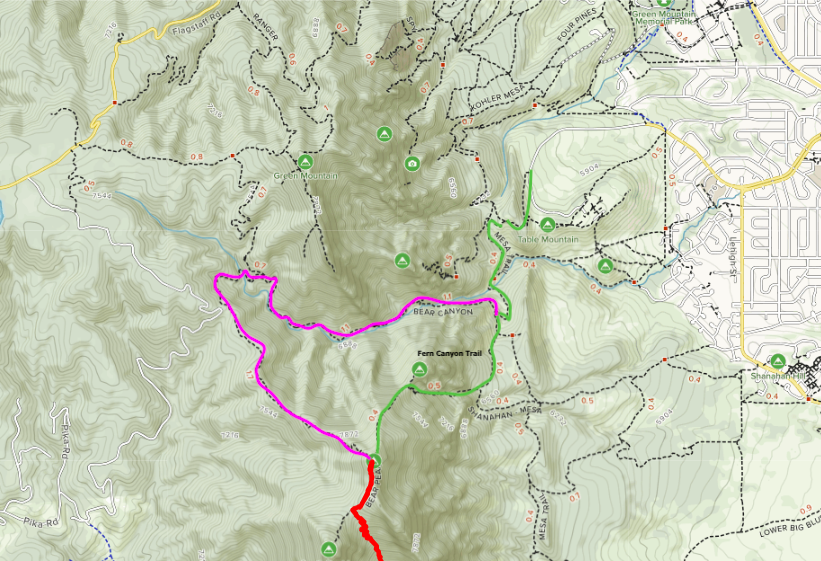
Bear Canyon, Fern Canyon Trail Map
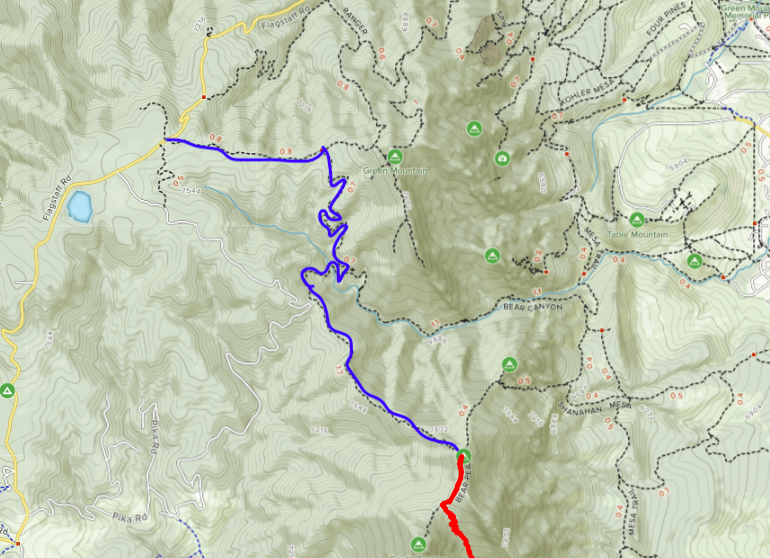
Bear Peak West Ridge Trail Map
Trails
Bear Canyon Trail “The Classic”– 8.1 Miles Round Trip (Loop) – 2,847 Feet Elevation Gain
This peak begins at the National Center for Atmospheric Research (NCAR), which is the same starting location to hike the NCAR Ramble Trail, Mesa trail, Bear Canyon, Fern Canyon, Green Bear and several other popular hikes in the Boulder area.
The trail begins as a well maintained path heading west on the NCAR trail until meeting up with the Mesa trail. Turn left (south) and continue onto the Mesa trail where you will hike through a forest and over a small bridge. Afterwards, you will make a right turn onto Fern Canyon trail which is where you will begin the bulk of the elevation gain- first the Fern Canyon trail will contain several switchbacks and moderate elevation gain, but it will progress into a straight and steep rise in elevation until you reach the summit. Here, you have the option to climb a rock scramble to get 360 degree views, but do not worry- the view below the scramble is worth the hike up!
To return to the NCAR area parking lot, begin the rocky descent in Bear Peak West Ridge where you will walk down the ridge to Bear Creek. Continue onto Bear Canyon trail which will lead you to Mesa Trail, over the small bridge where the Mesa Trail (which will have an increase in elevation for a short period of time) will lead you back to the NCAR trail. Finally, take the NCAR trail back to the NCAR parking area and your car!
Bear Canyon and Bear West Ridge Ascent (Counter-Clockwise) – 8.1 miles – 2,847 Feet Elevation Gain
You can complete this loop the other direction, however this route is longer on the ascent and steeper on the descent which will be more impactful on the knees.
If you are interested in hiking both Bear Peak and South Boulder Peak by the Shanahan North Fork, Fern Canyon and Mesa trails it will be an 8 mile loop with 3,353 feet of elevation gain.
This route is highlighted in Blue on trail maps.
Green West Ridge Trail – 9 miles – 2,100 Feet Elevation Gain
This is a less traveled approach. Hikers often choose this starting point if also looking to summit Green Mountain. Though this approach is longer in mileage, it has less cumulative elevation gain.
Begin at Green Mountain West Ridge Trailhead, and avoid private property signs. After 0.9 miles, turn right (south) onto Green Bear Trail. 1.5 miles later, make a right turn to Bear Peak West Ridge.
Continue on Bear Peak West Ridge for 2 miles to the summit.
South Mesa Approach – 8.2 miles
This approach is about the same length as the most popular route from the Bear Canyon and Fern Canyon trails.
Begin at South MesaTrailhead on Mesa Trail. This route is highlighted in red on trail maps.
Weather Forecast
Here is a detailed forecast for the area in the next four days.
Eldorado Springs, CO
Overnight
A chance of snow showers. Mostly cloudy, with a low around 21. North northeast wind around 2 mph. Chance of precipitation is 30%. New snow accumulation of less than half an inch possible. Little or no ice accumulation expected.
Friday
A slight chance of snow showers before noon, then snow showers likely and a slight chance of thunderstorms. Mostly cloudy. High near 33, with temperatures falling to around 29 in the afternoon. North wind 3 to 9 mph. Chance of precipitation is 60%. New snow accumulation of less than one inch possible.
Friday Night
Snow and a slight chance of thunderstorms. Cloudy, with a low around 25. Northeast wind 3 to 8 mph. Chance of precipitation is 90%. New snow accumulation of 4 to 8 inches possible.
Saturday
Snow likely before noon, then a chance of snow showers. Cloudy, with a high near 33. Northeast wind around 6 mph. Chance of precipitation is 70%. New snow accumulation of 1 to 2 inches possible.
Saturday Night
Mostly cloudy, with a low around 27. Southwest wind around 6 mph.
Sunday
Sunny, with a high near 54.
Sunday Night
Partly cloudy, with a low around 39.
Hiking in winter
Because this hike features exposed hiking above tree-line near the summit, it is essential to bring the proper winter hiking equipment. Also, due to the buildup of ice and snow in the final rock summit, it is recommended that only experienced hikers attempt the final descent. Simply be cautious and make good decisions.
Directions
NCAR Trailhead
West Ridge Trail
South Mesa Trail
Additional Pictures
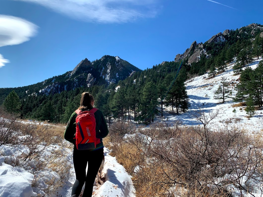
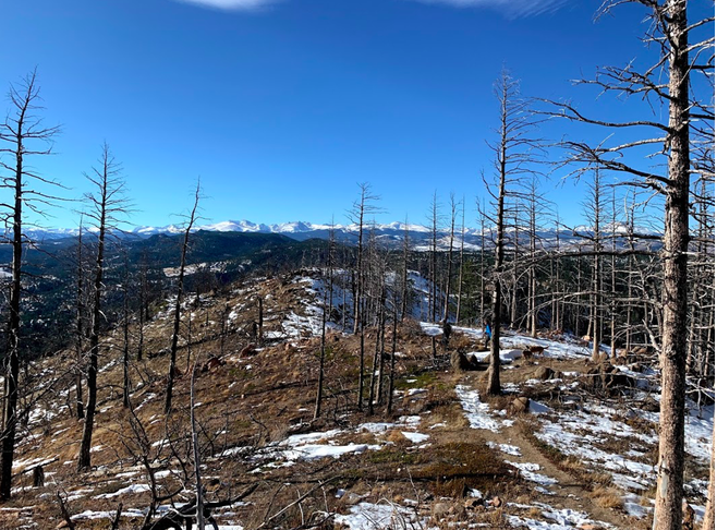
Trail Views Heading Towards Bear Peak
Bear Peak Views
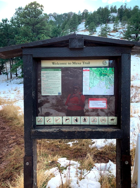
Bear Peak Trailhead
Bear Peak Trail Views
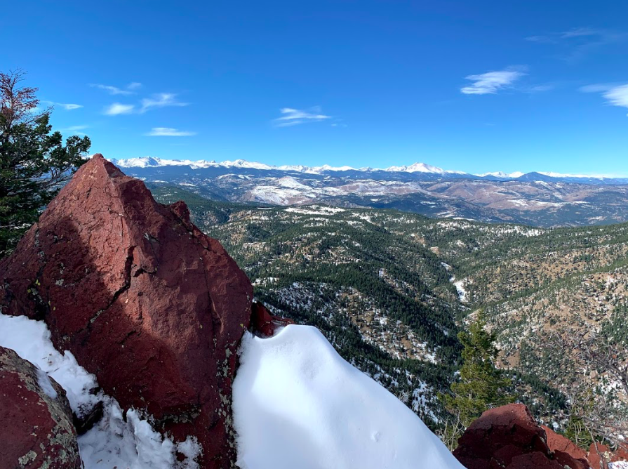
Bear Peak Summit Views

Max DesMarais is the founder of hikingandfishing.com. He has a passion for the outdoors and making outdoor education and adventure more accessible. Max is a published author for various outdoor adventure, travel, and marketing websites. He is an experienced hiker, backpacker, fly fisherman, backcountry skier, trail runner, and spends his free time in the outdoors. These adventures allow him to test gear, learn new skills, and experience new places so that he can educate others. Max grew up hiking all around New Hampshire and New England. He became obsessed with the New Hampshire mountains, and the NH 48, where he guided hikes and trail runs in the White Mountains. Since moving out west, Max has continued climbed all of the Colorado 14ers, is always testing gear, learning skills, gaining experience, and building his endurance for outdoor sports. You can read more about his experience here: hikingandfishing/about