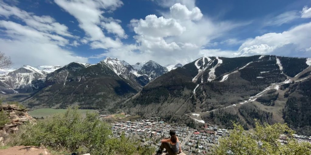
In Telluride, a common saying goes, “You come for the winter and stay for the summer.”
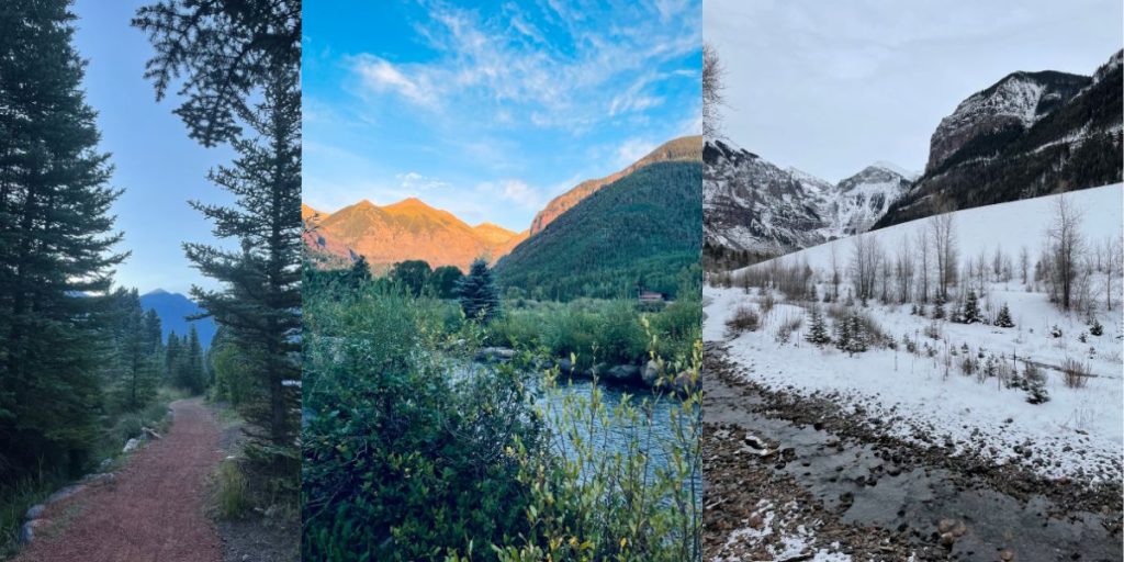
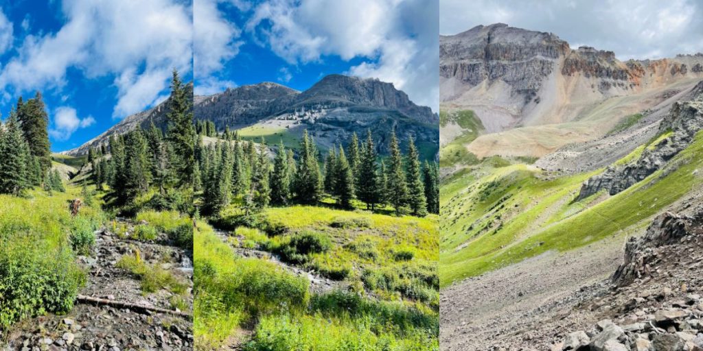
Summer in Telluride, Colorado, is an explosion of color with cool mornings and afternoon showers. It’s a playground for mountain biking singletrack, climbing in the Box Canyon at sunset, and hiking to high alpine lakes.
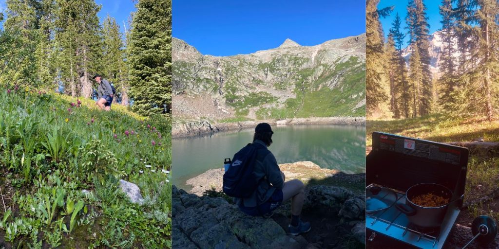
The best time to hike in Telluride is July through September when wildflowers bloom and eventually, the Aspen leaves turn into golden hues.
Here are the best Telluride hikes for everyone:
Easy Hikes in Telluride
San Miguel River Trail
Elevation Gain: 393 feet (120 meters)
Distance: 6.6 miles (10.6 kilometers)
Duration: 2 hours
Type: Out & Back
Trailhead: 37.935203, -107.812720
The River Trail winds along the San Miguel River through the town of Telluride. Following the river, the trail extends east to the Conoco Gas Station and west to the Pandora Mill. Telluride’s River Trail is a local favorite for running, winter hiking, and morning coffee strolls.
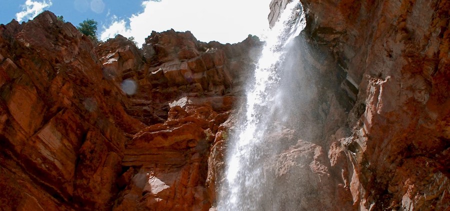
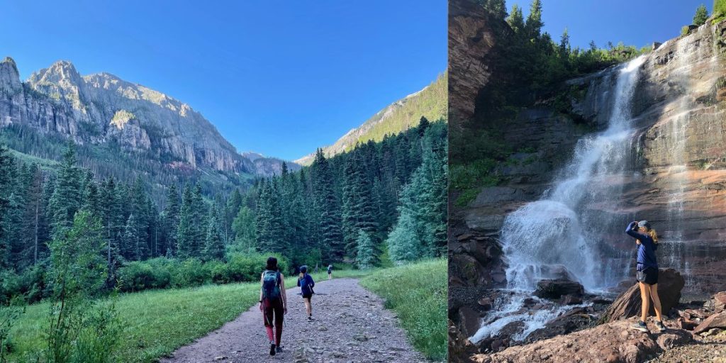
Cornet Creek Falls Trail
Elevation Gain: 301 feet (92 meters)
Roundtrip Distance: 0.6 miles (1 kilometer)
Duration: 30 minutes
Type: Out & Back
Trailhead: 37.940694, -107.812563
A short walk from Aspen Street lies the 80-foot Cornet Creek waterfall. The trail is a short scramble on loose rock and soil, where Telluride hikers find a refreshing waterfall and stunning views of the Telluride Ski Resort across the valley.
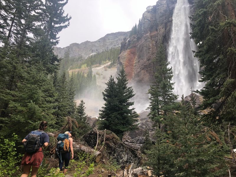
Bridal Veil Falls Trail
Elevation Gain: 826 feet (252 meters)
Roundtrip Distance: 2.0 miles (3.2 kilometers)
Duration: 1-2 hours
Type: Out & Back
Trailhead: 37.928726, -107.776908
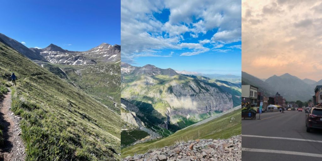
Did you know Telluride is home to the tallest free-falling waterfall in Colorado? Bridal Veil Falls is 365 feet high and towers over the Box Canyon. You can see it anywhere from town. The newly created trail by the Telluride Mountain Club allows hikers to bypass the switchbacks on Black Bear Pass. Bridal Veil Falls is a must-do hike in Telluride, plus it’s an access point for other beautiful hikes near Telluride.
Intermediate Hikes in Telluride
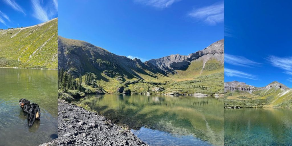
Bridal Veil Falls Trail to Blue Lake Trail
Elevation Gain: 2,669 feet (814 meters)
Roundtrip Distance: 7.7 miles (12.4 kilometers)
Duration: 3-5 hours
Type: Out & Back
Lower Trailhead: 37.928726, -107.776908
Beyond Bridal Veil Falls is Bridal Veil Basin. Bridal Veil Basin is an outlet to hiking trails, abandoned mines, and high alpine lakes like Blue Lake. Blue Lake is a tucked-away treasure in the San Juan Mountains. Some hikers wake up early before the crowds and park at the top of Bridal Veil Falls, but if you plan to drive, make sure you have a high-clearance vehicle and prepare for the dangerous switchbacks. Most hikers park by the Bridal Veil Falls trailhead and hike the additional two miles.
Bear Creek Trail
Elevation Gain: 1,092 feet (333 meters)
Roundtrip Distance: 4.5 miles (7.2 kilometers)
Duration: 2 hours
Type: Out & Back
Trailhead: 37.9343, -107.8119
A popular day hike in Telluride is Bear Creek Trail. Its gradual incline heads deeper into Bear Creek through Aspen and Pine groves. A portion of the trail forges through an old avalanche path, a reminder of just how powerful avalanches are. Eventually, hikers find the waterfalls they hear miles before. It’s a perfect trail for families, runners, and anyone acclimating to the elevation.
Jud Wiebe Trail
Elevation Gain: 1,213 feet (375 meters)
Roundtrip Distance: 3.1 miles (5 kilometers)
Duration: 2 hours
Type: Loop
Trailhead: 37.9412, -107.8124
The Jud is a Telluride staple with relatively short mileage and sweeping views of Bridal Veil Falls, Telluride, Telluride Ski Resort, and even down valley. Regardless of where you begin, Tomboy Road or Aspen Street, prepare for a strenuous first mile. The best time to hike the Jud Wiebe Trail is early morning with the rising sun or in the fall when the Aspens turn Telluride into a perpetual golden hour.
Hope Lake Trail
Elevation Gain: 1,515 feet (462 meters)
Roundtrip Distance: 6.0 miles (9.7 kilometers)
Duration: 2-3 hours
Type: Out & Back
Trailhead: 37.804715, -107.852334
Although Hope Lake Trail is a 45-minute drive from Telluride, the trip is worth it. The trail is a variety of creek crossings, switchbacks, and vibrant wildflowers that lead you to a high alpine lake. The Hope Lake Trailhead is also near several camping spots nestled in wildflower and skunk cabbage meadows with views of the San Juans and Trout Lake. Hope Lake Trail is one of the best hikes near Telluride.
Difficult Hikes in Telluride
Ajax Peak Trail
Elevation Gain: 3,802 feet (1,159 meters)
Roundtrip Distance: 10.0 miles (16 kilometers)
Duration: 6-8 hours
Type: Out & Back
Trailhead: 37.928726, -107.776908
Like many hiking trails in Telluride, Bridal Veil Falls is your access point before you hit the treeline. Ajax Peak is no exception. You can see Ajax Peak looming over the Box Canyon from anywhere in town. It’s beautiful shrouded in fog, sun, and snow, but the 12,785-foot peak is even more spectacular from its bird’s eye view. Hike Ajax Peak and take in 360-degree views of Telluride, Mt. Sneffels, and Wilson Peak. Along the way, you’ll suffer through stunning switchbacks, stumble upon old mine artifacts, hear marmots and pikas, and crossover Ingram Falls.
Ballard Mountain Trail
Elevation Gain: 3,933 feet (1,199 meters)
Roundtrip Distance: 6.4 miles (10.3 kilometers)
Duration: 5-7 hours
Type: Out & Back
Trailhead: 37.9343, -107.8119
Ballard Mountain towers over Telluride at 13,000 feet. It’s a challenging hike from town, where you gain nearly 4,000 feet of elevation in just over three miles. Locals call it the Stairmaster for good reason. Although Ballard proves to be a tough climb, it’s worth the trek.
Sneffels Highline Trail
Sneffels Highline Trail
Elevation Gain: 3,986 feet (1215 meters)
Roundtrip Distance: 14.3 miles (23 kilometers)
Duration: 7-10 hours
Type: Loop
Trailhead: 37.9412, -107.8124
Hiking Sneffels Highline Trail will leave you in wonder. How does a place have such beautiful outdoor access right from its front door? From town, access the Highline from the Jud Wiebe Trail or Deep Creek Trail. Sneffels is an all-day affair that should start early because of the weather that eventually rolls in. If you are prepared and acclimated, Sneffels Highline is the perfect way to experience Telluride and the San Juans. It’s a smattering of views, singletrack, wildflowers, waterfalls, creek crossings, and wildlife.
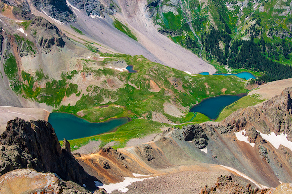
Lower, Middle, and Upper Blue Lakes Trail
Elevation Gain: 2,509 feet (765 meters)
Roundtrip Distance: 8.7 miles (14 kilometers)
Duration: 4-6 hours
Type: Out & Back
Trailhead: 38.035568, -107.807022
Do you love high alpine lakes? Then Blue Lake Trail should be on your list of hikes to do in Telluride. Don’t confuse Blue Lakes with Blue Lake in Bridal Veil Basin. The Lower, Middle, and Upper Blue Lakes Trail is an hour’s drive from Telluride in nearby Ridgway. This is an extremely popular hike so prepare to arrive early, plan a trip during the week, or even consider backpacking into lower Blue Lakes. Sleeping at the edges of a natural turquoise lake under the guise of mountains is just another day in the San Juans.
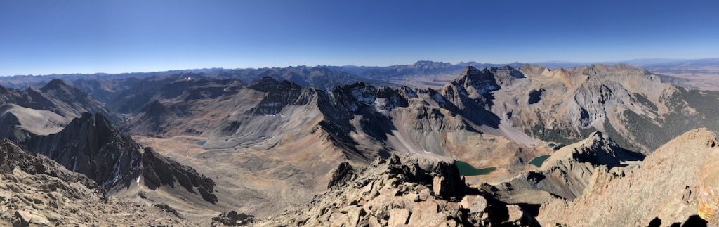
Mount Sneffels Trail via Blue Lakes Trail
Elevation Gain: 5,501 feet (1,677 meters)
Roundtrip Distance: 13 miles (21 kilometers)
Duration: 9-11 hours
Type: Out & Back
Trailhead: 38.035568, -107.807022
Are you driving into Telluride from Montrose, Ouray, or Ridgway? You will see Mount Sneffels looming over the landscape. At 14,158 feet, the mountain is one of the few 14ers in the region. You can access this hike from Yankee Boy Basin or Blue Lakes in Ridgway. Regardless of which route you choose, be prepared. It’s a difficult route with rock fall and technical routes of class 2 and 3 climbing.
Read our full guide to hiking Mount Sneffels here.
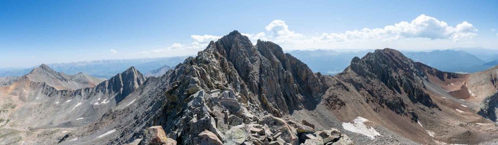
Wilson Peak via Rock of Ages Trail
Elevation Gain: 3,658 feet (1,115 meters)
Roundtrip Distance: 9.1 miles (14.5 kilometers)
Duration: 5-8 hours
Type: Out & Back
Trailhead: 37.883410, -108.018293
Wilson Peak is a 14er in the Lizard Head Wilderness and part of the trio of 14ers that lie 13 miles southwest of Telluride. In addition to Wilson Peak, you can climb Mt. Wilson at 14,246 feet and El Diente at 14,159 feet. Wilson Peaks summit sits around 14,021 feet. It’s the easier hike and climb compared to the others in trio. If you begin your adventure from the Rock of Ages Trail, you will start hiking at 10,350 feet in elevation. Be prepared for rock fall, route finding, and a false summit. Although any 14er in the San Juans is an undertaking and worthwhile, Wilson Peak should be at the top of your list if you’re hiking in Telluride. It’s an impressive and humbling peak in one of the most beautiful mountainous regions in the world. Plus, Wilson Peak is on the Coors beer can.
Read our full guide to hiking Wilson Peak here.
Wasatch Trail

Elevation Gain: 4,324 feet (1,318 meters)
Roundtrip Distance: 14.5 miles (23.3 kilometers)
Duration: 8-10 hours
Type: Loop
Trailhead: 37.9343, -107.8119
The Wasatch Trail is what you make it. You can either begin this full-day hike in Telluride at the Bear Creek Trailhead, the Bridal Veil Falls Trailhead or even on the ski resort at the base of See Forever. No matter what you choose, the Wasatch Trail will be one of the most stunning hikes you’ve ever done. The trail follows single track through meadows of wildflowers, cold mountain springs, and varying terrain under the guise of looming mountains. The best time to hike Wasatch Trail is in late July and August, when the wildflowers are rampant.
Madeleine is a freelance writer and social media manager in the outdoor, gear, and travel space. She loves being buried in the snow, running single-track, and eating gummies next to high alpine lakes. When she’s not writing or traveling, you can find Madeleine in Telluride, Colorado romping around in the San Juans.