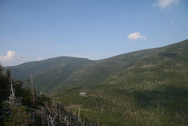
Galehead Mountain is a 4,024 foot mountain in the Twin Range in Franconia, New Hampshire in the White Mountains. The summit itself does not have any great views, but there are points near the summit with excellent views.
Elevation: 4,024 feet (1,227 meters)
Elevation gain: 2,657 feet
Length: 10.2 miles roundtrip
Difficulty: Moderate
Duration (book time): 6-7 hours
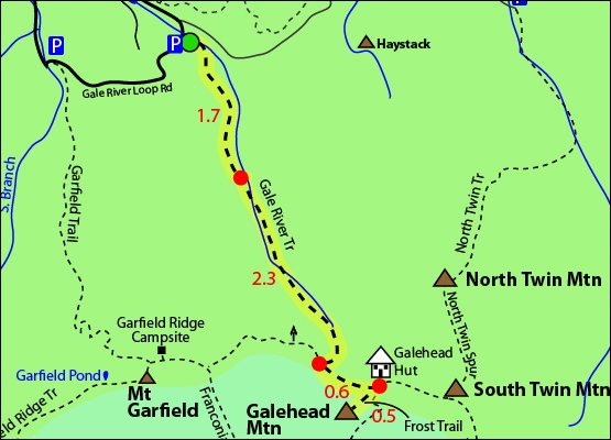
Trail map

Trails
Gale River Trail, Frost Trail
Begin hiking on the Gale River Trail for roughly 4 miles, until you reach the junction for the Garfield Ridge Trail, a small section of the Appalachian Trail. Here, you will want to stay left and continue for about 0.6 miles until you reach the AMC Galehead Hut. Here, there is only one way to reach the summit of Mount Galehead. The .5 mile long Frost Trail is short and steep, leading you to the summit. To descend, head back down to the hut and retrace your steps back down to the trailhead parking lot where you began.
The views on the trails surrounding Galehead hut are fantastic, however there are not views at the summit of Galehead.
Alternate routes
A longer approach to summit Galehead Mountain is by using the Garfield Trail and more of the Garfield Ridge Trail, making a long day hike loop. This option features great views at the summit of Mount Garfield.
Elevation gain: 2,975 feet
Distance: 15.1 miles roundtrip
Duration (book time): 8 hours
Difficulty: Strenuous

Hiking in winter
Gale River Loop road is closed during the winter. This will add mileage to the hike as seen above in the trail maps. Plan accordingly.
Camping and overnight hiking options
The AMC Galehead Hut is located just east of the summit of Mount Galehead. The hut is open to hikers from mid-May to mid-October. Fees may apply and reservations may be required.
The Guyot Campsite and Shelter is located south of Mount Guyot’s summit. There is also the Garfield Ridge Campsites offered at first come first serve basis.
Parking
The parking lot for this hike is located on Gale River Loop Road off Route 3 in Bethlehem, New Hampshire. In the winter, parking is available at the beginning of Gale River Loop road.
Directions
To get to the the Gale River trailhead parking area
Take exit 35 off I-93 onto Route 3 North towards Twin Mountain/Lancaster. Drive 4.8 miles on Route 3 then turn right onto Gale River Loop Road. Follow the road until you see the sign for the Gale River Parking Lot. (You will pass the Garfield Trail head parking lot).
Weather
Extremely severe storms can develop suddenly and unexpectedly, especially above treeline in the White Mountains. Always check the weather forecast before heading out. Here is the forecast for the next 4 days:
Additional photos

Photo credit – Tim Sackton
