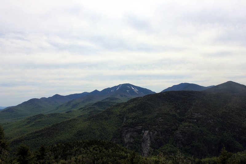
Standing at 4,840 feet, Gray Peak is the 7th tallest Adirondack High Peak in the state of New York. It is located in Keene Valley and is often climbed in conjunction with Mount Marcy and Mount Skylight. Gray Peak is the tallest mountain in the High Peaks without a maintained trail to the summit.
Elevation – 4,840 feet (1,475 meters)
Elevation gain – 2,661 feet ( 811 meters)
Distance – 8.4 miles one-way (13.6 km)
Difficulty – Strenuous
Duration (book time) – 12 to 14 hours
Trails
via the Adirondack Loj
(2,661 feet of elevation gain, 16 miles round-trip, 12 to 14 hours book time)
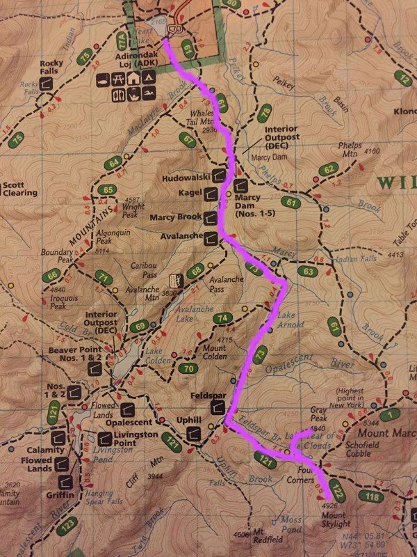
From the Loj follow the approach trail to the High Peaks leading to Marcy Dam. From Marcy Dam, follow the trail to Avalanche Pass. After passing by Avalanche Camps, take a left toward Lake Arnold. You will steeply climb up the shoulder of Mount Colden and reach Lake Arnold. Here you will stay left until passing by Feldspar Lean-to. 0.1 miles past the lean-to is an intersection. Stay to the left and continue to climb steeply up to Lake-Tear-of-the-Clouds. At the lake, there will be a faint herd-path to your left that requires bouldering upon entering a spruce forest. This path leads to the summit of Gray Peak. Climb up the moderately steep section until you reach the summit of Gray Peak. To descend, retrace your steps (carefully) until reaching the trailhead parking lot where you began.
Loop Hike Option
(5,068 feet of elevation gain, 17.6 miles round-trip, 12 to 14 hours book time)
Starting from the Adirondack Loj, follow the Van Hoevenberg trail 2.3 miles until you reach Marcy Dam. Cross over Marcy Dam and continue on the trail toward Avalanche Lake (marked with yellow trail markers). Hike along Marcy Brook for about a mile until reaching a junction for the trail to Mount Colden and Lake Arnold. Turn left here and begin your climb on the Lake Arnold trail (Marked with blue trail markers). Climb steeply until reaching the lake at 3,772 feet in elevation at the base of Mount Colden. From here, continue on the trail toward the Feldspar Brook where the trail begins to level out a bit. After reaching Feldspar Brook lean-to and the junction to Lake Tear of the Clouds, take a left at the junction (marked with yellow markers), and climb steadily for 1.5 until reaching Lake Tear of the Clouds. Once you reach the Lake Tear of the Clouds, follow the Gray Peak herd path for .5 miles until reaching the summit of Gray Peak. After enjoying the views at the summit, you will return back to Lake Tear of the Clouds, making a left turn on the same trail you came from and head toward Four Corners to begin your ascent up Mount Skylight. From Four Corners, take a right to begin your .5-mile climb to the summit of Skylight (marked in red markers). After enjoying the 360-degree views on the summit of Mount Skylight, you will head back to Four Corners. From here you start to climb up Mount Marcy (marked with yellow markers). From Four Corners you will climb for less than a mile on steep and rugged terrain until you reach the summit of Mount Marcy, the third and final peak of the hike. After taking in the view, continue over Marcy to merge with the Van Hoevenberg trail (marked with blue markers) for 7.4 miles back to the Adirondack Loj. After about 3 miles you will reach Indian Falls. From the falls you will continue on the Van Hoevenberg trail for 1.9 miles before reaching Marcy Dam. Here, retrace your steps for 2.3 miles back to the Adirondack Loj where you began your hike.
Trail Map

Camping And Overnight Hiking Options
Camping is permitted at Avalanche Lake at the Avalanche Camps with plenty of first come, first serve lean-to’s.
Hiking In Winter
In winter the easiest and safest route is to descend the West side of Marcy and up and along the ridgeline to the summit. It is advised that you check the weather forecast and avoid attempting in poor conditions. Snowshoes and crampons are strongly recommended along with other winter hiking essentials.
Parking
Parking for Gray Peak is located on Adirondak Loj Road in Lake Placid, New York. There is a self serve pay station at the lot.
Directions
Leave Lake Placid on Route 73 and follow the route toward Keene. Drive for about 3 miles to Adirondack Loj Road on the right hand side. Follow Adirondack Loj Road until its end at Heart Lake and park in the main parking lot. Small parking fees (about $10) is required to park here.
Weather Forecast
Here is a detailed weather forecast for the next four days:
Lake Placid, NY
Overnight
Mostly cloudy, with a low around 33. South wind around 13 mph.
Friday
A chance of rain showers after 2pm. Mostly cloudy, with a high near 45. South wind 14 to 28 mph. Chance of precipitation is 50%. New rainfall amounts between a tenth and quarter of an inch possible.
Friday Night
Rain showers likely before midnight, then a chance of rain and snow showers. Mostly cloudy, with a low around 30. Southwest wind 18 to 26 mph. Chance of precipitation is 70%. Little or no snow accumulation expected.
Saturday
A slight chance of snow showers before 7am, then a slight chance of rain showers. Partly sunny, with a high near 38. West wind 20 to 24 mph. Little or no snow accumulation expected.
Saturday Night
A slight chance of rain and snow showers before 7pm. Mostly cloudy, with a low around 25. West wind 16 to 22 mph. New rainfall amounts less than a tenth of an inch possible.
Sunday
Partly sunny, with a high near 38. West wind 16 to 23 mph.
Sunday Night
Partly cloudy, with a low around 24. West wind 15 to 32 mph.
Additional Photos

Photo via Good Free Photos
