Belknap Mountain is in the Belknap Range in Gilford, NH. It is neighbored, and often combined with Gunstock Mountain, and Piper Mountain. This hike features various routes to summit (explained below) and a fire tower with stunning views.
Distance: 3.86 Miles Round Trip (6.21 km)
Height: 2,382 Feet (626.0 meters)
Elevation Gain: 1,323 feet (293.5 meters)
Difficulty: Easy to intermediate
Duration (Hike Time): 2-3.5 hours
Belknap MountainTrails
Each of the options are from the parking lot at the bottom of Carriage Road. If you drive to the top of Carriage road (open in summer), you can subtract 1.24 miles and 651 feet of elevation gain from the hike.
Warden’s Trail / Green Trail (From Lower Carriage Road) – 1.93 Miles To Summit – 1,323 Feet Elevation Gain
This is a common and easy to follow route to the summit. It features gradual elevation gain and is the shortest mileage route to the summit.
Start by hiking along Carriage Road until you reach the end of the road. In the parking lot, you’ll find a trail map that shows you the different starting locations. Simply follow the green trail markings to the summit.
If parking at the top of carriage road: .7 miles to the summit with 672 feet elevation gain.
Red Trail (From Lower Carriage Road) – From End of Belknap Mountain Road – 2.12 Miles To Summit – 1,315 Feet Elevation Gain
Hikers start by hiking along Carriage Road to the end of the road. Once hitting the end of the road, you’ll see a parking lot.
In the parking lot, you’ll find a trail map that shows you the different starting locations. Simply follow the red trail markings to the summit. This trail features gradual gains the entire way to the summit and is well traveled and easy to follow.
If parking at the top of carriage road: .88 miles to the summit with 664 feet elevation gain.
Blue Trail (From Lower Carriage Road) – 2.29 Miles To Summit – 1,351 Feet Elevation Gain
Hikers start by hiking along Carriage Road to the end of the road. Once hitting the end of the road, you’ll see a parking lot.
In the parking lot, you’ll find a trail map that shows you the different starting locations. Simply follow the blue trail markings to the summit. This trail features gradual gains the entire way to the summit and is well traveled and easy to follow.
Hikers will reach a junction in which they can go left or right. At that junction, to the left is towards Gunstock Mountain, the right goes towards Belknap Mountain.
If parking at the top of carriage road: 1.05 miles to the summit with 700 feet elevation gain.
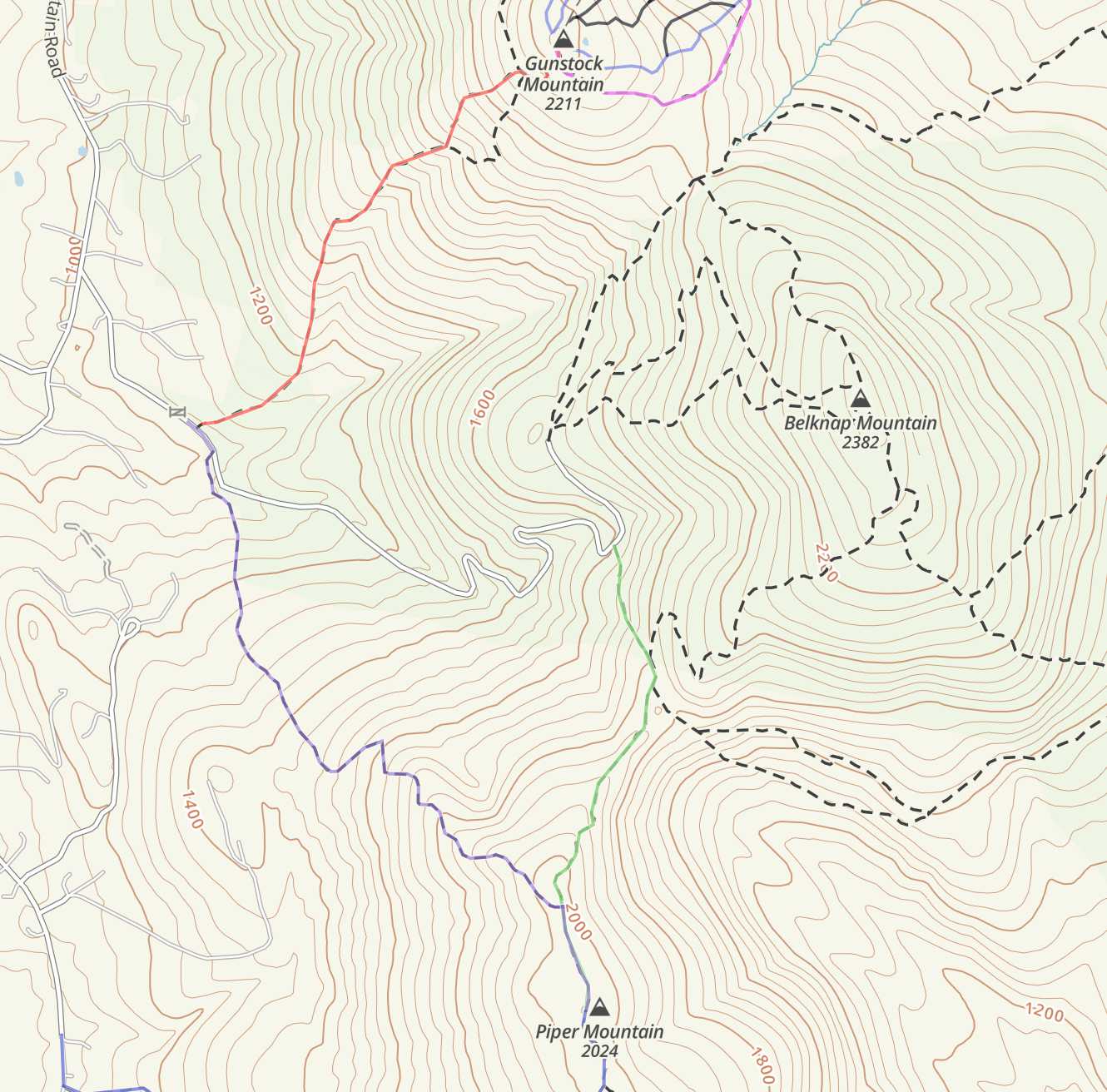
Trail Map
Download Full Map Here:
Alternate Routes
Hikers may also choose to hike Belknap Mountain in a loop with Piper. Belknap, Gunstock, and Belknap combined are also a common way to summit. There are tons of trails for hikers to choose from, so you can make your own path as long as you understand your abilities and navigation. Take a look at the full Belknap Range trail map provided above as there are various parking areas and trails to get to the ridge where you can access many peaks.
Directions
To Lower Carriage Road Trailhead (Belknap Range Trails)
To Upper Carriage Road
Weather Forecast
Laconia, NH
Additional Pictures
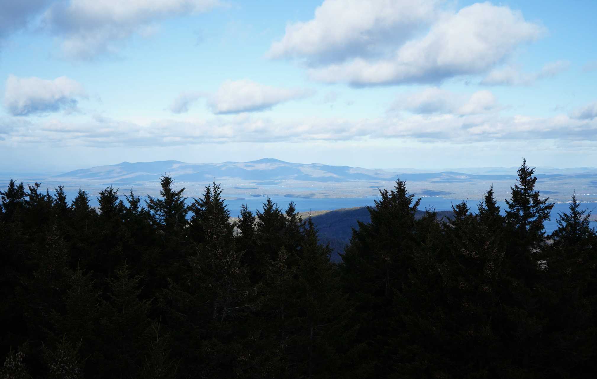
Belknap Mountain Summit Views
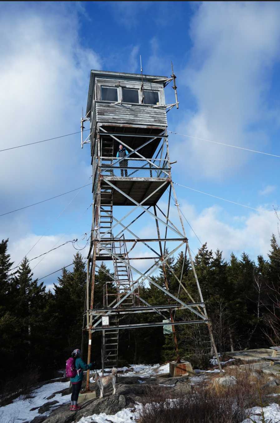
Belknap Mountain Firetower
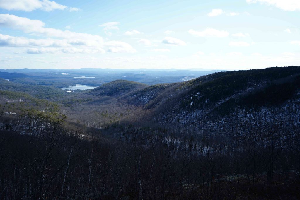
Mount Piper From Mount Belknap

Max DesMarais is the founder of hikingandfishing.com. He has a passion for the outdoors and making outdoor education and adventure more accessible. Max is a published author for various outdoor adventure, travel, and marketing websites. He is an experienced hiker, backpacker, fly fisherman, backcountry skier, trail runner, and spends his free time in the outdoors. These adventures allow him to test gear, learn new skills, and experience new places so that he can educate others. Max grew up hiking all around New Hampshire and New England. He became obsessed with the New Hampshire mountains, and the NH 48, where he guided hikes and trail runs in the White Mountains. Since moving out west, Max has continued climbed all of the Colorado 14ers, is always testing gear, learning skills, gaining experience, and building his endurance for outdoor sports. You can read more about his experience here: hikingandfishing/about