If you ask anyone in Salt Lake City, or Google “best hikes near salt lake city”, Lake Blanche will be at the top, or near the top of the list. It is less than 30 minutes from nearly all of Salt Lake City, features a well traveled, and moderate incline, and definitely has some stunning views. Here’s everything you need to know to check out this beautiful location within Big Cottonwood Canyon.
Quick Navigation:
Trail Map | Trails | Hiking In Winter | Camping | Weather | Directions | Pictures
Difficulty – Intermediate
Distance – 6.9 miles round trip (11.1 km)
Height – 8,920 feet (2718.82 m)
Elevation gain – 2,787 feet (849.48 m)
Duration – 5-6 hours (book time)
Trailhead Location – Mill B South Trailhead (6,264 Feet)
Dogs – Not allowed on this trail
Need To Know Information
- Dogs are not allowed on this hike.
- Swimming is not allowed in any of the lakes in this area.
- This is a popular hike, and you will encounter people. Parking fills up quite fast.
- There is overflow parking on the road and the nearby trailhead (explained below).
- Lake Blanche is the first of 3 lakes at this location, and we have information below about how much added distance it is to the other very nearby lakes.
- Camping is common, and there are no fees or permits required. Camping information and regulations below.
- Fishing is allowed at this lake with a Utah Fishing License.
Trail Map
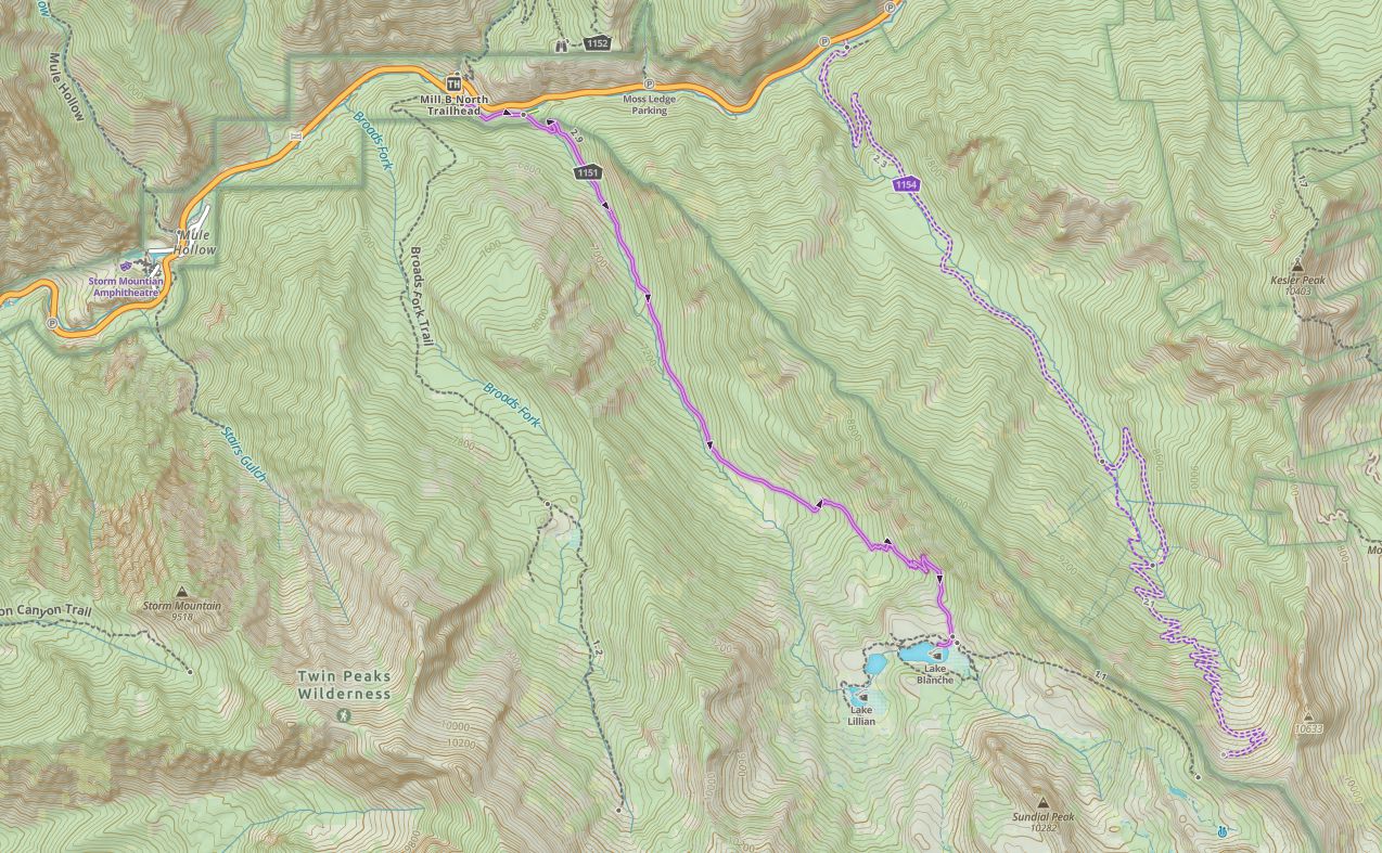
Click to enlarge this map
Routes
Lake Blanche Via Mill B South Trailhead – 6.9 miles round trip (11.1 km) – 2,787 feet (849.48 m) Elevation Gain
This is the only commonly taken route to Lake Blanche. Hikers begin on a paved path along the gorgeous Big Cottonwood Creek and diverge from the paved path to the right, at a marked junction about 0.25 miles from the parking lot. This portion of the trail is steep at the beginning. From here, the trail is well maintained, very easy to follow, doesn’t have any junctions, and maintains a moderate incline for the entirety of the hike to Lake Blanche.
Most of this hike is in a gorgeous forest, but hikers are rewarded with occasional, and very stunning views along the way up. The trail is mostly dirt, with some rocks, and boulders mixed in until the last tenth of a mile where the route is mostly rock to the lake.
Adding Lake Florence And Lake Lillian
Once reaching Lake Blanche, the views are stunning, and hikers can actually walk all around the lake.
If hikers choose to add in Lake Florence, they add roughly:
- An additional 0.30 miles to reach Lake Florence
If hikers choose to add in Lake Florence and Lake Lillian, they add roughly:
- An additional 0.50 miles to reach Lake Lillian and Lake Florence
This ads a total of about 1 mile, and 150 feet of elevation gain round trip. Hikers can add a bit more by exploring around the lakes as well.
Hiking in Winter
This is a very common winter hike, and the above information does not change very much aside from being prepared for the weather, and bringing snowshoes or microspikes.
Camping Information
This is a common camping area. Due to the wilderness area and watershed regulations, no campfires, dogs, horses, or bicycles are allowed. Any campers must camp at least 200 feet away from trails, lakes, or streams. There is a limit of 10 campers per group.
Fishing Lake Blanche
Lake Blanche has a healthy population of trout. This is a catch and release fishery. Fish will take dry flies on most summer days.
Weather
Here is a detailed weather forecast for the area:
Alta, UT
Tonight
Mostly clear. Low around 40, with temperatures rising to around 42 overnight. South southeast wind around 6 mph.
Wednesday
Sunny, with a high near 60. South wind around 8 mph.
Wednesday Night
A slight chance of rain and snow showers after midnight. Partly cloudy, with a low around 38. South wind around 7 mph. Chance of precipitation is 20%.
Thursday
A chance of snow showers before 9am, then a chance of rain showers between 9am and noon, then showers and thunderstorms likely. Mostly cloudy, with a high near 52. South southwest wind around 13 mph. Chance of precipitation is 60%.
Thursday Night
Showers and thunderstorms likely before 9pm, then a slight chance of thunderstorms and rain and snow showers. Mostly cloudy, with a low around 35. West wind 7 to 10 mph. Chance of precipitation is 80%.
Friday
Snow showers and a slight chance of thunderstorms before noon, then showers and thunderstorms between noon and 3pm, then snow showers and a chance of thunderstorms. Cloudy, with a high near 40. Chance of precipitation is 100%. New snow accumulation of less than one inch possible.
Friday Night
Snow showers likely. Cloudy, with a low around 30. Chance of precipitation is 70%. New snow accumulation of 1 to 2 inches possible.
Directions
The Mill B South Trailhead is a small parking lot, but parking is located along the road as long as cars stay off the road, and not over the white lines. Non parking spots are denoted by signs. This trailhead is at a large bend in the road, and located within 100 feet of another trailhead that can serve as overflow parking as well. This is a very popular destination, so parking is often limited on weekends, holidays, or nice weather days.
Additional Pictures

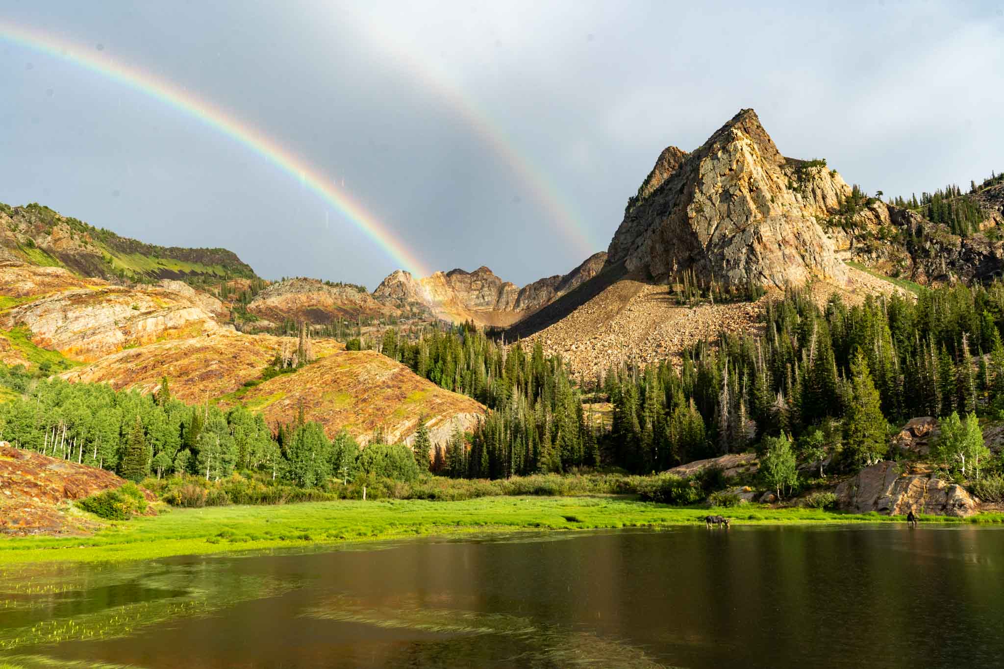
Lake Blanche with rainbows
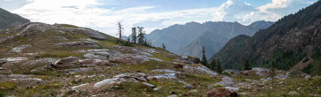
Views looking back at Big Cottonwood Canyon from Lake Blanche
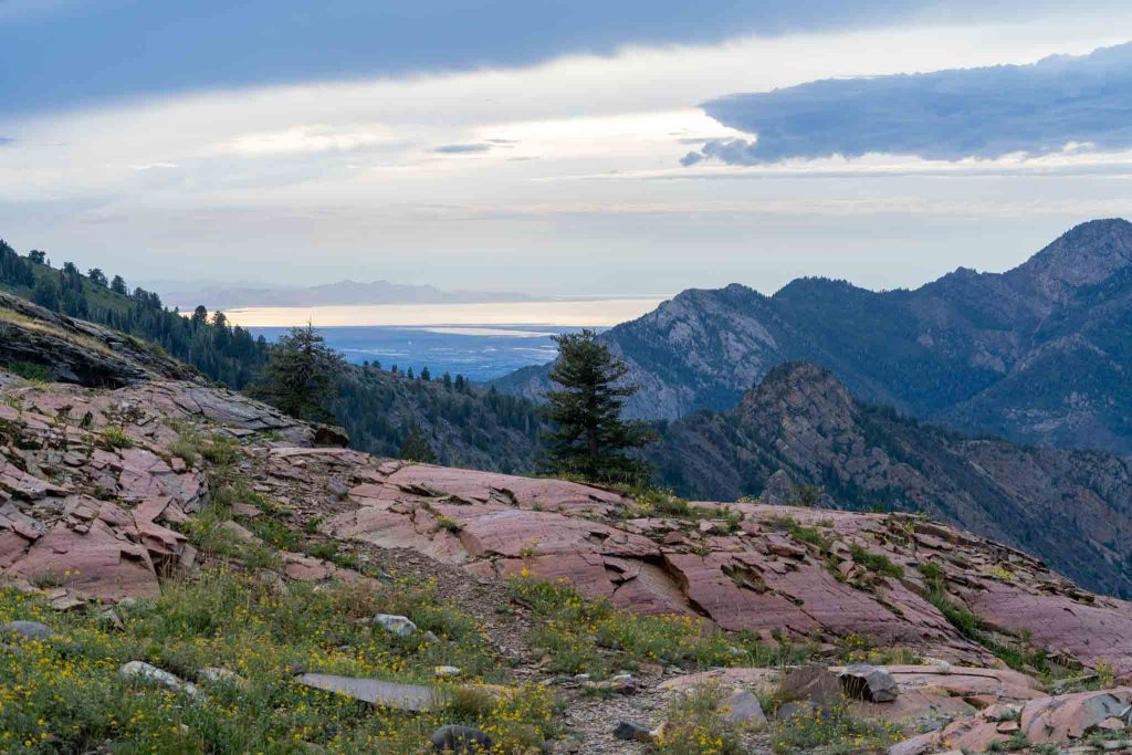
Salt Lake City as seen from Lake Blanche
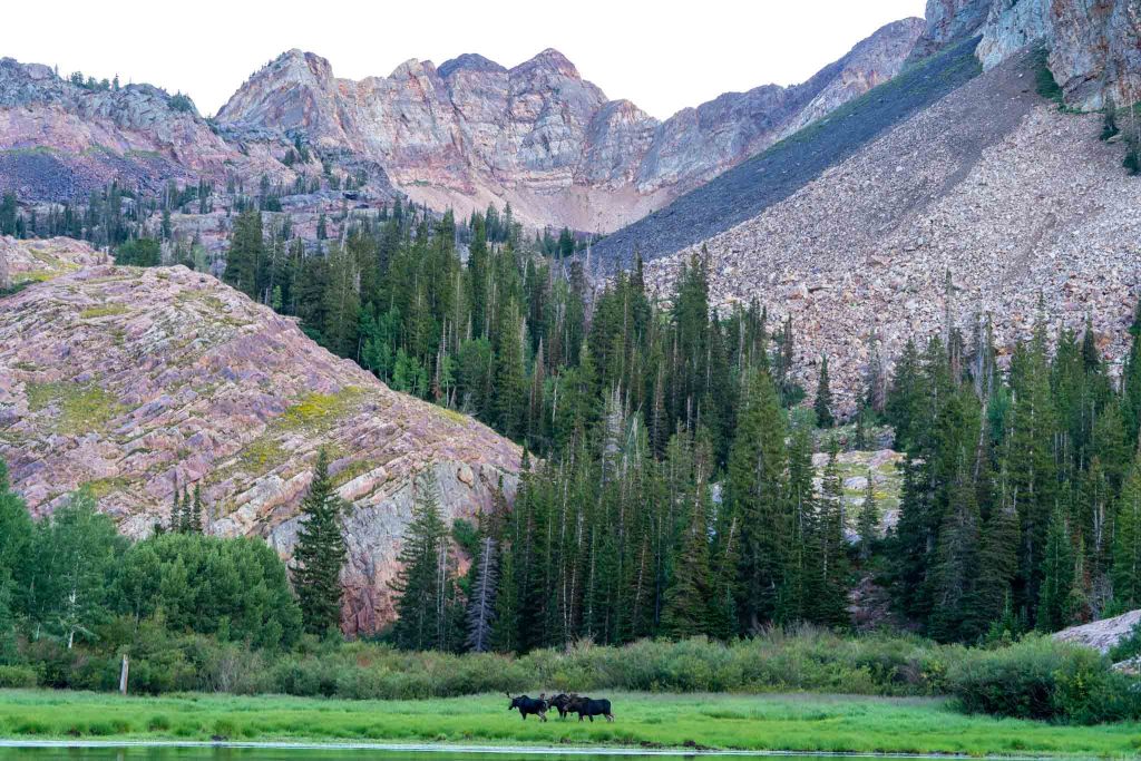
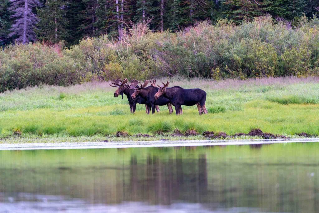
Three moose at Lake Blanche
Lake Blanche Moose
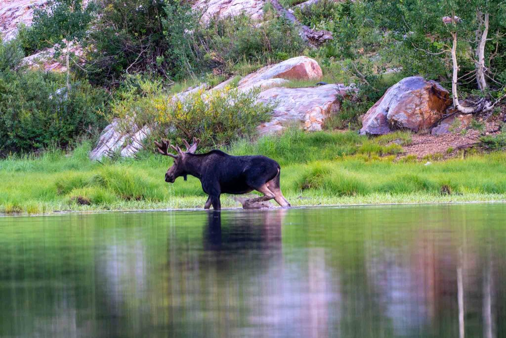
A moose walking out of Lake Blanche
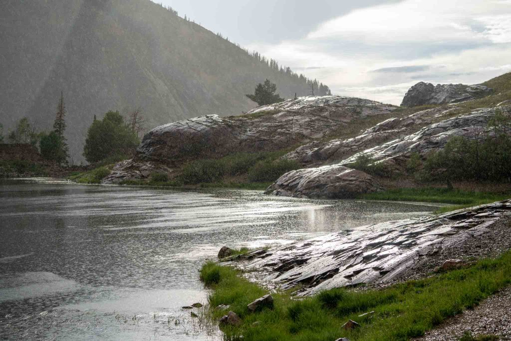
Lake Blanche while raining

Max DesMarais is the founder of hikingandfishing.com. He has a passion for the outdoors and making outdoor education and adventure more accessible. Max is a published author for various outdoor adventure, travel, and marketing websites. He is an experienced hiker, backpacker, fly fisherman, backcountry skier, trail runner, and spends his free time in the outdoors. These adventures allow him to test gear, learn new skills, and experience new places so that he can educate others. Max grew up hiking all around New Hampshire and New England. He became obsessed with the New Hampshire mountains, and the NH 48, where he guided hikes and trail runs in the White Mountains. Since moving out west, Max has continued climbed all of the Colorado 14ers, is always testing gear, learning skills, gaining experience, and building his endurance for outdoor sports. You can read more about his experience here: hikingandfishing/about
PR Lake Blanche
Perfect trail conditions and views yet again!
Trail Run With Neighboring Basin
Did a trail run in the rain on this day and ended at Lake Blanche. Weather cleared at the lake which was great. Even though it rained heavy, the trails stayed in great shape.
Double Rainbow & Triple Moose Sightings
Honestly, you cannot get a better day. Light rain created a double rainbow behind the lake. That rainbow led to three bull moose eating, rubbing racks, and walking around.
One of the most incredible evening hikes of my life.