Crater Lake and Mirror Lake certainly have very generic names for lakes, but the views are by no means ordinary. Hiking to Crater Lake in the Indian Peaks Wilderness of Colorado should be on the bucket list of just about anyone living in the state. The views of the extremely unique Lone Eagle Peak make this one of the most scenic lakes in the country. Here’s everything you should know.
It is worth noting that in this article we are discussing the Crater Lake in the Indian Peaks Wilderness, not the Crater Lake in the Maroon Snowmass Wilderness.
Quick Navigation:
Trail Map | Trails | Hiking In Winter | Camping | Directions | Pictures
Difficulty – Strenuous
Distance – 14.6 miles round trip (23.50 km)
Height –10,395 feet (3168.40 m)
Elevation gain – 3,027 feet (922.63 m)
Duration – 8-9 hours (book time)
Hike Class: Class 2
Trailhead Location – Monarch Lake Trailhead (8,367 Feet)
Dogs – Allowed on leash
Need To Know Information
- A permit is required for anyone planning to stay overnight from June 1 through September 15. More information on that can be found here: https://www.fs.usda.gov/recarea/arp/recarea/?recid=8080
- Dogs are allowed on leash.
- Between Nov. 15 and June 15 the final mile of road to the trailhead is closed, requiring hikers to hike exra.
Trail Map
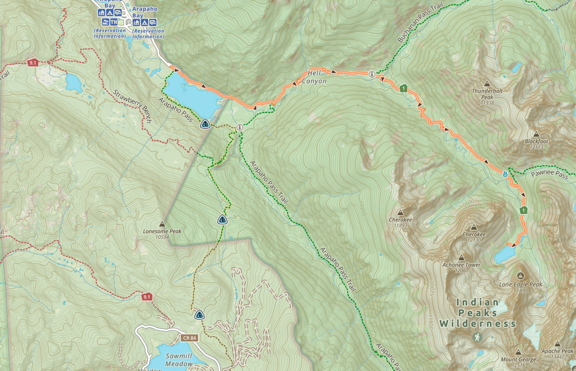
Crater Lake Trail Map, Indian Peaks Wilderness, Colorado
Routes
Crater Lake Via Monarch Lake Trailhead – 14.6 Miles Round Trip (23.50 km) – 3,027 Feet (922.63 m) Total Elevation Gain – Class 1
This hike is a relatively straightforward hike that starts at the Monarch Lake Trailhead. In only a couple hundred feet, you’ll be along Monarch Lake and seeing absolutely stunning views. The trails are well traveled in the first couple of miles, but the traffic drops quite a bit once you pass monarch lake.
The first 2 miles are relatively flat, but hikers begin to ascend more once they hit the trail junction for the Arapahoe Basin Spur. Hikers continue straight on the Cascade Creek Trail.
3.3 miles in, hikers will reach a junction for the Buchanan Pass Trail. This trail heads off to the left, but hikers stay straight. The trail here goes through Aspens where moose are frequently seen, and even has several gorgeous waterfalls.
The next junction is at mile 6.3. This left turn is the Pawnee Pass Trail, but hikers should continue straight. Hikers will begin to see small spur trails to campsites in this area towards the lake. Simply follow the main trails all the way to Crater Lake.
Hiking in Winter
The final mile to the trailhead is closed in winter (Nov. 15 to June 15). This means that hikers will need to add about 1 mile each way of flight hiking to the overall totals in winter.
Camping Information
This is an extremely popular first come first serve backpacking zone. There are specific rules and regulations for camping here, and specifici campsites that backpackers are required to camp on.
You can see those zones and rules here.
There is also a nearby campground at Arapaho Bay. You can reserve spots and get more information here.
Weather
Here is a detailed weather forecast for the area:
Snowmass Village, CO
Directions
Directions to Monarch Lake Trailhead:
Additional Pictures
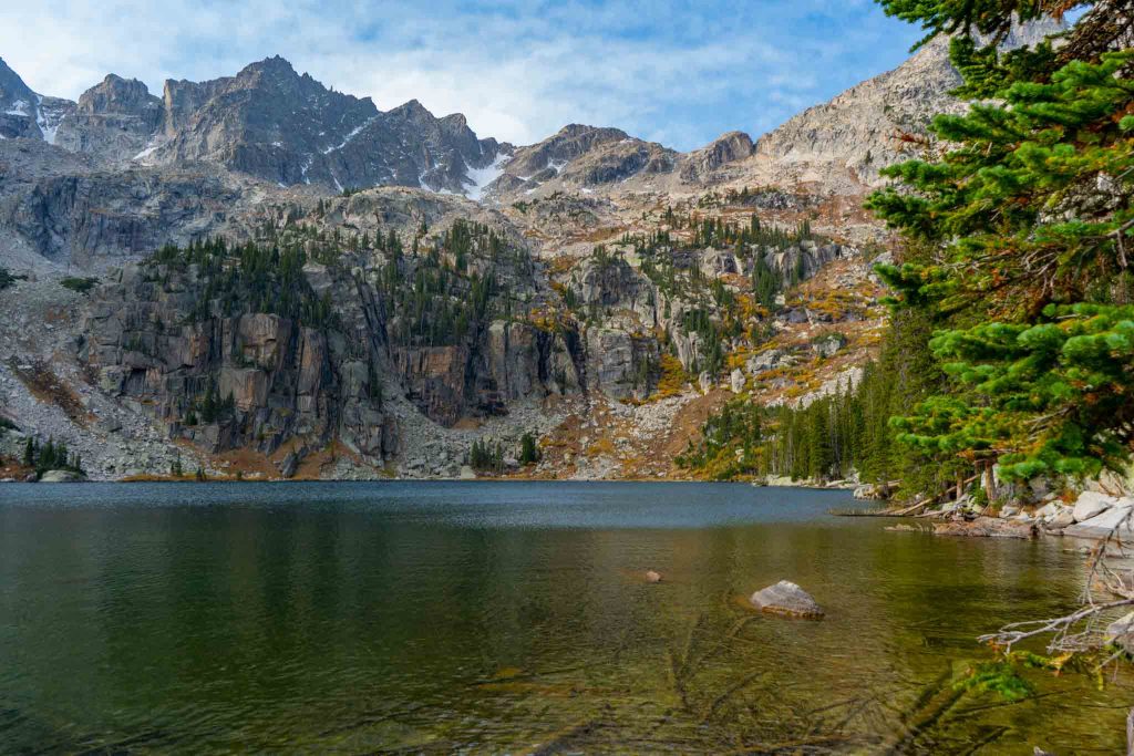
Crater Lake views
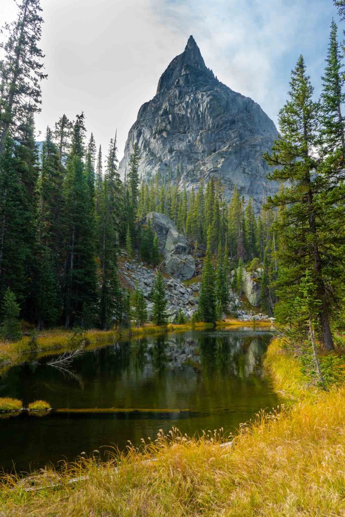
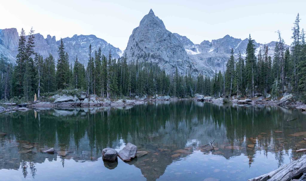
Lone Eagle Peak seen from a small pond before Crater Lake
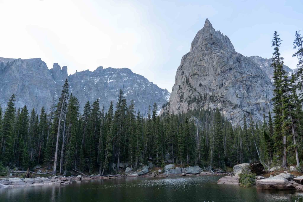
Lone Eagle Peak from Mirror Lake
Mirror Lake

Max DesMarais is the founder of hikingandfishing.com. He has a passion for the outdoors and making outdoor education and adventure more accessible. Max is a published author for various outdoor adventure, travel, and marketing websites. He is an experienced hiker, backpacker, fly fisherman, backcountry skier, trail runner, and spends his free time in the outdoors. These adventures allow him to test gear, learn new skills, and experience new places so that he can educate others. Max grew up hiking all around New Hampshire and New England. He became obsessed with the New Hampshire mountains, and the NH 48, where he guided hikes and trail runs in the White Mountains. Since moving out west, Max has continued climbed all of the Colorado 14ers, is always testing gear, learning skills, gaining experience, and building his endurance for outdoor sports. You can read more about his experience here: hikingandfishing/about