Greyrock Mountain and Greyrock Meadows is a gorgeous hike located only 25 minutes outside Fort Collins. This hike features fantastic views of Poudre Canyon and the surrounding peaks, takes hikers across a gorgeous bridge over the Poudre River, and ascends 2,000+ vertical feet. Here is everything you need to know.
Distance – 6.2 miles round trip (9.98 km)
Highest Point – 7,513 feet (2,289.96 m)
Elevation gain – 2,043 feet (622.7 m)
Duration – 4 to 6 hours
Difficulty – Intermediate
Seasons – Year-round (caution needed in winter – see below)
Trailhead Location – Greyrock Trailhead – 5,630 feet (directions below)
Trail Map
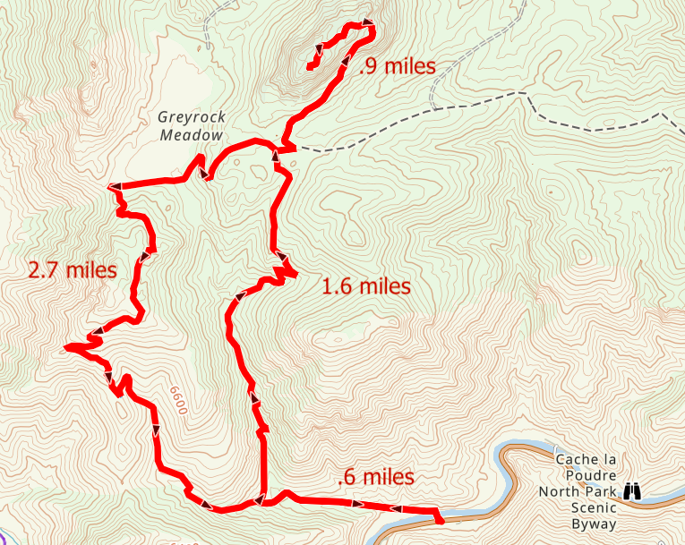
Greyrock Mountain Trail Map
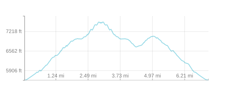
Greyrock Mountain Elevation Profile
Here is a Google Map with GPX file for you.
Trail Options
Greyrock Trail Out And Back: 6.2 Miles Round Trip | 2,043 Feet Elevation Gain
The Greyrock Trail (946) is the most direct route to the summit. The trail is very well traveled, easy to follow, and goes along a creek for quite some time. The trail is relatively flat to for the first .65 miles before reaching the junction between the Meadows Trail (947), and the Greyrock Trail (946). From here, hikers bear to the right.
The trail begins ascending pretty quickly and views are quite fantastic only after a short time of ascending. The trail gains about 1,000 feet over the next mile. 1.7 miles in, the trail eases up in grade a little bit at 6,800 get and hikers begin to get great views of the surrounding peaks.
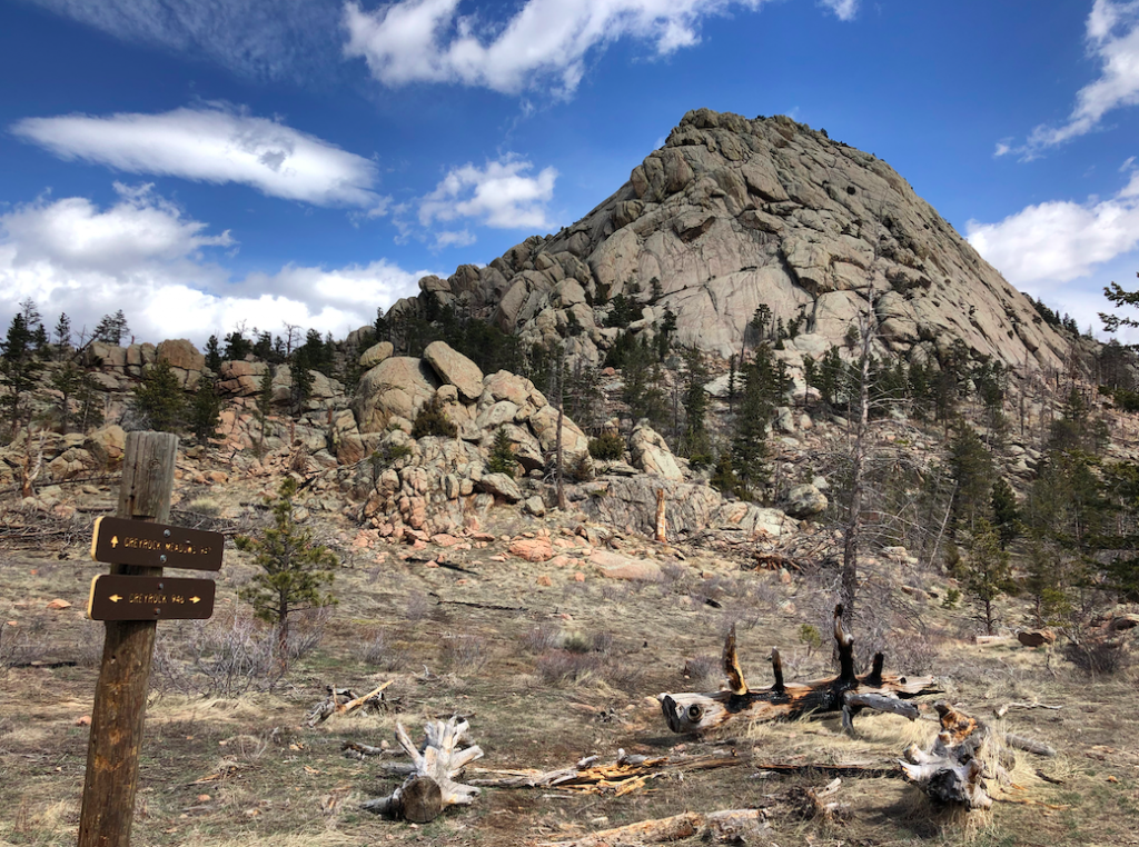
2.1 miles in hikers will reach the junction of the Greyrock Trail and the Greyrock Meadows Trail. The summit of Greyock is in clear view here and the views are stunning (picture below). From here, the last mile to the summit is the most difficult section with a the steepest grade.
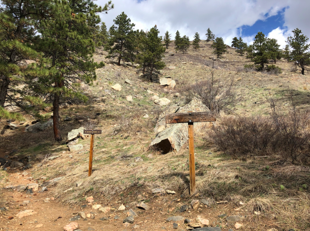
The trail can also be a little difficult to follow here. Keep an eye out for wooden posts marking the trail, and metal signs later on.
Greyrock Trail & Greyrock Meadows Loop: 7.15 Miles Round Trip | 2,515 Feet Elevation Gain
This loop path involves going up one, and down the other. This is slightly longer, but it is worth the diversity. We recommend ascending the summit trail, and descending the meadows.
From the junction heading down, the trail is easy for first mile from the junction. Hikers will ascend to 7,088 feet over the next mile to reach the highest point of the meadows trail. Views here are outstanding. From here, hikers quickly descend over 1,000 feet in the next mile before meeting back up with the Greyrock summit trail.
Greyrock Meadows Trail Out & Back: 8.4 Miles Roundtrip
This route would be taking the Meadows trail to the summit, and returning the same way.
Hiking Greyrock Mountain in Winter
This is a great winter hiking area. Extra caution needs to be taken during wet and icy times. We highly recommend bringing traction devices such as microspikes to remain safe on the trails and to avoid falls.
Camping And Other Information
There are no official campsites near the trail, however all along Poudre Canyon there are many campgrounds to choose from that are very close. You can read more about amenities and camping nearby here: https://www.fs.usda.gov/recarea/arp/recarea/?recid=36779
Also, there are various places along the trail in which you can camp. Tent sites that have been heavily used, as well as plenty of areas where you could place a tent easily. This is a great camping location.
Dogs are allowed here.
This trail is heavily traveled by climbers that will climb the last rock face to the summit of the mountain.
Current weather conditions:
Here is the detailed weather forecast for the next few days. We highly recommend you check out the mountain forecast for this region the morning of your hike.
Laporte, CO
Tonight
Snow showers likely. Cloudy, with a low around 25. East southeast wind around 9 mph. Chance of precipitation is 70%. New snow accumulation of 2 to 4 inches possible.
Saturday
Snow showers likely. Cloudy. High near 36, with temperatures falling to around 34 in the afternoon. East southeast wind around 9 mph. Chance of precipitation is 70%. New snow accumulation of around one inch possible.
Saturday Night
A slight chance of snow showers and a slight chance of thunderstorms before midnight. Mostly cloudy, with a low around 28. South wind 2 to 7 mph. Chance of precipitation is 20%.
Sunday
Sunny, with a high near 56. Southwest wind 2 to 10 mph, with gusts as high as 16 mph.
Sunday Night
Partly cloudy, with a low around 38. West southwest wind 6 to 10 mph, with gusts as high as 16 mph.
Monday
A slight chance of rain showers after noon. Mostly sunny, with a high near 66. Chance of precipitation is 20%.
Monday Night
Partly cloudy, with a low around 35.
Directions & Parking
The parking area has quite a few spots, and there are some street overflow parking spots along highway 14. This lot is only a short distance away from the Hewlett Gulch Trail.
Directions to Greyrock Mountain Trailhead:
Additional Pictures
Greyrock Summit from Trail Junction
Junction of Greyrock Meadows and Greyrock Mountain Loop
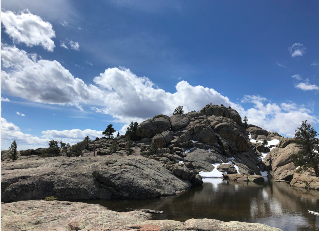
Pond Near Summit
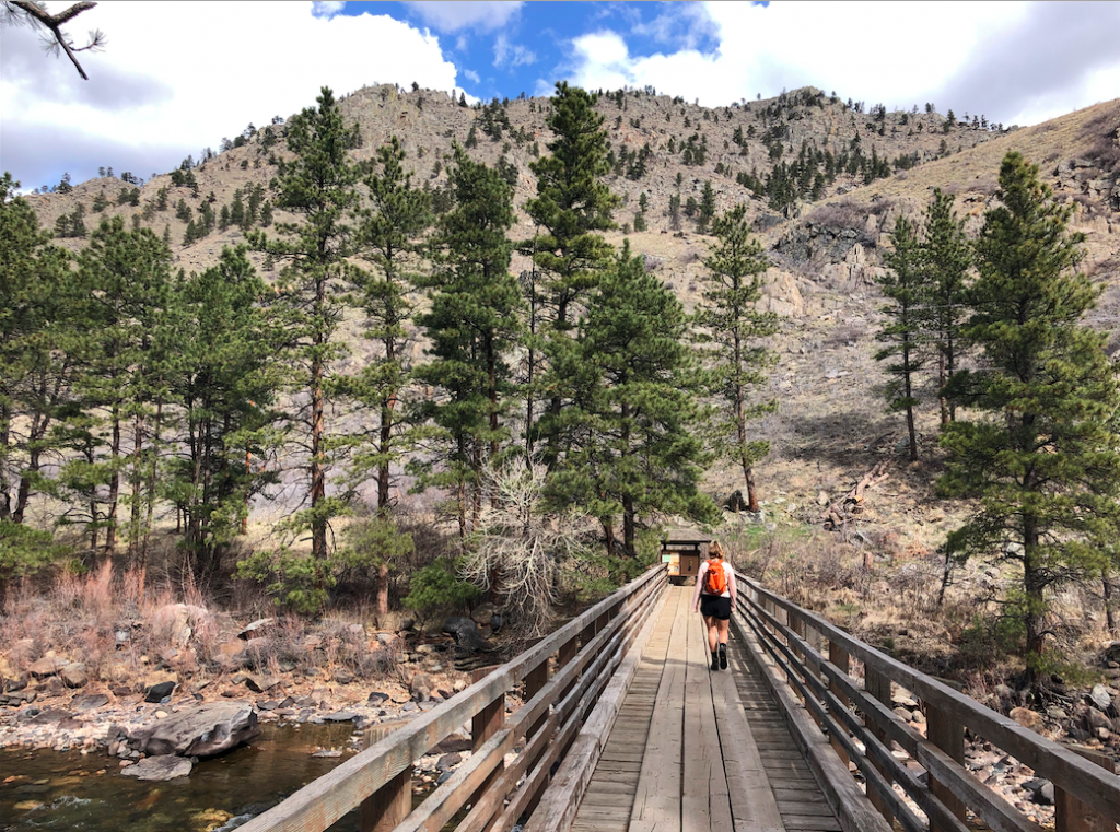
Greyrock Mountain Bridge Across the Poudre River at Trailhead
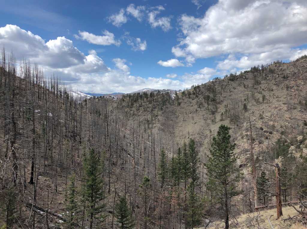
Views from Trail

Max DesMarais is the founder of hikingandfishing.com. He has a passion for the outdoors and making outdoor education and adventure more accessible. Max is a published author for various outdoor adventure, travel, and marketing websites. He is an experienced hiker, backpacker, fly fisherman, backcountry skier, trail runner, and spends his free time in the outdoors. These adventures allow him to test gear, learn new skills, and experience new places so that he can educate others. Max grew up hiking all around New Hampshire and New England. He became obsessed with the New Hampshire mountains, and the NH 48, where he guided hikes and trail runs in the White Mountains. Since moving out west, Max has continued climbed all of the Colorado 14ers, is always testing gear, learning skills, gaining experience, and building his endurance for outdoor sports. You can read more about his experience here: hikingandfishing/about