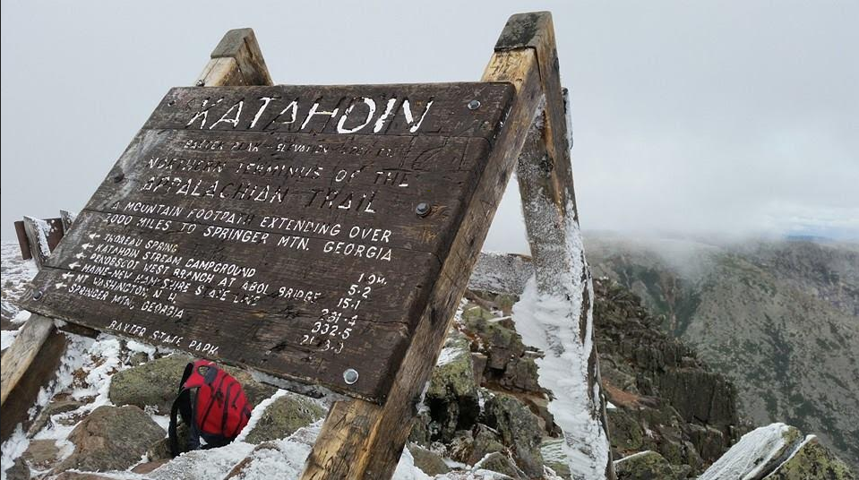
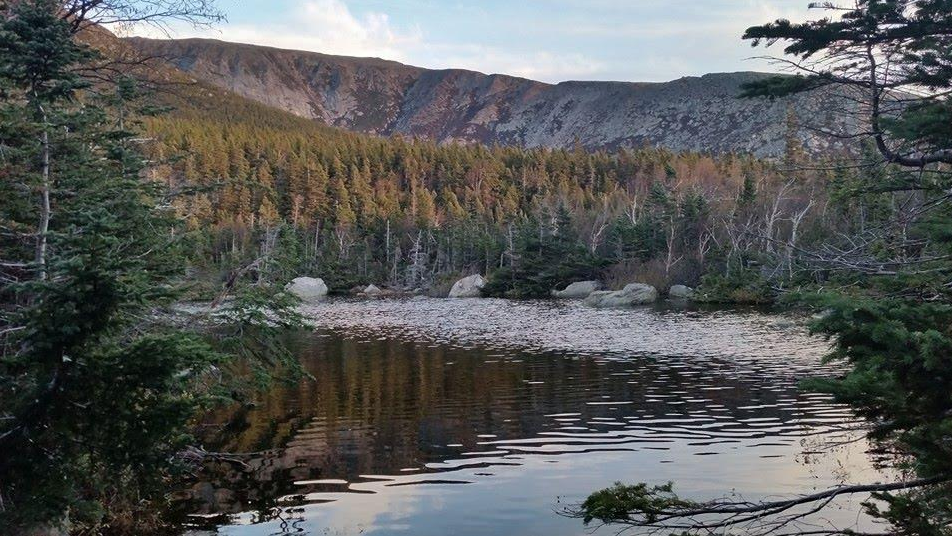
Hamlin Peak is a spur off the north side of Mount Katahdin, located in northern Maine’s Baxter State Park. One can access the peak via an out & back hike on the Hamlin Ridge Trail or by a loop hike that follows the stunning Knife Edge Trail to include Baxter Peak, Mt. Katahdin’s highest summit. The view from Hamlin Peak to the Great Basin makes one feel like they are in the Rockies rather than New England. This peak is based accessed from May until October. Permits are required for camping and parking within Baxter State Park.
Height: 4,756 feet (1,449 meters)
Distance: 9.2 miles (14.8 km) via Hamlin Ridge Trail. 11.1 miles (17.9 km) via Knife Edge loop, 10.8 miles (17.4 km) via Saddle Trail, 13.1 miles (21.1 km) via the Hunt Trail, 10.6 miles (17.1 km) via the Abol Trail
Elevation Gain: 3,267 ft. (996 m) via Hamlin Ridge Trail. 4,475 ft. (1,364 m) via Knife Edge Loop, 3,466 ft. (1,056 m) via Saddle Trail, 4,272 ft. (1,302 m) via Hunt Trail, 4,049 ft. (1,234 m) via the Abol Trail
Duration: 7-8 hours via Hamlin Ridge Trail, 11-12 hours via Knife Edge Loop, 7-9 hours via Saddle Trail, 10-11 hours via Hunt Trail, 9-11 hours via Abol Trail
Difficulty: Very Difficult/Strenuous
Trail Maps
Trails
Note: All route options have long, exposed sections of ridge hiking/climbing. DO NOT attempt in poor weather.
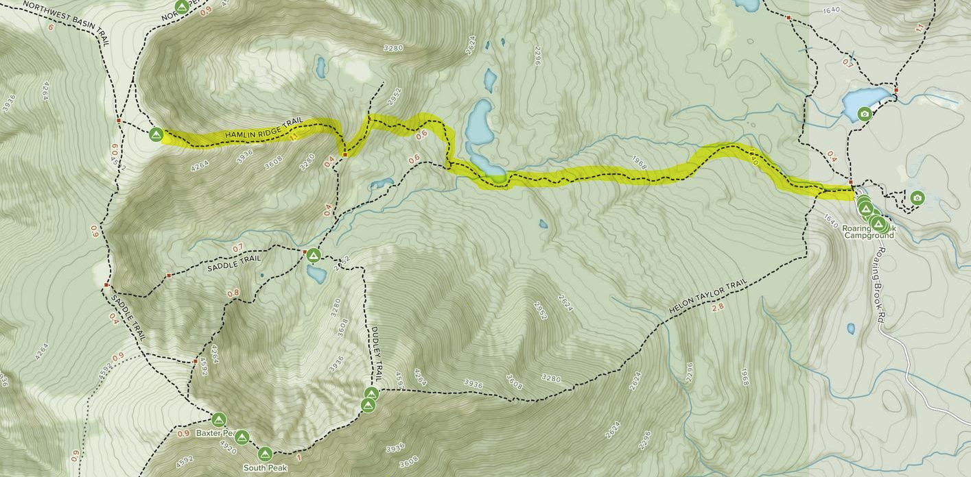
Hamlin Peak via Hamlin Ridge Trail – 9.2 miles (14.8 km) – 3,267 ft. (996 m) elevation gain
From Roaring Brook Campground, follow the steadily-climbing Chimney Pond Trail for 2.3 miles to the North Basin Cut-Off Trail. Take the North Basin Cut-Off Trail for 0.7 miles to the North Basin Trail. From here, follow the steep North Basin Trail for 0.3 miles to the intersection with the Hamlin Ridge Trail. Follow the exposed Hamlin Ridge Trail for 1.3 miles to Hamlin Peak. Return the way you came.
Hamlin Peak via Knife Edge Loop – 11.1 miles (17.9 km) – 4,475 ft. (1,364 m) elevation gain
From Roaring Brook Campground, follow the Helon Taylor Trail for 3.2 miles up to Keep Ridge and eventually Pamola Peak. From Pamola Peak, follow the Knife Edge Trail, through the Chimney, to Chimney Peak, South Peak (0.8 miles), and Baxter Peak (1.1 miles), Katahdin’s highest summit. Note: The Knife Edge Trail is only 3-4 feet wide in some sections and requires a decent scramble when climbing through The Chimney, a rock formation that will be traversed shortly after leading Pamola Peak. Some say this is the most invigorating trail in the Northeast. Hikers should note that it is also one of the most dangerous and has claimed lives.
From Baxter Peak, follow the Saddle Trail over Tableland, a large plateau on the flank of Katahdin, for 0.8 miles to the intersection of the Saddle Slide and the NW Basin Trail. Take the NW Basin Trail for 1 mile to the intersection of the Hamlin Ridge Trail. Turn right on the Hamlin Ridge Trail for .1 miles to reach Hamlin Peak.
From Hamlin Peak, descend via the Hamlin Ridge Trail for 1.3 miles to the North Basin Trail. Follow the North Basin Trail for .3 miles to the North Basin Cut Off Trail. Take the North Basin Cut-Off Trail for 0.7 miles. Turn left on to the Chimney Pond Trail. Follow the Chimney Pond Trail for 2.3 miles to Roaring Brook Campground.
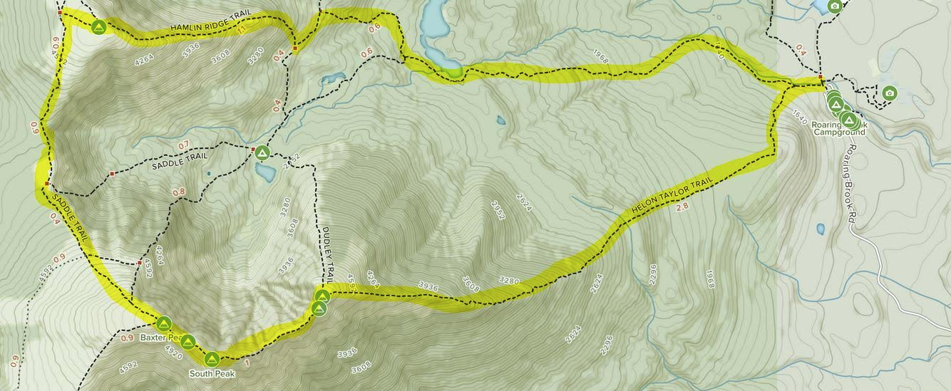
Hamlin Peak via Saddle Trail (10.8 miles (17.4 km) – 3,466ft. (1,056m) elevation gain
From Roaring Brook Campground, follow the Chimney Pond Trail for 3 miles to Chimney Pond. From here, follow the Saddle Trail, Katahdin’s “most mellow” trail up to the Saddle. Once at the Saddle, turn right onto the NW Basin Trail for 1 mile to the Hamlin Ridge Trail Junction. Turn right onto the Hamlin Ridge Trail and follow for 0.2 miles to Hamlin Peak.
From here, you can return the way you came or (recommended) take the Hamlin Ridge Trail down 1.3 miles to the North Basin Trail. Follow the North Basin Trail for 0.3 miles then take a right onto the North Basin Cut-Off for 0.7 miles to the Chimney Pond Trail. Follow the Chimney Pond Trail for 1.3 miles back to Roaring Brook Campground.
Hamlin Peak via Hunt Trail (13.1 miles (21.1 km) – 4,272 ft. (1,302m) elevation
From Katahdin Stream Campground, follow the steadily climbing Hunt Trail for 1.2 miles until you reach Katahdin Stream Falls. From the falls, continue on the Hunt Trail at a steep grade for 1.5 miles until you reach the “cave”, a literally “cool” resting spot before you enter what is known as the Hunt Spur, a rough mile of steep and difficult climbing through large boulders.
Once through the spur, at 3.7 miles, you will reach what is known as the “Gateway”, where you will pop out onto Katahdin’s Tableland. After about 0.5 miles you will reach Thoreau Spring, an unreliable water source. From here, take the Baxter Peak Cut-Off Trail for 0.9 miles north across the Tableland to the Saddle Trail. Follow the Saddle Trail for 1.3 miles to the Hamlin Ridge Trail. Turn right onto the Hamlin Ridge Trail for 0.2 miles until you reach Hamlin Peak. Turn back the way you came and have the Aleve ready at your car or campsite!
Hamlin Peak via Abol Trail (10.6 miles (17.1 km) – 4,049 ft. (1,234m) elevation gain
From the Abol Campgound (between lean-tos 11 & 12), follow the Abol Slide Trail for 2.9 consistently uphill miles. What begins as a gradual stroll through hardwoods turns into a series of switchbacks and eventually hand over foot climbing. Please use caution on the slide as rocks can become loose and are slippery in wet weather. Once above tree level this route can be extremely windy and exposed, like most routes on Katahdin.
Once you reach to the junction with the Hunt Trail and Baxter Peak Cutoff Trail, take the Baxter Peak Cutoff Trail for 0.9 miles north across the Tableland to the Saddle Trail. Follow the Saddle Trail for 1.3 miles to the Hamlin Ridge Trail. Turn right onto the Hamlin Ridge Trail for 0.2 miles until you reach Hamlin Peak. Turn back the way you came.
Hiking in Winter
Hiking in Baxter State Park in the winter is very restricted and could be categorized as ice-climbing rather than hiking. Baxter State Park requires users to submit a registration form via mail (not available online) to camp, solo, or go above treeline in the winter. Sites at most campgrounds can be booked in the winter, but advanced reservations are recommended. Most park roads are only snowmobile or across county ski/snowshoe accessible so distances to summits are much longer. Please see: https://www.baxterstatepark.org/wp-content/uploads/2017/03/WinterMileageChart.pdf
Camping Information
There are four camping options for the routes described to Hamlin Peak. The first and most popular option is to reserve a site at Roaring Brook Campground, which offers 9 lean-tos, a 10-person bunkhouse, and 10 tent sites. The second option is to reserve a spot at Chimney Pond campground, which has 9 lean-tos and a 10-person bunkhouse. You must backpack 2.3 miles to get to Chimney Pond campground. To access the Hunt Trail, book a site at Katahdin Stream Campground, which has 12 lean-tos and 9 tent sites. To access the Abol Slide Trail, reserve a spot at Abol Campground , which also has 12 lean-tos and 9 tent sites. Reserving sites at any of these locations should be done well in advance (up to 4 months prior to your trip) is recommended as sites fill up quickly.
Baxter State Park Camping Reservation Info: https://baxterstatepark.org/summer-camping/
Current Weather Conditions
Millinocket, ME
Today
Sunny, with a high near 23. Wind chill values as low as -9. Northwest wind 24 to 33 mph.
Tonight
Mostly clear, with a low around 18. Northwest wind 10 to 23 mph.
Friday
Sunny, with a high near 35. Northwest wind 12 to 16 mph.
Friday Night
Mostly clear, with a low around 23. West wind 6 to 14 mph.
Saturday
Sunny, with a high near 45. Southwest wind around 8 mph.
Saturday Night
Mostly cloudy, with a low around 32. South wind around 10 mph.
Sunday
A chance of rain and snow showers after 8am. Partly sunny, with a high near 46. South wind 12 to 16 mph. Chance of precipitation is 30%.
Directions & Parking
Baxter State Park requires payment and reservations for both parking and camping within the park. You must make your reservation prior to arriving at the park gate. The parking reservation fee is $5 and is not needed if you have a camping reservation.
Roaring Brook Campground and parking area is located 45 minutes northwest of Millinocket, Maine. In Maine, take 95 north to exit 144-244 towards ME-157 towards Medway, Millinocket. Follow ME-157 (and signs for Baxter State Park) by taking a right onto Katahdin Ave. once in Millinocket. After 0.2 miles, turn left at the 2nd cross street onto Bates St. Continue onto Millinocket Rd, which turns into Millinocket Lake Rd. After 7.4 miles, continue onto Baxter Park Rd. Turn right at Park Tote Rd., where you will be required to show your receipt of parking or a camping reservation. Continue onto Roaring Brook Rd for 6.2 miles to the campground/parking area entrance.
Katahdin Stream Campground and parking area is located within Baxter State Park about 45 minutes from Millinocket. In Maine, take 95 north to exit 144-244 towards ME-157 towards Medway, Millinocket. Follow ME-157 (and signs for Baxter State Park) by taking a right onto Katahdin Ave. once in Millinocket. After 0.2 miles, turn left at the 2nd cross street onto Bates St. Continue onto Millinocket Rd, which turns into Millinocket Lake Rd. After 7.4 miles, continue onto Baxter Park Rd. Turn left onto Park Tote Rd. and follow it for about 8 miles until you see signs for Katahdin Stream Campground.
Abol Campground and parking area is located in the southwest part of Baxter State Park, about 40 minutes northwest of Millinocket. In Maine, take 95 north to exit 144-244 towards ME-157 towards Medway, Millinocket. Follow ME-157 (and signs for Baxter State Park) by taking a right onto Katahdin Ave. once in Millinocket. After 0.2 miles, turn left at the 2nd cross street onto Bates St. Continue onto Millinocket Rd, which turns into Millinocket Lake Rd. After 7.4 miles, continue onto Baxter Park Rd. Stay on Baxter Park Rd. for 8.7 miles and take a slight left onto Park Tote Rd. Abol Campground will be on the right after about 5.6 miles.
Additional Pictures
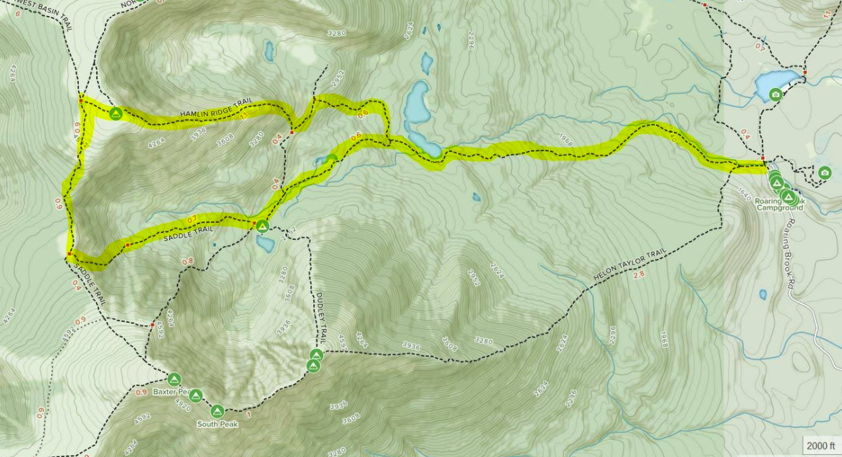
Saddle Trail & Hamlin Ridge Trail Map
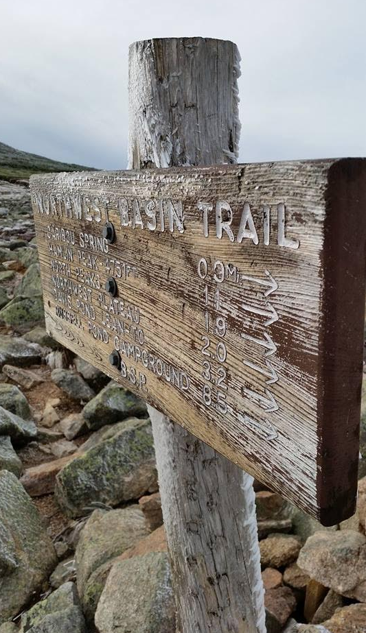
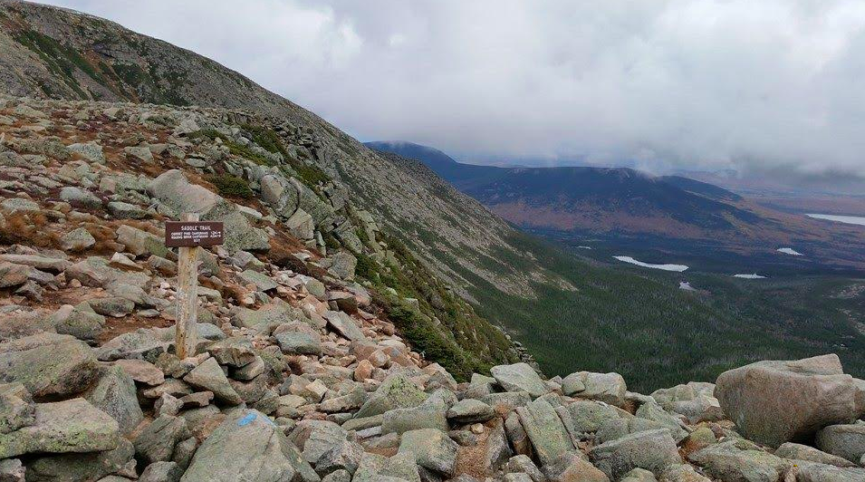
Saddle Trail Sign
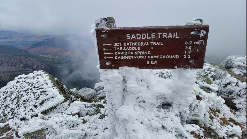
Saddle Trail Views

Ashley Spooner is an avid outdoors-woman from Thornton, NH. She has completed all of New Hampshire’s 48 4,000 Footers, the 273-mile Long Trail in Vermont, and the 100-Mile Wilderness in Maine. Ashley has also climbed all of the 4000 footers in Maine, including Katahdin numerous times, and has spent years hiking and backpacking in environments ranging from the Arctic Circle in the Lofoten Islands of Norway to the slot canyons of Utah and Arizona. She has also spent time hiking and backpacking in Montana, Oregon, California and Colorado. She holds a Master of Natural Resources degree and Sustainable Natural Resources Management Graduate Certificate from Oregon State University and currently works in Forestry for White Mountain National Forest (USFS).