Kit Carson Peak is a 14,165 foot peak in the Sangre De Cristo Mountains of Colorado. Hikers will summit Challenger Point (14,080 feet) and continue on to Kit Carson Peak. Here’s all the information you need to tackle this Colorado 14er.
Distance – 12.8 miles round trip (20.60 km)
Height – 14,165 feet (4,317.5 m)
Elevation gain – 6,680 feet (2,036.1 m)
Duration – 10-14 hours (book time)
Difficulty – Strenuous
Class: Class 3 Hike
Seasons – This hike can be completed in all seasons, but winter is especially difficult, and dangerous.
Trailhead Location – Willow Creek Trailhead / South Creston Trailhead (2WD) – 8,880 feet
Trails
Kit Carson & Challenger Peak Standard Route – 12.8 Mile Round Trip – 6,680 Feet Elevation Gain – Easy Class 3
2WD vehicles can reach the trailhead of this hike, however we recommend that you be extra careful in any 2WD vehicle without good clearance. This is the most common route and takes hikers over Challenger Point, before heading to Kit Carson’s summit. This is classified as a class 3 route, but it is on the easier side of the class 3 rating.
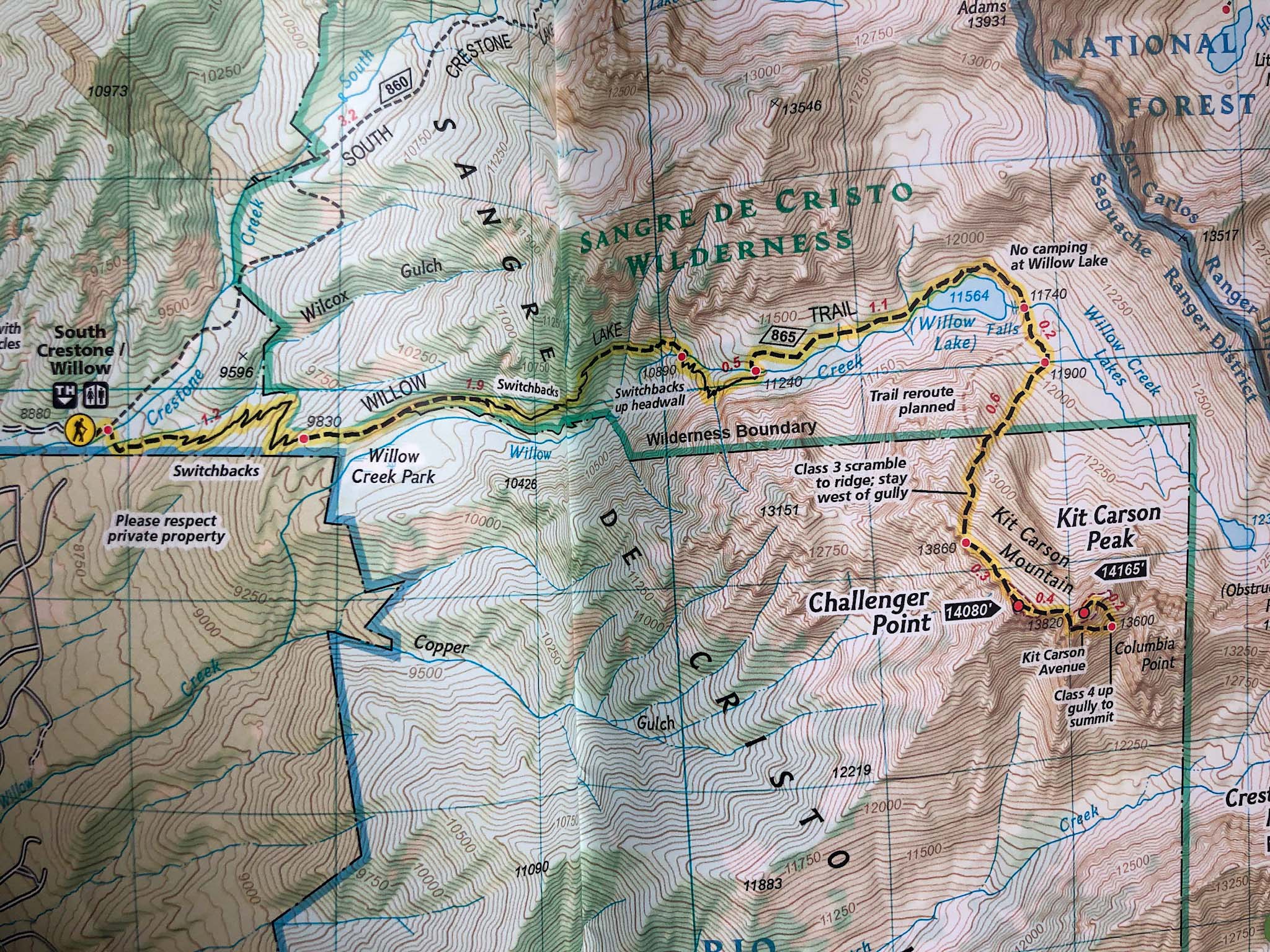
Hikers begin at the South Creston / Willow Creek trailhead and stay on the easy to follow Willow Lake Trail with numerous switchbacks. 3.1 miles in hikers will hit the base of the set of switchbacks that head up to the headwall before Willow Lake. Once reaching the top of the headwall, the hike is relatively flat towards Willow Lake.
About 4.2 miles into the hike, hikers will reach Willow Lake. The views are absurdly beautiful with cliffs to the right, the massive 180+ foot Willow falls draining into the lake, and trout feeding around the lake.
Hikers will reach the top of Willow Falls 4.7 miles into the hike and continue following the trail. There is a reroute planned in this section, so simply follow the trails marked appropriately as workers work on the trail. From here, the hike begins to get more difficult. Hikers will ascend scrambles and a gully that is very steep, features a lot of loose rock, and where all hikers should be wearing helmets and take a lot of caution. This tough hiking remains until hikers reach the ridge to Challenger Point.
Hikers have .6 miles left from Challenger Point, and they begin by descending to the saddle before Kit Carson. Hikers follow the well traveled trail around the large walls of Kit Carson and begin descending deceivingly far before taking a left turn marked by cairns up the easy class 3 gully to the summit of Kit Carson. Hikers retrace steps to get back down and should take note of the route they came to follow the simplest and easiest path back.
Dogs can accomplish this route without an issue, but there is rock fall potential at many points, so it may be beneficial to leave the dogs behind for this one.
Other Trail Options
The above is our recommended path for anyone’s first time summit on this mountain. With this being said, there are some other potential routes to the summit. Some meant for winter, and others that are class 4. We recommend reading about these routes or hearing from them from pros.
Trail Map
Hiking Kit Carson Peak In Winter
As with any 14er, this hike is significantly more dangerous in winter. These summits are doable in winter months via the same route, but added caution is needed. Because the low elevation of the trailhead, it is often accessible year round, but certain weather times can make it inaccessible.
Camping For Kit Carson Peak
Dispersed camping is allowed everywhere along this hike except for within 300 feet of Willow Lake. Near the lake you’ll find some incredibly beautiful camping spots that we highly recommend. In addition, you’ll find dispersed campsites at various points along the trail on the way to Willow Lake. We recommend you find a well used area already to pitch your tent or hammock. Practice leave no trace in this area. Because this is a Wilderness area, there are no fees or permits required.
If you want to do an overnight, we recommend camping within a half mile of Willow Lake. You will also find dispersed camping on the road leading to the trailhead.
Current Weather Conditions:
Here is the detailed weather forecast for the next few days. We highly recommend you check out the mountain forecast for this peak the morning of your hike.
Crestone, CO
Tonight
A chance of snow showers and a slight chance of thunderstorms. Cloudy, with a low around 22. South southwest wind 10 to 15 mph. Chance of precipitation is 30%. New snow accumulation of less than half an inch possible.
Saturday
A chance of snow showers before noon, then snow showers and a slight chance of thunderstorms. Mostly cloudy, with a high near 31. West southwest wind around 15 mph. Chance of precipitation is 80%. New snow accumulation of around one inch possible.
Saturday Night
A chance of snow showers and a slight chance of thunderstorms before midnight. Mostly cloudy, with a low around 18. West northwest wind 10 to 15 mph. Chance of precipitation is 40%. New snow accumulation of less than half an inch possible.
Sunday
A slight chance of snow showers after noon. Sunny, with a high near 36. West wind 10 to 15 mph. Chance of precipitation is 20%.
Sunday Night
Mostly clear, with a low around 21. West wind 10 to 15 mph.
Monday
A slight chance of snow showers and a slight chance of thunderstorms after 3pm. Mostly sunny, with a high near 38. West wind 15 to 30 mph, with gusts as high as 45 mph.
Monday Night
Partly cloudy, with a low around 23. West wind 15 to 20 mph, with gusts as high as 35 mph.
Directions & Parking
Here are directions to the Willow Creek Trailhead
Additional Pictures
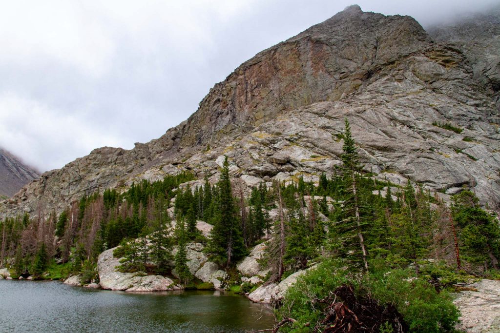
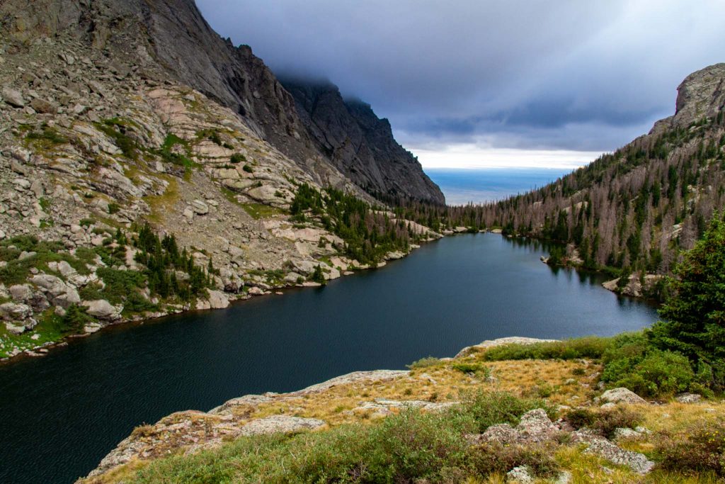
Cliffs over Willow Lake
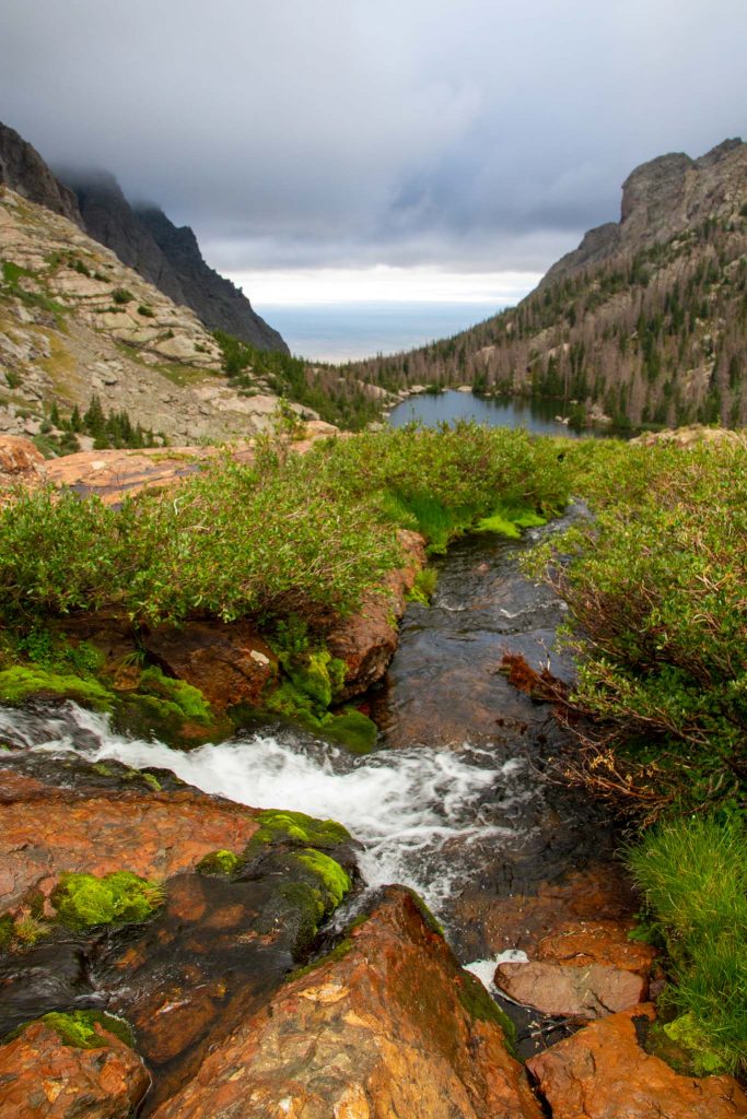
Views from above Willow Falls
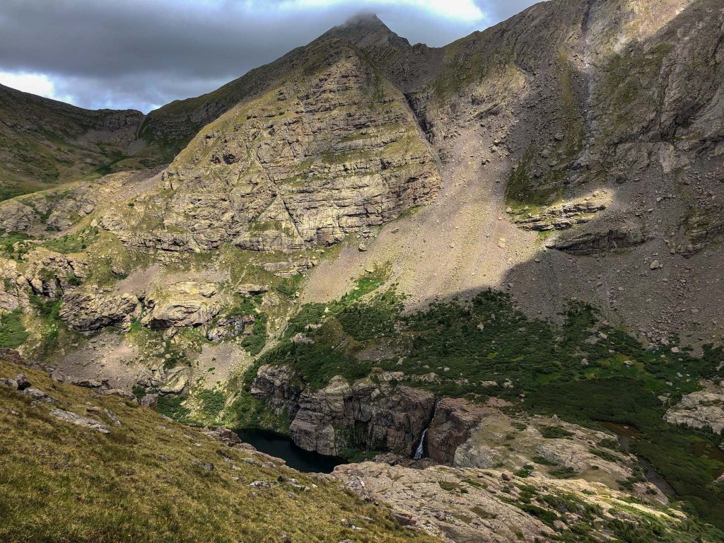
Views from above Willow Lake
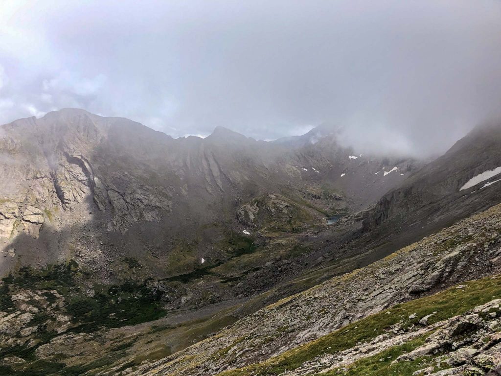
Views of upper willow lake
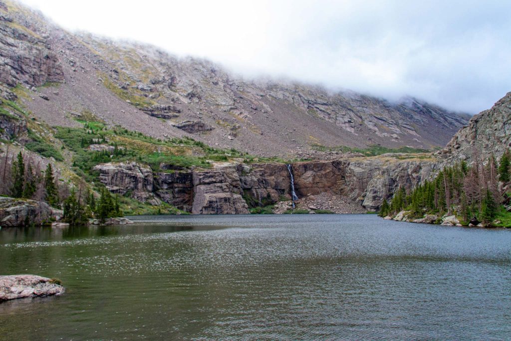
Willow Lake
Willow Lake views
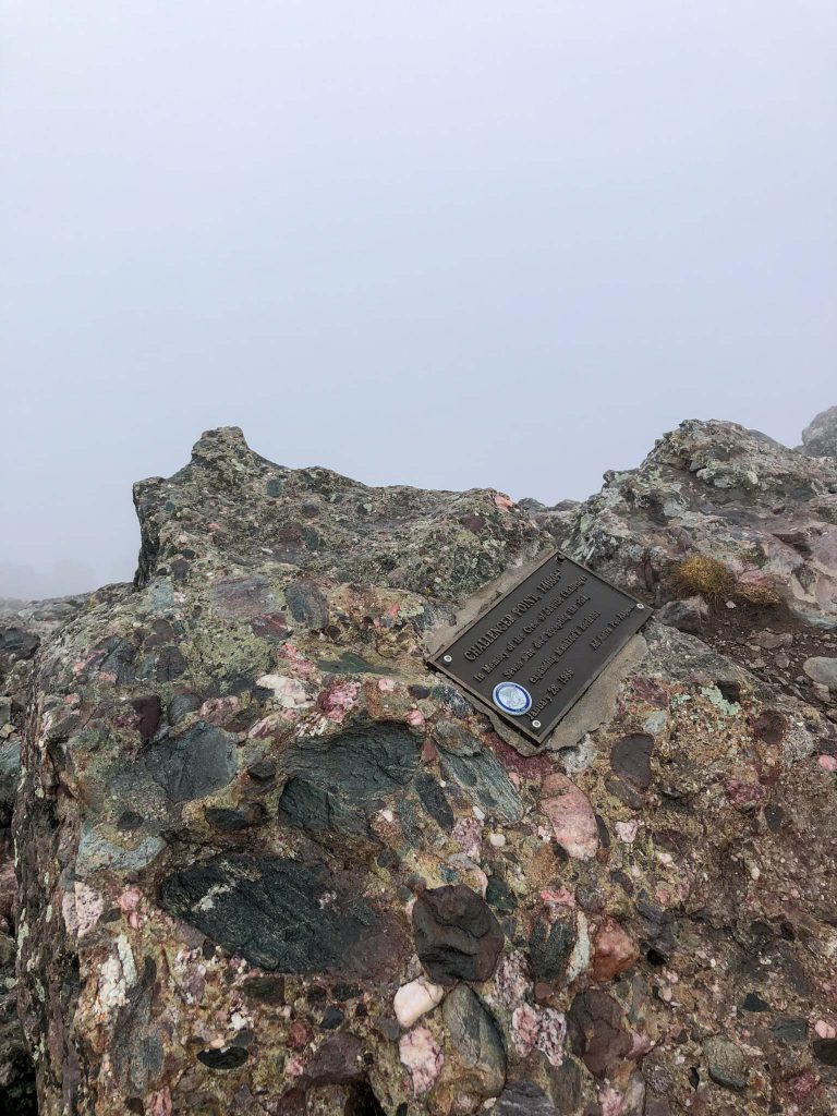
Challenger Point

Max DesMarais is the founder of hikingandfishing.com. He has a passion for the outdoors and making outdoor education and adventure more accessible. Max is a published author for various outdoor adventure, travel, and marketing websites. He is an experienced hiker, backpacker, fly fisherman, backcountry skier, trail runner, and spends his free time in the outdoors. These adventures allow him to test gear, learn new skills, and experience new places so that he can educate others. Max grew up hiking all around New Hampshire and New England. He became obsessed with the New Hampshire mountains, and the NH 48, where he guided hikes and trail runs in the White Mountains. Since moving out west, Max has continued climbed all of the Colorado 14ers, is always testing gear, learning skills, gaining experience, and building his endurance for outdoor sports. You can read more about his experience here: hikingandfishing/about