Lake Catherine is the last lake in a series of three beautiful lakes that make up an incredibly beautiful beginner friendly hike. Hikers pass Lake Mary, Lake Martha, and Lake Catherine on this hike, and here’s everything you need to know for this adventure.
Quick Navigation:
Trail Map | Trails | Hiking In Winter | Camping | Weather | Directions | Pictures
Difficulty – Easy
Distance – 4.1 miles round trip (6.60 km)
Height – 9,946 feet (3031.54 m)
Elevation gain – 1,230 feet (374.9 m)
Duration – 4.5-6 hours (book time)
Trailhead Location – Brighton Ski Resort (8,785 Feet)
Dogs – Not allowed on this trail
Need To Know Information
- Dogs are not allowed on this hike.
- Swimming is not allowed in any of the lakes in this area.
- This is a popular hike, and you will encounter people. There is plenty of free parking at the Brighton resort.
- Fishing is allowed at the lakes with a Utah Fishing License.
Trail Map
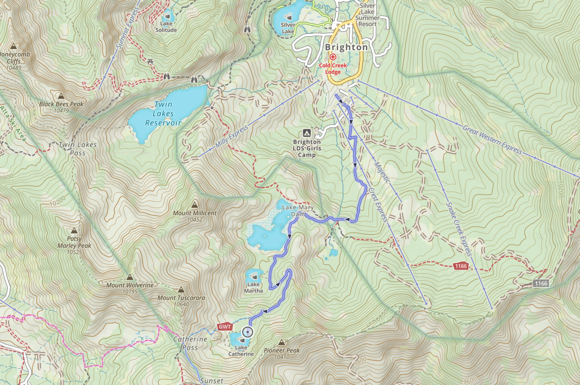
Click to enlarge this map
Download GPX File For This HIke
Routes
Lake Catherine Via Brighton Ski Resort – 4.1 miles round trip (6.60 km) – 1,936 feet (590.09 m) Elevation Gain
Hikers begin at the Brighton Resort parking lot and find the large trail map sign that shows the direction towards Lake Mary, Lake Martha, and Lake Catherine. This is a very popular spot, so you’ll likely find other hikers, but there is plenty of parking at the resort.
The trail starts relatively steep up some ski runs, but is very easy to follow, well maintained, and considered family friendly. Simply follow the trail and signs to Lake Mary (1.04 miles to Lake Mary) which already features stunning views, and then continue on the trail along the lake as it ascends quickly to Lake Martha (1.4 miles to Lake Martha). There are some side spur trails that can take hikers down to the shoreline of Lake Martha, but the main trail continues at similar gradients along taking hikers towards Lake Catherine.
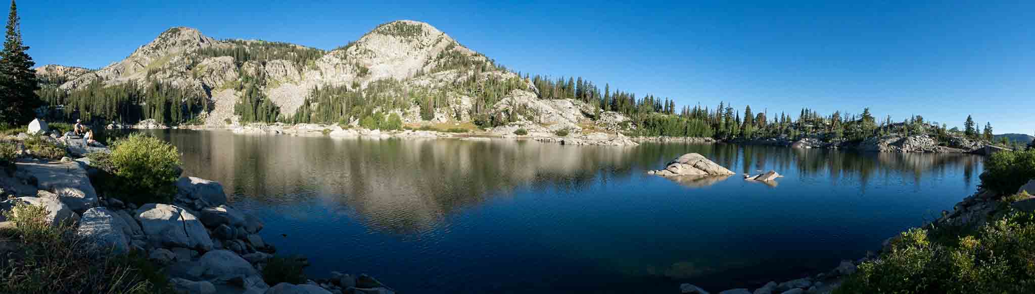
Lake Catherine has a full trail all the way around the lake as well.
Sunset Peak Via Brighton Ski Resort – 5.62 miles round trip (9.04 km) – 1,230 feet (374.9 m) Elevation Gain
Many hikers if they feel solid will consider hiking up to the peaks that look over Lake Catherine. Sunset Peak looms over lake Catherine, and has incredible views. You can read about this hike on our guide to Sunset Peak.
Once hikers reach lake Catherine, they continue following the route up towards the saddle between Sunset Peak and Mount Tuscarora, which is known as Catherine Pass.
Once reaching the pass, there are two trails, one that goes up the north side of Sunset peak, and one that loops around the back. The trail that loops around the back is slightly longer, but has great views, and is better maintained. We recommend this trail. It has several viewpoints along the way.
Simply follow the ridge to Sunset Peak, and retrace your steps when ready to return.
Hiking in Winter
This area is not often hiked in winter as it is part of the ski resort, and therefore it is being skied while the resorts are open.
Camping Information
People don’t generally camp for this hike, but there are accomodations at Brighton resort, as well as nearby campgrounds. The closest campground to the trailhead is the Redman Campground. Information and reservations can be found here.
There are also, campgrounds within Albion Basin that can be reserved when they are open. This campground contains 24 camping sites, each with picnic tables and campfire rings. Vault toilets are also on the premise. Information and availability can be found here.
Fishing Lake Mary, Lake Martha and Lake Catherine
All three lakes have healthy fish populations. This is a catch and release fishery, but many anglers can have success on most days on any of the lakes.
Weather
Here is a detailed weather forecast for the area:
Alta, UT
Tonight
A slight chance of snow showers after midnight. Mostly cloudy. Low around 33, with temperatures rising to around 35 overnight. Southwest wind around 10 mph. Chance of precipitation is 20%.
Thursday
A slight chance of snow showers between 9am and noon, then snow showers likely and a chance of thunderstorms between noon and 3pm, then a chance of thunderstorms and rain and snow showers. Partly sunny. High near 43, with temperatures falling to around 39 in the afternoon. Southwest wind around 12 mph. Chance of precipitation is 80%.
Thursday Night
Snow showers likely and a chance of thunderstorms. Mostly cloudy. Low around 30, with temperatures rising to around 32 overnight. West wind 6 to 9 mph. Chance of precipitation is 70%. New snow accumulation of 1 to 3 inches possible.
Friday
Snow showers and a chance of thunderstorms. Cloudy, with a high near 32. West wind 8 to 12 mph. Chance of precipitation is 100%. New snow accumulation of 4 to 8 inches possible.
Friday Night
Snow showers and a chance of thunderstorms. Mostly cloudy, with a low around 27. West northwest wind around 13 mph. Chance of precipitation is 80%. New snow accumulation of 2 to 4 inches possible.
Saturday
Snow showers before noon, then snow showers and a slight chance of thunderstorms. Cloudy, with a high near 29. Chance of precipitation is 90%. New snow accumulation of 2 to 4 inches possible.
Saturday Night
A chance of snow showers. Mostly cloudy, with a low around 25. Chance of precipitation is 40%. New snow accumulation of less than half an inch possible.
Directions
To Brighton Resort Trailhead:
Additional Pictures
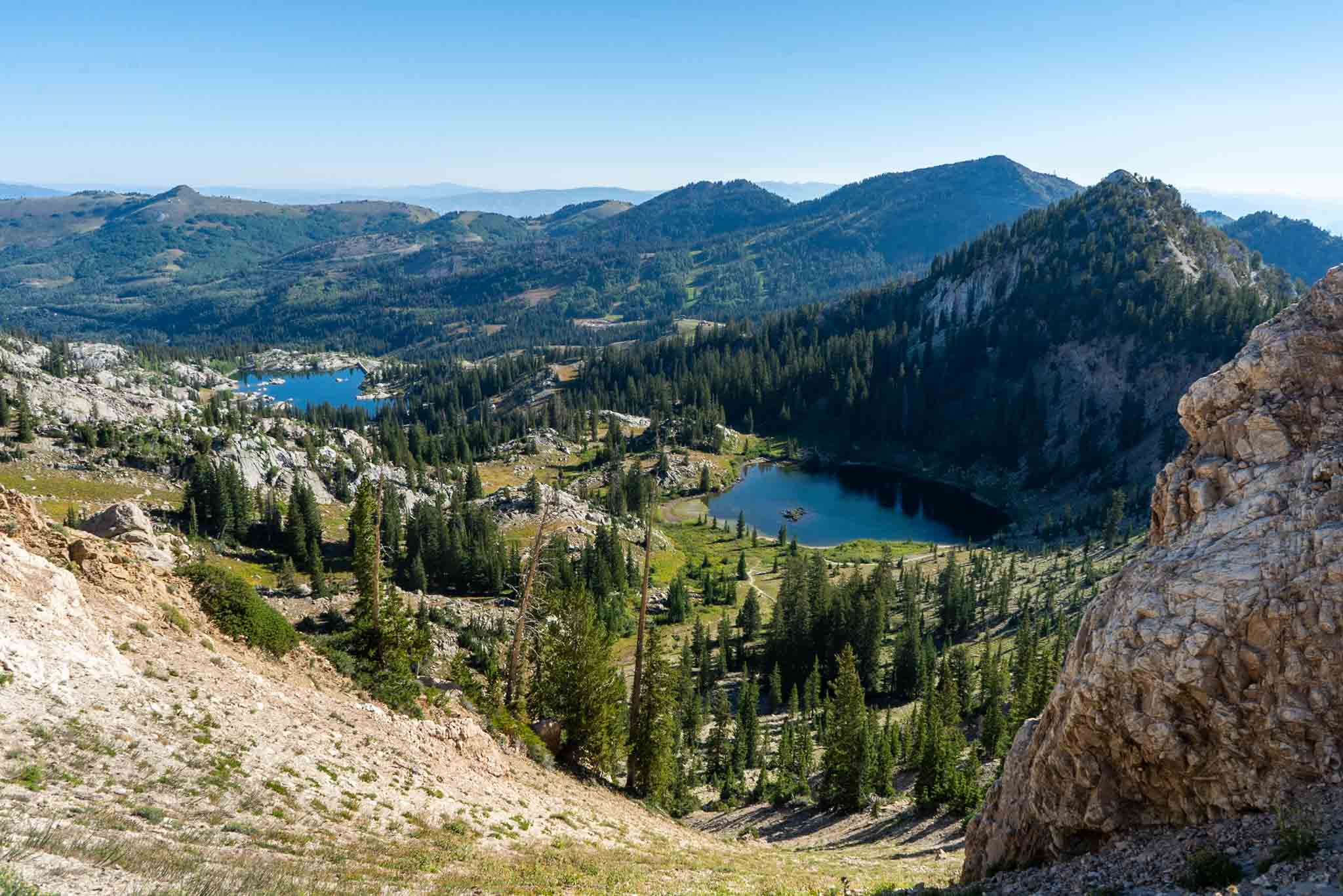
Views of the lakes from Catherine Pass
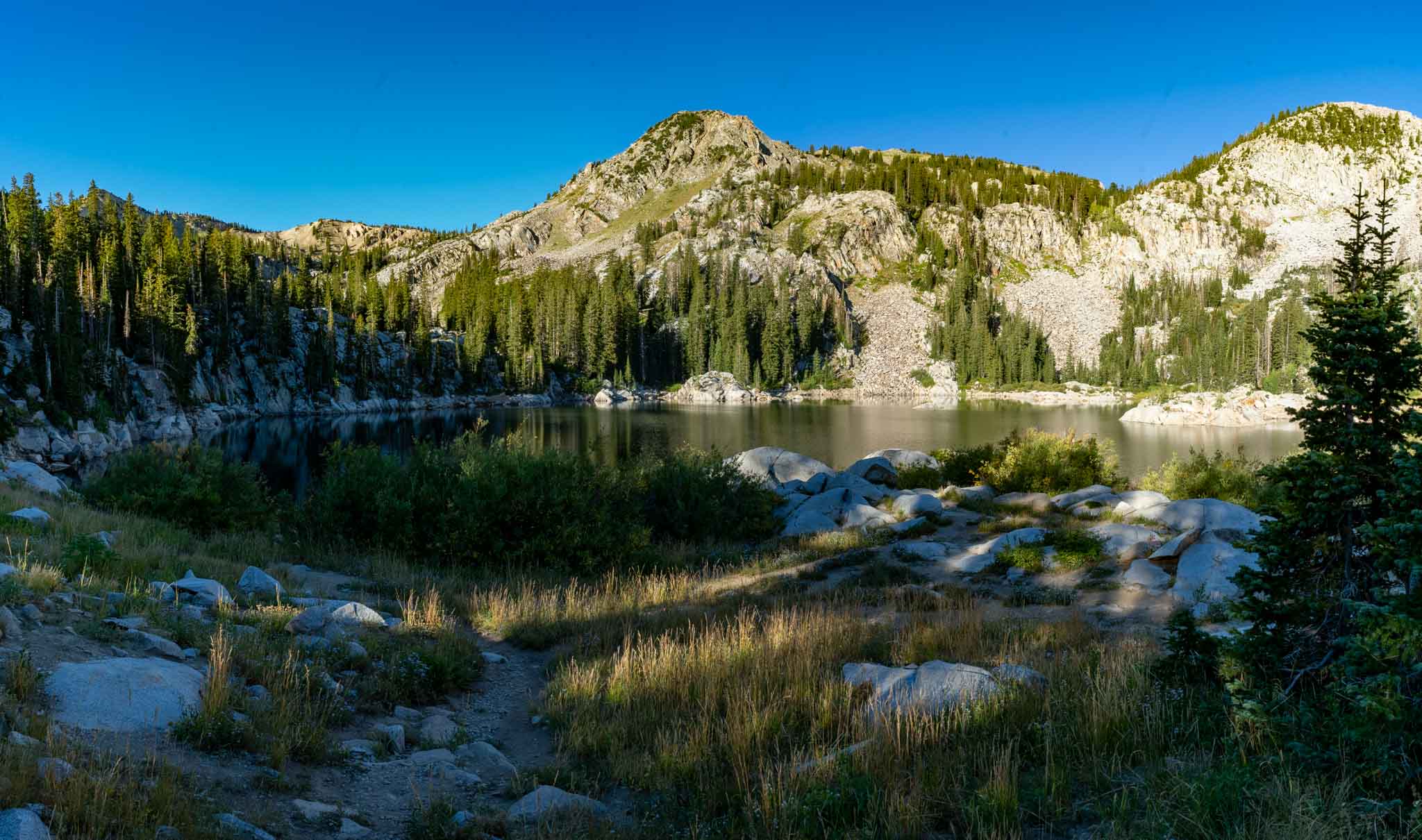
Views of Lake Mary

Views Of Lake Martha
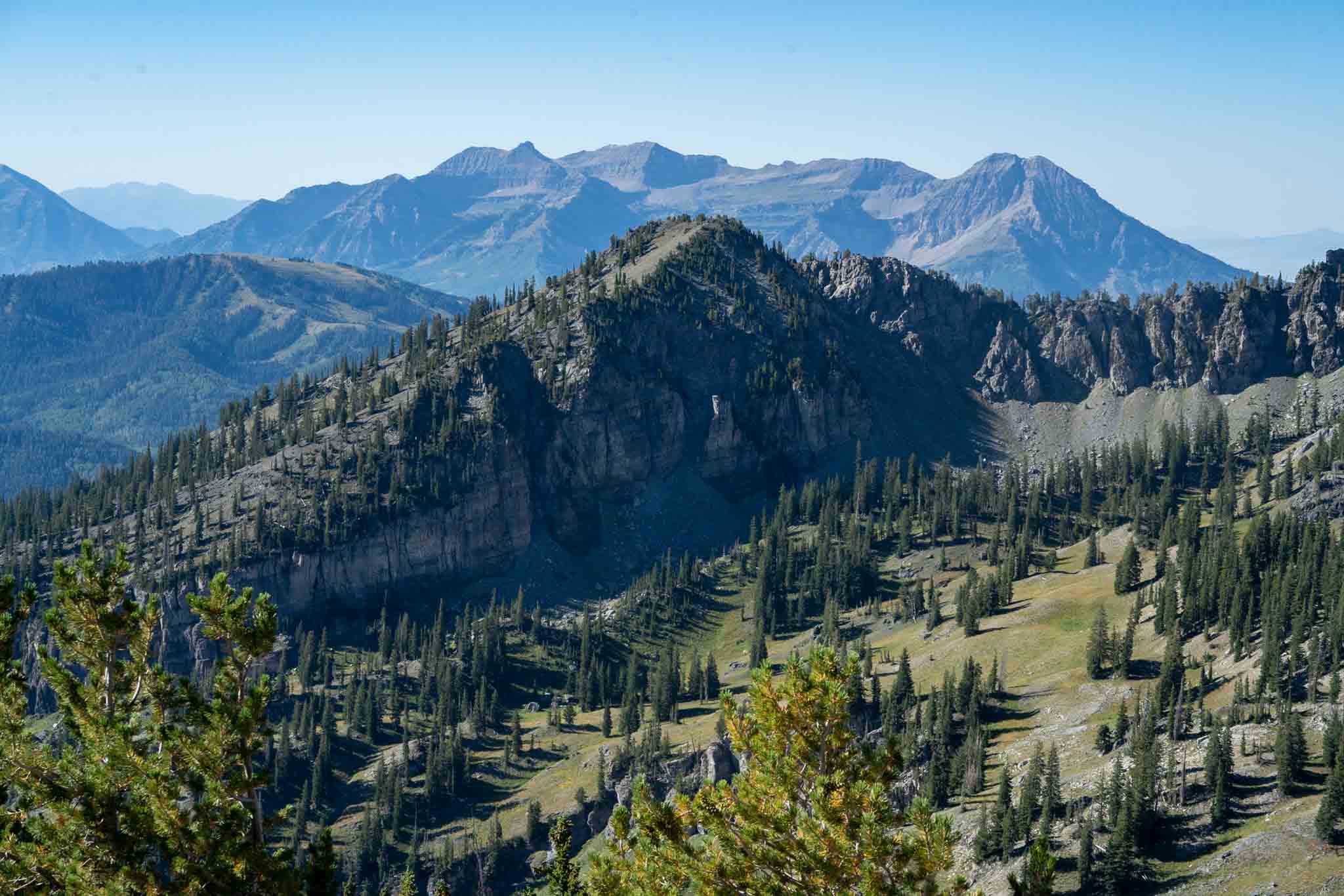
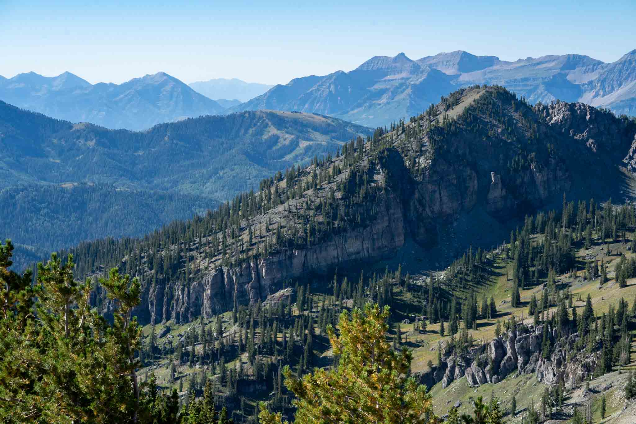
Views of Mount Timpanogos from the summit of Sunset Peak

Views of Mount Superior from the summit of Sunset Peak
Sunset Peak summit views

Sunset Peak and Lake Catherine from trail heading towards Catherine Pass

Max DesMarais is the founder of hikingandfishing.com. He has a passion for the outdoors and making outdoor education and adventure more accessible. Max is a published author for various outdoor adventure, travel, and marketing websites. He is an experienced hiker, backpacker, fly fisherman, backcountry skier, trail runner, and spends his free time in the outdoors. These adventures allow him to test gear, learn new skills, and experience new places so that he can educate others. Max grew up hiking all around New Hampshire and New England. He became obsessed with the New Hampshire mountains, and the NH 48, where he guided hikes and trail runs in the White Mountains. Since moving out west, Max has continued climbed all of the Colorado 14ers, is always testing gear, learning skills, gaining experience, and building his endurance for outdoor sports. You can read more about his experience here: hikingandfishing/about
Birthday Blizzard!
Hiked up with friends on my birthday. Planned to enjoy the lake and fish – even though it was snowing! But it was much windier and snowier than expected!
Bluebird day with fishing and Sunset Peak
Stopped by the lakes, enjoyed some great fishing, and also tagged Sunset peak!