Mount Antero is a 14,269 foot mountain in the Sawatch range of Colorado most well known for its gem filled mountainside. Below we will cover each of the trail options, information about camping, roads, trail maps and more to help you get hiking this Colorado 14er. This hike features tons of camping options, various trailheads, and the ability to drive up to 13,600 feet with the proper vehicle.
Distance – 15 miles round trip (24.14 km)
Height – 14,269 feet (4,349.2 m)
Elevation gain – 5,280 feet (1609.3 m)
Duration – 9 to 12 hours (book time)
Difficulty – Strenuous
Class: Class 2 Hike
Seasons – Year-round (caution and experience needed in winter – see below)
Trailhead Location – Baldwin Gulch Trailhead – 9,420 feet (directions below)
Trails
Baldwin Gulch Road (2WD trailhead): 15 Miles Round Trip | 5,280 Feet Elevation Gain | Class 2
This is the most common route up Mount Antero. Hikers along the road will frequently be passed by bikers and all terrain vehicles. This is by no means an isolated trail. Everything is quite easy to follow given this is a very well used road. Hikers will also find this terrain to be easily walkable.
The road also features a gradual gain over the entire course of the hike (see elevation profile image below). This makes it seem easier than a lot of other 14ers. Don’t be fooled however, starting from the 2WD trailhead makes this a long day with a lot of mileage and elevation gain.
Once hikers reach the 4wd trailhead, 2.7 miles into the hike, they will have to cross a stream, which has boulders making the crossing relatively easy on foot.
Hikers reach treeline 4.1 miles into the hike. The views are stunning from here on out.
Hikers reach the end of the road .5 miles from the summit (7 miles from the lower trailhead), from here the hiking becomes class 2 along a ridge, and then quickly ascending a scree field to the summit. This is the most difficult part of the hike.
Baldwin Gulch Road (4WD trailhead): 9.6 Miles Round Trip | 3,419 Feet Elevation Gain | Class 2
This route is the same as above but starts significantly higher at 10,850 feet. Only 4 wheel drive vehicles with high clearance should attempt this road. Subaru Outbacks, Crosstreks, Forresters can make it, but it is highly risky and not recommended.
Additionally, there are dispersed campsites between the 2WD and 4WD trailhead in which you can stay in. This will of course add some distance depending upon where you park/camp.
Often, the road contains snow until early June, so be sure to check road conditions before traveling.
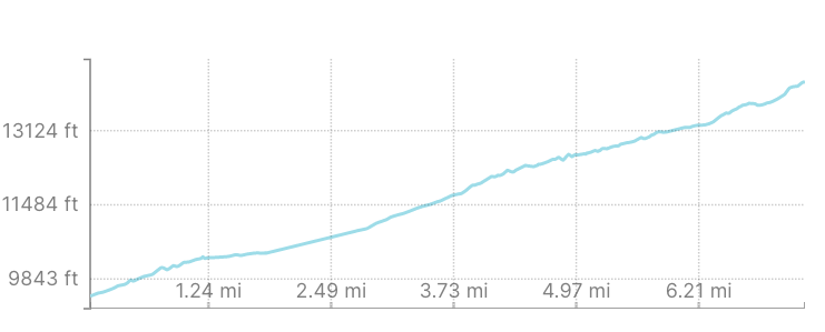
Baldwin Gulch Elevation Gain Profile – Mount Antero
Browns Creek Trail: 15.4 Miles Round Trip | 5,416 Elevation Gain | Class 2
This route is less traveled, but a fantastic overnight route. Hikers will not run into vehicles until meeting up with the road below Mount White as no motor vehicles are allowed. For those without 4WD vehicles, this is a great route. It is a tougher route to the summit due to mileage and elevation gain, but there is great camping, great views, and less traffic for most of the route.
You can find information on the Browns Creek Trailhead here (camping information below): https://www.fs.usda.gov/recarea/psicc/recarea/?recid=18209
This route is often covered in snow from November-May.
This route also features gradual gains across the majority of the hike as it follows Little Browns Creek. Eventually hikers find their way through wildflowers and alpine meadows below Mount White.
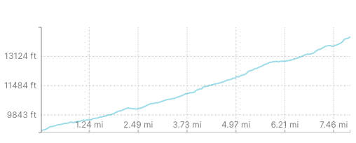
Browns Creek Trail Elevation Gain Profile – Mount Antero
Trail Map
Below we have a trail map for each of the above routes described.
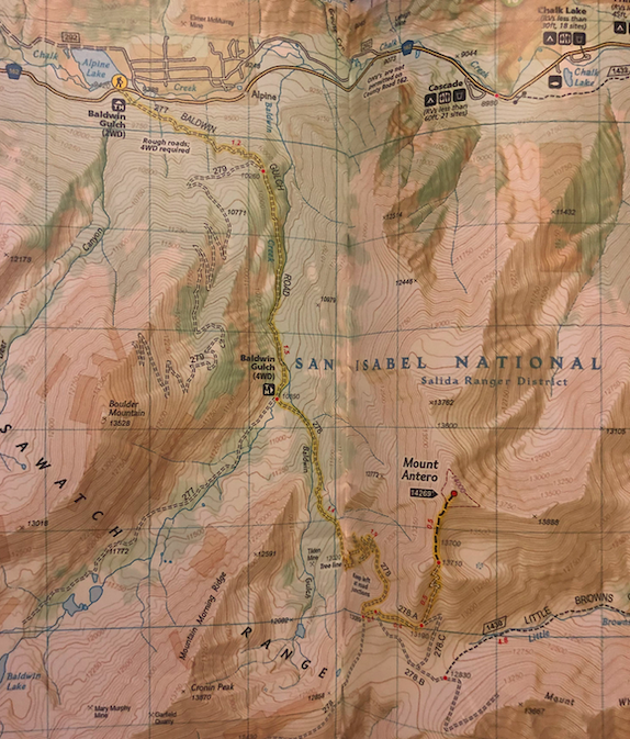
Mount Antero Trail Map – Baldwin Gulch Trailhead
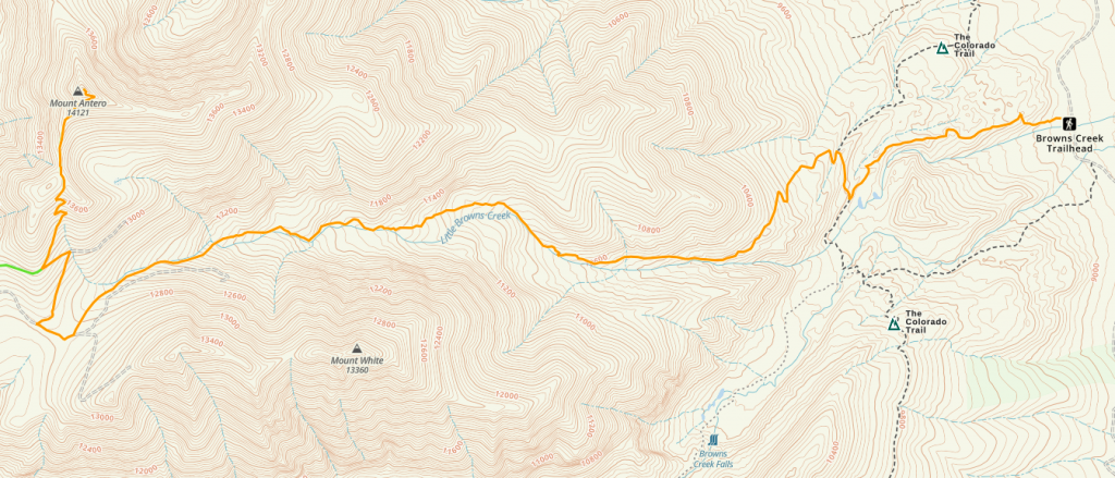
Mount Antero Trail Map – Browns Creek Trail
Hiking Mount Antero in Winter
Either route above can be accomplished in winter. Of course, the right gear and preparation is needed to summit either peak in winter.
The standard route (Baldwin Gulch) has avalanche danger. Hikers should not stay on the road the whole way, they should stay away from the gullies and stay on ridge tops and spurs to be the most safe. In winter, you should be aware of the avalanche dangers and avoid the most prone areas as much as possible.
Both trailheads routes are accessible year round, though it will only be the 2wd trailhead available for the Baldwin Gulch Trailhead.
Camping For Mount Antero
There are tons of dispersed campsites along the road leading to the trailhead for both Baldwin Gulch and Browns Creek.
Baldwin Gulch Camping: There are dispersed sites near the 2WD trailhead, all along the road to the 4WD trailhead, at the 4WD trailhead, and even a short distance after the 4WD trailhead. This is a busy camping area.
Browns Creek has dispersed camping near the trailhead as well as early on in the hike. Camping is allowed in used camping spots, but it is not allowed to make a new camping area here.
Current weather conditions:
Here is the detailed weather forecast for the next few days. We highly recommend you check out the mountain forecast for this region the morning of your hike.
Garfield, CO
Tonight
A slight chance of snow showers and a slight chance of thunderstorms before 9pm. Partly cloudy, with a low around 25. West southwest wind 30 to 35 mph. Chance of precipitation is 20%. New snow accumulation of less than one inch possible.
Friday
A slight chance of snow showers between noon and 3pm, then a slight chance of snow showers and a slight chance of thunderstorms. Mostly sunny, with a high near 40. West wind 25 to 35 mph, with gusts as high as 50 mph. Chance of precipitation is 20%. Little or no snow accumulation expected.
Friday Night
A chance of snow showers and a slight chance of thunderstorms. Mostly cloudy, with a low around 24. South southwest wind 10 to 30 mph, with gusts as high as 45 mph. Chance of precipitation is 40%.
Saturday
A chance of snow showers before noon, then snow showers likely and a slight chance of thunderstorms. Partly sunny, with a high near 39. West southwest wind 10 to 30 mph. Chance of precipitation is 70%. New snow accumulation of less than half an inch possible.
Saturday Night
A chance of snow showers and a slight chance of thunderstorms before midnight. Partly cloudy, with a low around 23. West wind 10 to 20 mph. Chance of precipitation is 30%.
Sunday
A slight chance of snow showers after noon. Sunny, with a high near 40. West wind 15 to 20 mph. Chance of precipitation is 20%.
Sunday Night
Mostly clear, with a low around 26. West wind around 20 mph.
Directions & Parking
Directions to Baldwin Gulch Trailhead (Mount Antero Road Trailhead):
Directions To Browns Creek Trailhead:
Additional Pictures
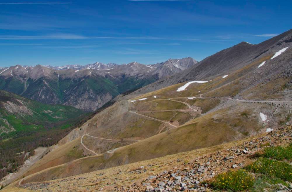
Mount Antero Road
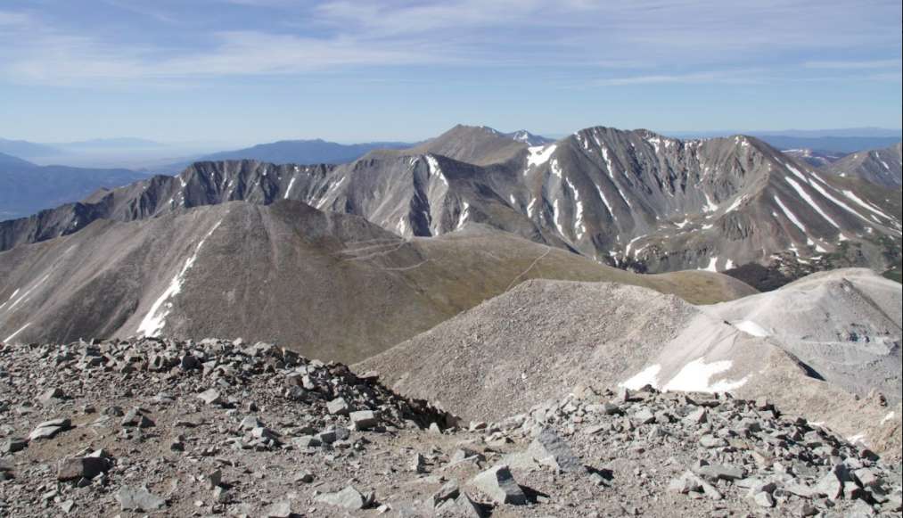
Summit Views on Mount Antero
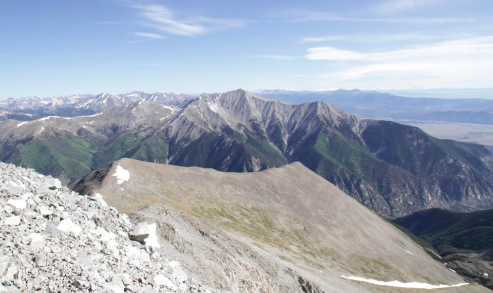
Mount Antero Summit Views

Max DesMarais is the founder of hikingandfishing.com. He has a passion for the outdoors and making outdoor education and adventure more accessible. Max is a published author for various outdoor adventure, travel, and marketing websites. He is an experienced hiker, backpacker, fly fisherman, backcountry skier, trail runner, and spends his free time in the outdoors. These adventures allow him to test gear, learn new skills, and experience new places so that he can educate others. Max grew up hiking all around New Hampshire and New England. He became obsessed with the New Hampshire mountains, and the NH 48, where he guided hikes and trail runs in the White Mountains. Since moving out west, Max has continued climbed all of the Colorado 14ers, is always testing gear, learning skills, gaining experience, and building his endurance for outdoor sports. You can read more about his experience here: hikingandfishing/about