Mount Elbert is a 14,433 foot mountain in the Sawatch Range of Colorado. Below we will cover each of the trail options, information about camping, roads, trail maps and more to help you plan and summit Colorado’s highest peak. Elbert is considered one of the easier Colorado 14ers in terms of the trail conditions and gradual steepness, however, it still requires substantial distance, elevation gain, and hikers spend a significant amount of time above treeline.
Distance – 9.6 miles round trip (15.4 km)
Height – 14,433 feet (4,399.18 m)
Elevation gain – 4,530 feet (1,380.74 m)
Duration – 7 to 9 hours (book time)
Difficulty – Strenuous
Class: Class 1 Hike
Seasons – Year-round (caution and experience needed in winter – see below)
Trailhead Location – Mount Elbert Trailhead – 10,060 feet (directions below)
Trails
North Mount Elbert Trail: 8.8 Miles Round Trip | 4,530 Feet Elevation Gain | Class 1
This is the most common route up Mount Elbert. It features a very steady gain all the way to the summit, and is a very highly trafficked trail.
There are countless dispersed campsites along the road near the trailhead, as well as established campgrounds. The hike begins in the woods and steadily rises to treeline. It is easy to follow, in great condition, and features a few false summits. hikers reach treeline 2.9 miles into the hike. From here, most of the hike is visible via the ridge, and the views are stunning from here on out.
South Mount Elbert Trail (4WD Vehicle): 8.8 Miles Round Trip | 4,100 Feet Elevation Gain | Class 2
This route begins near Twin Lakes Reservoir, and is frequently trafficked. The dirt road is accessible for most 4WD vehicles. This is actually the easiest route to the summit, is easy to follow, and features a steady elevation gain to the summit.
Road Conditions: During the winter the 4WD road is not accessible by car.
South Mount Elbert Trail (2WD Vehicle): 12.4 Miles Round Trip | 5,000 Feet Elevation Gain | Class 2
This is the same route as above just with added distance and some road walking. In the winter, the road to the 4WD is often impassable, making it necessary from starting at this trailhead.
Trail Map
The below map shows the standard route, mileage markers, elevation markers, and more for the North Mount Elbert Trail and the South Mount Elbert Trail.
Mount Elbert Trail Map
Want this trail map? Here is the link.
Hiking Mount Elbert in Winter
Either route above can be accomplished in winter. Of course, the right gear and preparation is needed to summit Elbert in winter.
During winter the South Mount Elbert 2WD trailhead will be your best starting point as it only ads 1.8 miles on the road. The road to the North Mount Elbert trail is closed in winter.
Camping For Mount Elbert
The North Elbert trail features tons of dispersed campsites near the trailhead. This is an awesome location to spend the night.
There are also two National Forest campgrounds; Halfmoon East Campground & Elbert Creek Campground, located on Halfmoon road right next to the trailheads for Mount Massive and Mount Elbert. Elbert creek has RV sites for less than 35 foot RVs and 17 tent sits. You can read more about each campground at the below links:
Both campgrounds don’t have reservable sites, so they are first come first serve. $7 day fees for parking, $20 per site for overnight camping (2 vehicles, or 1 RV). Any additional vehicle is $6.
For the South Mount Elbert Trail, there are camping spots at the Lakeview Campground: https://www.fs.usda.gov/recarea/psicc/recreation/camping-cabins/recarea/?recid=12486&actid=29
Current weather conditions:
Here is the detailed weather forecast for the next few days. We highly recommend you check out the mountain forecast for this region the morning of your hike.
Twin Lakes, CO
Tonight
Mostly clear, with a low around 25. West southwest wind 15 to 20 mph.
Thursday
A chance of snow showers between noon and 3pm, then a chance of snow showers and a slight chance of thunderstorms. Mostly sunny, with a high near 41. West southwest wind 15 to 20 mph. Chance of precipitation is 50%. New snow accumulation of less than half an inch possible.
Thursday Night
A chance of snow showers and a slight chance of thunderstorms. Cloudy, with a low around 23. West wind 20 to 25 mph, with gusts as high as 40 mph. Chance of precipitation is 50%. New snow accumulation of 1 to 2 inches possible.
Friday
A slight chance of snow showers before noon, then snow showers likely and a slight chance of thunderstorms. Mostly cloudy, with a high near 33. West wind 15 to 25 mph, with gusts as high as 40 mph. Chance of precipitation is 60%. New snow accumulation of less than one inch possible.
Friday Night
Snow showers and a chance of thunderstorms. Mostly cloudy, with a low around 19. Southwest wind 10 to 15 mph. Chance of precipitation is 80%. New snow accumulation of 1 to 2 inches possible.
Saturday
Snow showers before 9am, then snow showers and a chance of thunderstorms. Cloudy, with a high near 29. West southwest wind 10 to 15 mph. Chance of precipitation is 100%. New snow accumulation of 6 to 10 inches possible.
Saturday Night
Snow showers. Mostly cloudy, with a low around 18. West wind around 15 mph. Chance of precipitation is 80%. New snow accumulation of 1 to 3 inches possible.
Directions & Parking
Directions to North Mount Elbert Trailhead
Directions To South Mount Elbert Trailhead:
Additional Pictures
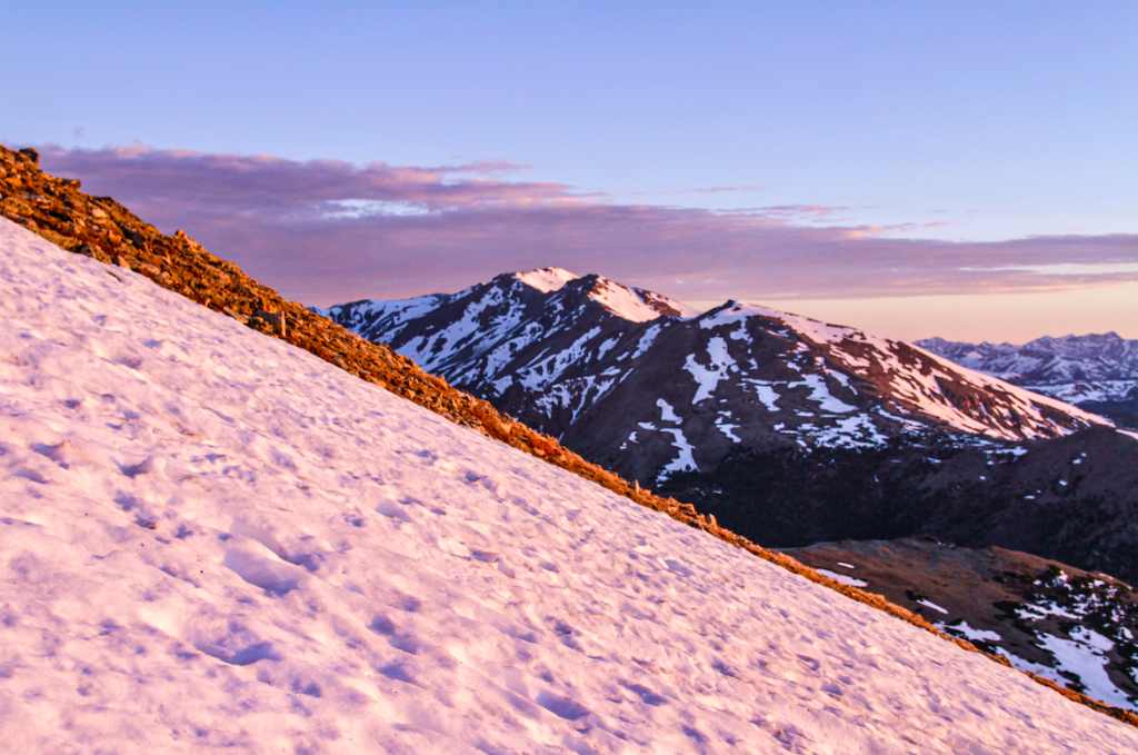
Views From Mount Elbert
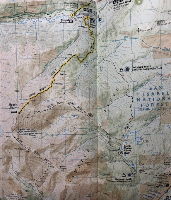
Mount Massive As Seen On Mount Elbert
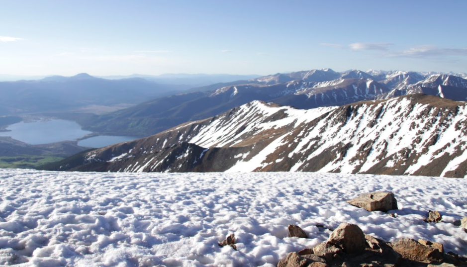
Views of Twin Lakes From Mount Elbert
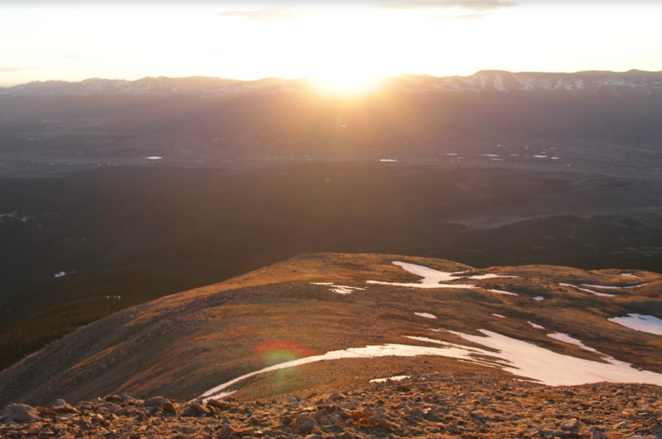
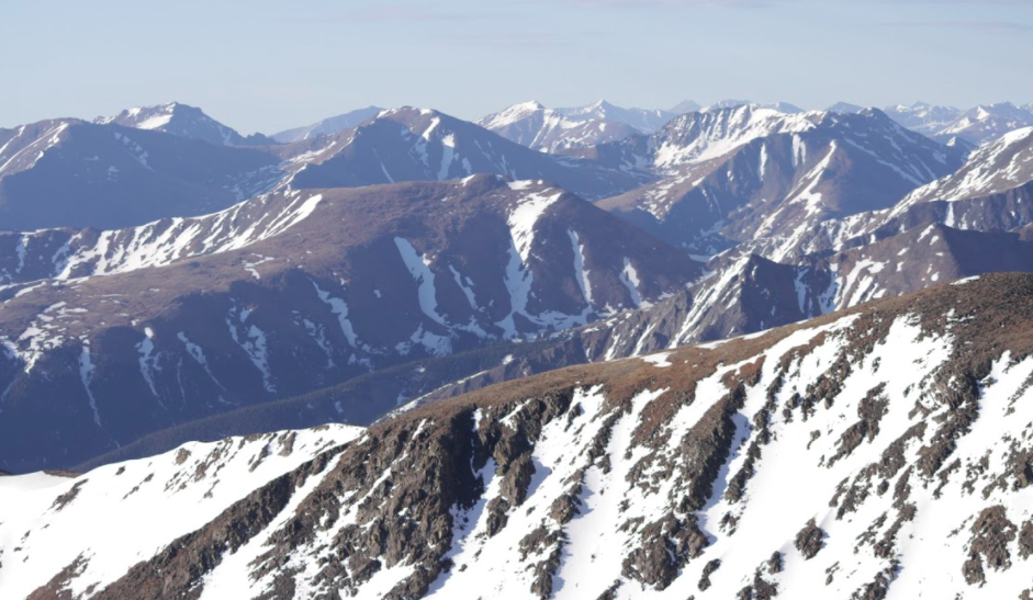
Sunrise on Mount Elbert

Max DesMarais is the founder of hikingandfishing.com. He has a passion for the outdoors and making outdoor education and adventure more accessible. Max is a published author for various outdoor adventure, travel, and marketing websites. He is an experienced hiker, backpacker, fly fisherman, backcountry skier, trail runner, and spends his free time in the outdoors. These adventures allow him to test gear, learn new skills, and experience new places so that he can educate others. Max grew up hiking all around New Hampshire and New England. He became obsessed with the New Hampshire mountains, and the NH 48, where he guided hikes and trail runs in the White Mountains. Since moving out west, Max has continued climbed all of the Colorado 14ers, is always testing gear, learning skills, gaining experience, and building his endurance for outdoor sports. You can read more about his experience here: hikingandfishing/about