Mount Garfield is a 10 mile round trip hike with incredible 360 degree views. With 3,500 feet of elevation gain spread over 5 miles, it offers mostly gradual incline, making the hike seem to be at the easy to moderate level.
Joseph Getts is a lifelong resident of New Hampshire who enjoys the limitless outdoor activities that the Granite State has to offer. Follow his YouTube Channel, Getts Wild and check out his other videos here.
Height: 4,501 feet
Length: 10 miles round trip
Duration: 4-9 hours (Book time 8 hours)
Difficulty: Intermediate
Elevation Gain: 2,959
Trails
Mount Garfield Trail
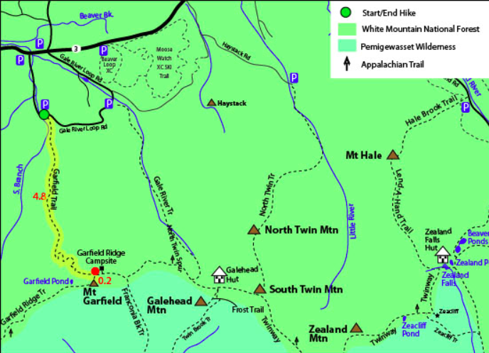
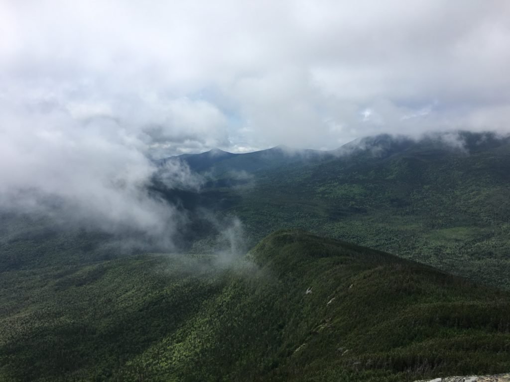
The trail starts near the middle of Gale River Loop Road. The gradual incline continues for around 4.8 miles before the last .2 miles brings you to the summit. The foundation of an old fire tower lies at the top. Clear views into the heart of the Pemi Wilderness with clear views of the Franconia Range, Owl’s Head, North and South Twin, and the Bonds.
Other Trails
Hikers can also choose to summit Mount Garfield from Mount Lafayette on Franconia Ridge. This path is absolutely stunning but far more strenuous. You can take a look at the maps in our Lafayette or Franconia Ridge post (linked to in this paragraph).
Hikers can also choose to hike from the trailhead further east on Gale River Loop Road. This is the quickest trail to hike Galehead Mountain, but it can be a detour to Mount Garfield as well. Adding in Galehead is a good way to knock of two 4,000 footers on a long day hike.
Trail Map
Trail Conditions
The trail is often dry, well maintained and well traveled. No issues with any type of footwear. The gradual incline nearly the whole way makes the conditions in Winter, Summer, Fall or Spring all manageable.
Nearby hikes. Mount Garfield is most often hiked alone, but it is part of the Pemi loop, and is connected the Franconia Ridge and Galehead Mountain.
Driving Directions
Take 93 North through Franconia Notch, hop on to Route 3 towards Twin Mountain and take a right onto Gale River Loop Road. You will pass numerous campsites before coming to the parking area.
Weather Forecast
Bethlehem, NH
Today
Sunny, with a high near 42. Northwest wind 10 to 15 mph, with gusts as high as 25 mph.
Tonight
Mostly cloudy, with a low around 26. East wind 5 to 20 mph, with gusts as high as 35 mph.
Thursday
A slight chance of snow showers between 8am and 10am, then a chance of rain and snow showers. Partly sunny, with a high near 42. Southeast wind 15 to 20 mph, with gusts as high as 35 mph. Chance of precipitation is 40%.
Thursday Night
A chance of rain showers before 11pm, then a chance of rain and snow showers between 11pm and 2am. Mostly cloudy, with a low around 32. South wind 10 to 15 mph, with gusts as high as 25 mph. Chance of precipitation is 40%.
Friday
A chance of rain showers after 3pm. Mostly cloudy, with a high near 44. South wind 15 to 25 mph, with gusts as high as 45 mph. Chance of precipitation is 30%.
Friday Night
Rain showers likely. Mostly cloudy, with a low around 37. Chance of precipitation is 60%.
Saturday
A chance of rain showers. Mostly cloudy, with a high near 41. Chance of precipitation is 30%.
Pictures
Want to read more about the NH 48?
Max DesMarais is the founder of hikingandfishing.com. He has a passion for the outdoors and making outdoor education and adventure more accessible. Max is a published author for various outdoor adventure, travel, and marketing websites. He is an experienced hiker, backpacker, fly fisherman, trail runner, and spends his free time in the outdoors. These adventures allow him to test gear, learn new skills, and experience new places so that he can educate others. Max grew up hiking all around New Hampshire and New England. He became obsessed with the New Hampshire mountains, and the NH 48, where he guided hikes and trail runs in the White Mountains. Since moving out west, Max has continued his frequent adventures in the mountains, always testing gear, learning skills, gaining experience, and building his endurance for outdoor sports. You can read more about his experience here: hikingandfishing/about
-
Beauty
-
Parking
-
Trail Conditions


