Mount Lindsey is a stunning Colorado 14er that features incredible views of the nearby Little Bear, Blanca Traverse. Lindsey is a class 3 hike with a simple approach, and features a bit of scrambling, or loose rock a starting only a short distance from the summit. Here’s everything you need to know to hike Mount Lindsey.
Distance – 8 miles round trip (12.87 km)
Height – 14,042 feet (4280.00 m)
Elevation gain – 3,800 feet (1158.24 meters)
Duration – 6 – 9 hours (book time dependant upon trailhead start)
Difficulty – Strenuous
Class: Class 2 Hike or Class 3 (explained below)
Seasons – This hike can be completed in all seasons, but winter is especially difficult, and dangerous. Roads to trailheads close in winter.
Trailhead Location – Lily Lake Trailhead (10,670 Feet)
Quick Navigation:
Routes | Trail Map | Camping Info | Weather | Directions | Pictures
Need To Know Information
-
- The road to Lily Lake Trailhead is a very long dirt road that 2wd vehicles likely won’t make it all the way to the trailhead, therefore, we recommend a 4wd trailhead unless you are willing to add 3-5 miles each way depending upon conditions. Road is considered a 3/6 difficulty
- Camping is allowed at the trailhead, but this is a busy trailhead and it does fill up pretty quickly even though it is large.
- There is tons of available free dispersed camping on the road leading to the trailhead
- The road to the trailhead is rough, but accessible for 4wd vehicles at American Basin, or high clearance 2WD at Silver Creek / Grizzly Gulch.
- The road to the trailhead is often closed in winter many miles below Lily Lake.
Hiking Route Options
Lily Lake Trailhead | Standard Route – 8 Miles Round Trip (12.87 km) – 3,800 Feet Elevation Gain (1,158.2 meters) | Class 2 or Class 3
While winter hikers, backcountry skiers, and some other adventurous people may take a other routes, there is only one main route to the summit. This route has two options just before the summit, 1 option features class 3 scrambling on very solid rock, while another features a class 2 walk up steep scree and loose rock. For safety reasons, we recommend the class 3 route (explained below). The class 3 route does feature some steep climbing and exposure, so those that are afraid of heights and exposure may need to stick to the class 2 loose rock gully. This gully has a lot of rock fall danger in it, and therefore, we recommend avoiding it if you can.
Hikers begin on the Lily Lake Trailhead where it stays relatively flat and has some minor downhills for the first 1.1 miles. 1.1 miles in, hikers will reach the junction to Lily Lake which they will not take. Stay left to continue towards Mount Lindsey. There is a stream crossing just after this junction which during high water might require some rock hopping and balancing across trees, or taking the boots off.
After the river crossing, the trail heads towards a nearby boulder field through some dense forest. Once reaching this boulder field at around 10,800 feet the trail begins the more intense elevation gain as it through easy to follow, but steep hiking. At around 11,400 feet, hikers will reach a gully with wildflowers (in proper season) and a stream running through the middle where they continue to ascend along the left hand side of the river before crossing it at about 11,600 feet.
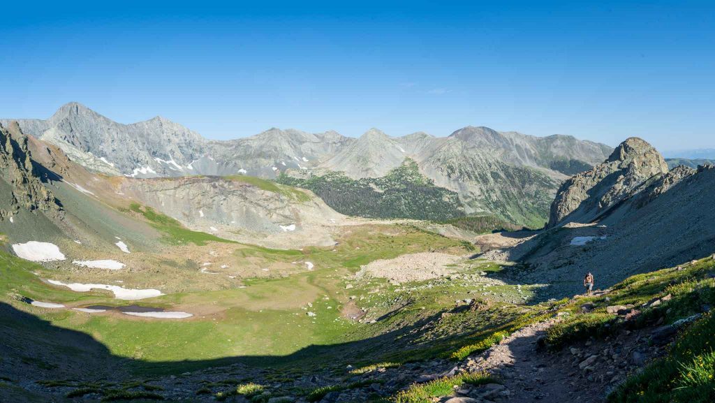
Hikers then continue along the trail hitting treeline at just about 12,000 feet where they views are incredible in the center of a high basin with unreal 360 degree views. From this lifted basin, hikers descend eastward slightly before beginning a climb towards a saddle at 13,000 feet. Then hikers head towards the saddle between Iron Nipple (that’s the mountain next to Lindsey), and Lindsey by heading across a boulder field. This saddle is reached at 13,150 feet. Here the remainder of the route is visible.
This is where hikers have the choice of taking the solid rock class 3 up the ridge to the summit, or taking the loose rock gully class 2 to the summit. Additionally, there are a couple other routes you can take that have some brief class 4 moves to continue to the summit if you are a not bothered by exposure. The image below highlights each of these routes. Tons of caution needs to be taken for any of these routes, and this shouldn’t be attempted if you don’t have scrambling or route finding experience. Hikers summit, and head back the same route.
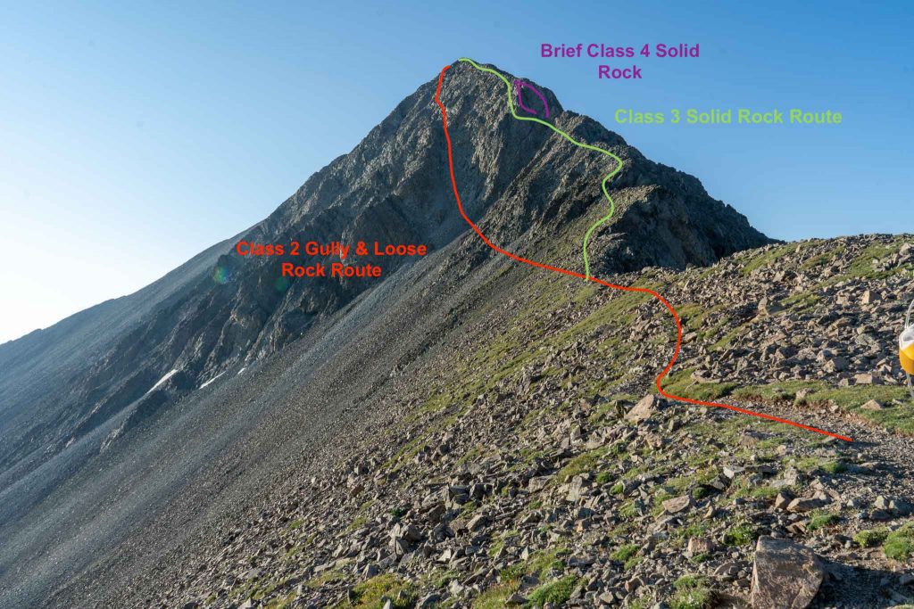
Mount Lindsey Class 2 Vs Class 3
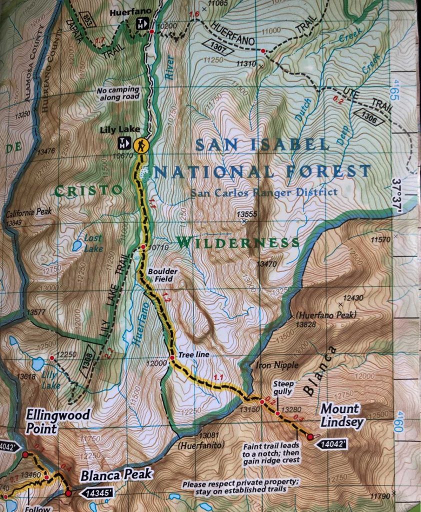
Trail Map
Camping For Mount Lindsey
There is tons of dispersed and free camping along the road leading to the trailhead. Additionally, hikers often sleep in cars at the trailhead. There is also dispersed camping allowed on the hike. You can read about the rules and regulations for the Sangre De Cristo Wilderness here.
Current Weather Conditions:
Here is the detailed weather forecast for the next few days. We highly recommend you check out the mountain forecast for this peak the morning of your hike.
Fort Garland, CO
Tonight
Mostly clear, with a low around 30. Southwest wind 20 to 25 mph.
Thursday
A slight chance of snow showers after 2pm. Mostly sunny, with a high near 37. West southwest wind 20 to 35 mph, with gusts as high as 50 mph. Chance of precipitation is 20%.
Thursday Night
A slight chance of snow showers and a slight chance of thunderstorms before 3am. Mostly cloudy, with a low around 26. West wind 25 to 30 mph, with gusts as high as 50 mph. Chance of precipitation is 20%. New snow accumulation of less than half an inch possible.
Friday
A chance of snow showers and a slight chance of thunderstorms after noon. Mostly sunny, with a high near 34. West southwest wind 25 to 30 mph, with gusts as high as 40 mph. Chance of precipitation is 30%.
Friday Night
A chance of snow showers and a slight chance of thunderstorms. Mostly cloudy, with a low around 19. Southwest wind 20 to 30 mph, with gusts as high as 40 mph. Chance of precipitation is 50%. Little or no snow accumulation expected.
Saturday
Snow showers likely before noon, then snow showers and a chance of thunderstorms. Partly sunny, with a high near 28. Southwest wind around 20 mph, with gusts as high as 35 mph. Chance of precipitation is 90%. New snow accumulation of 1 to 3 inches possible.
Saturday Night
A chance of snow showers. Mostly cloudy, with a low around 19. West southwest wind around 20 mph. Chance of precipitation is 50%. New snow accumulation of less than one inch possible.
Directions & Parking
As stated above, the road is a bit rough, and we recommend a 4wd vehicle if you want to ensure you make it the Lily Lake trailhead. 2wd vehicles may make it far but may need to add several miles each way.
Directions to Lily Lake Trailhead:
Additional Pictures
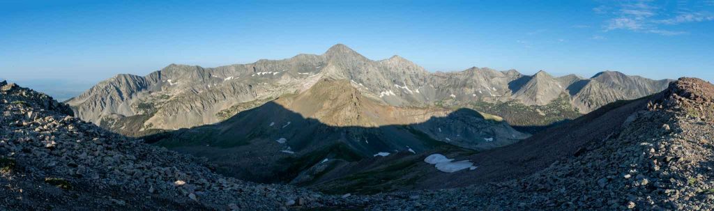
Summit pano views from Mount Lindsey. Looking at Little Bear Blanca traverse.
Views of basin near first saddle
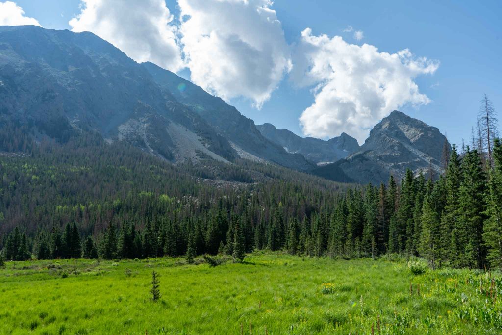
Early views after Lily Lake trailhead
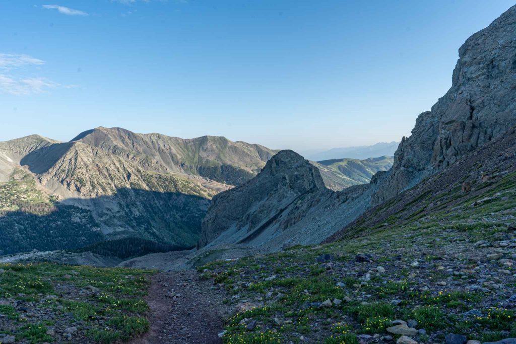
Trail views heading up out of the basin
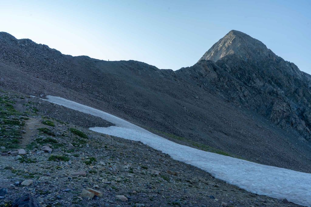
Mount Lindsey as seen from first saddle
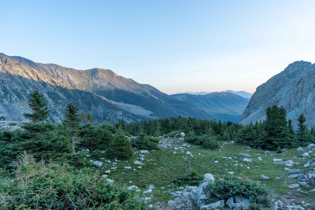
Views from in the basin
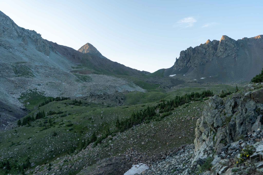
Views of Mount Lindsey from the basin
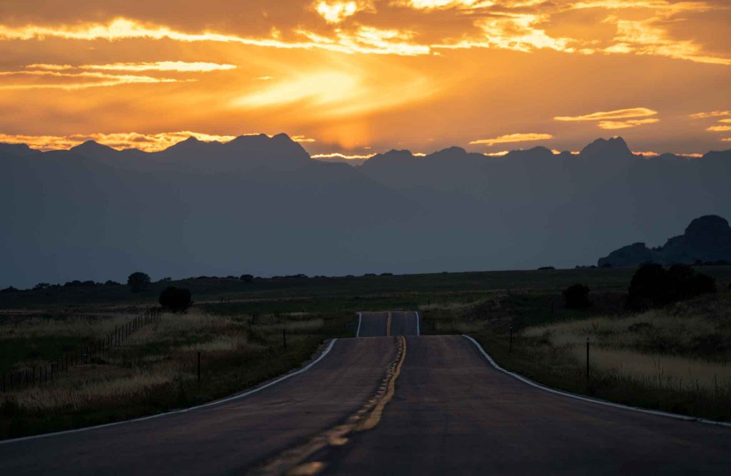
The road heading towards Lily Lake Trailhead (before it turns to dirt)

Max DesMarais is the founder of hikingandfishing.com. He has a passion for the outdoors and making outdoor education and adventure more accessible. Max is a published author for various outdoor adventure, travel, and marketing websites. He is an experienced hiker, backpacker, fly fisherman, backcountry skier, trail runner, and spends his free time in the outdoors. These adventures allow him to test gear, learn new skills, and experience new places so that he can educate others. Max grew up hiking all around New Hampshire and New England. He became obsessed with the New Hampshire mountains, and the NH 48, where he guided hikes and trail runs in the White Mountains. Since moving out west, Max has continued climbed all of the Colorado 14ers, is always testing gear, learning skills, gaining experience, and building his endurance for outdoor sports. You can read more about his experience here: hikingandfishing/about