Red Pine Lake is located in Little Cottonwood Canyon only a short distance away from Salt Lake City. It is frequently rated as one of the top hikes on the Wasatch front for lake lovers. Red Pine Lake consists of two lakes, Red Pine Lake, and Upper Red Pine Lake. In this article, you’ll get all the info you need for hiking to these gorgeous spots.
Quick Navigation:
Trail Map | Trails | Hiking In Winter | Camping | Weather | Directions | Pictures
Difficulty – Strenuous
Distance – 6.6 miles round trip (10.62 km)
Height – 9,026 feet (2751.13 m)
Elevation Gain – 4,190 feet (1277.11 m)
Duration – 5-6 hours (book time)
Hike Class – Class 3
Trailhead Location – Mount Olympus Trailhead (4,830 Feet)
Dogs – Allowed off leash, but the scrambling portion for dogs can be difficult, and owners need to be careful.
Need To Know Information
- Dogs are allowed on this trail. The last portion of the hike to the summit involves some scrambling. This can be difficult and dangerous for dogs, so it is important to be cautious in these areas, and turn around if you don’t feel comfortable with your dog here.
- This is a popular hike, and you will encounter people. Parking fills up quite fast.
- There is overflow parking on the road (explained below).
- The top portion of this hike features class 2 to 3 scrambling. Meaning you’ll likely need to use your hands, and caution needs to be taken here. While most people are capable of this, a fear of heights, or inexperience scrambling is a detriment here.
- Bikes are not allowed in the Mount Olympus Wilderness.
Trail Map
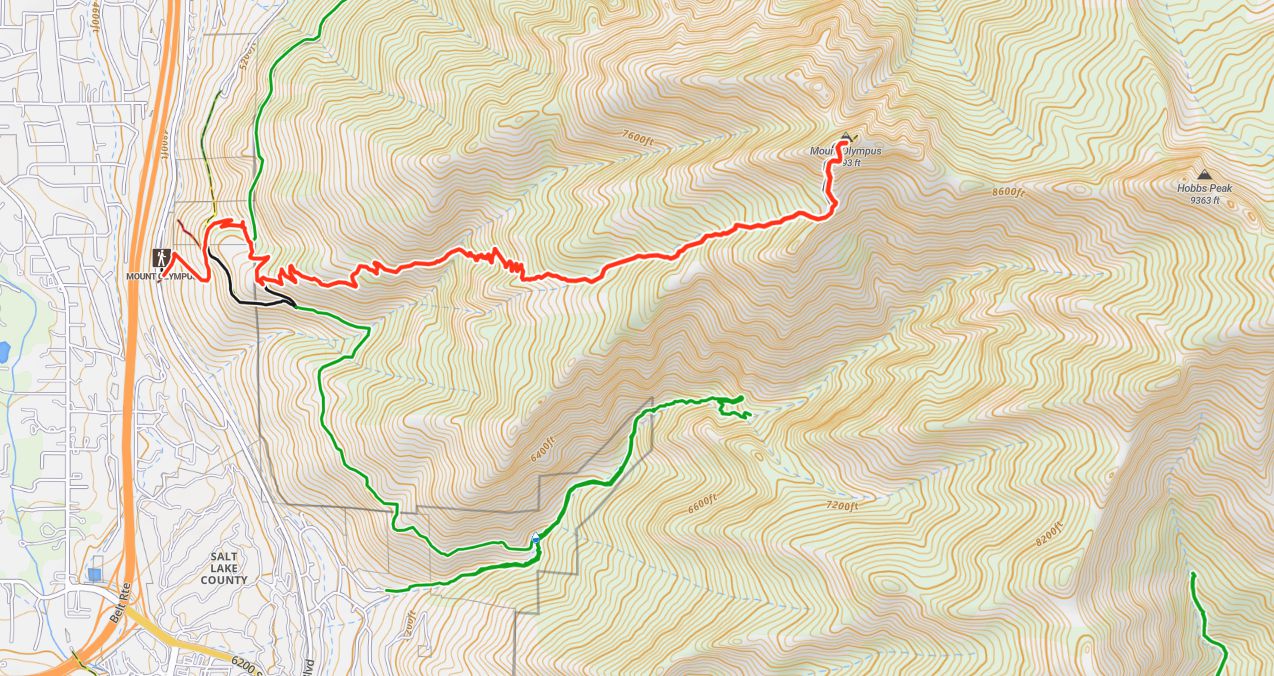
Mount Olympus Trail Map
Routes
Mount Olympus Via Mount Olympus Trailhead – 6.6 miles round trip (10.62 km) – 41,190 feet (1277.11 m) Elevation Gain
This is the only common route to the summit of Mount Olympus. The Trailhead starts next to the parking lot. Hikers begin heading uphill instead of following the level trail at the trailhead. From here, the trail is extremely well traveled and well maintained. The trail ranges from moderately steep to quite steep across the entire route to the summit.
0.3 miles in, hikers will reach a junction. Both the let and right will take you in the proper direction and are basically equidistant. If taking the left here, hikers will reach another trail junction 0.3 miles further where they need to bear right and get back on th the Mount Olympus Trail. I hikers turn right, they are staying on the Mount Olympus trail, and will need to take a left turn in 0.3 miles to stay on the Mount Olympus Trail. This is the last junction of the hike, as the rest of the way is simply following the well traveled path up the the mountain.
Views are pretty exceptional just about the entire way, but particularly at the 0.5 mile market onwards. The trail begins to get a bit steeper 2 miles into the hike as the trail enters Tolcats Canyon and the trail has some tree cover.
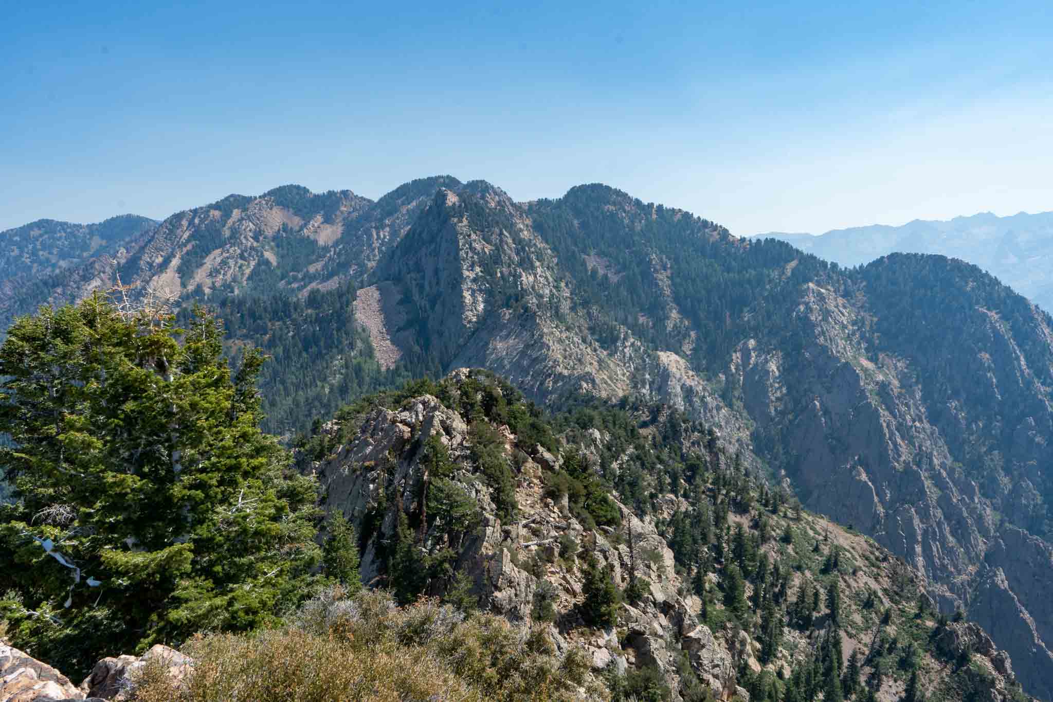
Hikers will eventually ascend to a gorgeous viewpoint, and will look up at the last push to the summit (which has class 3 sections) of scrambling. It is after this viewpoint where the hike is most difficult due to the scrambling necessary, and where extra caution needs to be taken. The trail often has several routes around rocks, boulders, and trees, so simply take the path that works best for you. The summit area is filled with jagged boulders which is difficult walking, but the views are stunning.
Retrace your steps to get back.
Hiking in Winter
This is a great winter hike for those with some experience with winter hiking. The route remains the same, but hikers need to be prepared for the weather, and bringing snowshoes, or microspikes. The trail is often packed, so snowshoes are not necessary in many cases, but we believe microspikes are necessary in winter. Particularly for the final class 3 section of hiking to the summit. In winter, extreme caution needs to be taken here as it is steep, and dangerous ice can develop in this section.
Camping Information
People do not camp for this mountain due to the trailheads proximity to the city, and lack of campsites. This peak is in the Mount Olympus Wilderness, meaning camping is allowed greater than 200 feet from water sources, and greater than 200 feet from the trail. With this mountain, this leaves no quality camping options. Therefore, this is not a mountain where people camp. You can read about the Mount Olympus Wilderness regulations here.
Weather
Here is a detailed weather forecast for the area:
Holladay, UT
Today
Sunny. High near 47, with temperatures falling to around 45 in the afternoon. West wind 5 to 9 mph.
Tonight
Partly cloudy. Low around 37, with temperatures rising to around 39 overnight. West wind 2 to 9 mph.
Friday
Mostly cloudy, with a high near 53. West northwest wind 6 to 10 mph.
Friday Night
Mostly cloudy, with a low around 40. North northeast wind 6 to 10 mph.
Saturday
Mostly sunny, with a high near 58. West wind 6 to 13 mph.
Saturday Night
Partly cloudy, with a low around 44.
Sunday
Mostly sunny, with a high near 62.
Directions
The Mount Olympus Trailhead is a large parking lot with 48 parking spots (2 of them handicap spots). These 48 spots still fill up quickly on the weekends. There is some overflow parking on Wasatch Blvd just south of the trailhead where you will likely see cars on the side of the highway.
Additional Pictures
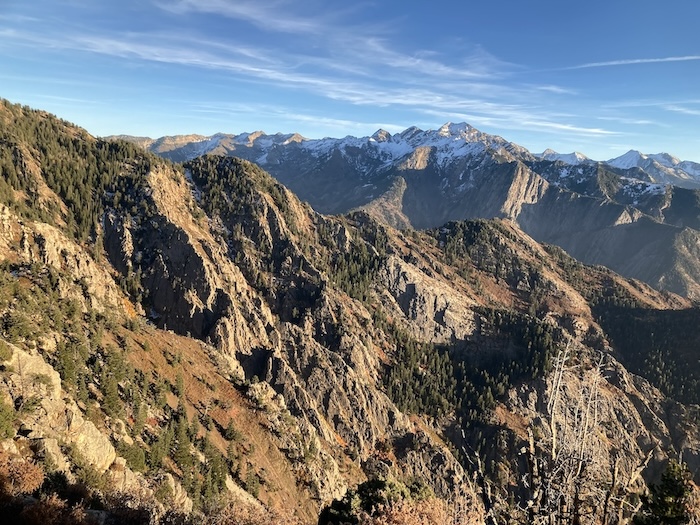
Views from the saddle before the final push to the summit of Olympus.
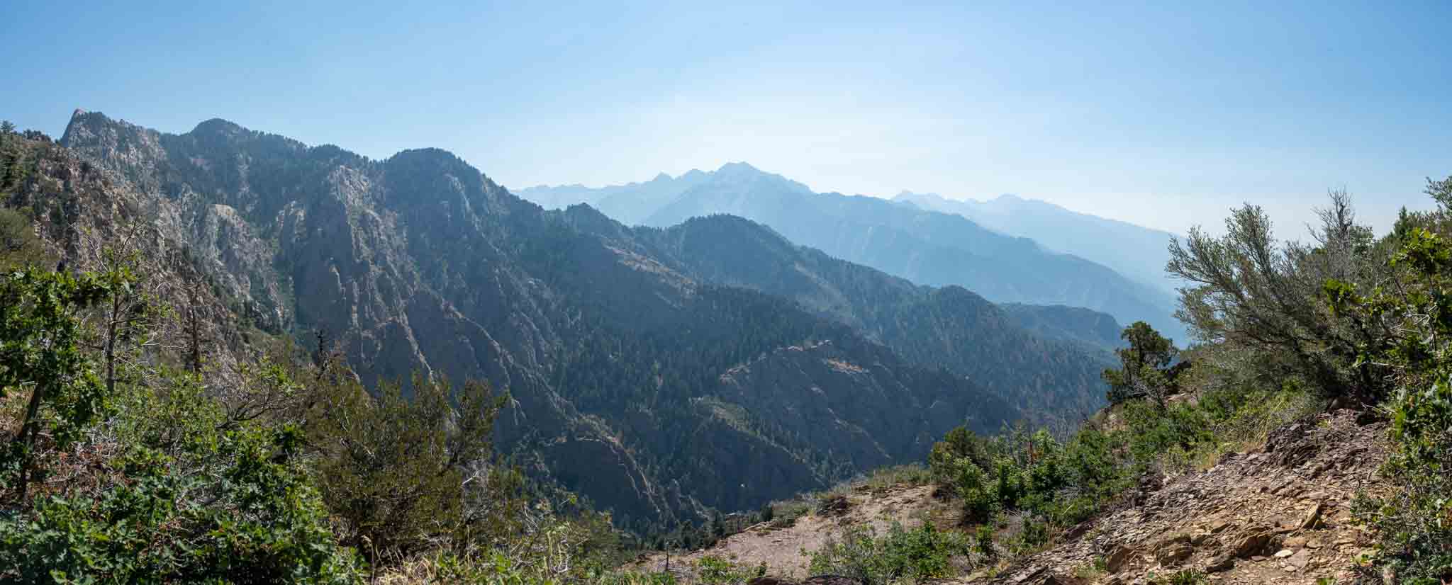
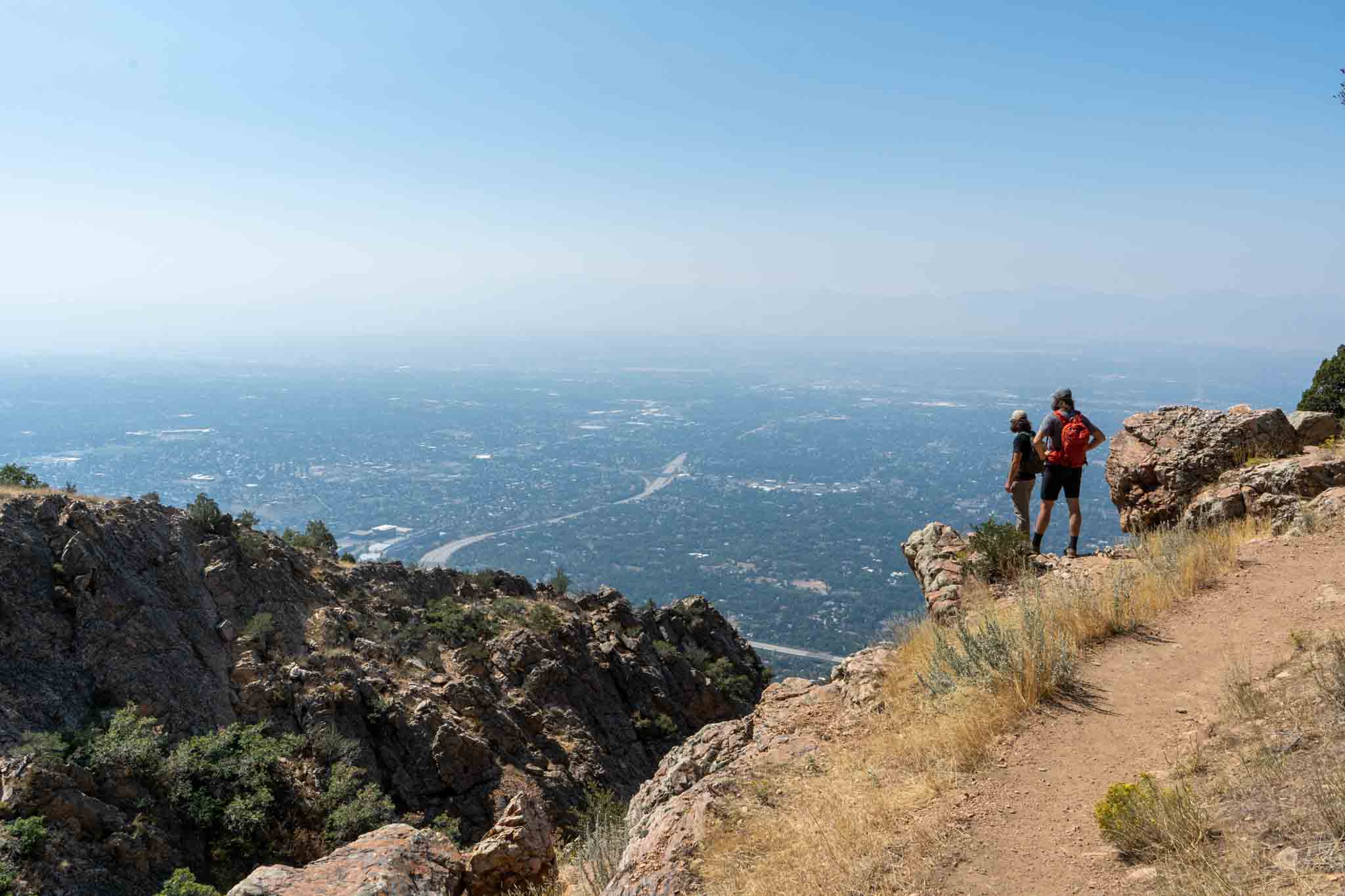
Views of Salt Lake City from the summit of Olympus on a smoky day
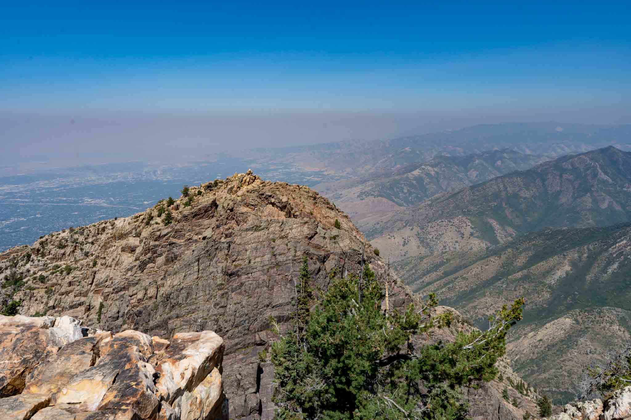
Views of Salt Lake City from the summit of Olympus on a smoky day
Views along the trail of Mount Olympus

Max DesMarais is the founder of hikingandfishing.com. He has a passion for the outdoors and making outdoor education and adventure more accessible. Max is a published author for various outdoor adventure, travel, and marketing websites. He is an experienced hiker, backpacker, fly fisherman, trail runner, and spends his free time in the outdoors. These adventures allow him to test gear, learn new skills, and experience new places so that he can educate others. Max grew up hiking all around New Hampshire and New England. He became obsessed with the New Hampshire mountains, and the NH 48, where he guided hikes and trail runs in the White Mountains. Since moving out west, Max has continued his frequent adventures in the mountains, always testing gear, learning skills, gaining experience, and building his endurance for outdoor sports. You can read more about his experience here: hikingandfishing/about
-
Beauty
-
Parking
-
Trail Conditions
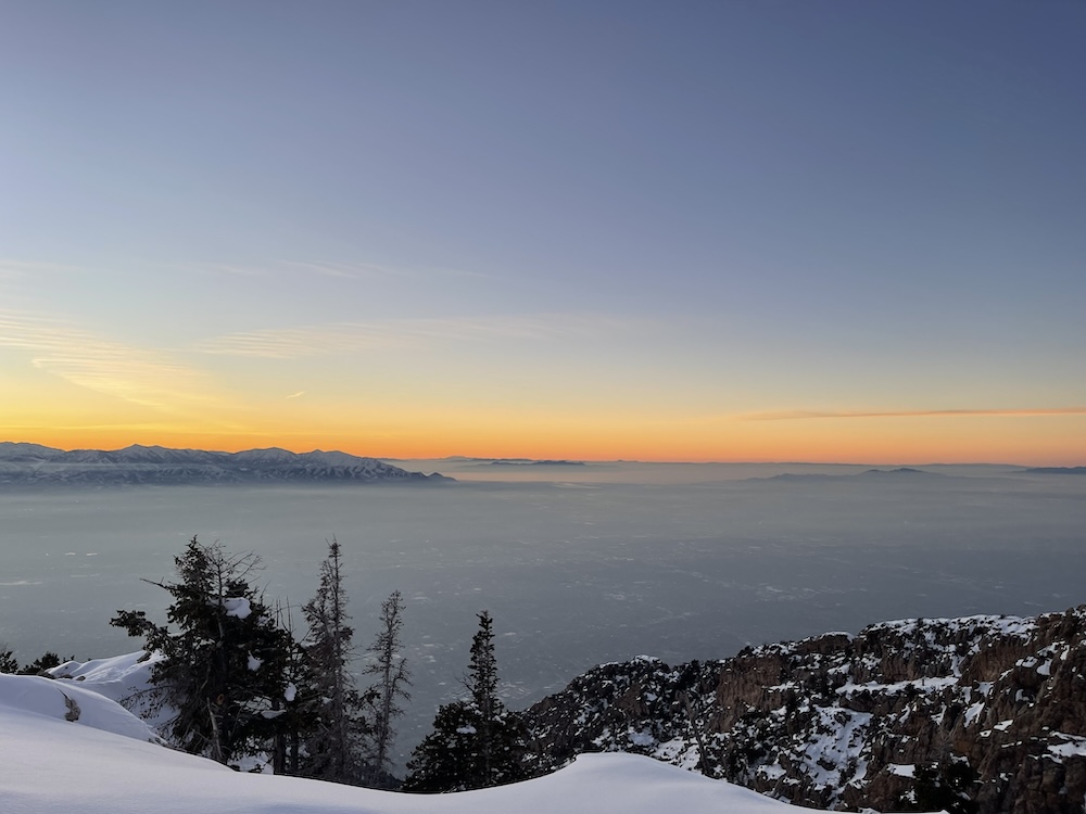
Incredible Sunset & Snow Covered Trails
January 29th, 2024 has an incredible sunset with the inversion down below. Slightly muddy trails below, snow was in good condition to move fast, but a little “postholy” as we approached the summit. Spikes and poles recommended!
Cloudy, but gorgeous, and snow covered
October 28th, 2024 featured some pretty stellar views and about 10 other hikers on trail. Conditions were solid down below, and snowy up high. Microspikes and poles would be helpful. Conditions allowed for a solid pace if comfortable moving fast in the snow!