Mount Raymond in Big Cottonwood Canyon just outside Salt Lake City, Utah is a hike with incredible views, a couple routes, and some class 3 scrambling. In this article, we’ll cover everything you need to know before setting out on your Mount Raymond adventure.
Quick Navigation:
Trail Map | Trails | Hiking In Winter | Camping | Weather | Directions | Pictures
Difficulty –Strenuous
Distance – 7.8 miles round trip (8.88 km)
Height – 10,241 feet (2529.54 m)
Elevation gain – 3,100 feet (732.43 m)
Duration – 3-4 hours (book time)
Trailhead Location – Butler Fork trailhead (7,172 Feet)
Dogs – Not allowed
Need To Know Information
- Dogs are not allowed.
- There are a few common routes. The most common is from the Butler Fork Trailhead which is the easiest route, the second most common is from Millcreek Canyon, and the third is from lower in Big Cottonwood Canyon at the Mill B North trailhead. We describe each of these for you below.
Trail Map

Routes
Mount Raymond’s Class 3 scramble:
It is worth noting that all routes to the summit require class 3 scrambling near the end of the hike to reach the summit. The scrambling features solid handholds, but it can be difficult for those that have issues with heights or drop offs. This scramble occurs only minutes before the summit of Mount Raymond. Pictures are below for reference.
Mount Raymond Via Butler Fork
Distance – 7.8 miles round trip (12.55 km)
Elevation gain – 3,200 feet (975.36 m)
Duration – 6-8 hours (book time)
Trailhead Location – Butler Fork trailhead (7,172 Feet)
This is the most common route to the summit of Mount Raymond due to the higher elevation starting point, and the fact that the trailhead is located within Big Cottonwood Canyon.
This trail is well traveled, well maintained, and well marked, making it easy or anyone to follow. Hikers follow the signs towards Mount Raymond and Gobblers Knob.
If you are interested in this route, we have created a GPX route of it here.
Mount Raymond Via Bowman Fork Trailhead in Mill Creek Canyon
Distance – 9.46 miles round trip (15.22 km)
Elevation gain – 4,270 feet (1301.50 m)
Duration – 8-10 hours (book time)
Trailhead Location – Bowman Fork Trailhead
This is simply another route from Millcreek Canyon (which requires a pass, or a $5 parking fee). This is a common approach for those that want to avoid driving into Big Cottonwood Canyon. It is relatively straightforward, and increases both the mileage and elevation gain.
If you are interested in this route, we have created a GPX route of it here.
Mount Raymond Via Mill B North
Distance – 11.9 miles round trip (19.15 km)
Elevation gain – 5,101 feet (1554.79 m)
Duration – 10-12 hours (book time)
Trailhead Location – Mill B North Fork Trailhead
This is not the recommended route to the summit due to substantial increase in length and elevation gain. That being said, this route combines some incredibly stunning scenery. We believe this is the most scenic route. It too is simple to follow as the trails are well traveled and well marked. If you want to lengthen your day and make this hike even more difficult, we highly recommend it. You’ll come across far fewer people after a couple miles in the trail.
If you are interested in this route, we have created a GPX route of it here.
Hiking in Winter
This is prone to avalanche conditions in winter and should only be done by those who are aware of current avalanche conditions, and are prepared for winter hiking. This is a common backcountry skiing zone, but because of the avalanche dangers, this zone should only be done by those with experience in avalanche terrain. You can read the current avalanche forecasts on the Utah Avalanche Center website.
Camping Information
Backcountry camping is allowed in Big Cottonwood canyon pending you are on Forest Service property. Camping must be at least 1/2 mile off of any road, and 200 feet from any trails, water, or developed areas.
If approaching from Millcreek, you can backcountry camp. More information can be found here.
Weather
Here is a detailed weather forecast for the area:
Holladay, UT
Tonight
Mostly cloudy. Low around 31, with temperatures rising to around 33 overnight. West southwest wind around 6 mph.
Saturday
Mostly sunny, with a high near 49. West wind 6 to 10 mph.
Saturday Night
Mostly clear, with a low around 35. Southwest wind 7 to 10 mph.
Sunday
Sunny, with a high near 57. Southwest wind 8 to 14 mph.
Sunday Night
Partly cloudy, with a low around 35. West southwest wind 8 to 15 mph.
Monday
Mostly sunny, with a high near 52.
Monday Night
Partly cloudy, with a low around 36.
Directions
To Big Cottonwood Canyon Trailhead at Butler Fork Trailhead
To Millcreek Canyon Trailhead at Bowman Fork Trailhead
To Big Cottonwood Canyon Trailhead at Mill B North Trailhead
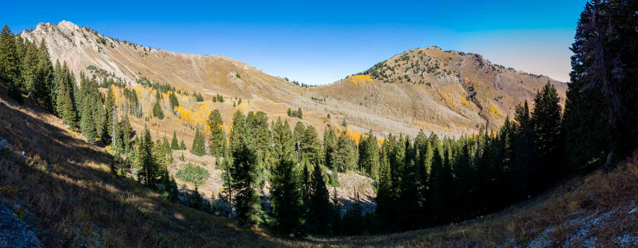
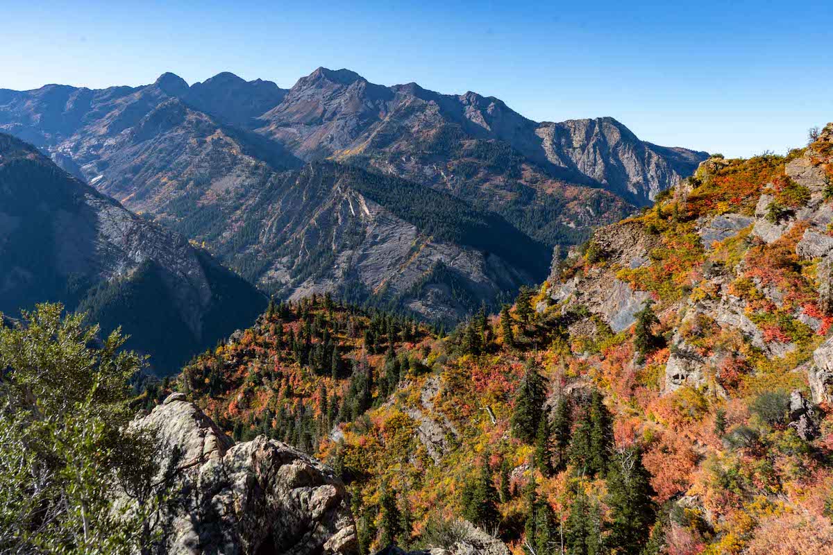
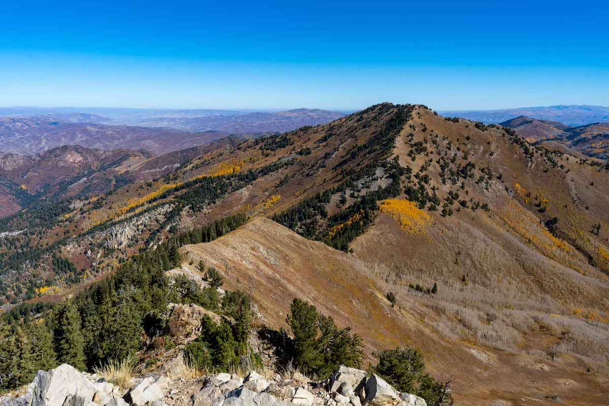
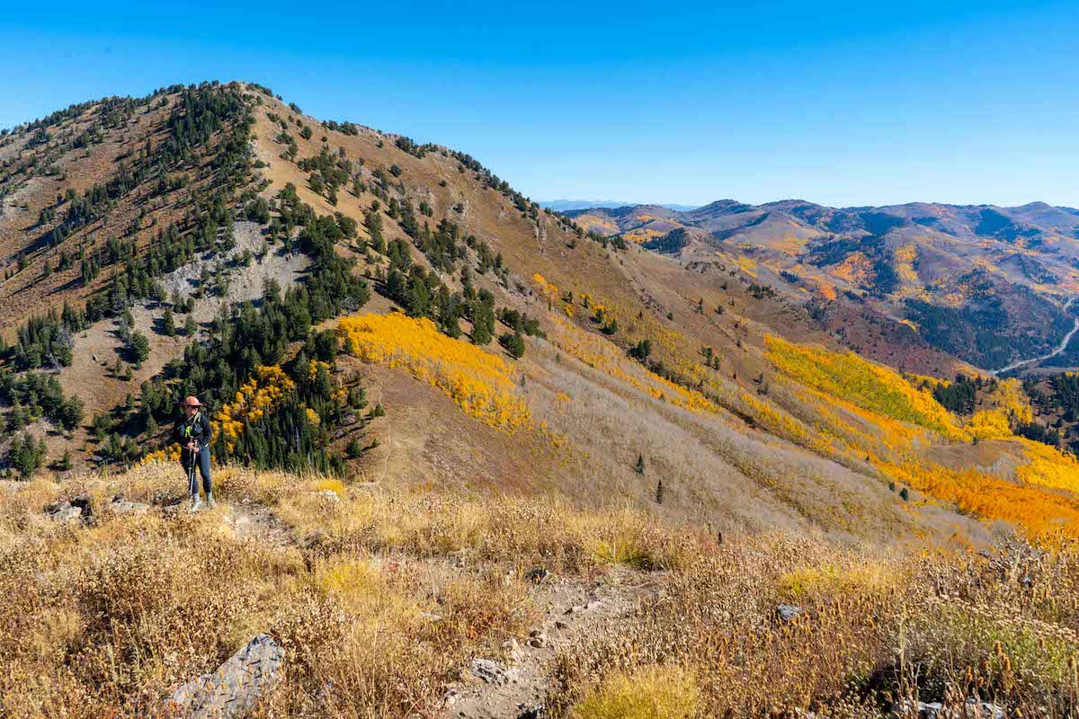
Additional Pictures
Views along the Mill B North trail
Gobbler’s Knob as seen from the summit of Mount Raymond
Views of Gobbler’s Knob on the ridge towards Mount Raymond
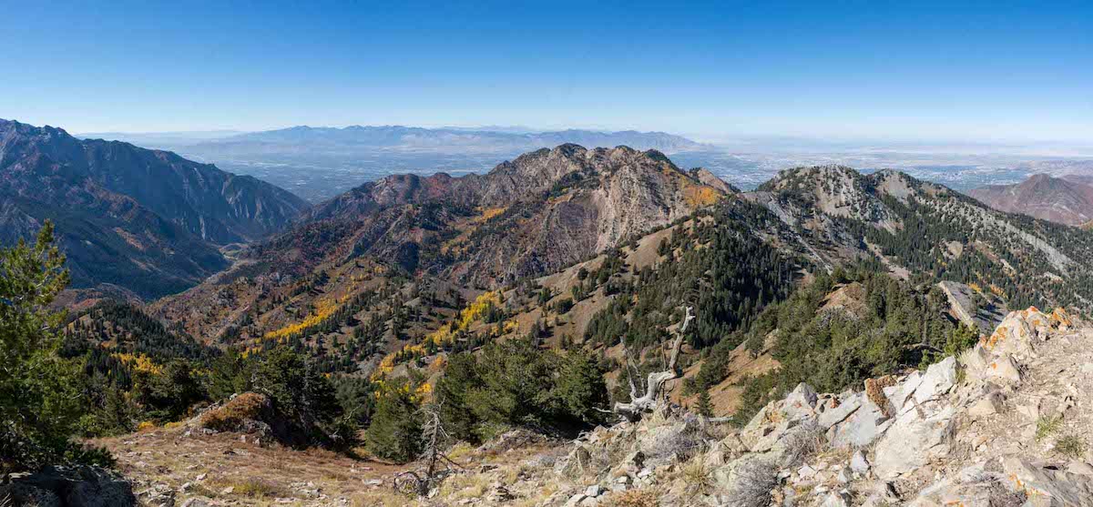
Views of Salt Lake City from Mount Raymond summit

Max DesMarais is the founder of hikingandfishing.com. He has a passion for the outdoors and making outdoor education and adventure more accessible. Max is a published author for various outdoor adventure, travel, and marketing websites. He is an experienced hiker, backpacker, fly fisherman, backcountry skier, trail runner, and spends his free time in the outdoors. These adventures allow him to test gear, learn new skills, and experience new places so that he can educate others. Max grew up hiking all around New Hampshire and New England. He became obsessed with the New Hampshire mountains, and the NH 48, where he guided hikes and trail runs in the White Mountains. Since moving out west, Max has continued climbed all of the Colorado 14ers, is always testing gear, learning skills, gaining experience, and building his endurance for outdoor sports. You can read more about his experience here: hikingandfishing/about
Insane Foliage & Perfect Weather
We had some of the best foliage views we have ever seen on this day. Coupled with perfect weather, this was an incredible day.
We hiked the long way from Mill D, where as most others on the trail came from Butler Fork, or Mill Creek. Talking to other hikers, all trails were in pretty perfect conditions with great foliage.