Mount Yale is a stunning hike located in the Sawatch Range in Colorado. Mount Yale sits at 14,196 feet (4,326.9 meters) above sea level. This is a common hike in all months, and is a fantastic winter hiking option as well. The views after breaking treeline are absolutely stunning.
Distance –9.2 miles round trip (14.81 km)
Height – 14,196 feet (4,326.9 m)
Elevation gain – 4,410 feet (1,344.17 m)
Duration – 6 to 9 hours (book time)
Difficulty – Strenuous
Class: Class 2 Hike
Seasons – Year-round (caution and experience needed in winter – see below)
Trailhead Location – Denny Creek Trailhead – 9,900 feet (directions below)
Trail Map
Mount Yale Trail Map – Colorado
Trails
Mount Yale Trail: 9.2 Miles Round Trip | 4,410 Feet Elevation Gain | Class 2
This is the most common route up Mount Yale and begins at the Denny Creek Trailhead Parking. This lot is large, and opened year round.
Hikers will begin heading up a steady incline on a well traveled portion of trail that is easy to follow. The first river crossing is 1 mile in, and .3 miles after that, hikers reach a trail junction between the Browns Pass Trail and the Mount Yale Trail.
Hikers will experience a very steady incline once reaching treeline, and 3.5 miles into the hike, the steepest ascent begins. The last .2 mile of trails ascends the final ridge to the summit.
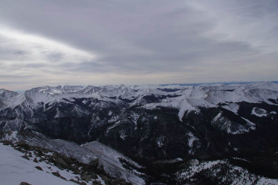
Hikers experience absolutely stunning views just before treeline, and they remain stunning all the way to the summit.
East Ridge Route: 10.5 Miles Round Trip | 5,000 Feet Elevation Gain | Class 2
This is a far less traveled route that begins at the Avalanche trailhead (directions below). This is not the recommended trail as there are plenty of steep sections with loose rock, and route finding is important on this route given the trail is difficult to follow.
Hiking Mount Yale in Winter
Mount Yale is a great winter ascent. The trailhead remains open year round, so mileage is not added. Hikers don’t need to deviate from the standard route in winter months, though there are areas of avalanche risk that need to be monitored.
Due to the steep slope near the summit, traction is completely necessary, snowshoes are necessary, and an ice axe is recommended.
As with all CO 14ers, experience and extreme caution is necessary in the winter.
Camping Information
The closest campground is the Collegiate Peaks Campground. Details for this campground can be found here. Camping is not permitted at the trailhead.
Current weather conditions:
Here is the detailed weather forecast for the next few days. We highly recommend you check out the mountain forecast for this region the morning of your hike.
Buena Vista, CO
Tonight
A chance of snow showers and a slight chance of thunderstorms. Cloudy, with a low around 22. South southwest wind 5 to 10 mph. Chance of precipitation is 50%. New snow accumulation of less than half an inch possible.
Saturday
A chance of snow showers before 9am, then snow showers likely and a chance of thunderstorms. Partly sunny, with a high near 37. West wind 10 to 30 mph, with gusts as high as 45 mph. Chance of precipitation is 70%. New snow accumulation of around one inch possible.
Saturday Night
Partly cloudy, with a low around 21. West northwest wind 15 to 30 mph.
Sunday
Sunny, with a high near 39. West northwest wind 15 to 20 mph.
Sunday Night
Mostly clear, with a low around 25. West wind 15 to 20 mph, with gusts as high as 35 mph.
Monday
A slight chance of snow showers and a slight chance of thunderstorms between noon and 3pm. Mostly sunny, with a high near 39. West wind 20 to 45 mph.
Monday Night
Partly cloudy, with a low around 24. West wind 20 to 30 mph.
Directions & Parking
This trailhead is accessible year round. This trailhead is often absolutely packed due to snowmobiling trails at the trailhead. This is also a popular winter hiking route.
Directions to Denny Creek Trailhead
The Avalanche trailhead is located on the same road, just a little east of the Denny Creek trailhead.
Additional Pictures
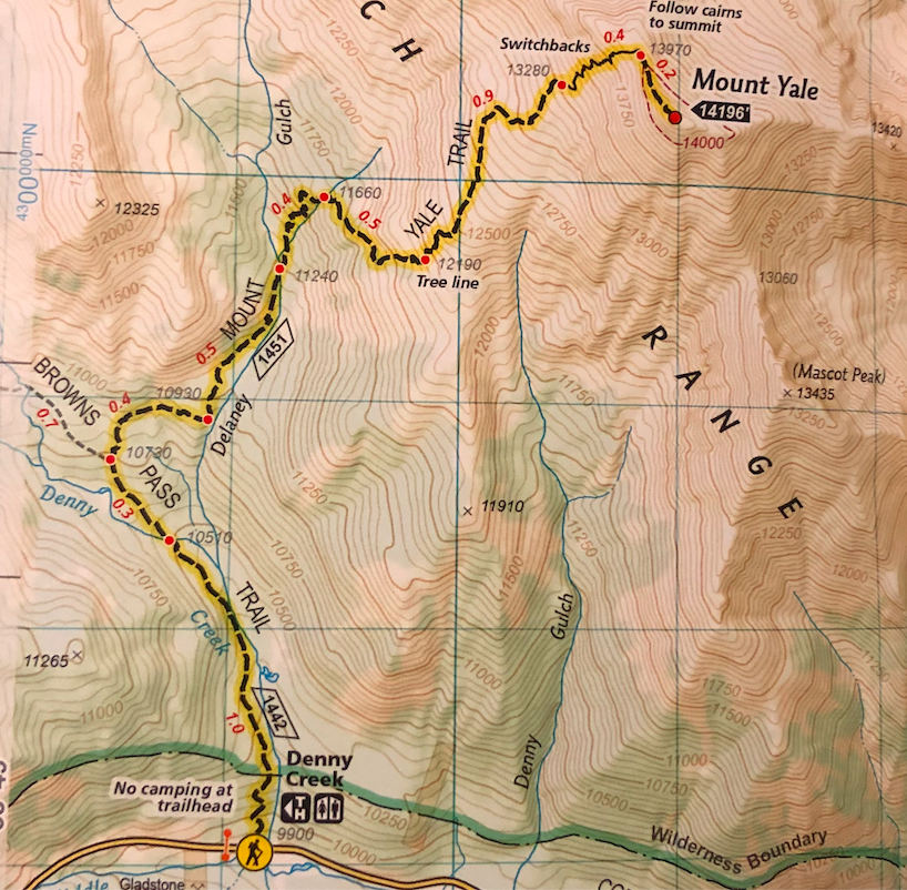
Views Westward on Mount Yale
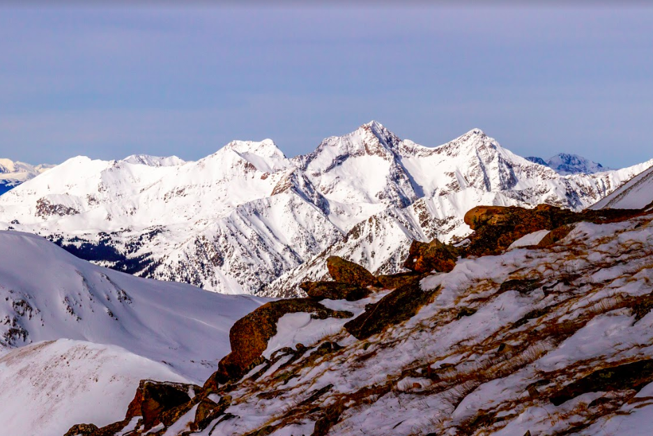
Views while hiking up Mount Yale
Mount Yale Trail Views
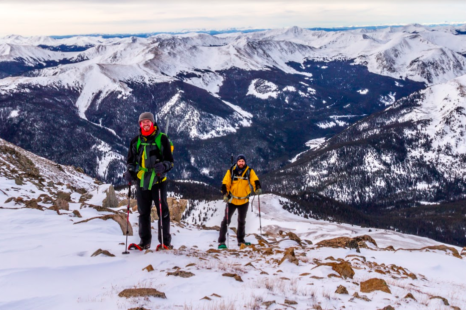
Summit views on Mount Yale
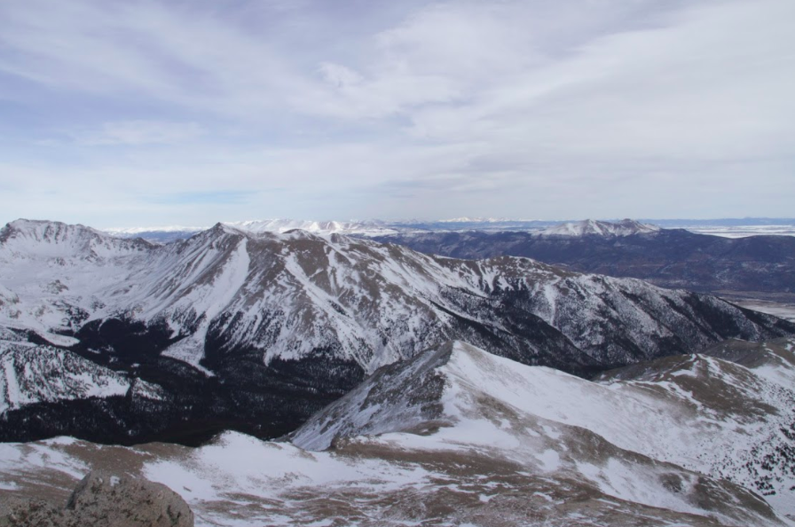
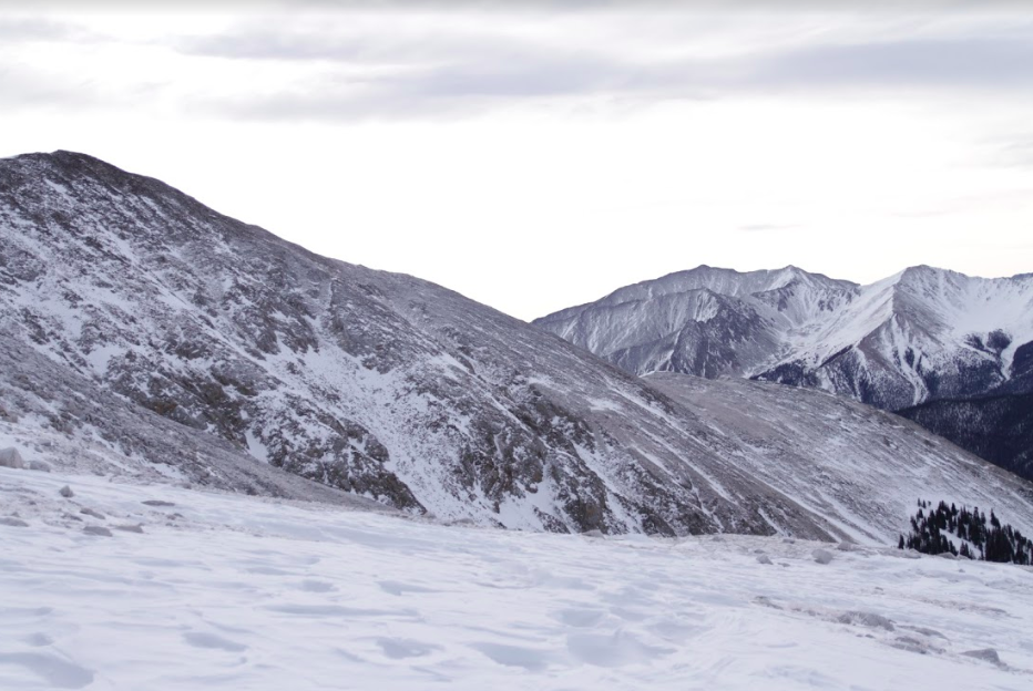
Views from Mount Yale summit

Max DesMarais is the founder of hikingandfishing.com. He has a passion for the outdoors and making outdoor education and adventure more accessible. Max is a published author for various outdoor adventure, travel, and marketing websites. He is an experienced hiker, backpacker, fly fisherman, backcountry skier, trail runner, and spends his free time in the outdoors. These adventures allow him to test gear, learn new skills, and experience new places so that he can educate others. Max grew up hiking all around New Hampshire and New England. He became obsessed with the New Hampshire mountains, and the NH 48, where he guided hikes and trail runs in the White Mountains. Since moving out west, Max has continued climbed all of the Colorado 14ers, is always testing gear, learning skills, gaining experience, and building his endurance for outdoor sports. You can read more about his experience here: hikingandfishing/about