Ouzel Falls is a beautiful and easy to intermediate hike located on the southeastern part of Rocky Mountain National Park. This hike features stunning views, waterfalls, streams, fishing opportunities, and the ability for hikers to continue hiking to other awesome destinations. Here is everything you need to know about hiking to Ouzel Falls. Ouzel Falls is often combined with hiking to Ouzel Lake and/or Bluebird Lake.
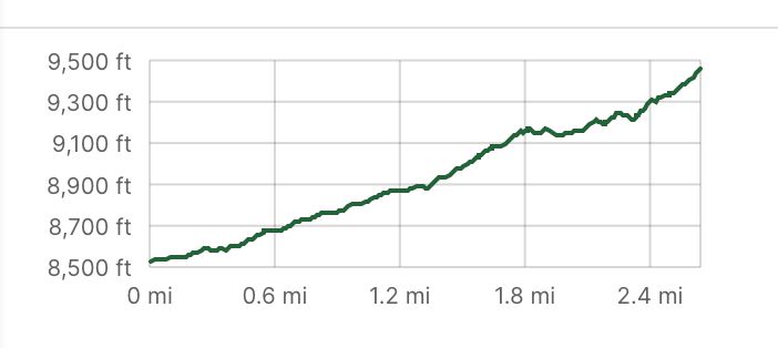
Distance – 5.32 miles round trip (8.56 km)
Height – 9,472 feet (2887.07 m)
Elevation gain – 1,216 feet (370.64 meters)
Duration – 4-5 hours
Difficulty – Intermediate
Class: Class 1 Hike
Trailhead Location – Wild Basin Trailhead (8,532 feet)
Quick Navigation:
Routes | Trail Map | Camping Info | Weather | Directions | Pictures
Need To Know Information
-
- This hike lies within Rocky Mountain National Park, so a national park permit is required. The entrance is the Wild Basin Entrance station which can have up to date information here: https://www.nps.gov/romo/entrance_stations.htm
- Permits may be required depending upon the time of year. This information can be found here: https://www.nps.gov/romo/planyourvisit/timed-entry-permit-system.htm
- Winter season has parking lot closures, which would mean hikers need to park at the Wild Basin Winter Parking trailhead. (More information below)
- Dogs are not allowed in Rocky Mountain National Park.
Hiking Route Options
The most common hiking option is from the Wild Basin Trailhead, however some hikers may leave from the Allenspark Trailhead. This makes it a longer hike, but still quite simple. We recommend the Wild Basin Trailhead due to the ability for hikers to enjoy upper and lower Copeland falls along the way.
Wild Basin Trailhead | 5.32 Miles Round Trip (8.56 km) – 1,216 Feet Elevation Gain (370.64 meters) | Class 1
Hikers begin at the Wild Basin Trailhead where the trail is very well marked and well traveled. The trailhead has bathrooms, a trail map, a large parking lot, and quickly takes hikers to the trail right next to the gorgeous river.
0.4 miles into the hike, hikers can take a couple hundred foot detour to view upper and lower Copeland Falls.
About 1.4 miles in hikers, should turn left to stay on the Wild Basin Trail towards Ouzel Falls. It is after this, that the hike starts to have some more serious elevation gain, however the entire hike contains relatively gradual gaines.
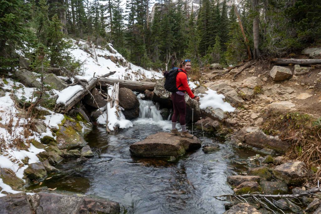
Hikers will then hike towards Calypso Cascades, where they will cross a gorgeous bridge just after turning right towards Ouzel Falls.
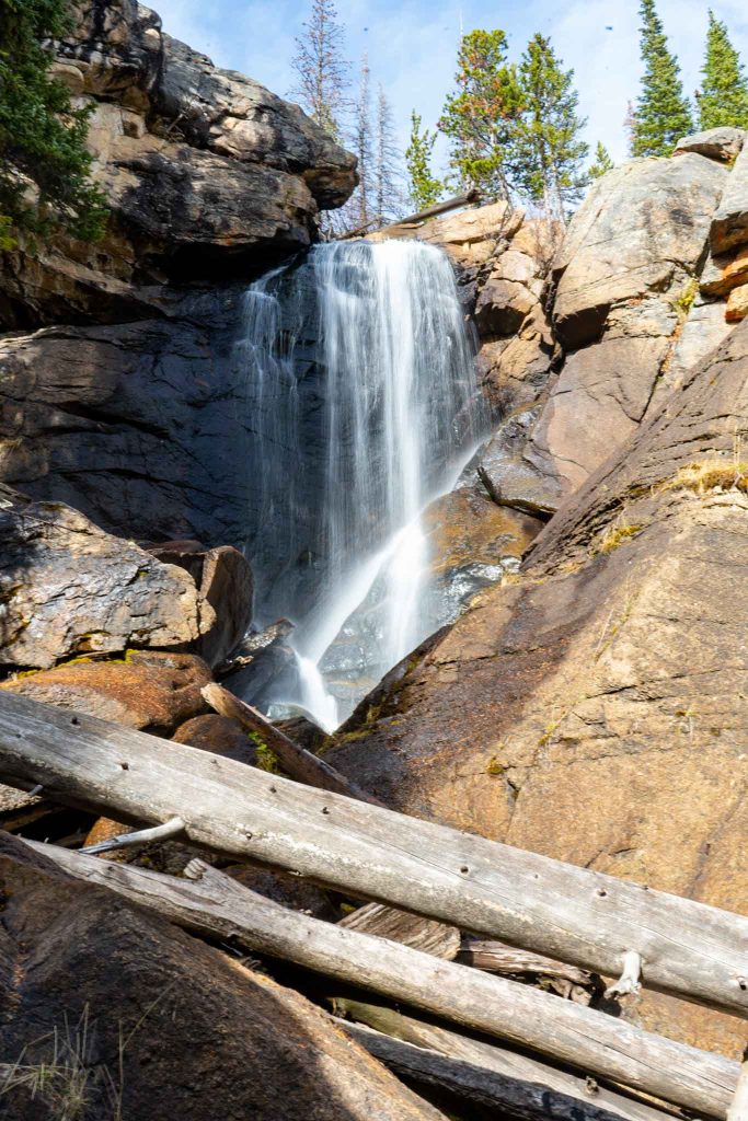
2.6 Miles into the hike, hikers will reach the spur to Ouzel Falls. This is the couple hundred foot spur that everyone should take to the base of the falls. The falls are visible from the bridge, but it is this spur trail that gives the best views.
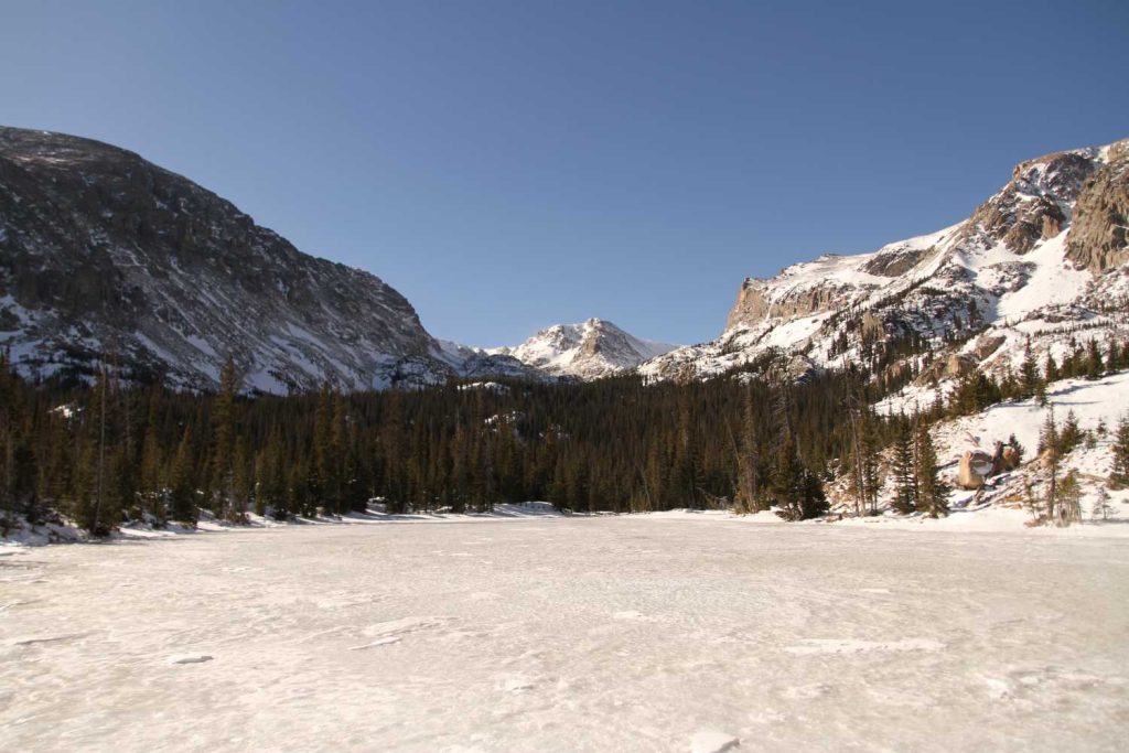
Hiking Ouzel Falls In Winter
This hike is accessible in winter, but traction should be brought due to icy conditions. It should also be noted that in winter, the road to Wild Basin Trailhead closes, which means that hikers need to park at the Wild Basin Winter Trailhead. It is about 1 mile from the winter trailhead to the summer trailhead and about 150 feet of elevation. So in winter, hikers need to be prepared to hike an additional 2 miles round trip.
Trail Map
Camping For Ouzel Falls
Because this hike is located in RMNP, camping in this area requires a wilderness backpacking permit. There are several camping areas, including a tentsite at Ouzel lake that can be reserved. Information on how to reserve is here: https://www.nps.gov/romo/planyourvisit/wild_guide.htm#permit
Ouzel Lake Tentsite
Upper Ouzel Creek
Pine Ridge Tentsite
Aspen Knoll Tentsite
Tahosa Tent Site
Thunder Lake Campsite (not very close, but great for Thunder Lake!)
For each of the above, see this link: https://www.nps.gov/romo/planyourvisit/site_details.htm
This includes information about each of the tent sites.
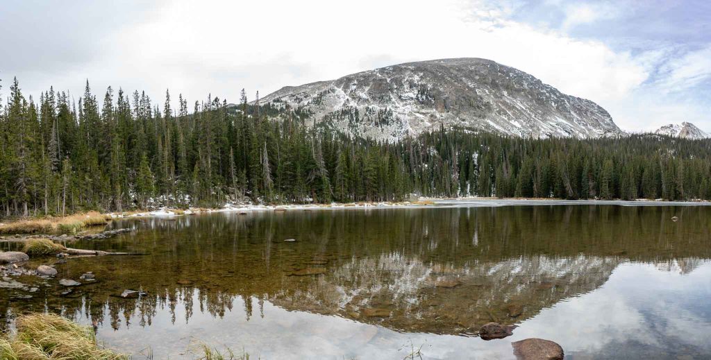
Fishing Ouzel Creek, Ouzel Lake, and North St. Vrain Creek
Ouzel Lake is known for fantastic fly fishing. All of the waters around the lake, including the creeks and the other lakes have fantastic fishing. All catch and release waters for anglers. This is a fantastic hiking destination to bring the fly rod to. These are artificial lure, catch and release only waters.
Current Weather Conditions:
Here is the detailed weather forecast for the next few days. We highly recommend you check out the mountain forecast for this area the morning of your hike.
Allenspark, CO
Directions & Parking
Directions to Wild Basin Trailhead:
Additional Pictures
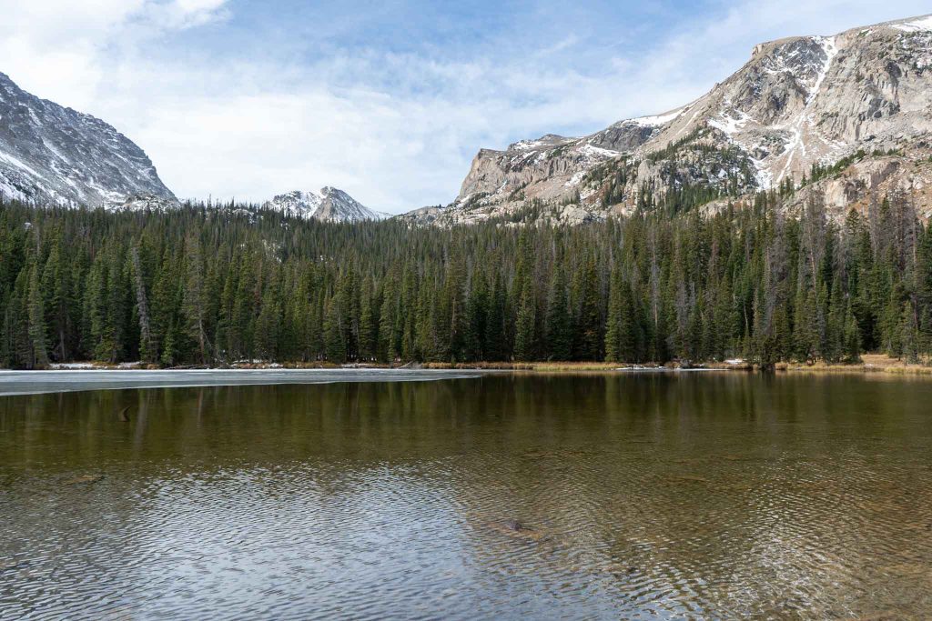
Ouzel Creek just before the lake

Max DesMarais is the founder of hikingandfishing.com. He has a passion for the outdoors and making outdoor education and adventure more accessible. Max is a published author for various outdoor adventure, travel, and marketing websites. He is an experienced hiker, backpacker, fly fisherman, backcountry skier, trail runner, and spends his free time in the outdoors. These adventures allow him to test gear, learn new skills, and experience new places so that he can educate others. Max grew up hiking all around New Hampshire and New England. He became obsessed with the New Hampshire mountains, and the NH 48, where he guided hikes and trail runs in the White Mountains. Since moving out west, Max has continued climbed all of the Colorado 14ers, is always testing gear, learning skills, gaining experience, and building his endurance for outdoor sports. You can read more about his experience here: hikingandfishing/about