Pyramid Peak is an iconic Colorado 14er in the Elk Mountains that sits at 14,018 feet tall, features tons of mountain goats, and exposed class 4 climbing. Here we will cover everything you need to know.
Distance – 8.2 miles round trip (13.20 km)
Height – 14,018 feet (5491.89 m)
Elevation gain – 4,900 feet (1493.52 meters)
Duration – 7 – 9 hours (book time dependant upon trailhead start)
Difficulty – Strenuous
Class: Class 4 Hike
Trailhead Location – Maroon Lake Trailhead (9,560 feet)
Quick Navigation:
Routes | Trail Map | Camping Info | Weather | Directions | Pictures
Need To Know Information
-
- Parking in the summer is extremely hard to come by, and the process is a bit confusing. We explain all of this below.
- This is a class 4 hike with exposure. It should only be attempted by hikers that have other class 3 and 4 experience.
- Dogs must be on leash in the Maroon Bells-Snowmass Wilderness. This hike has a lot of loose rock and exposure, so no dogs without substantial class 3 and 4 experience should be on this hike. In addition, there are a lot of goats and rockfall danger.
- There are many mountain goats on this hike during most of the summer season.
Hiking Route Options
There is only one common route to the summit of pyramid peak.
Maroon Lake Trailhead | 8.2 Miles Round Trip (13.2 km) – 4,900 Feet Elevation Gain (1,493 meters) | Class 4
Begin at the parking lot for Maroon Lake along the Maroon Snowmass Trail. .5 miles in, hikers will reach the junction for the scenic loop trail, and they should stay to the right along the Maroon Snowmass Trail towards Crater Lake. 1.6 miles in, hikers will reach the junction that heads up towards Pyramid Peak. This trail is marked by cairns, and is not marked by signs. It is easy to walk past, so pay attention once you get about a mile in on the hike. If you happen to pass the first trail, there is actually a second entrance to the trail also marked by a cairn that hikers who are staying overnight at Crater Lake would end up taking.
It is just after this junction that the trail starts to gain the most elevation. The trail remains very well taken care of as it switchbacks up quickly to above treeline. 1.2 miles after the junction, hikers will reach giant cairns at the base of a large boulder field below Pyramid known as the amphitheater. Here, the summit of Pyramid can be seen. Hikers follow the cairns as well as they can through the boulder field, knowing that the trail eventually cuts left into the gully below the saddle hikers will eventually ascend to. Hikers will be hiking through the boulders for about .4 miles before cutting left across the boulders to the base of Pyramid’s northeast ridge.
Hikers reach the base of this steep and loose dirt and rock ascent. This is about a 1,000 foot climb to the saddle through scree and loose rock. Poles are extremely nice to have for both directions on this section. Hikers are rewarded with stunning views when reaching the saddle at around 13,000 feet. From here, the hike turns to class 3 and 4 climbing to the summit.
Hikers follow the cairns to the right side of the ridge at the saddle, and then follow cairns to cut left onto the ridge to the south side of the ridge. Many descriptions of this hike explain that route finding is very difficult. It is extremely important to stay on trail, but the trail has a lot of cairns and is very well traveled. Simply pay attention to the terrain and cairns to follow correct routes. The first difficult moves of the hike occur shortly after getting to the south side of the ridge, where they get to what is known as the “cliff traverse” where thin trail looms over some steep terrain below.
The next larger obstacle is known as the “green wall” where in reality there are lots of cairns and routes up the green wall, around the wall, and on both sides. Follow cairns and what you deem is the safest approach for you. From here, the trail has tons of routes marked by cairns. All of this terrain features lots of exposure, loose rocks, and mountain goats willing to throw rocks down at you. Caution should be taken on all of this terrain.
Summit views are incredible.
Trail Map
Pyramid Peak Trail Map
Camping For Pyramid Peak
Most people doing Pyramid as an overnight hike will camp out at Crater Lake, which has 11 campsites. If all spots are filled, campers can camp as long as they are .25 miles away from the lake. In formation on camping can be found here: https://www.fs.usda.gov/recarea/whiteriver/recarea/?recid=40563
The difficult part of camping here is landing an overnight parking permit, or arranging being dropped off. Parking reservation or shuttle reservations to the lake can be found here: https://aspenchamber.org/plan-trip/trip-highlights/maroon-bells/reservations. Hikers can be dropped off between 6-8 am without a parking reservation. Hikers are required to purchase a one way shuttle back down to Aspen Highlands on the way out unless someone is picking you up after 5pm.
In addition to the Crater Lake Options, there are several campgrounds along the road to Maroon Lake. Below we order them as the closest to Maroon lake first:
East Maroon Portal
Silver Queen Campground
Silver Bell Campground
Silver Bar Campground
Current Weather Conditions:
Here is the detailed weather forecast for the next few days. We highly recommend you check out the mountain forecast for this peak the morning of your hike.
Snowmass Village, CO
Tonight
Mostly clear, with a low around 28. Southwest wind around 15 mph.
Thursday
A chance of snow showers and isolated thunderstorms after noon. Mostly sunny, with a high near 32. West southwest wind 15 to 25 mph. Chance of precipitation is 70%. New snow accumulation of around one inch possible.
Thursday Night
Snow showers likely and a slight chance of thunderstorms. Mostly cloudy, with a low around 20. West wind 20 to 25 mph. Chance of precipitation is 60%. New snow accumulation of 2 to 4 inches possible.
Friday
Snow showers likely before noon, then snow showers and a chance of thunderstorms. Mostly cloudy, with a high near 26. West wind 15 to 20 mph. Chance of precipitation is 90%. New snow accumulation of 1 to 3 inches possible.
Friday Night
Snow showers and a chance of thunderstorms. Cloudy, with a low around 18. Southwest wind 10 to 20 mph. Chance of precipitation is 80%. New snow accumulation of 2 to 4 inches possible.
Saturday
Snow showers before 9am, then snow showers and a chance of thunderstorms. Cloudy, with a high near 22. Chance of precipitation is 100%. New snow accumulation of 5 to 9 inches possible.
Saturday Night
Snow showers and a chance of thunderstorms. Mostly cloudy, with a low around 19. Chance of precipitation is 80%. New snow accumulation of 2 to 4 inches possible.
Directions & Parking
From the roundabout, take the exit for Maroon Creek Road. Follow the road until the Aspen Highlands Center. If you are day hiking or don’t have a parking pass, you will need to park here and take the suttle. Continue along the road if you are traveling to Maroon Lake Trailhead.
Important Note: Read our camping section above for more information on parking fees, shuttle use, overnight parking, times you can enter, and dropoff information.
Directions to Maroon Lake Trailhead:
Additional Pictures
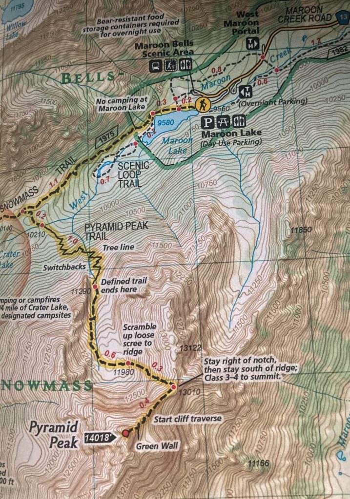
Mountain goat on the summit of Pyramid
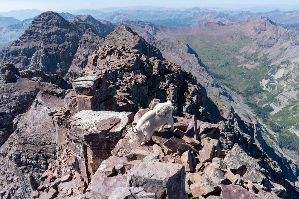
Views after reaching the saddle of the northeast ridge
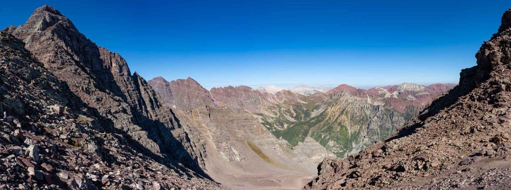
Mountain goat on the saddle
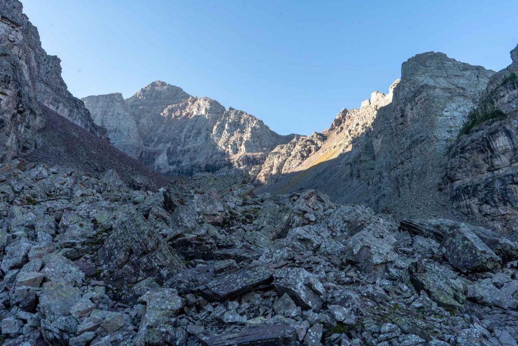
Trail right as you enter the amphitheatre
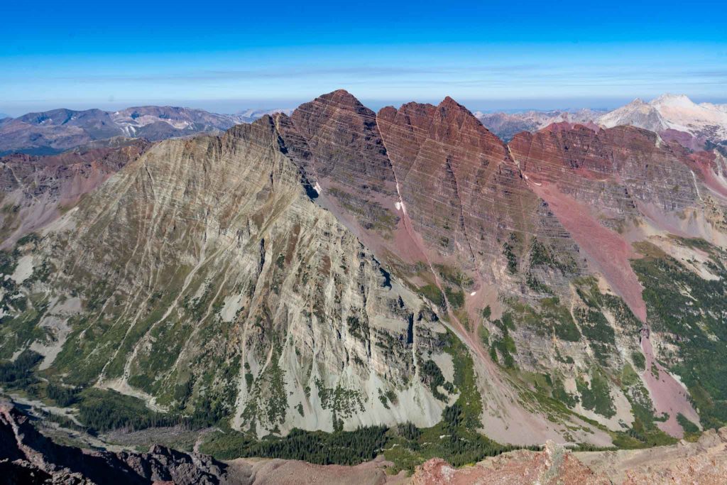
Views of the Maroon Bells from summit of Pyramid Peak
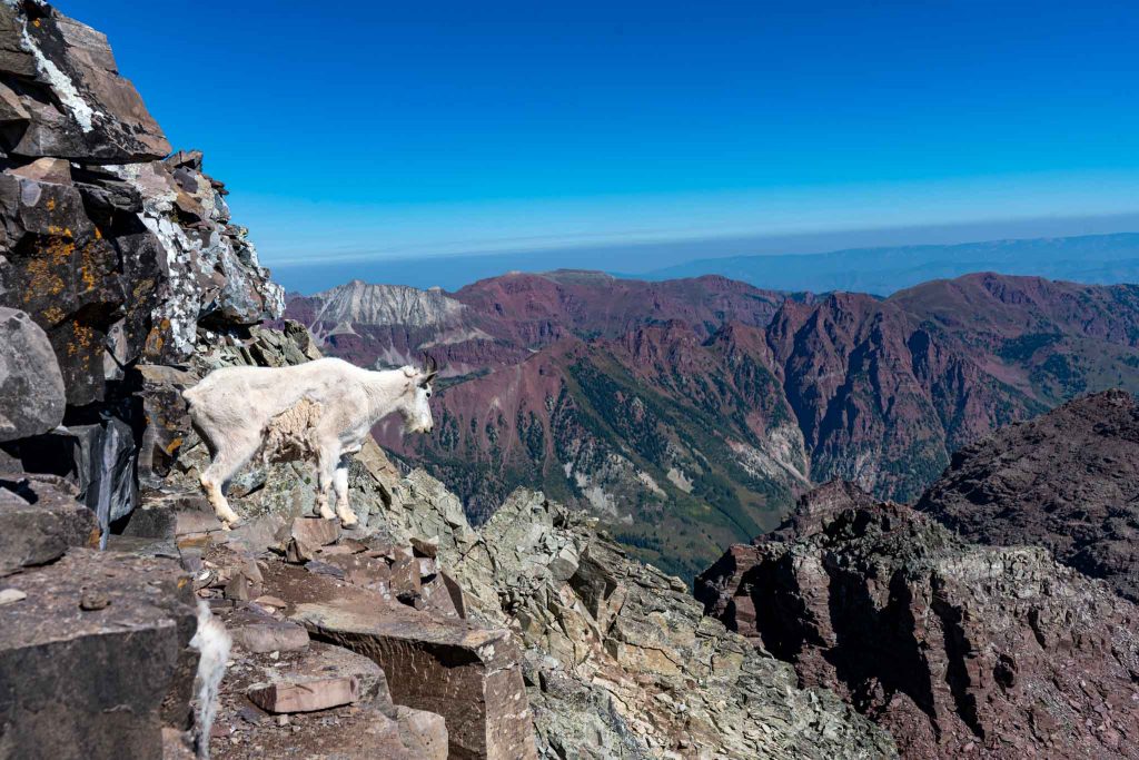
Mountain goat a little below the summit of Pyramid Peak
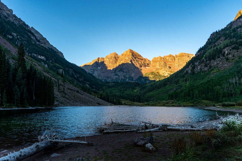
Maroon Bells as seen from Maroon Lake
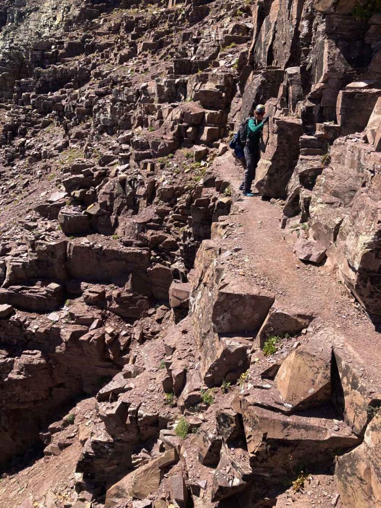
Part of the cliff traverse on Pyramid Peak

Max DesMarais is the founder of hikingandfishing.com. He has a passion for the outdoors and making outdoor education and adventure more accessible. Max is a published author for various outdoor adventure, travel, and marketing websites. He is an experienced hiker, backpacker, fly fisherman, backcountry skier, trail runner, and spends his free time in the outdoors. These adventures allow him to test gear, learn new skills, and experience new places so that he can educate others. Max grew up hiking all around New Hampshire and New England. He became obsessed with the New Hampshire mountains, and the NH 48, where he guided hikes and trail runs in the White Mountains. Since moving out west, Max has continued climbed all of the Colorado 14ers, is always testing gear, learning skills, gaining experience, and building his endurance for outdoor sports. You can read more about his experience here: hikingandfishing/about