
Sugarloaf Peak is a stunning summit located in Little Cottonwood Canyon near Alta, Utah. This is a beginner to intermediate friendly hike that can be shortened by paying a $10 day parking fee, or hikers can park for free at the Albion Base Trailhead. Here’s everything you need to know about this hike.
Quick Navigation:
Trail Map | Trails | Hiking In Winter | Camping | Weather | Directions | Pictures
Difficulty – Easy
Distance – 3.56 miles round trip (5.73 km)
Height – 11,051 feet (3368.34 m)
Elevation gain – 1,601 feet (487.98 m)
Duration – 3-4 hours (book time)
Trailhead Location – Albion Base Trailhead (8,694 Feet) or Cecret Lake Trailhead
Dogs – Not allowed on this trail
Need To Know Information
- Dogs are not allowed on this hike.
- As of September 2022, this lake was drained, which means it likely will not be filled until the spring of 2023.
- Swimming is not allowed in any of the lakes in this area.
- This is a popular hike, and you will encounter people. Parking fills up quite fast.
- There are two main routes for this hike. The easiest route requires paying for a day parking pass. Both are explained below.
- Camping is common, as there are campgrounds near this lake. Camping information and regulations below.
- Fishing is allowed at Cecret Lake with a Utah Fishing License.
Trail Map

Click image to enlarge
Download GPX For Lower Trailhead Here
Download GPX For Upper Trailhead Here
Routes
Sugarloaf Peak Via Cecret Lake Trailhead – 3.56 miles round trip (5.73 km) – 1,601 feet (487.98 m) Elevation Gain
This is a common starting point for those summiting the peaks here, and requires a day pass (explained below) to park at the upper trailhead.
The Cecret Lake Trailhead has a good sized parking lot with overflow parking in another lote only about 100 feet away. This is very well marked and well traveled, so it is easy for hikers to follow the signs and trails to Cecret Lake. The trail moderately gains elevation for the first half mile, and gets a bit steeper in the last quarter mile before reaching Cecret Lake.
After reaching the lake, hikers continue upwards along the well traveled trail towards the summit of Sugarloaf. Hikers also have the option at the lake of taking the route to the left of the lake to the summit, but this trail is not as well maintained, and it is recommended to stay on the standard route behind the lake.
Sugarloaf Peak Via Albion Base Trailhead – 7.78 miles round trip (12.52 km) – 2,548 feet (776.63 m) Elevation Gain
This is the route that hikes will take if they want to avoid the day parking fees, or they simply want to hike through the beautiful Albion Basin where wildlife is often seen. Hikers begin at the Albion Base Trailhead and simply follow the trails and signs towards Cecret Lake. This trail remains with a moderate incline just about the entire way on well traveled and well maintained trails. Once reaching the same trail hikers take from the Cecret Lake Trailhead, the hike is the same as the other route.
Hiking in Winter
This area is not hiked in winter as it is part of the ski resort, and therefore it is being skied on while the resorts are open.
Camping Information
There are campgrounds within Albion Basin that can be reserved when they are open. This campground contains 24 camping sites, each with picnic tables and campfire rings. Vault toilets are also on the premise. Information and availability can be found here.
Fishing Cecret Lake
Cecret Lake does have fish in it. With our most recent trip, the lake was drained, and therefore we suspect fish have died. We will release more information when we know regarding when this lake will be fishable again. This is a catch and release fishery.
Weather
Here is a detailed weather forecast for the area:
Alta, UT
Today
A slight chance of rain and snow showers after 3pm. Sunny, with a high near 48. South southwest wind 14 to 17 mph. Chance of precipitation is 20%.
Tonight
A chance of rain and snow showers after 9pm. Partly cloudy. Low around 32, with temperatures rising to around 34 overnight. South southwest wind 12 to 16 mph. Chance of precipitation is 30%.
Thursday
A chance of snow showers before noon, then snow showers likely and a chance of thunderstorms. Mostly cloudy. High near 40, with temperatures falling to around 36 in the afternoon. Southwest wind 12 to 15 mph. Chance of precipitation is 70%. New snow accumulation of less than half an inch possible.
Thursday Night
Snow showers likely and a chance of thunderstorms. Mostly cloudy, with a low around 29. West wind 9 to 14 mph. Chance of precipitation is 70%. New snow accumulation of 1 to 3 inches possible.
Friday
Snow before noon, then snow and a chance of thunderstorms. Cloudy, with a high near 31. West southwest wind around 13 mph. Chance of precipitation is 100%. New snow accumulation of 5 to 9 inches possible.
Friday Night
Snow likely and a slight chance of thunderstorms before midnight, then snow showers likely. Mostly cloudy, with a low around 24. Chance of precipitation is 70%. New snow accumulation of 3 to 5 inches possible.
Saturday
Snow showers. Cloudy, with a high near 30. Chance of precipitation is 90%. New snow accumulation of 3 to 5 inches possible.
Directions
The first trailhead is the lower trailhead that is free to park at. There is free parking along the main road, across the street, and in various locations. Parking is relatively easy, and marked, but the trailhead starts right behind the Alta Ski Shop. This is the Albion Base Trailhead:
The next most common trailhead is the Cecret Lake Trailhead:
Hikers can also choose to park at the Catherine Pass Trailhead if they choose. This trailhead is between the lower trailhead and the Cecret Lake Trailhead, and hikers can join the trail system from this parking lot:
Additional Pictures
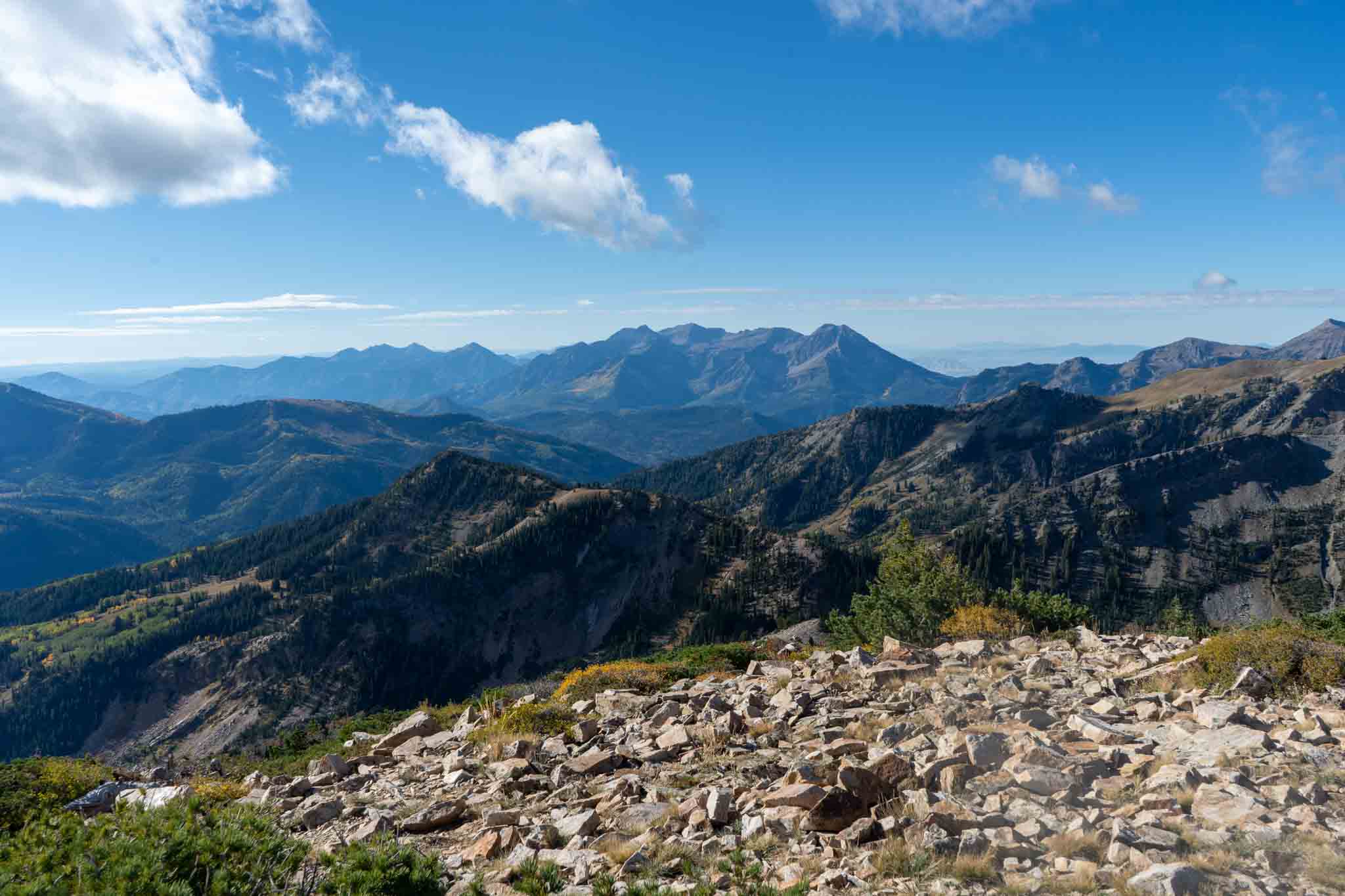
Mount Timpanogos from Sugarloaf Summit
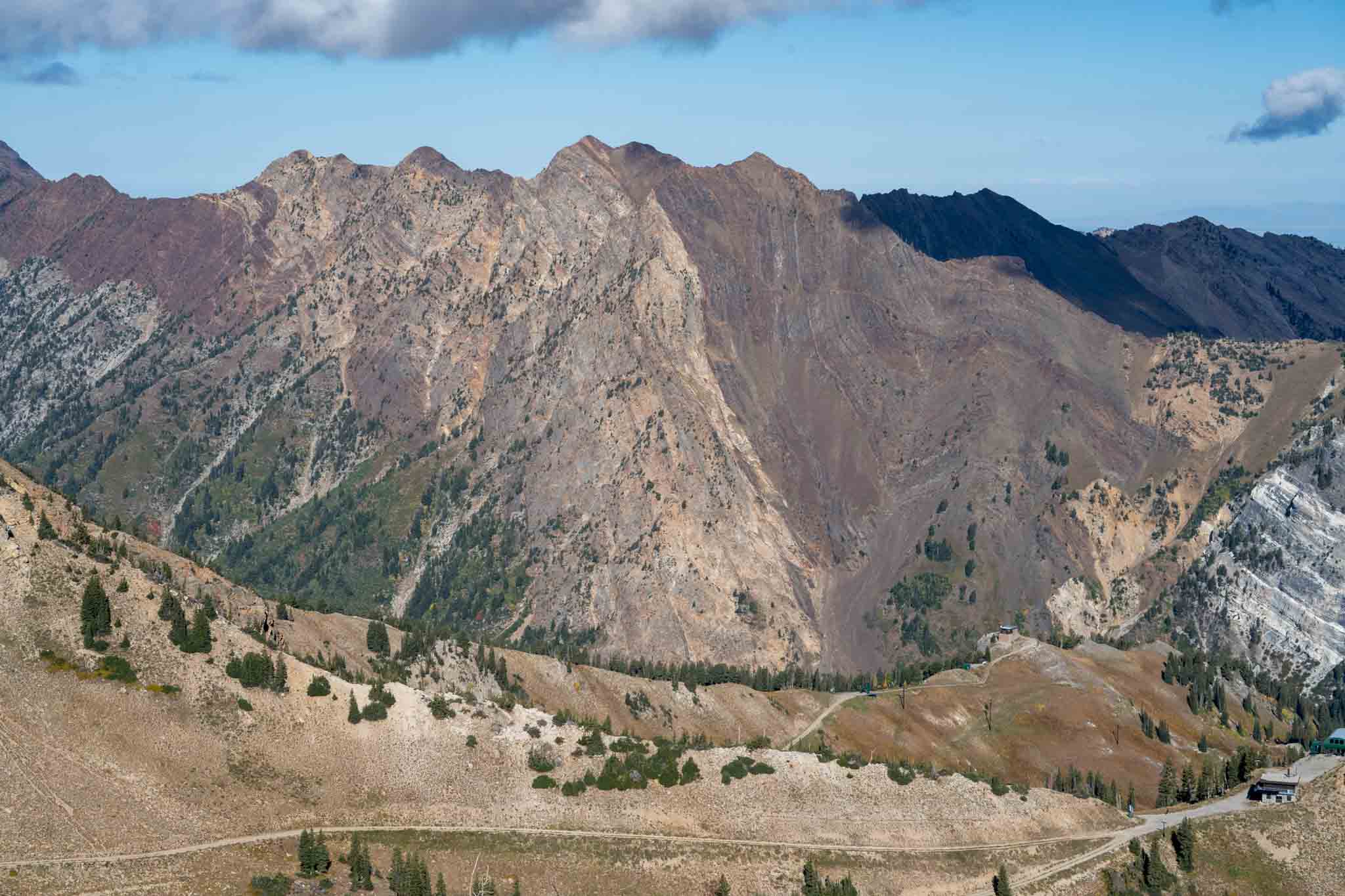
Mount Superior from Sugarloaf Summit
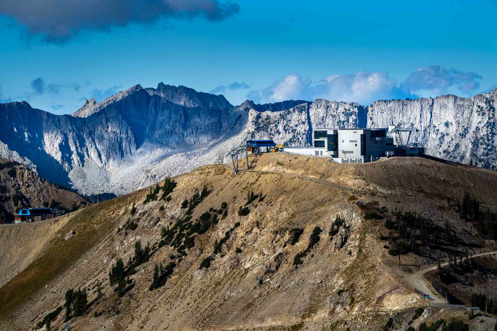
Snowbird’s Summit Lodge from Sugarloaf
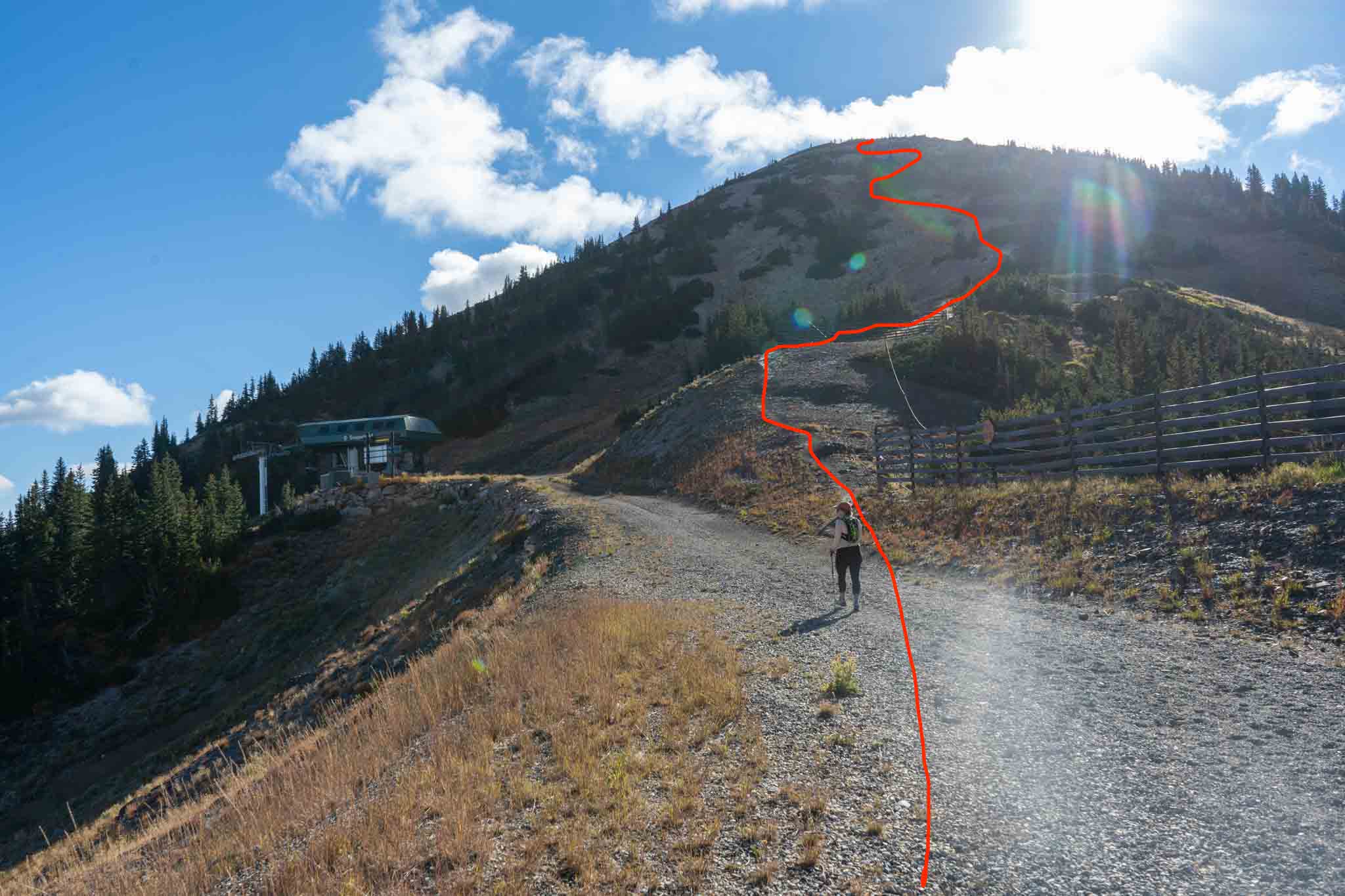
The route to the summit of Sugarloaf
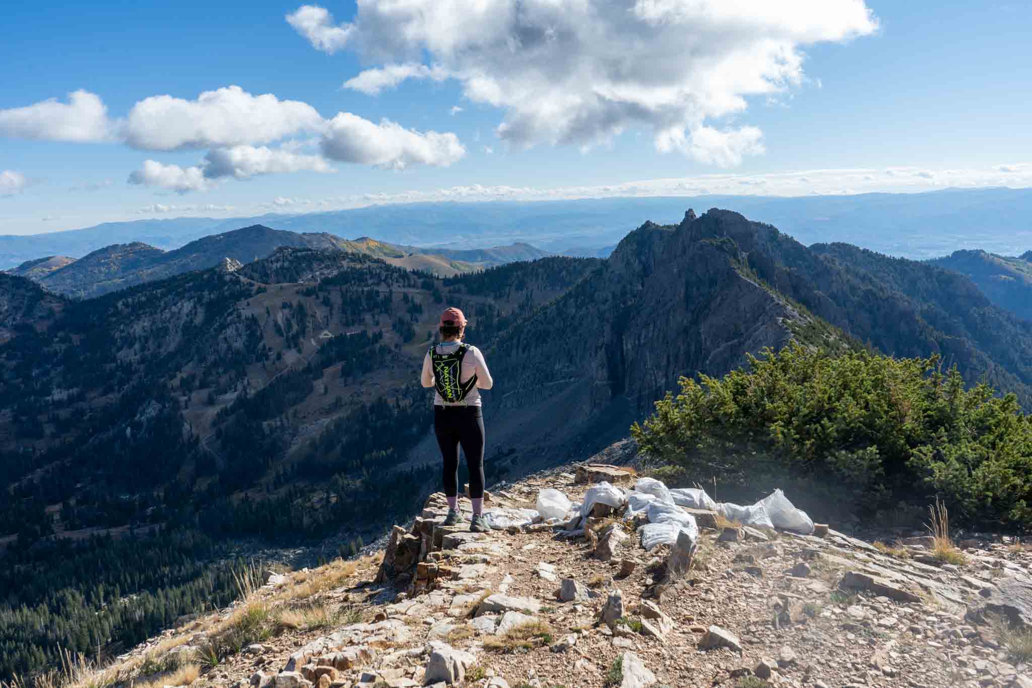
Views from Sugarloaf Peak
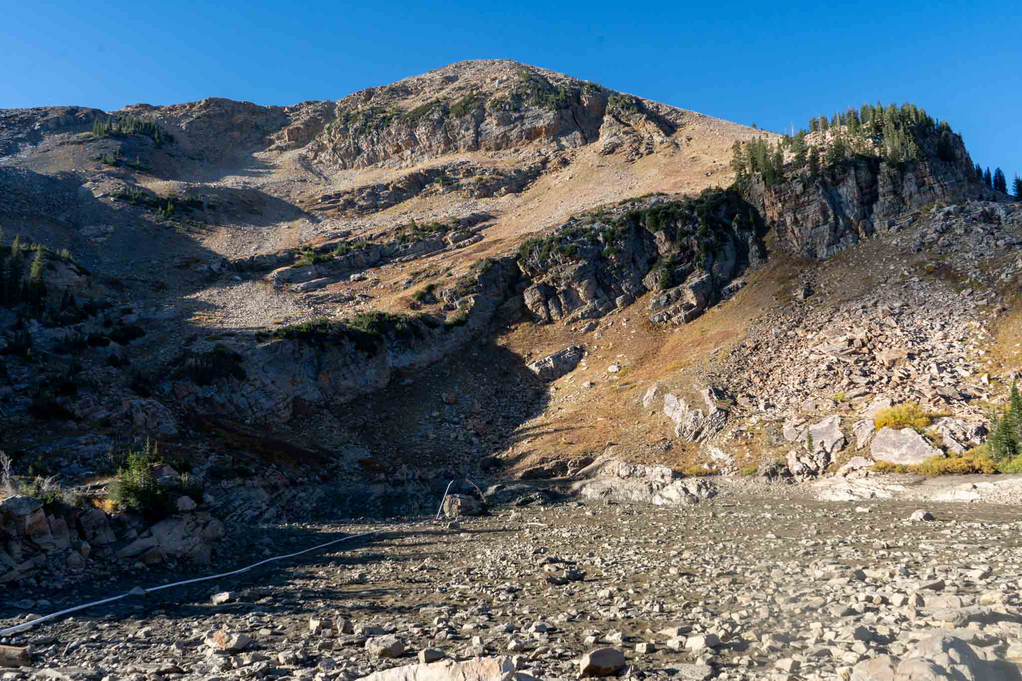
Dry Cecret Lake with Sugarloaf in the background

Max DesMarais is the founder of hikingandfishing.com. He has a passion for the outdoors and making outdoor education and adventure more accessible. Max is a published author for various outdoor adventure, travel, and marketing websites. He is an experienced hiker, backpacker, fly fisherman, backcountry skier, trail runner, and spends his free time in the outdoors. These adventures allow him to test gear, learn new skills, and experience new places so that he can educate others. Max grew up hiking all around New Hampshire and New England. He became obsessed with the New Hampshire mountains, and the NH 48, where he guided hikes and trail runs in the White Mountains. Since moving out west, Max has continued climbed all of the Colorado 14ers, is always testing gear, learning skills, gaining experience, and building his endurance for outdoor sports. You can read more about his experience here: hikingandfishing/about
Stunning conditions with rain in distance
Rain in distance, not on peak, great sunset!
Perfect Weather, Foliage CECRET LAKE DRY
Incredible day. We had no idea about the issue that occurred which caused Cecret Lake to be fully drained. This was a bummer! But everything else was amazing. Hoping that ecosystem can recover quickly.