Sunshine Peak and Redcloud Peak are two fourteeners commonly combined into a day hike. These peaks are located in the San Juan Mountains of Southern Colorado and are accessed from the town of Lake City. There are multiple ways to hike these peaks, so we will discuss each of the options below, including if hikers only want to summit one.
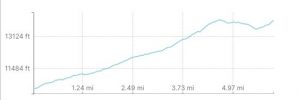
Distance – 11.8 miles round trip (18.99 km)
Height – 14,034 feet (4277.56 m)
Elevation gain – 5,062 feet (1542.90 meters)
Duration – 8 – 9 hours (book time dependant upon trailhead start)
Difficulty – Strenuous
Class: Class 2 Hike
Seasons – This hike can be completed in all seasons, but winter is especially difficult, and dangerous.
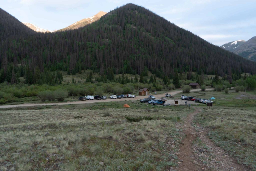
Trailhead Location – Silver Creek / Grizzly Gulch Trailhead (10,420 Feet) – Alternate trailhead at Mill Creek Campground
Quick Navigation:
Routes | Trail Map | Camping Info | Weather | Directions | Pictures
Need To Know Information
-
- Dogs are allowed on this hike.
- The standard route is not the same as the winter route due to road closures and avalanche dangers.
- Camping is allowed at the trailhead.
- The road to the trailhead is rough, but accessible for 2wd vehicles with good clearance.
Hiking Route Options
Sunshine & Redcloud Combined Standard Route (Via Redcloud Peak) – 11.8 Miles Round Trip – 5,062 Feet Elevation Gain (1542.90 meters)
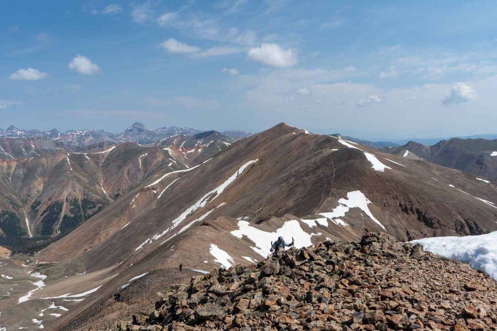
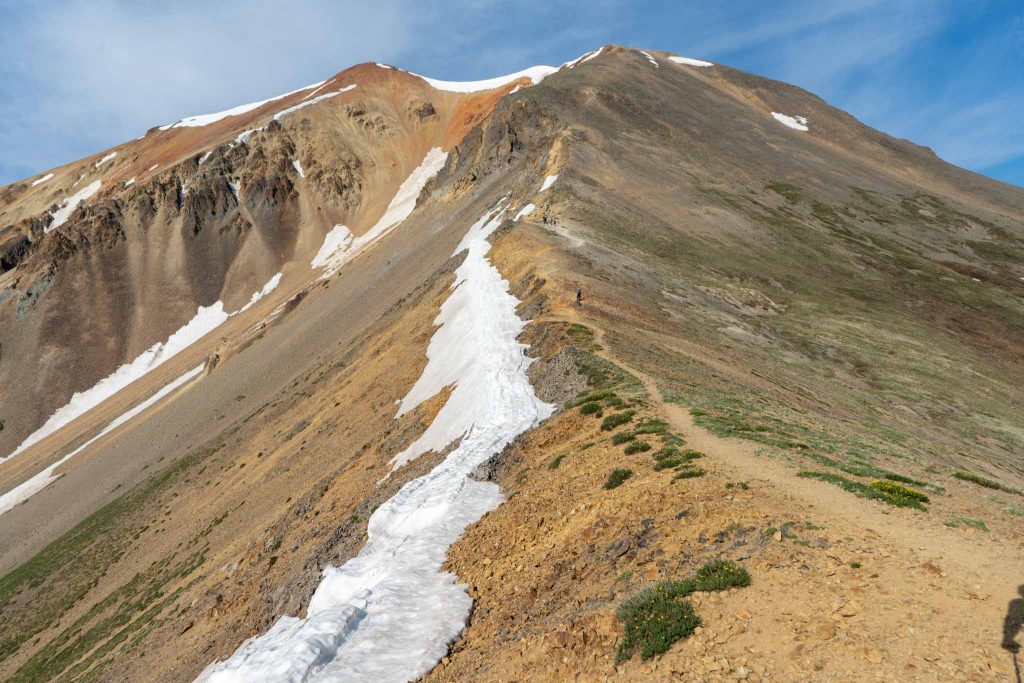
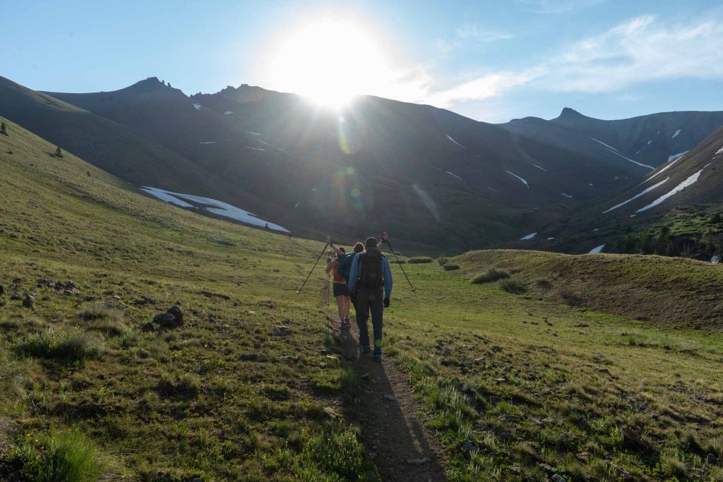
This route starts from the Silver Creek / Grizzly Gulch Trailhead at 10,420 feet. Hikers follow the well maintained and easy to follow gradual trail. At points, this trail gets close to Silver Creek where it can be a little more difficult to see and find, but simply stay along any of the well traveled paths until the trail passes the creek entirely an heads into the basin under Redcloud Peak. The trail remains pretty gradual until getting just below the ridge to Redcloud. Here the trail begins to switchback up to the ridge, and then continue steep switchbacks all the way to the summit of Redcloud. The summit becomes clear once hikers gain the ridge above the basin (see pictures below).
Once summiting Redcloud, the route to Sunshine is pretty obvious and easy to follow. The two summits are 1.3 miles apart and dip to 13,520 feet between the two peaks. While the trail is easy to follow and relatively good quality, this is sustained mileage with some elevation gain in exposed terrain. Be sure to watch for incoming weather. Pictures below will make this route clear to you.
Redcloud Peak Only From Standard Route – 9.2 Miles (14.81 km) – 4,002 Feet (1,219.8M) Elevation Gain
This route starts from the Silver Creek / Grizzly Gulch Trailhead at 10,420 feet and follows the same directions as above, but hikers simply turn around at the summit of Redcloud.
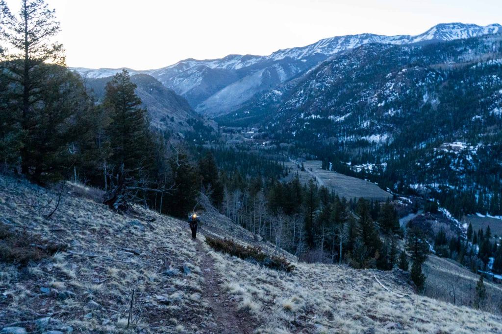
Winter Hiking Sunshine & Redcloud Peak – 8.6 Miles Round Trip – 5,100 Feet Elevation Gain
The winter route start is located at the Mill Creek Campground several miles before the standard trailhead on the same road (directions below). This route is extremely steep and on more difficult terrain. The shortened distance of this route doesn’t make up for the increased difficulty even though this remains class 2 hiking the entire way. Hikers can of course take this in the summer as well, but we recommend the standard route.
The trail is easy to follow up until hikers approach treeline, where the trail is easy to follow when winter conditions are not around, but because this route is less traveled, hikers should be ready to find the best route to the ridgeline during winter conditions.
Hikers begin hiking across the road from the campground by walking at a slight left angle across the road and finding the trail. The trail switchbacks up the steep mountain side with various terrain ranging from good solid ground to loose dirt, to gravel and rocks. The trail becomes significantly nicer after treeline, when hikers can simply follow the ridgeline to the summit of Sunshine.
Winter Hiking Sunshine Peak – 7 Miles Round Trip – 4,600 Feet Elevation Gain
Trail Map
We created a Gaia GPS Map route for you on the standard route for both peaks:
https://www.gaiagps.com/public/iBkNanZynWoky9Lvl7dgjE9f
Here is a trail map as well for you (click to enlarge):
Standard Route In Pink, Winter Route In Blue
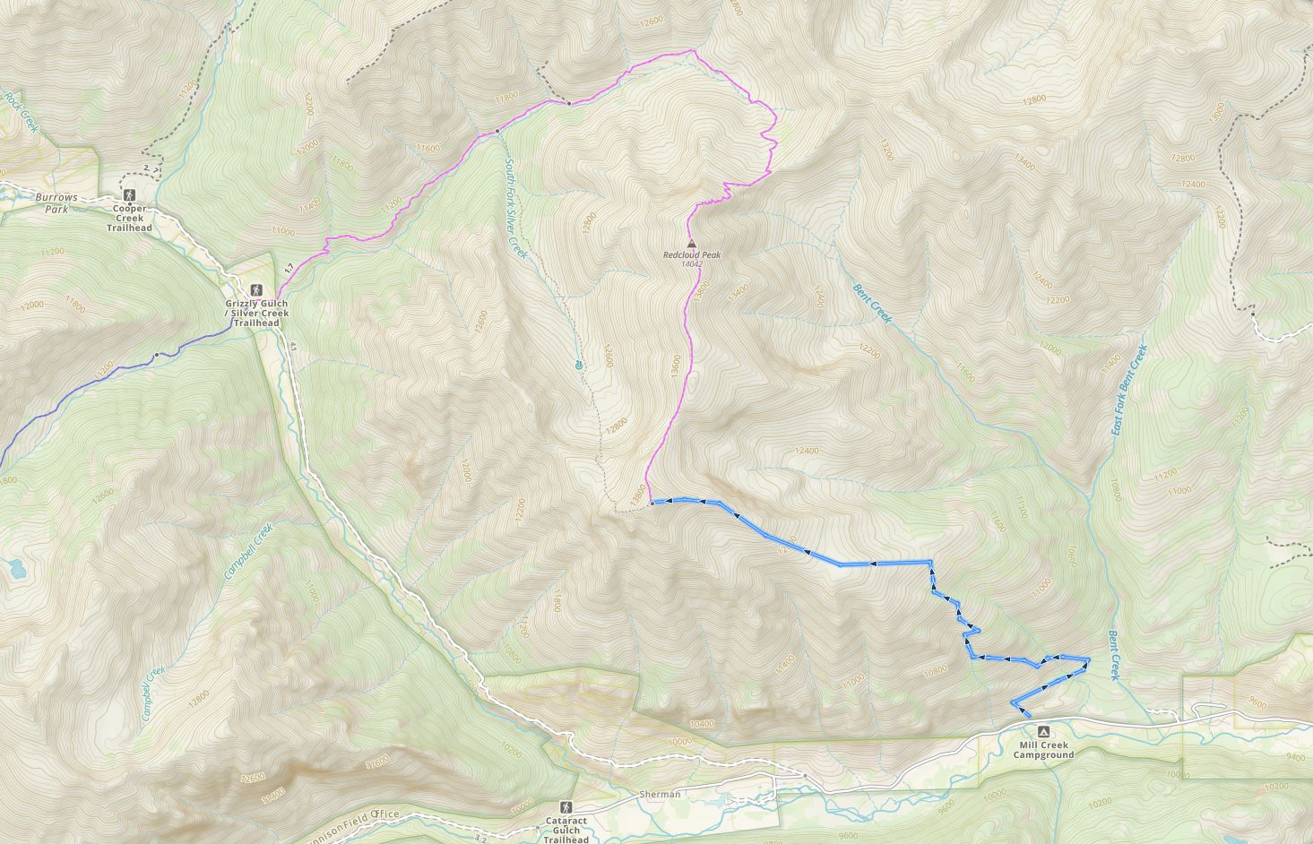
Sunshine & Redcloud Peak Trail Map
Camping For Sunshine & Redcloud Peak
Hikers most frequently stay in the town of South Fork, but the road leading to the trailhead contains campgrounds, like Mills Creek Campground, and various places to camp. The trailhead also has some established tent sites.
Current Weather Conditions:
Here is the detailed weather forecast for the next few days. We highly recommend you check out the mountain forecast for this peak the morning of your hike.
Lake City, CO
Directions & Parking
2WD vehicles can make it to both trailheads. The standard trailhead requires a 2WD vehicle with some clearance.
Directions to Silver Creek / Grizzly Gulch Trailhead:
Directions To Mill Creek Campground (winter route):
Additional Pictures
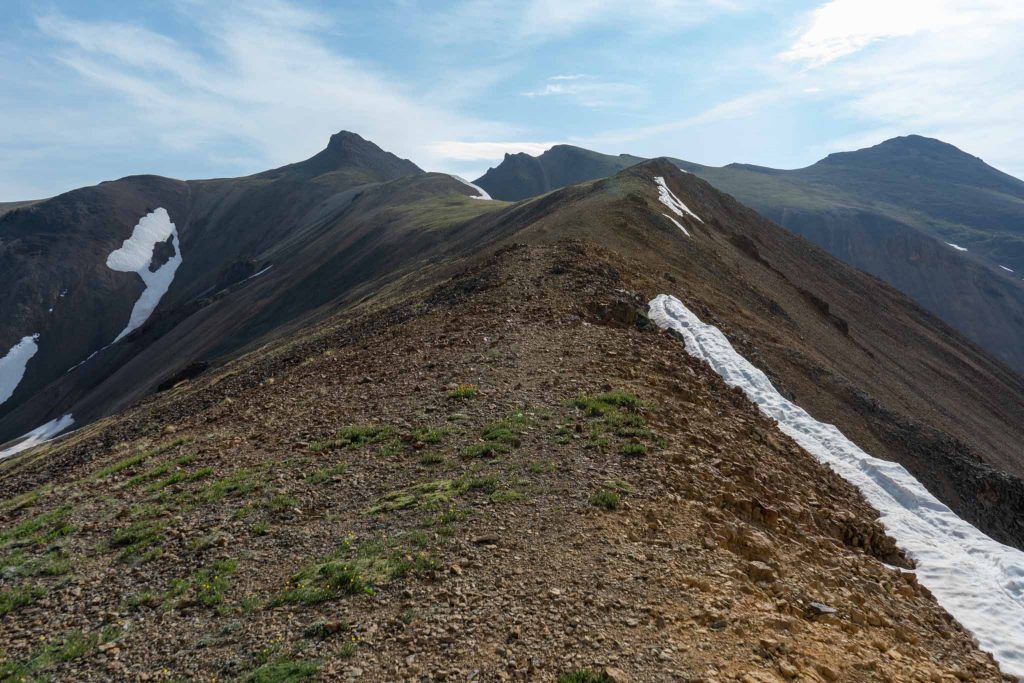
Redcloud Peak As Seen From Sunshine Peak Summit
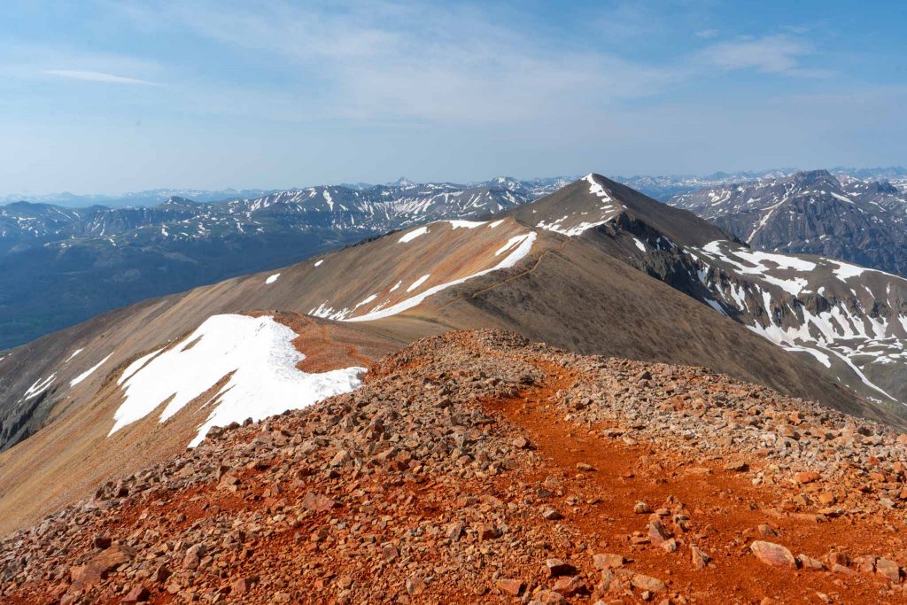
Sunshine Peak As Seen From Redcloud Peak Summit
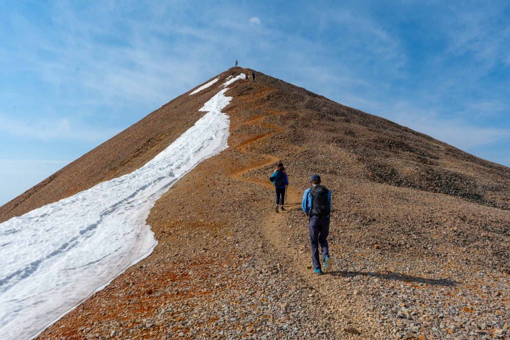
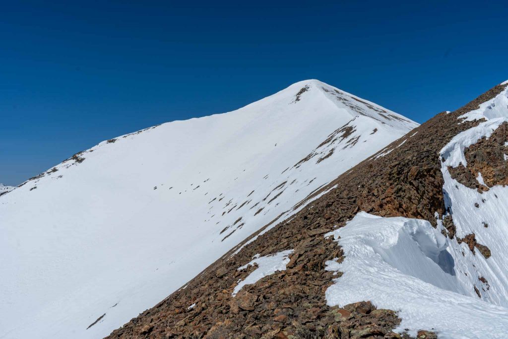
Just Before The Summit Of Redcloud Peak
Just Before The Summit Of Redcloud Peak
Just Before The Summit Of Redcloud Peak
Just Before The Summit Of Redcloud Peak
Just Before The Summit Of Redcloud Peak
Sunshine Peak From Ridge On Winter Route
Hiking Sunshine And Redcloud Peak
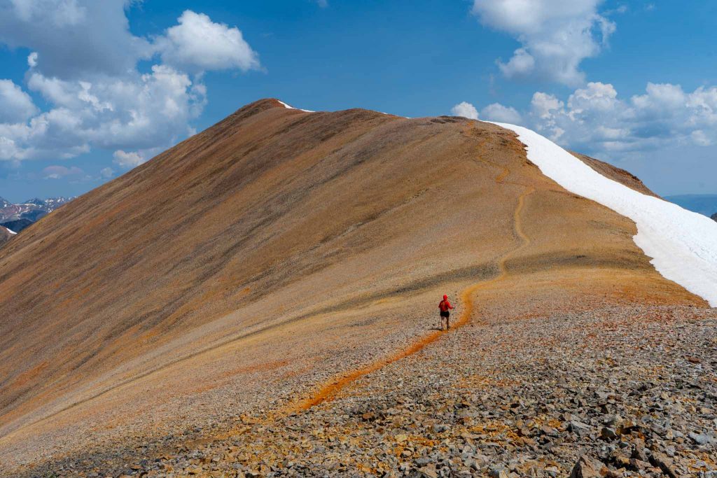
Heading Back Towards Redcloud Peak From Sunshine

Max DesMarais is the founder of hikingandfishing.com. He has a passion for the outdoors and making outdoor education and adventure more accessible. Max is a published author for various outdoor adventure, travel, and marketing websites. He is an experienced hiker, backpacker, fly fisherman, backcountry skier, trail runner, and spends his free time in the outdoors. These adventures allow him to test gear, learn new skills, and experience new places so that he can educate others. Max grew up hiking all around New Hampshire and New England. He became obsessed with the New Hampshire mountains, and the NH 48, where he guided hikes and trail runs in the White Mountains. Since moving out west, Max has continued climbed all of the Colorado 14ers, is always testing gear, learning skills, gaining experience, and building his endurance for outdoor sports. You can read more about his experience here: hikingandfishing/about