Tabeguache Peak is a 14,155 foot mountain in the Sawatch range of Colorado. Below we will cover each of the trail options, information about camping, roads, trail maps and more to help you get hiking this Colorado 14er. Hikers most frequently summit Mount Shavano, then continue on to Tabeguache Peak.
Distance – 11 miles round trip (17.7 km)
Height – 14,155 feet (4,301.4 m)
Elevation gain – 5,100 feet (1554.5 m)
Duration – 7 to 9 hours (book time)
Difficulty – Strenuous
Class: Class 2 Hike
Seasons – Year-round (caution and experience needed in winter – see below)
Trailhead Location – Blanks Gulch Trailhead – 9,760 feet (directions below)
Trails
Mount Shavano And Tabeguache Peak Via Mount Shavano Trail: 11 Miles Round Trip | 5,100 Feet Elevation Gain | Class 2
This is the most common route up Tabeguache peak, and passes over the summit of Mount Shavano. It is very easy to follow, well trafficked, and features switchbacks at the steepest sections.
Beginning and Blanks Gulch Trailhead, hikers hike for .1 miles before taking a right onto the Colorado trail. Hikers stay on the Colorado Trail for .3 miles and then turn left onto the Mount Shavano Trail. From here, hikers begin quickly ascending through the forest and reach treeline (12,000 feet) 2.7 miles into the hike.
From treeline, the trail features incredible views of the rock ledges, and the summit of Shavano can be seen. Hikers will gain the ridge 3.9 miles into the hike. From here, the last summit push is .7 miles with some loose rocks (scree) to the summit.
Once summiting Shavano, hikers continue along to Tabeguache, which is easily visible from the summit of Shavano. From the summit of Shavano, hikers begin descending across boulders down to the saddle between the two peaks. This descent is .6 miles, and drops to 13,720 feet.
Then hikers begin climbing up the last push to Tabeguache over .3 miles to the summit at 14,155 feet (435 foot gain from the saddle).
The peaks are .9 miles apart, so hikers add another 1.8 miles round trip.
Mount Shavano Trail to Angel of Shavano: 9.5 Miles Round Trip | 5,100 Feet Elevation Gain | Class 2
This route is less traveled, but is often used as the winter route or spring route to head up Shavano. It is a more direct route, and takes hikers over the Angel of Shavano, which is a snow feature that looks a bit like an angel on Shavano’s southeast slopes.
This begins the same way along the Mount Shavano trail, but hikers diverge from the Mount Shavano trail around 10,600 feet, (about 3/4 of a mile after turning on the Mount Shavano Trail. The terrain levels out here. Hikers simply follow the best path to get into the gulch. The trail can be hard to find. The alternative option is to maintain on the Mount Shavano trail until around 11,200 feet, and simply cut left, enter the creek drainage, and make your way towards the Angel of Shavano. We definitely recommend using a GPS to know your exact location
Hikers begin heading up the snowfields as far as they go. Usually heading up towards the east ridge to the summit has the most snow cover, and therefore crosses back over the Mount Shavano Trail.
Alternate Routes
Angel of Shavano Trailhead: This is less common due to added length and elevation gain, but a great options still. The Angel of Shavano Trailhead adds 4 miles round trip and about 600 feet of elevation gain if hikers want to start there. The trail is relatively flat and easy to follow. Hikers will be on the Colorado trail until bearing left on the Mount Shavano Trail.
East Ridge: During winter, many hikers will choose to follow the Mount Shavano Trail, but break off of it to gain the east ridge of Shavano, walk that ridge, and then summit. This is not an established route at the moment, but is still an option.
Trail Map
The below map shows the standard route, mileage markers, elevation markers, and more for the Mount Shavano and Tabeguache Peak. Hikers looking to follow to Angel of Shavano are making their own path through the snowfield.
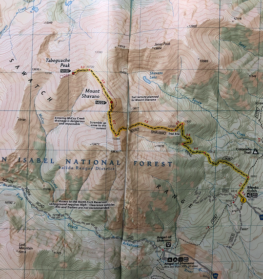
Tabeguache Peak Trail Map
Hiking Mount Tabeguache and Shavano in Winter
Either route above can be accomplished in winter. Of course, the right gear and preparation is needed to summit either peak in winter.
The trailhead is accessible year round, though frequently the road leading to the summer trailhead experiences snowdrifts that will add miles to your hike. Depending upon the timing, hikers may need to add quite a few miles on road 252 to reach the summer trailhead.
Hikers may choose to hike the Mount Shavano Trail and gain the east ridge as soon as possible during winter months, or they may choose the Angel of Shavano route.
Camping For Tabeguache peak
There are tons of dispersed campsites along the road leading to the trailhead. In addition, there is a large field about .3 mile from the trailhead (marked with a sign to camping and overflow parking) in which you should have no problem finding a dispersed site. There is no camping allowed at the trailhead, but the various dispersed campsites nearby are perfect options. The views from the field where dispersed camping is located are fantastic.
There is also camping at the Angel of Shavano Campground: https://www.fs.usda.gov/recarea/psicc/recreation/recarea/?recid=12631
Current weather conditions:
Here is the detailed weather forecast for the next few days. We highly recommend you check out the mountain forecast for this region the morning of your hike.
Garfield, CO
Directions & Parking
Directions to Blanks Gulch Trailhead
Directions To Angel of Shavano Trailhead and Campground:
Additional Pictures
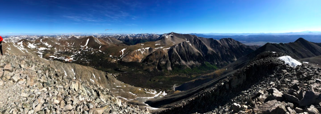
Views of Arkansas River Valley From Mount Shavano
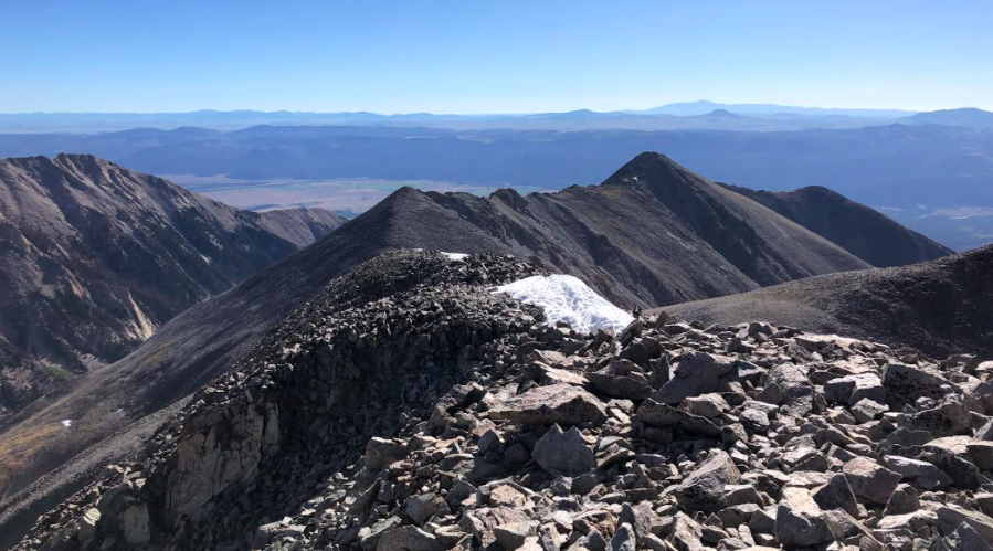
The Saddle Between Shavano and Tabeguache
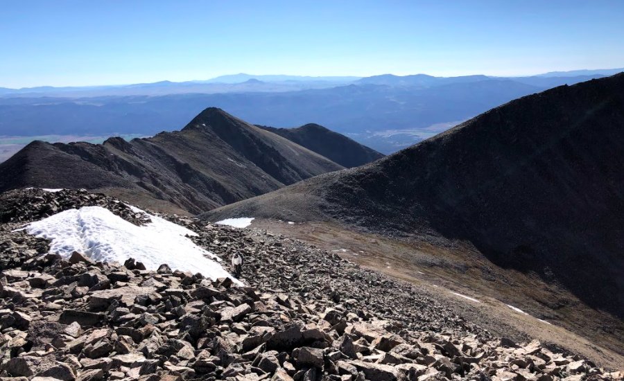
The Saddle Between Shavano and Tabeguache
The Ridge Along Tabeguache Peak
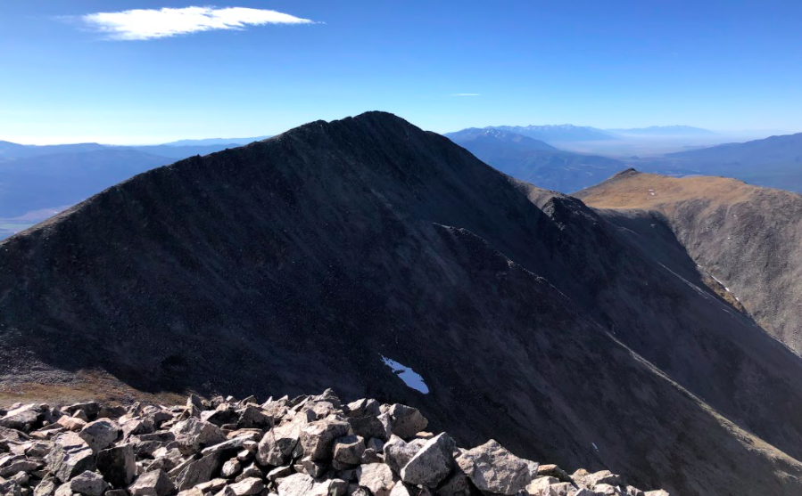
Mount Shavano As Seen From Tabeguache
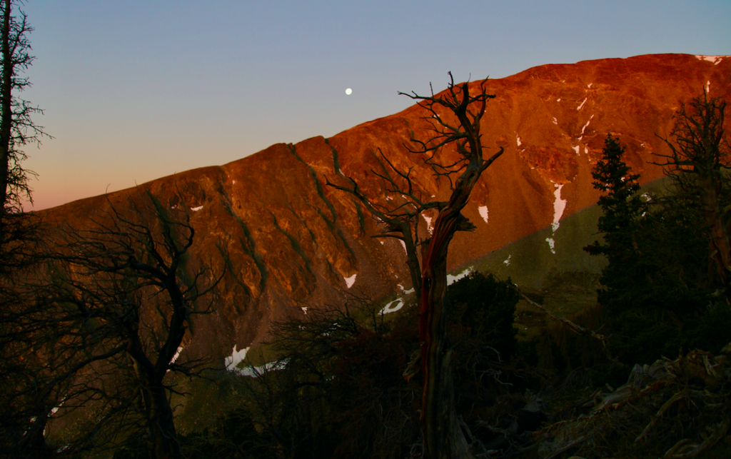
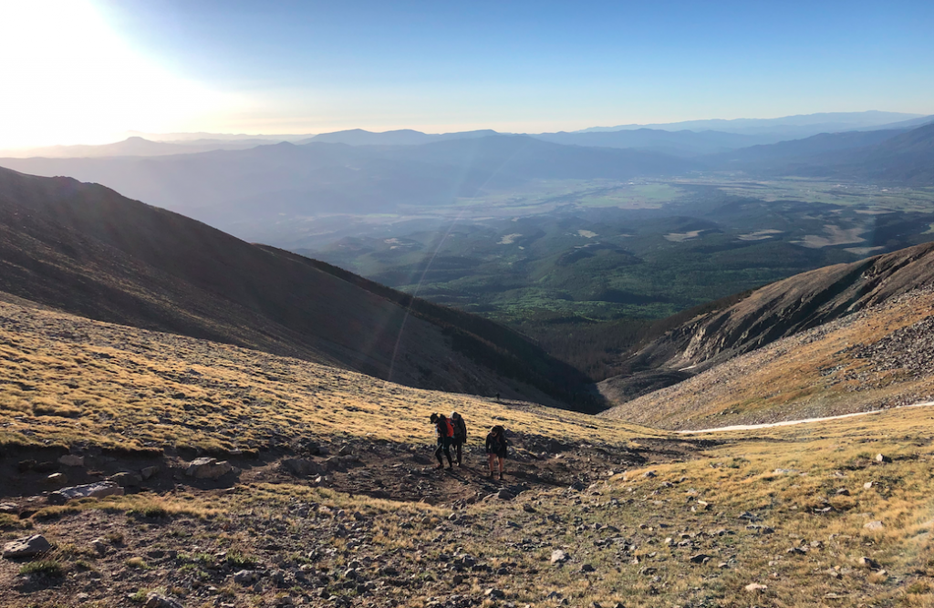
Sunrise Views on Mount Shavano Trail

Max DesMarais is the founder of hikingandfishing.com. He has a passion for the outdoors and making outdoor education and adventure more accessible. Max is a published author for various outdoor adventure, travel, and marketing websites. He is an experienced hiker, backpacker, fly fisherman, trail runner, and spends his free time in the outdoors. These adventures allow him to test gear, learn new skills, and experience new places so that he can educate others. Max grew up hiking all around New Hampshire and New England. He became obsessed with the New Hampshire mountains, and the NH 48, where he guided hikes and trail runs in the White Mountains. Since moving out west, Max has continued his frequent adventures in the mountains, always testing gear, learning skills, gaining experience, and building his endurance for outdoor sports. You can read more about his experience here: hikingandfishing/about
-
Beauty
-
Parking
-
Trail Conditions