
White Pine Lake is located in Little Cottonwood Canyon only a short distance away from Salt Lake City. It is often considered one of the top lake hikes in the Wasatch. The lake is located at the base of White Baldy, Red Baldy, and Thunder Mountain, which creates a stunning backdrop. In this article, you’ll get all the info you need for hiking to this gorgeous lake.
Quick Navigation:
Trail Map | Trails | Hiking In Winter | Camping | Weather | Directions | Pictures
Difficulty – Intermediate
Distance – 10.1 miles round trip (16.25 km)
Height – 9,945 feet (3031.24 m)
Elevation gain – 2,995 feet (912.88 m)
Duration – 6-7 hours (book time)
Trailhead Location – White Pine Trailhead (7,671 Feet)
Dogs – Not allowed on this trail
Need To Know Information
- Dogs are not allowed on this hike.
- Swimming is not allowed in any of the lakes in this area.
- This is a popular hike, and you will encounter people. Parking fills up quite fast.
- There is overflow parking on the road (explained below).
- Camping is common, and there are no fees or permits required. Camping information and regulations below.
Trail Map
Click map to enlarge
Routes
White Pine Lake Via White Pine Trailhead – 10.1 miles round trip (16.25 km) – 2,995 feet (912.88 m) Elevation Gain
This is the only commonly taken route to White Pine Lake. Hikers begin at the trailhead behind the bathrooms located at the parking lot. Hikers descend a small amount before crossing a footbridge over Little Cottonwood Creek. From here, the trail is road width, well maintained, and very well traveled. Hikers will ascend a moderate incline for 0.9 miles before reaching the first junction. Hikers will find a sign leading to the far left towards White Pine Lake, and a second sign towards Red Pine Lake and Maybird Gulch. This junction is located at a beautiful spot along the river as well.
Hikers follow signs to White Pine Lake (a hard left turn).
The trail to White Pine lake remains a dirt road width with moderate gain the entire way, making this a straightforward ascent that consistently gains elevation the entire route. There aren’t any trail junctions to worry about, so staying on the road all the way to the lake is very easy.
The road eventually takes you above White Pine Lake by about 150 feet before it drops down to the lake. Hikers can also choose to walk around the lake if they would like.
Hiking in Winter
This is a great winter hike, but the summer route is exposed to avalanche danger in winter. Due to this, the trail should be avoided during elevated avalanche risk danger times, and should only be done by those with experience understanding avalanche conditions.
Camping Information
This is a common camping area. Due to the wilderness area and watershed regulations, no campfires or dogs are allowed. Any campers must camp at least 200 feet away from trails, lakes, or streams. Campers will find established sites all around both lakes pretty easily.
Fishing White Pine Lake
White Pine Lake does have fish in it. In our experience, it isn’t heavily populated, but they are there, catchable, and some even have some decent size (14+ inches). This is a catch and release fishery. Fish will take dry flies on most summer days, but using a dry dropper rig is highly recommended.
Weather
Here is a detailed weather forecast for the area:
Alta, UT
Today
Sunny, with a high near 43. West wind around 12 mph.
Tonight
Partly cloudy. Low around 29, with temperatures rising to around 33 overnight. West wind around 10 mph.
Friday
Mostly cloudy, with a high near 48. West northwest wind around 10 mph.
Friday Night
Mostly cloudy, with a low around 32. West northwest wind 7 to 10 mph.
Saturday
Mostly sunny, with a high near 53. West wind 7 to 14 mph.
Saturday Night
Partly cloudy, with a low around 35.
Sunday
Mostly sunny, with a high near 57.
Directions
The White Pine Trailhead is a medium sized parking lot, but parking is located along the road as long as cars stay off the road, and not over the white lines. This is a very popular destination, so parking is often limited on weekends, holidays, or nice weather days. You’ll frequently see cars lining the road as this trailhead is a popular spot for several hiking destinations.
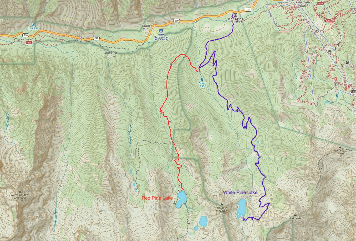
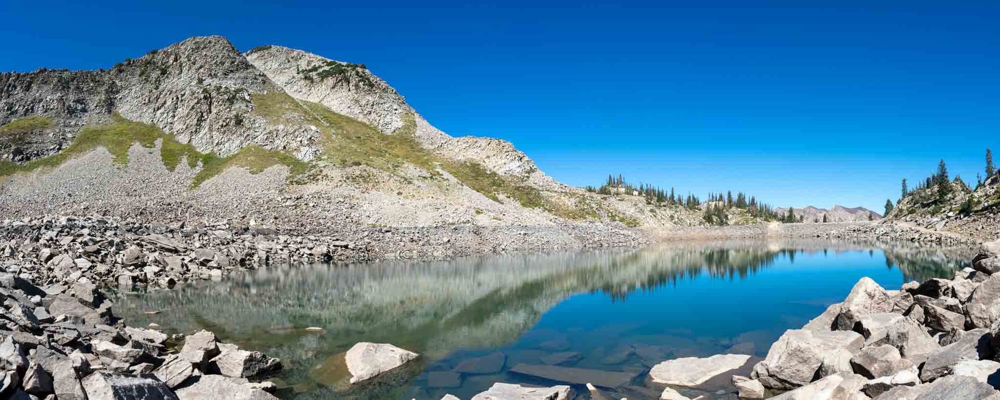
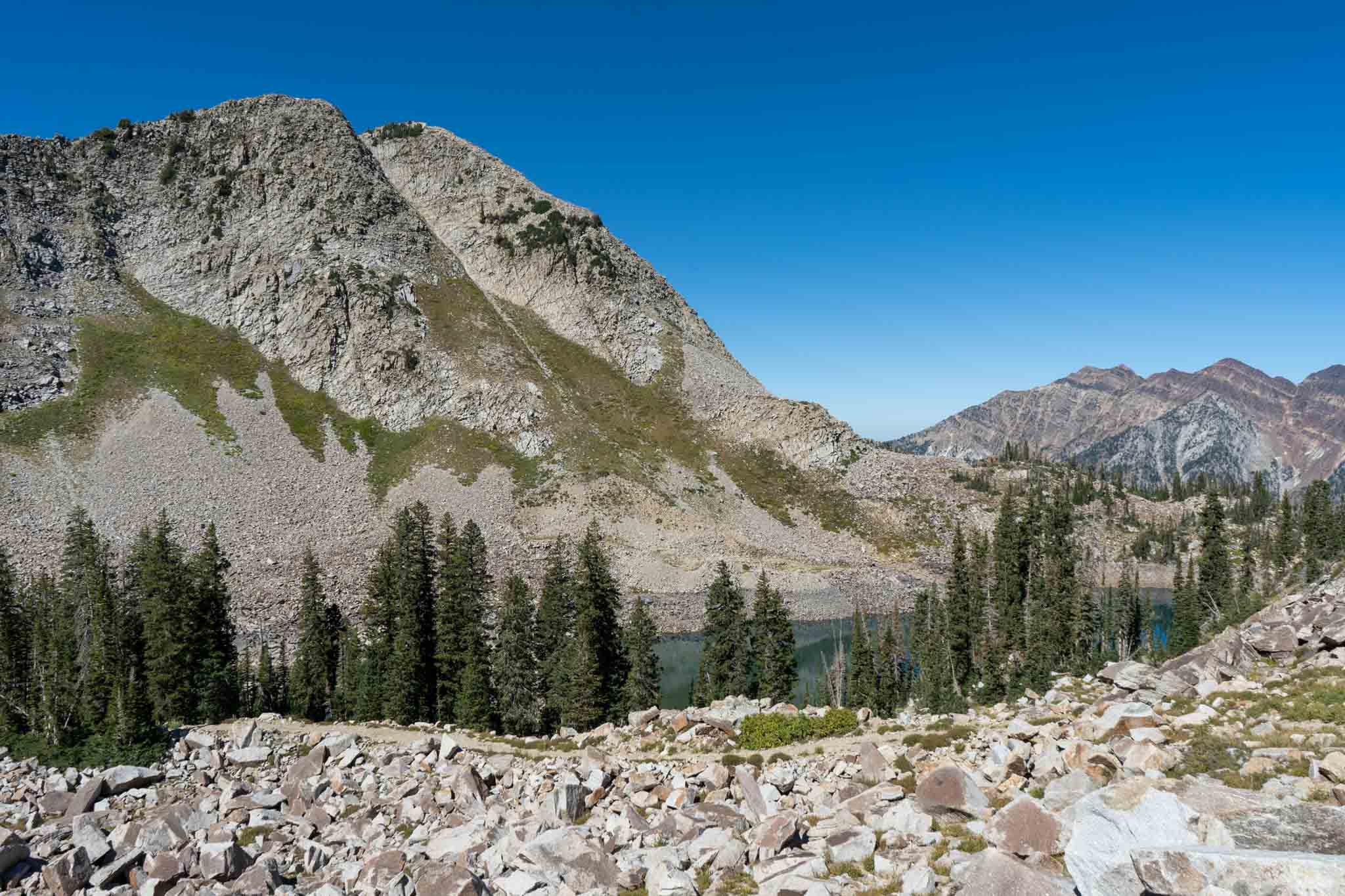
Additional Pictures
Hiking White Pine Lake, Utah
Hiking White Pine Lake, Utah
Views of Mount White Baldy from the road to White Pine Lake
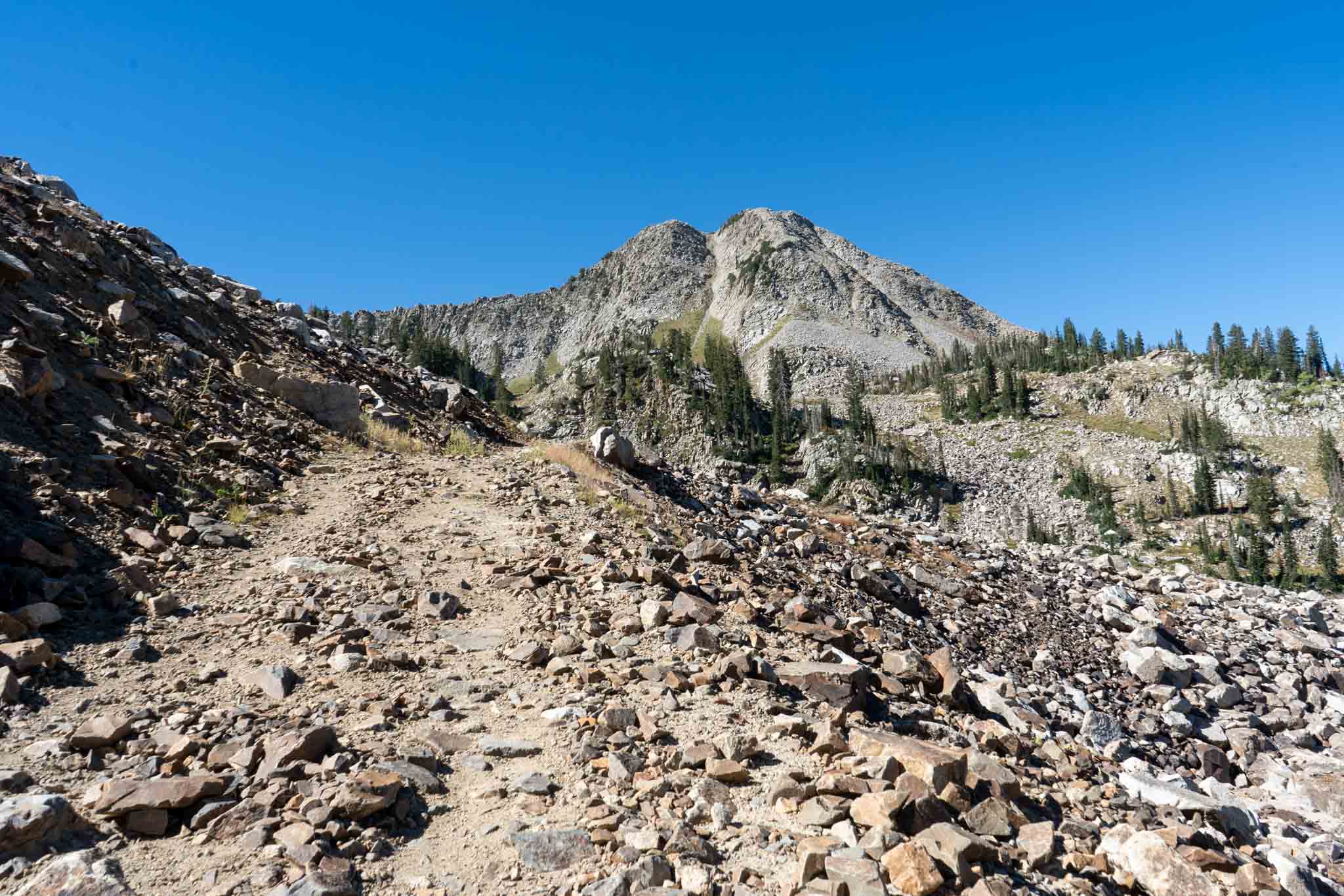
Views of Thunder Mountain from the road to White Pine Lake
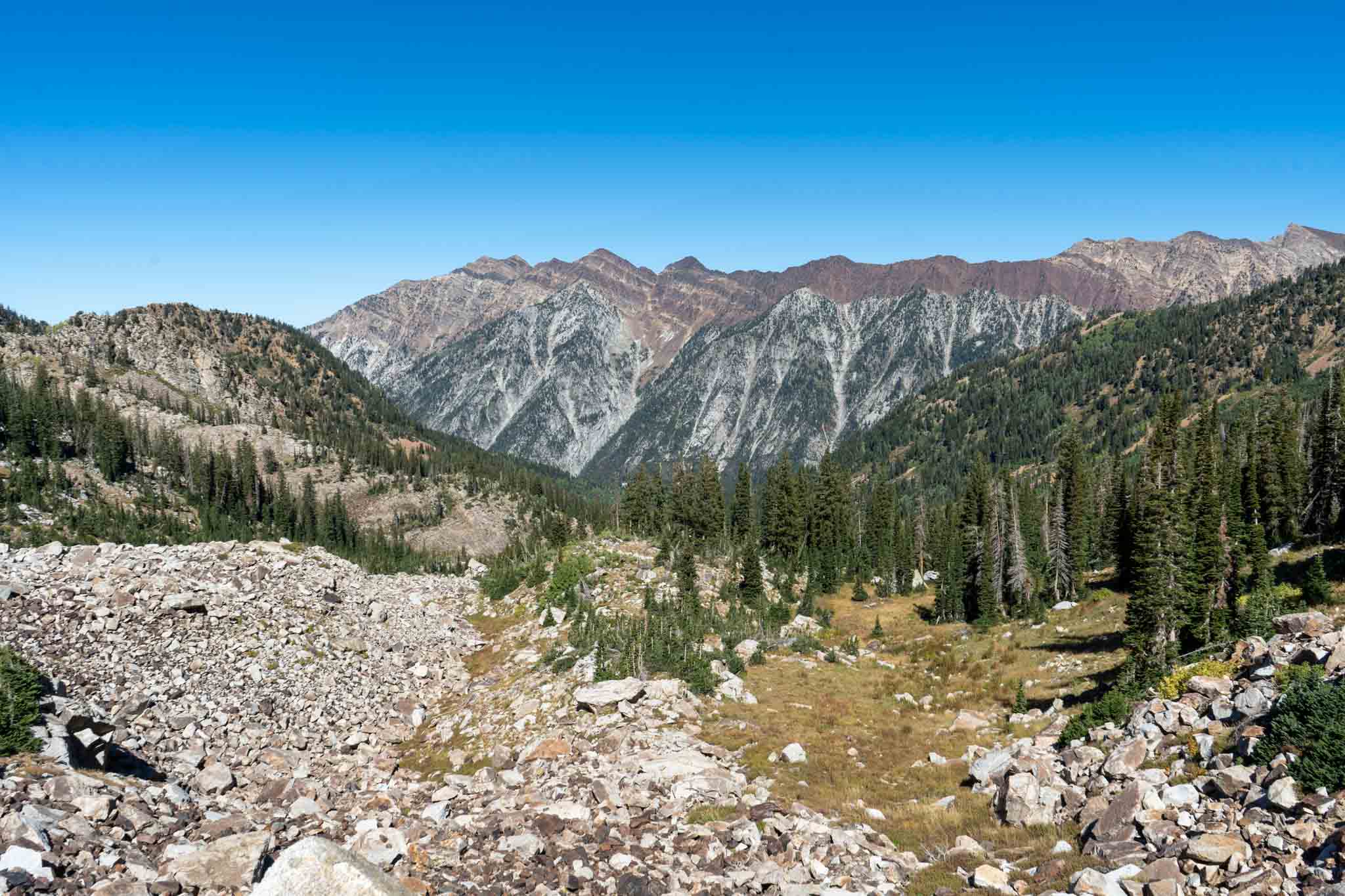
Views of Dromedary Peak, Sunrise Peak and more

Max DesMarais is the founder of hikingandfishing.com. He has a passion for the outdoors and making outdoor education and adventure more accessible. Max is a published author for various outdoor adventure, travel, and marketing websites. He is an experienced hiker, backpacker, fly fisherman, trail runner, and spends his free time in the outdoors. These adventures allow him to test gear, learn new skills, and experience new places so that he can educate others. Max grew up hiking all around New Hampshire and New England. He became obsessed with the New Hampshire mountains, and the NH 48, where he guided hikes and trail runs in the White Mountains. Since moving out west, Max has continued his frequent adventures in the mountains, always testing gear, learning skills, gaining experience, and building his endurance for outdoor sports. You can read more about his experience here: hikingandfishing/about
-
Beauty
-
Parking
-
Trail Conditions
Another perfect bluebird day
Had the dad visiting and we took him to this lake for our first time up here. Amazing views. Saw one large fish meandering around!