Horsetooth Mountain is a beautiful mountain located just west of Fort Collins in Larimer County, Colorado. This is a heavily trafficed mountain in the Front Range of the Colorado Rockies with views of Horsetooth Reservoir, Fort Collins, and larger peaks to the west (including Longs Peak).
Difficulty – Intermediate
Distance – 5 miles round trip (8.04 km)
Height – 7,259 feet (2,213 m)
Elevation Gain – 1,400 feet (426.7 m)
Duration – 4 to 5 hours
Seasons – Year-round.
Trailhead Location – Horsetooth Mountain Open Space
Trail Map
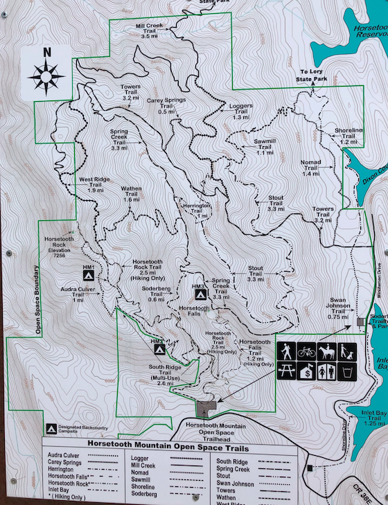
Horsetooth Mountain Trail Map
Trails
There are quite a few paths to the summit of Horsetooth Mountain. Hikers can easily make a loop out of any of these trails by following a trail map like above. You will also see on the trail map where hikers can start on a trial, switch to another where they meet up, and continue on. An example would be starting on the south ridge trail, and then taking the Horsetooth Rock Trail to the summit.
It is also important to note that some trails are “multi-use” meaning, you will see bikers or horse riders.
Horsetooth Rock Trail – 2.5 miles to summit
This is the most common and direct route to the summit. Hikers begin at the right end of the parking lot on the trail, and stay on the trail all the way to the summit. You will cross various junctions, Horsetooth falls, South Ridge Trail, and the Soderberg trail. Often, hikers will see Mule Deer, and views are abundant all the way up.
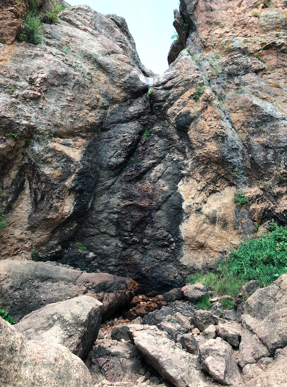
Horsetooth Falls Trail – 3.5 miles to summit
This is a very well trafficked trail for hikers looking to see Horsetooth falls. When dry, the rock formations are cool, but not nearly as nice during more wet months. Hikers begin hiking on the Horsetooth Rock Trail, but turn right onto the falls trail. Hikers will then connect with the Spring Creek Trail, then turn onto the Soderberg Trail, before returning back to the Horsetooth Rock Trail.
South Ridge Trail – 2.6 miles to summit (multi-use trail)
This is also a well trafficked trail. This trail features great views the whole way, but it is also a shared path with bikers and horse riders. A great option is to start on the South Ridge, and then turn onto the horsetooth rock trail.
Directions & Parking
Hikers park at the Horsetooth Mountain Open Space area managed by Larimer County. Hikers will need to either pay a $9 daily parking fee, or have a Larimar county yearly permit. These can be found here.
Current Weather Conditions
Here is the next 4 day detailed forecast:
Fort Collins, CO
Overnight
Snow showers. Cloudy, with a low around 29. East southeast wind around 6 mph. Chance of precipitation is 90%. New snow accumulation of 2 to 4 inches possible.
Saturday
Snow showers likely before 3pm, then a chance of rain and snow showers. Cloudy, with a high near 40. East wind around 7 mph. Chance of precipitation is 70%. New snow accumulation of less than one inch possible.
Saturday Night
Mostly cloudy, with a low around 30. South southeast wind 2 to 6 mph.
Sunday
Sunny, with a high near 61. South wind 2 to 10 mph, with gusts as high as 16 mph.
Sunday Night
Partly cloudy, with a low around 40. West southwest wind 6 to 10 mph, with gusts as high as 16 mph.
Monday
A slight chance of showers and thunderstorms after noon. Mostly sunny, with a high near 73. Chance of precipitation is 20%.
Monday Night
Partly cloudy, with a low around 38.
Additional Pictures
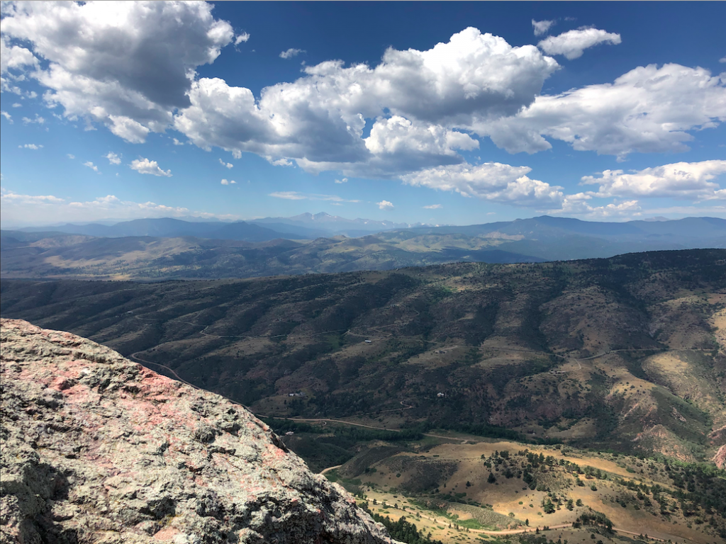
West Facing Views from Horsetooth Mountain
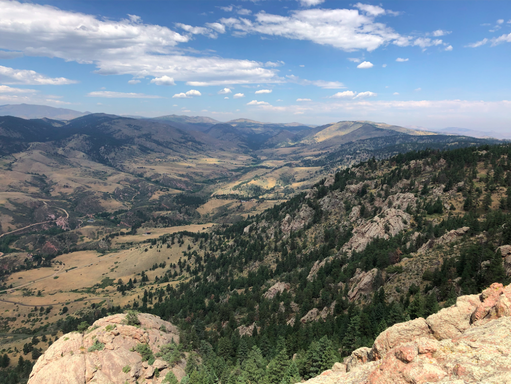
Horsetooth Mountain Summit Views
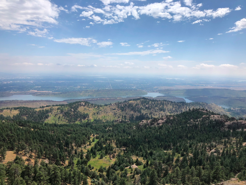
Horsetooth Reservoir from Summit
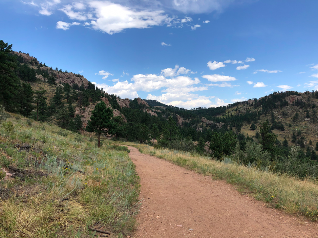
Soderberg Trail Views
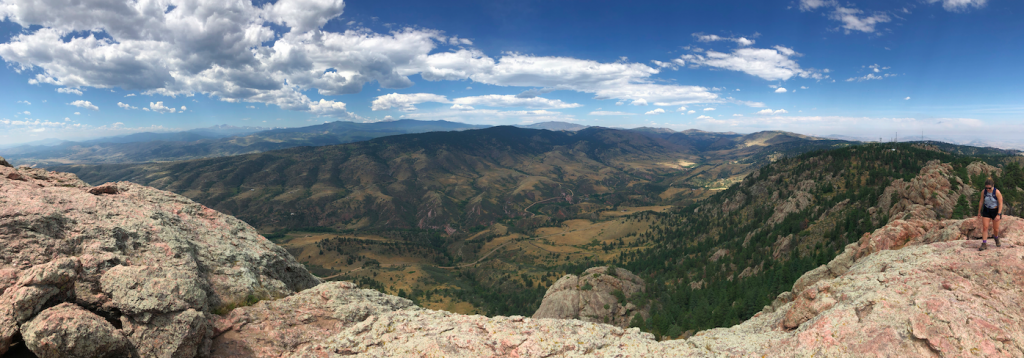
Horsetooth Mountain Panorama

Max DesMarais is the founder of hikingandfishing.com. He has a passion for the outdoors and making outdoor education and adventure more accessible. Max is a published author for various outdoor adventure, travel, and marketing websites. He is an experienced hiker, backpacker, fly fisherman, backcountry skier, trail runner, and spends his free time in the outdoors. These adventures allow him to test gear, learn new skills, and experience new places so that he can educate others. Max grew up hiking all around New Hampshire and New England. He became obsessed with the New Hampshire mountains, and the NH 48, where he guided hikes and trail runs in the White Mountains. Since moving out west, Max has continued climbed all of the Colorado 14ers, is always testing gear, learning skills, gaining experience, and building his endurance for outdoor sports. You can read more about his experience here: hikingandfishing/about