Middle Tripyramid Mountain is a 4,140 foot mountain located in the Sandwich Range of the White Mountains in New Hampshire. North Tripyramid Mountain is only 0.7 miles away from its summit, making it a popular “peak bagging” option for day hikers. The Tripyramids are best known for their slides, providing hikers with more of a challenge.
Elevation: 4,140 feet (1,261.9 meters)
Elevation gain: 2,903 feet (884.8 meters)
Distance: 9 miles round trip – 10.8 miles with North Tripyramid Mountain
Duration (book time): 6 hours
Difficulty: Strenuous
Trails
Livermore Trail & Mount Tripyramid Trail
Begin hiking on the Livermore trail for 2.6 miles until reaching an intersection with the Mount Tripyramid Trail. Here, continue hiking along the Livermore trail. After about 1 mile of hiking, you will reach the summit of Middle Tripyramid Mountain. Many hikers will choose to continue on to North Tri, with another 1.2 miles of steep, rocky and mostly exposed terrain. It is 1.2 miles of exposed bouldering to reach the summit of Middle Tripyramid Mountain. To descend, you will follow the Mount Tripyramid Trail for 3.7 miles, descending another rocky slide before linking back to the Livermore Trail at its southern end. Follow the Livermore trail until you reach the trailhead parking lot in which you started at.
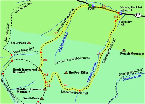
Trail Map

Map courtesy of TrailsNH
Alternate Routes
Pine Bend Brook Trail, Sabbaday Brook Trail
Start your hike on the Pine Bend Brook Trail and continue for 3.2 miles until you reach a junction with the Scaur Ridge trail. Here you will stay straight to continue on the Pine Bend Brook Trail for another 0.8 miles until you reach the summit of North Tripyramid Mountain. From the summit, continue hiking for another 0.7 miles until you reach the summit of Middle Tripyramid Mountain. To descend, retrace your steps back towards the way you came, until you reach the junction for the Sabbaday Brook Trail. Here, take a right onto the Sabbaday Brook Trail until you reach Sabbaday Falls. Continue for 0.3 miles until reaching the parking area. You will then need to walk roughly 1 mile down Route 112 to the area you parked. A car spot is also an option for this hike.
Parking
Parking for the Livermore Trail is located off Tripoli Road.
There are 2 trailheads you can choose to start and end at for this hike. Pine Bend Brook Trail is limited to roadside parking off of Route 12, while the Sabbaday Brook trailhead parking lot has plenty of spaces in a full lot.
Directions
To get to the Sabbaday Brook Trail parking area:
Coming from the West, the parking lot will be located roughly 20 miles East of the junction I-93 and the Kancamagus Highway, on the right side of the road.
Coming from the East, the parking lot will be located roughly 15.5 miles West of the junction I-93 and the Kancamagus Highway, on the left side of the road.
To get to the Livermore Trail parking area:
Drive towards Waterville Valley ski area, branching right towards Tripoli Road. Take this for road and continue for roughly one mile and make a right turn onto Tripoli road. The parking lot will be to your left and a WMNF parking pass is needed.
*NOTE* Tripoli Road is closed during the winter.
Weather
Always check the Mount Washington Observatory Higher Summits forecast before heading out on any hike.
Here is the weather forecast for next four days:
Bartlett, NH
Additional Photos
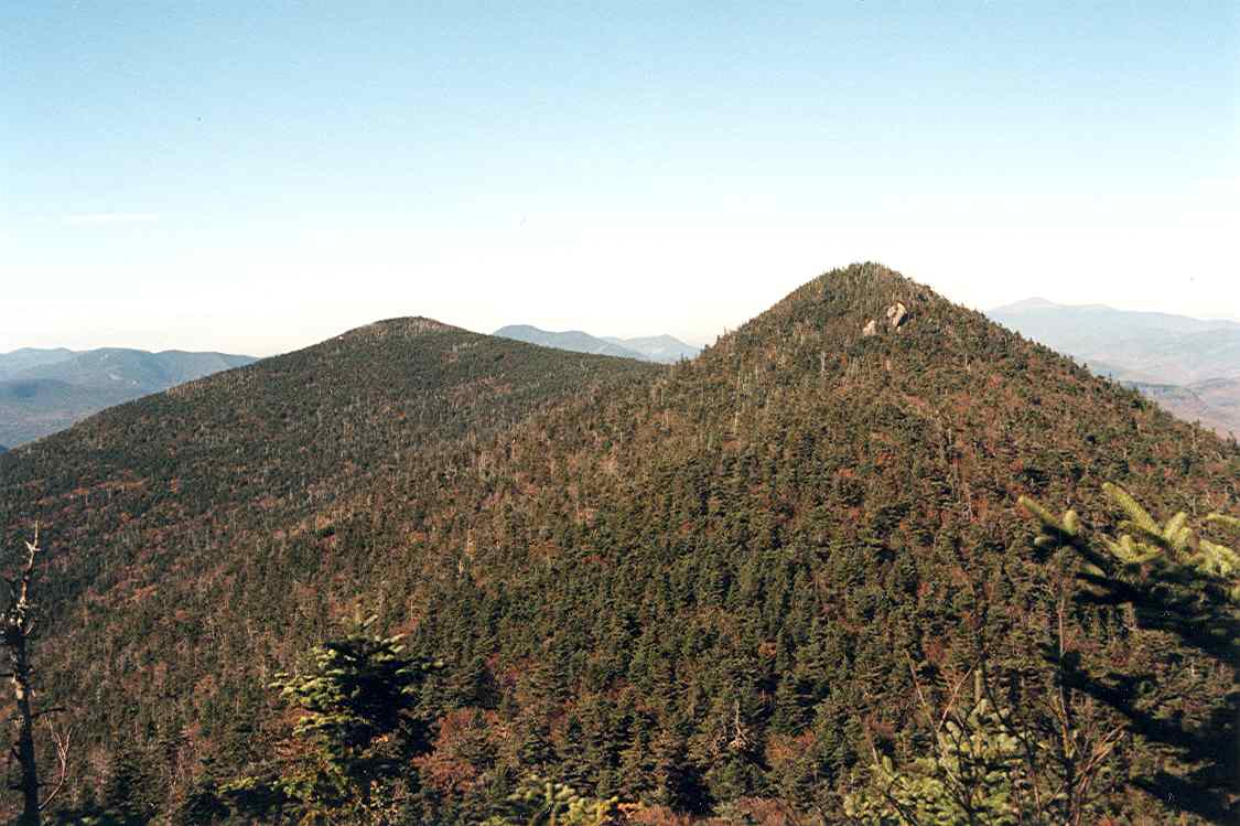
Photo credit – Wikipedia

Andrea is a writer, hiker, and adventurer from New England. She enjoys snowboarding, sunrise hikes, winter, night hiking, traveling, and photography.