Mount Cabot is one of the northern most 4,000 foot mountains in NH. It is far less frequented than other peaks, and still offers hikers a unique experience in New Hampshire’s White Mountains. It is mainly a mountain for peak baggers looking to tackle the NH 48. Though it may bot have the most stunning summit views, the trails through the isolated woods are beautiful.
Height: 4,170 feet
Distance: 9.6 miles
Elevation Gain: 2,900 feet
Duration: 3-5 hours
Difficulty: Intermediate
Trail Map
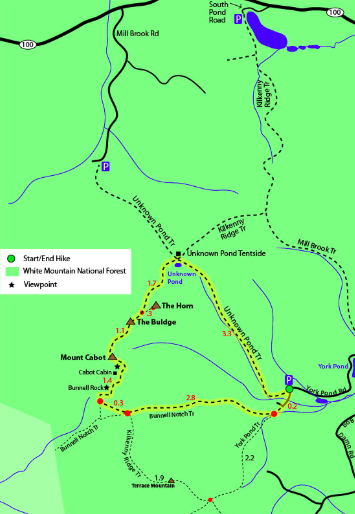
Map Courtesy of 4000footers.com
Trails
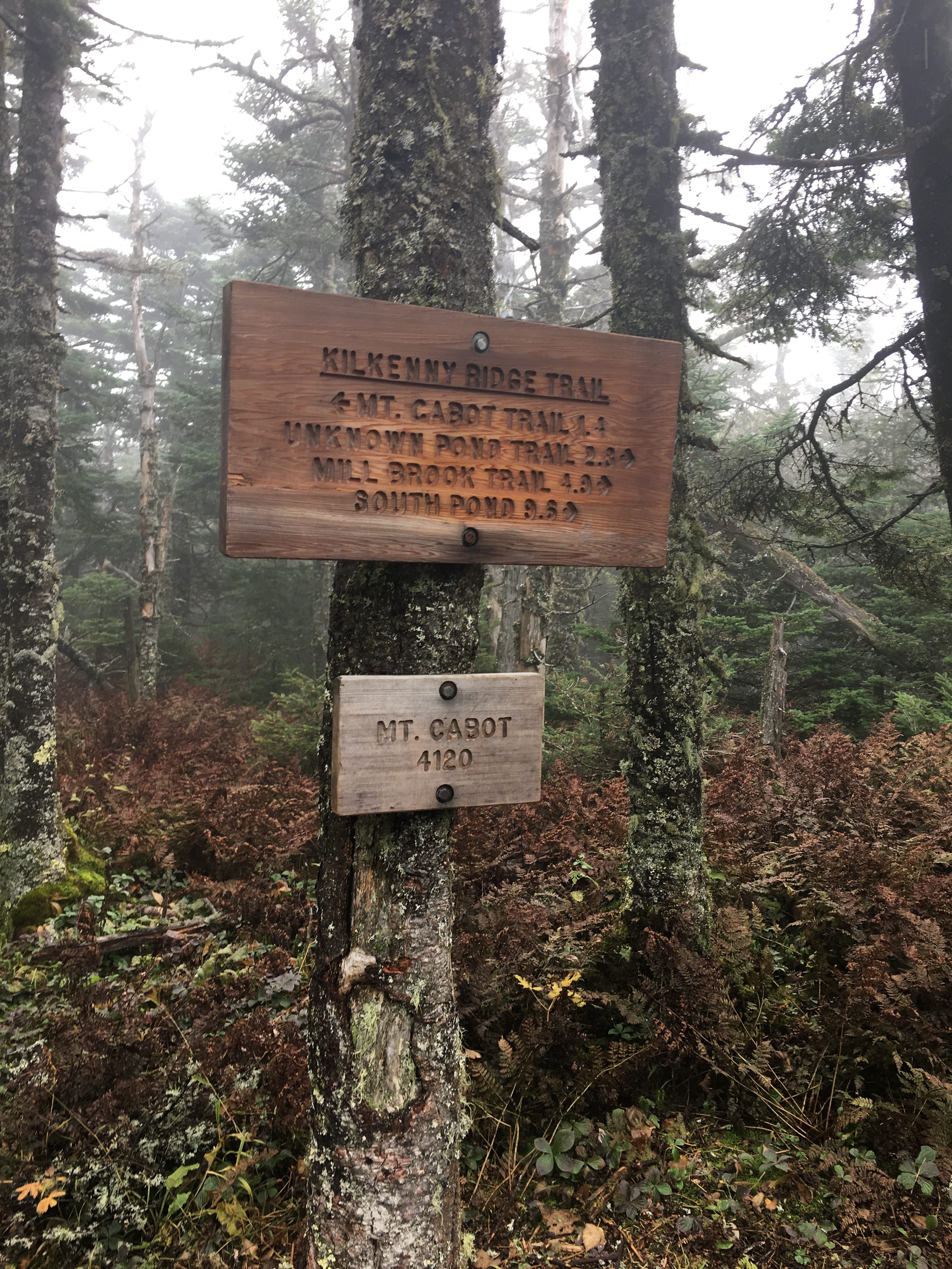
Bunnel Notch Trail
This trail begins at the end of York Pond Road, and ascends to Mount Cabot in 4.7 miles, making a 9.4 mile round trip hike. The trailhead is located a little past the Berlin Fish Hatchery.
Unknown Pond Trail South
This trail begins at the end of York Pond Road as well. You will head north on the Unknown Pond Trail before turning left towards Mount Cabot at Unknown Pond. This is 11.8 miles round trip.
Unknown Pond Trail North
This trail begins at the end of Mill Brook Road. This is the lesser traveled route up Mount Cabot. This is a 10.6 mile round trip with 3,250 feet of elevation gain.

Directions
To Bunnel Notch / York Pond Trailhead / Unknown Pond (South End)
To Unknown Pond Trailhead (North End)
Weather Forecast
Berlin, NH
More Pictures

Max DesMarais is the founder of hikingandfishing.com. He has a passion for the outdoors and making outdoor education and adventure more accessible. Max is a published author for various outdoor adventure, travel, and marketing websites. He is an experienced hiker, backpacker, fly fisherman, backcountry skier, trail runner, and spends his free time in the outdoors. These adventures allow him to test gear, learn new skills, and experience new places so that he can educate others. Max grew up hiking all around New Hampshire and New England. He became obsessed with the New Hampshire mountains, and the NH 48, where he guided hikes and trail runs in the White Mountains. Since moving out west, Max has continued climbed all of the Colorado 14ers, is always testing gear, learning skills, gaining experience, and building his endurance for outdoor sports. You can read more about his experience here: hikingandfishing/about