A class 2 mountain, Mount Democrat, is also a renowned for the gorgeous Kite Lake located at the trailhead. As one of the easier 14ers, this mountain attracts a lot of hiking enthusiasts every year. Located in Pike National Forest of the Rocky Mountains of North America, Mt. Democrat is very frequently combined with 3 other peaks, Mount Cameron, Mount Lincoln, and Mount Bross. Hiking all of these summits is referred to as the Decalibron, and it is a stunning adventure, and one of the most efficient ways to cross off Colorado 14ers.
Difficulty – Intermediate
Distance – 4 miles round trip (6.44 km)
Height – 14,148 feet (4,312.3 meters)
Elevation gain –2,150 Feet (655.3 meters)
Duration – 5 to 8 hours (book time)
Hike Class: Class 2
Seasons – Year-round (caution and experience needed in winter – see below)
Trailhead Elevation – 12,030 ft (3666.7 meters)
***IMPORTANT NOTE***
– The summit of Mount Bross and Mount Lincoln closed to the public. Read about this here: https://www.14ers.org/peaks/mosquito-range/mount-bross/
Trail Map
Trails
KITE LAKE TRAIL: 4 MILES ROUND TRIP | 2,150 FEET ELEVATION GAIN
Kite Lake trail is comparatively easier than many others in the region. The hike begins above treeline, so views at the trailhead are already stunning. Hikers begin hiking a moderate grade upwards for the first half mile. Seeing mountain goat is a strong possibility. The views of the surrounding mountains, and the lake back at the trailhead are fantastic.
After crossing a few mining ruins (.6 miles in), hikers will begin ascending at a steeper grade towards the junction between Mount Democrat and Mount Cameron. Hikers will reach this junction 1.4 miles into the hike. The next .4 miles are the most difficult of the hike as the grade is steep, and features lots of loose rock.
Hikers will first reach a false summit (1.8 miles in). The summit is only .2 miles later.
Hiking in Winter
Mt. Democrat is known as a great winter hiking 14ers. The trail appears to be simple, but caution still needs to be taken. There is moderate avalanche risk that hikers should be weary of. Also, some of the exposed section of the ridge is very icy. Traction and caution should be taken.
Camping Information
There are 5 tent sites available at the Kite Lake Campground. It also features toilets, parking at trailhead, and picnic tables. No water is available. The camping fee is $12. Information on camping can be found here. Kite lake is frequently fished.
Current Weather Conditions
Here is a detailed forecast for the next 4 days:
Alma, CO
Overnight
A chance of snow showers and patchy blowing snow. Mostly cloudy, with a low around 20. West wind around 20 mph, with gusts as high as 35 mph. Chance of precipitation is 30%. New snow accumulation of less than half an inch possible.
Friday
Patchy blowing snow between 8am and 10am, then patchy blowing snow and a slight chance of snow showers between 10am and noon, then areas of blowing snow and a chance of snow showers and a slight chance of thunderstorms between noon and 3pm, then a chance of snow showers and patchy blowing snow and a slight chance of thunderstorms. Partly sunny, with a high near 28. West wind 20 to 30 mph, with gusts as high as 45 mph. Chance of precipitation is 50%. New snow accumulation of around one inch possible.
Friday Night
Snow likely and patchy blowing snow and a slight chance of thunderstorms. Cloudy, with a low around 19. Southwest wind 15 to 20 mph, with gusts as high as 35 mph. Chance of precipitation is 70%. New snow accumulation of 2 to 4 inches possible.
Saturday
Snow likely before 11am, then a chance of snow and patchy blowing snow between 11am and noon, then snow showers and patchy blowing snow and a slight chance of thunderstorms. Mostly cloudy, with a high near 28. West wind 10 to 25 mph. Chance of precipitation is 90%. New snow accumulation of 1 to 3 inches possible.
Saturday Night
A chance of snow showers and patchy blowing snow and a slight chance of thunderstorms before midnight. Partly cloudy, with a low around 16. West northwest wind 10 to 20 mph, with gusts as high as 35 mph. Chance of precipitation is 30%. New snow accumulation of less than half an inch possible.
Sunday
A slight chance of snow showers after noon. Sunny, with a high near 34. West northwest wind 15 to 20 mph, with gusts as high as 35 mph. Chance of precipitation is 20%.
Sunday Night
Partly cloudy, with a low around 21. West wind 15 to 25 mph, with gusts as high as 40 mph.
Directions & Parking
Parking at the trailhead is $3 per day and done via self service.
The road to the trailhead starts in Alma, and one can reach there by taking one of the following routes:
- Colorado 9 to Alma
- Highway 285 to Fair play and then Highway 9 to Alma
- Highway 9 exit (exit 203) off of the I-70 via Breckenridge
As soon as you reach Alma, look for a sign for the road to Kite Lake. The sign is located in the middle of the town on the west side of the road. You will have to cross some residential area after this sign. As your vehicle gets closer to Kite Lake, the road conditions worsen, and the last mile is the worst. A good vehicle with wide clearance will, however, make it simple for you. 4WD recommended. If you don’t have a capable vehicle, you may see yourself adding mileage by having to park far down the road.
Additional Pictures
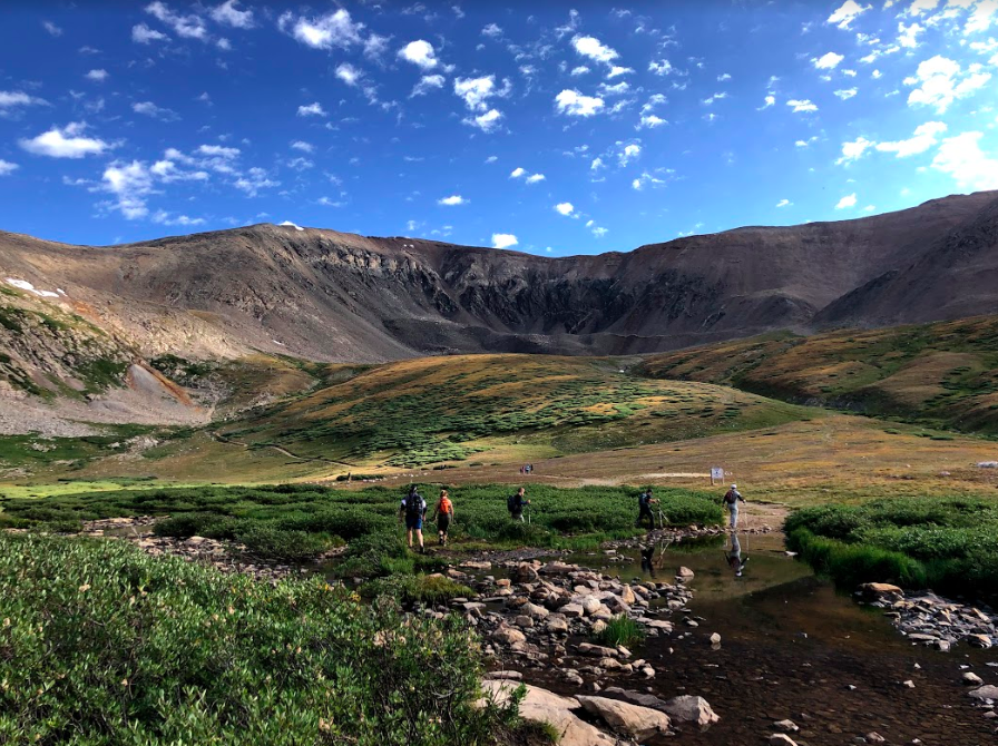
Looking back at Kite Lake
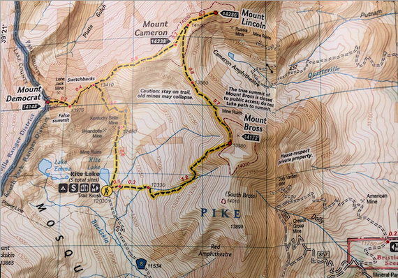
The Connection Between Mount Democrat and Mount Cameron
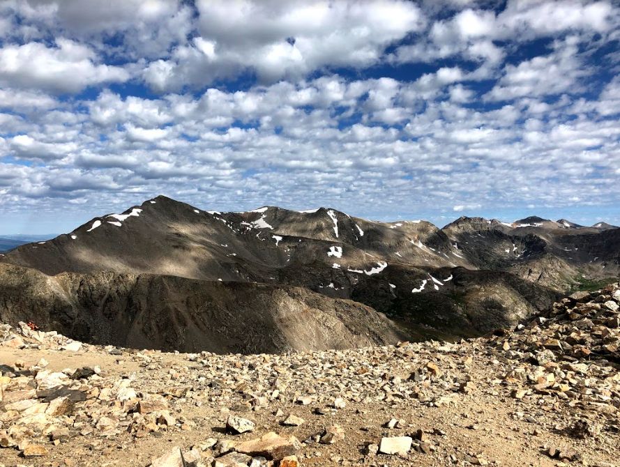
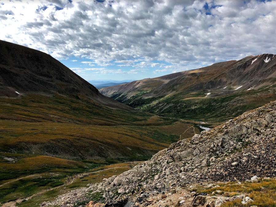
Views from Early on in Hike
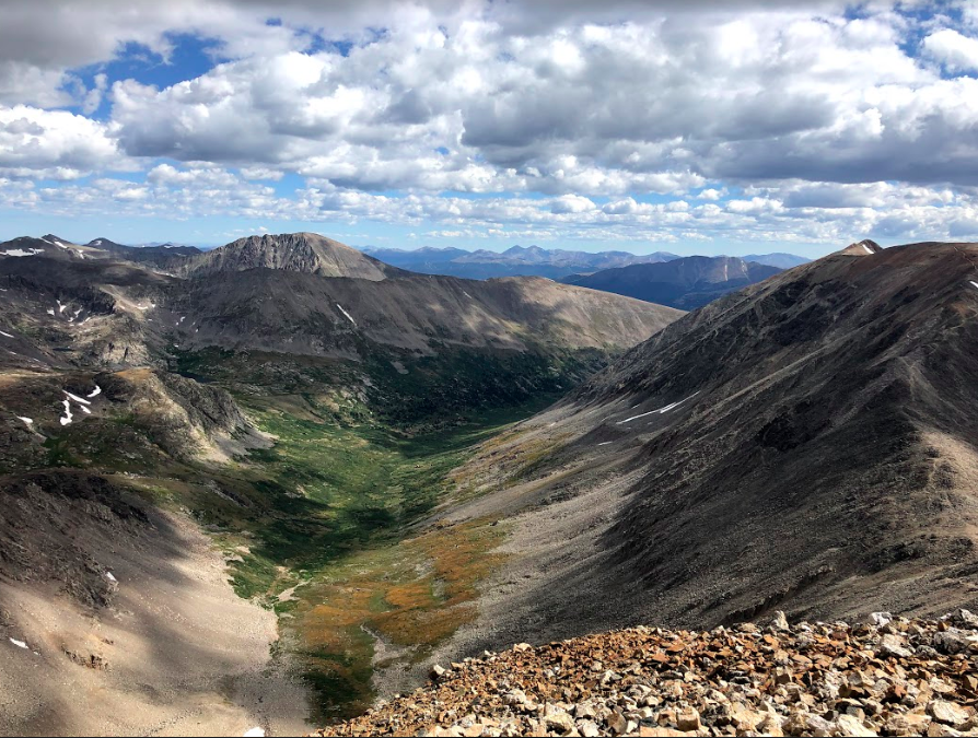
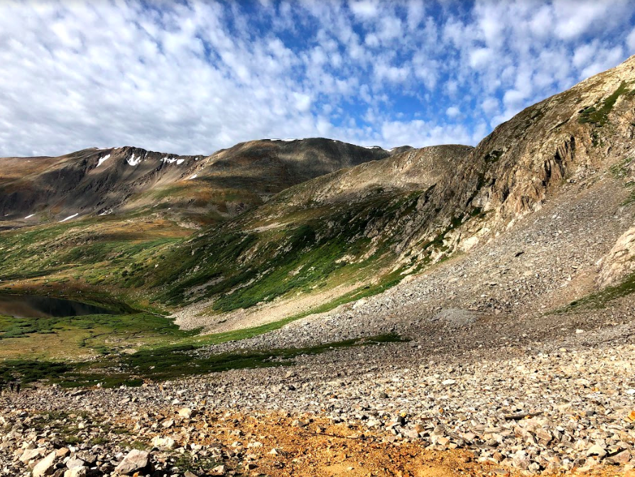
Views from Summit of Mount Democrat
Views of Kite Lake While Ascending Mount Democrat

Max DesMarais is the founder of hikingandfishing.com. He has a passion for the outdoors and making outdoor education and adventure more accessible. Max is a published author for various outdoor adventure, travel, and marketing websites. He is an experienced hiker, backpacker, fly fisherman, backcountry skier, trail runner, and spends his free time in the outdoors. These adventures allow him to test gear, learn new skills, and experience new places so that he can educate others. Max grew up hiking all around New Hampshire and New England. He became obsessed with the New Hampshire mountains, and the NH 48, where he guided hikes and trail runs in the White Mountains. Since moving out west, Max has continued climbed all of the Colorado 14ers, is always testing gear, learning skills, gaining experience, and building his endurance for outdoor sports. You can read more about his experience here: hikingandfishing/about