Mount Mansfield is a 4,393 foot mountain located in the Green Mountains of Vermont. It is the tallest peak in the entire state. Mount Mansfield has many secondary peaks including The Nose, Forehead and the Adam’s Apple.
Elevation: 4,393 feet
Elevation gain: 2,800 feet
Distance: 4.8 miles roundtrip
Duration (book time): 3 hours
Difficulty: Moderate
Trails
The Long Trail
From the parking lot, follow the Long trail for roughly 2 miles. You will pass by the Taft Lodge, an overnight spot for hikers. You will stay on the Long Trail by keeping left here. For 0.3 miles, hike until you reach the summit of Mount Mansfield, AKA The Chin. To get back to the parking lot, simply retrace your steps the way you came.
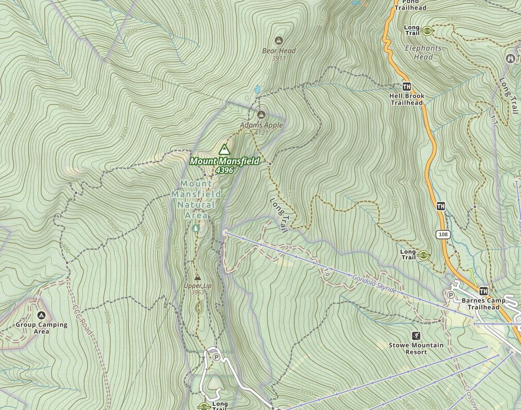
Trail map
Alternate routes
Hellbrook Trail
Elevation gain: 2,683 feet
Distance: 3.7 miles roundtrip
Difficulty: Strenuous
Duration (book time): 4 hours

Camping and Overnight Hiking Options
There is lodging at the Green Mountain Club’s Taft Lodge. A reader has added: The “lodge rate” is $6 per person
Parking
The parking lot for the Long Trail is located on Route 108 in Underhill, Vermont.
Directions
From I-89 North, take exit 10 for VT-100 South towards Waterbury US-2. Drive for roughly 0.3 miles and make a turn right onto VT-100 North. Drive for about 9.5 miles, then turn left onto VT-108 N/Mountain Road. Drive for another 9 miles and the trailhead parking lot will be on the right side of the road. *NOTE* The actual trail begins on the left side of the road.
Weather Forecast
Jeffersonville, VT
Overnight
Clear, with a low around 16. Northwest wind 15 to 18 mph.
Thursday
Sunny, with a high near 35. Northwest wind 12 to 15 mph.
Thursday Night
Clear, with a low around 18. Northwest wind 7 to 13 mph.
Friday
Sunny, with a high near 47. Northwest wind 3 to 7 mph.
Friday Night
Mostly clear, with a low around 28. East wind 3 to 8 mph.
Saturday
Mostly sunny, with a high near 53. South wind 9 to 17 mph.
Saturday Night
Rain showers likely after 8pm. Cloudy, with a low around 41. South wind 18 to 24 mph. Chance of precipitation is 70%.
Additional Photos


Andrea is a writer, hiker, and adventurer from New England. She enjoys snowboarding, sunrise hikes, winter, night hiking, traveling, and photography.