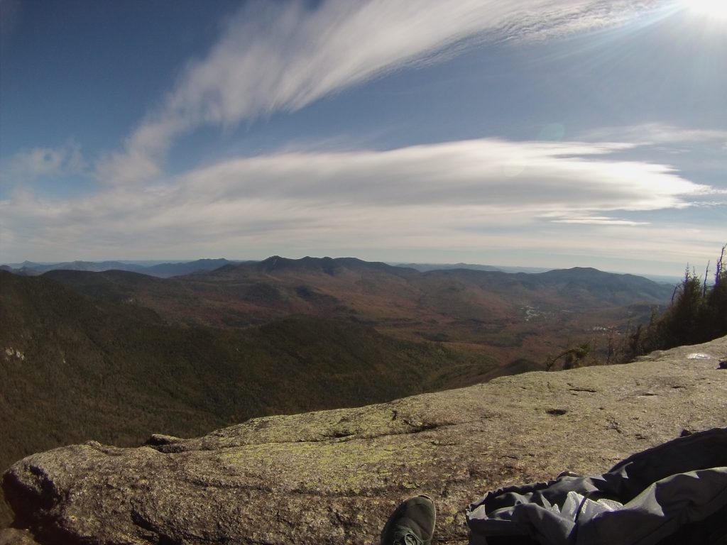
Mount Osceola is known for the beautiful clifftop views overlooking Waterville Valley. With approaches from Tripoli Road as well as the Kancamagus highway, gorgeous views, and easy double summit of East Osceola, this is a favorite among nearly all hikers.
Height: 4,340 feet (1,323 meters)
Distance: 6.4 miles
Elevation Gain: 2,050 feet
Duration: 3-5 hours
Difficulty: Intermediate
Trails
Mount Osceola Trail | 6.4 miles round trip | 2,050 feet elevation gain
This trail is the easiest route up Mount Osceola. It is frequently hiked though the summer and fall.
Greeley Pond Trail | 7.6 miles round trip | 3,116 feet elevation gain
This route will take you over East Osceola on the way to Osceola.
Trail Map
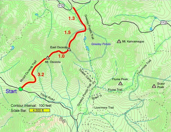
Hiking Mount Osceola and East Osceola
There are two options for summiting both Mount Osceola and East Osceola. Starting from either Tripoli Road, or from Route 112 (The Kanc). Starting from tripoli road is an 8.4 mile round trip with 2,950 feet of elevation gain. Greeley Pond Trail is slightly shorter with a 7.6 mile round trip and 3,116 feet of elevation gain.
Directions
To Mount Osceola Trail (Tripoli Road)
To Greeley Pond Trail (Route 112)
Weather Forecast
Lincoln, NH
Today
Sunny, with a high near 49. Southwest wind 15 to 20 mph, with gusts as high as 35 mph.
Tonight
A slight chance of rain showers between 1am and 2am, then a chance of rain. Mostly cloudy, with a low around 34. Southwest wind 15 to 20 mph, with gusts as high as 35 mph. Chance of precipitation is 40%. New rainfall amounts less than a tenth of an inch possible.
Wednesday
Rain before 1pm, then rain and snow between 1pm and 2pm, then rain and snow. Cloudy. High near 39, with temperatures falling to around 27 in the afternoon. West wind 15 to 30 mph, with gusts as high as 50 mph. Chance of precipitation is 100%. New snow accumulation of less than half an inch possible.
Wednesday Night
A chance of snow before 8pm, then a chance of snow showers between 8pm and midnight. Mostly clear, with a low around 19. Northwest wind 20 to 30 mph, with gusts as high as 50 mph. Chance of precipitation is 50%. New snow accumulation of less than half an inch possible.
Thursday
Sunny, with a high near 38. Northwest wind 15 to 30 mph, with gusts as high as 50 mph.
Thursday Night
Mostly clear, with a low around 24.
Friday
Sunny, with a high near 47.
Additional Pictures

Max DesMarais is the founder of hikingandfishing.com. He has a passion for the outdoors and making outdoor education and adventure more accessible. Max is a published author for various outdoor adventure, travel, and marketing websites. He is an experienced hiker, backpacker, fly fisherman, backcountry skier, trail runner, and spends his free time in the outdoors. These adventures allow him to test gear, learn new skills, and experience new places so that he can educate others. Max grew up hiking all around New Hampshire and New England. He became obsessed with the New Hampshire mountains, and the NH 48, where he guided hikes and trail runs in the White Mountains. Since moving out west, Max has continued climbed all of the Colorado 14ers, is always testing gear, learning skills, gaining experience, and building his endurance for outdoor sports. You can read more about his experience here: hikingandfishing/about