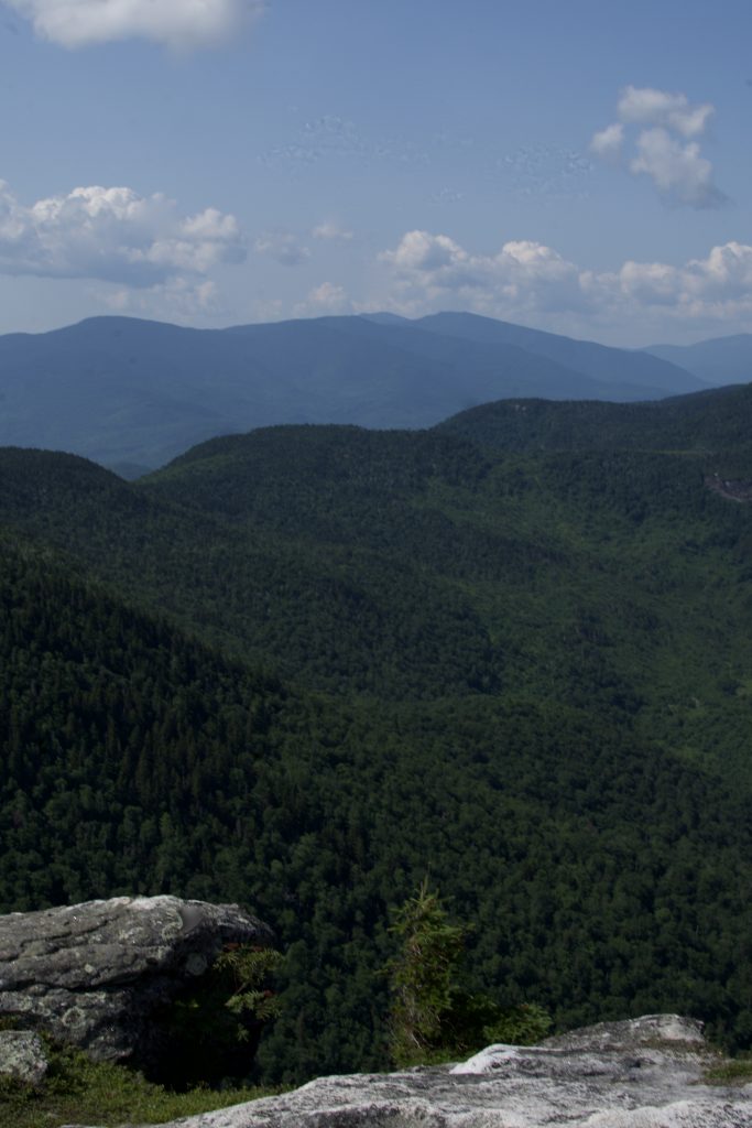
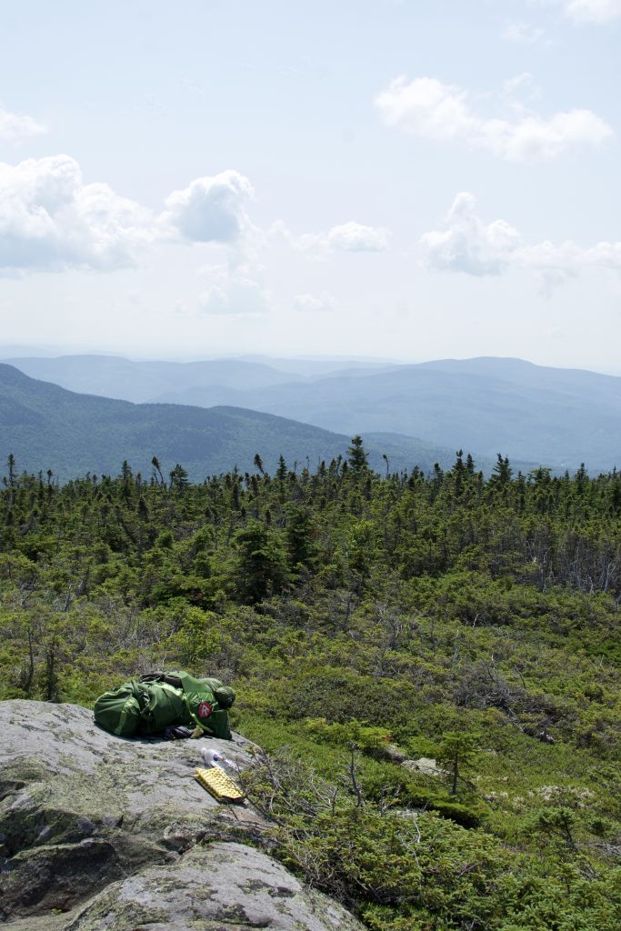
Mount Success is the last New Hampshire summit on the Appalachian Trail before the trail enters into Southern Maine and the Mahoosuc range. The summit of Success offers incredible 360 degree views. Mount Success is also home to the site of an airplane crash in 1954.
Elevation: 3,565 feet (1087 m)
Elevation Gain: 1,950 feet
Distance: 5.3 miles round-trip
Difficulty: Moderate to strenuous
Duration (book time): 4 to 5 hours
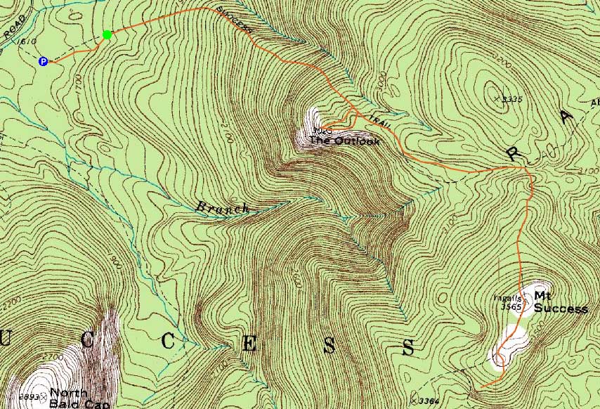
Trails
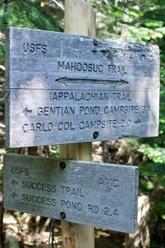
Success Trail
The most common approach to hike Mount Success is via the Success Trail, located off a logging road in Berlin, New Hampshire. The trail begins by following a small stream at a gentle grade. After easy walking, the trail begins to steepen uphill through an open forest. As you get higher, the grade of the trail increases steadily. At 1.6 miles from the trailhead you will reach a sign for the Outlook Loop on your right. Follow the trail an easy 0.3 miles over open rock until you reach a clearing for the Outlook. The 180 degree views are excellent, and it is a great spot to stop and have lunch. Continue on the path as it leads you off The Outlook past the top back to the Success trail. Turn right and the trail begins to flatten out for a bit, leading you across a ridge. There are many wet areas, swamps, and bog bridges on this section of the trail. After hiking another 0.8 miles from the Outlook Loop, you will reach the junction for the Appalachian Trail. Here, turn right onto the Mahoosuc Trail for another 0.6 miles of tricky rock scrambling until reaching the summit of Mount Success. The top offers 360 degree views from its bald summit. To descend, retrace your steps the way you came until you reach the trailhead and logging road where you began.
Carlo Col Trail
A slightly longer and lesser known approach to hike Mount Success is via the Carlo Col Trail. The trail leaves the Success Pond Road at mile 8.1, and the summit of Mount Success is 2.4 miles south when traveling along the Mahoosuc Trail.
Trail Map
The Airplane Crash of 1954
Many people visit Mount Success to check out the remains of the plane crash of 1954, which lie just south of the southern summit of Mount Success along the eastern boundary of the Appalachian Trail corridor. There are a set of blazes which can be followed to reach where the remains of the plane are located.
Camping and Overnight Hiking Options
There is camping along the Appalachian Trail at the Carlo Col shelter, roughly 2.6 miles north of the summit of Mount Success. Gentian Pond is another option in the area for camping and is 2.8 miles to the south of the summit of Mount Success. Both campsites have tent platforms, composting toilets, and a lean-to style shelter.
Parking
Parking for the Success Trail is roadside along the Success Pond Road in Success, New Hampshire. Note that there is no designated parking lot here – park along the side of the road and walk to the trailhead. Success Pond Road is a rough, dirt logging road and is shared with ATV riders.
Directions
The trailhead and parking area are located on Success Pond Road in Success, New Hampshire. From Route 16 in Berlin, head north and take Unity Street for 4.5 miles. In 0.9 miles, Unity Street connects with Coos Street. After 0.1 miles, make a left turn onto Hutchins Street. Drive for 0.8 miles until you reach Success Pond Road on your right, turn here. It is a rough, logging road and an AWD vehicle may be needed. Note that this is also an ATV shared road. Continue on Success Pond Road for 5.4 miles until reaching a spur road marked with a street sign for “Success Pond Trailhead”. There is a boulder blocking the street access so park here and it’s a short walk to reach the official start of the trail.
Carlo Col Trailhead:
Weather
Gorham, NH
Additional photos
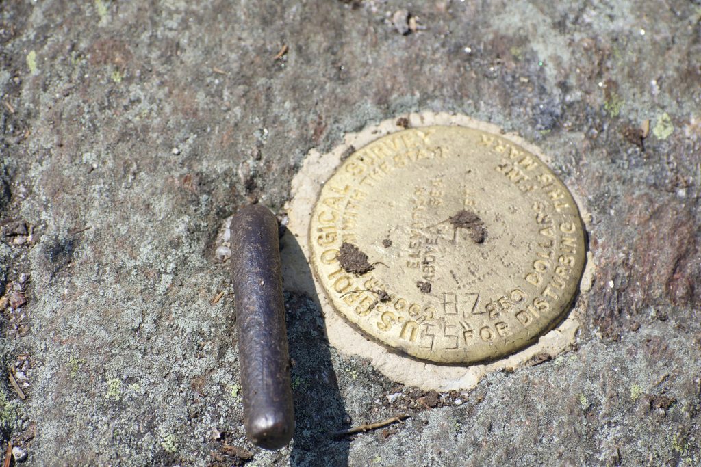
Mount Success Summit Marker

Andrea is a writer, hiker, and adventurer from New England. She enjoys snowboarding, sunrise hikes, winter, night hiking, traveling, and photography.