Mount Tecumseh is a 4,003 foot mountain located in the Sandwich Range of the White Mountains in New Hampshire. It is the shortest mountain on the AMC’s official 4,000 footers list. Waterville Valley Ski Resort is located on Mount Tecumseh.
Elevation: 4,003 feet (1,220 meters)
Elevation gain: 2,400 feet (731.5 meters)
Distance: 5.2 miles roundtrip (8.37 km)
Difficulty: Easy to moderate
Duration (book time): 3-4 hours
Trails
Mount Tecumseh Trail
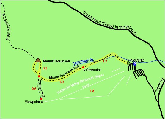
Begin your hike by following along the Mount Tecumseh Trail for 1.2 miles. You will reach a view point area at the 1.2 mile mark. Continue to follow the Mount Tecumseh Trail for another mile where you will reach a junction with the Sosman Trail. Stay right here to continue on the Mount Tecumseh Trail for 0.3 miles until you reach the summit of Mount Tecumseh. To descend, simply retrace your steps until you reach the trailhead parking lot you started at.
Trail map

Hiking in winter
The Mount Tecumseh Trail is entirely below tree line and is less exposed to the elements, but checking the weather forecast is always advised before any hike, especially during winter. Snowshoes and crampons will be necessary and always prepare for winter hiking conditions.
Camping And Overnight Hiking Options
There are many maintained campgrounds off of Tripoli Road and in the Waterville Valley area. Reservations and fees may apply.
Parking
The parking area for the Mount Tecumseh Trail is located in the Waterville Valley Ski area off Tripoli Road in Waterville Valley, New Hampshire.
Directions
To the Mount Tecumseh trailhead
From the south Take I-93 North to the Campton exit, Route 49 / Waterville Valley. Follow Route 49 through the town of Campton, and take a left at the sign for the Waterville Valley Ski Lodge. On the right hand side there will be a trail sign near the main lodge.
Weather Forecast
Although the summit of Mount Tecumseh is significantly lower in elevation than much of the White mountain region, always check the Higher summits forecast on the Mount Washington Observatory website before heading out. We also have the next 4 days detailed below:
North Woodstock, NH
Today
Mostly cloudy, with a high near 41. South wind 10 to 15 mph, with gusts as high as 30 mph.
Tonight
A chance of rain showers between 10pm and 2am, then a chance of rain. Cloudy, with a low around 35. Southwest wind 15 to 25 mph, with gusts as high as 35 mph. Chance of precipitation is 50%. New rainfall amounts less than a tenth of an inch possible.
Saturday
A chance of rain before 8am, then a slight chance of rain and snow showers. Mostly cloudy, with a high near 40. West wind 15 to 20 mph, with gusts as high as 35 mph. Chance of precipitation is 40%. New rainfall amounts less than a tenth of an inch possible.
Saturday Night
A slight chance of rain and snow showers before 7pm. Partly cloudy, with a low around 29. Northwest wind 15 to 30 mph, with gusts as high as 50 mph.
Sunday
Mostly sunny, with a high near 41. West wind 20 to 30 mph, with gusts as high as 50 mph.
Sunday Night
Partly cloudy, with a low around 28.
Monday
Sunny, with a high near 35.
Additional photos

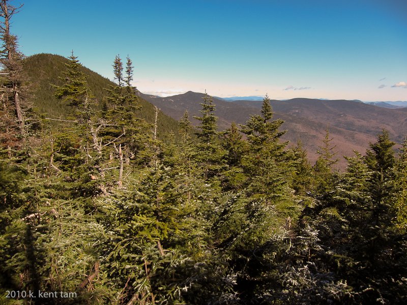
Photo credit – Kent
