Mount Waumbek is a 4,006 foot mountain located in the Pliny Range in the White Mountains of New Hampshire. It is the 3rd shortest of the 48 New Hampshire 4,000 footers, and the 2nd Northern-most 4,000 footer mountain in New Hampshire. The shortest and easiest route to the summit of Mount Waumbek is by taking the Starr King Trail. The trail crosses over the summit of Mount Starr King.
Elevation: 4,006 feet (1,221 meters)
Elevation gain: 2.700 feet
Distance: 7.2 miles roundtrip with Mt. Starr King
Duration (book time): 3 hours
Difficulty: Easy to moderate
Trails
Starr King Trail – 7.2 miles round trip – 2,700 feet elevation gain
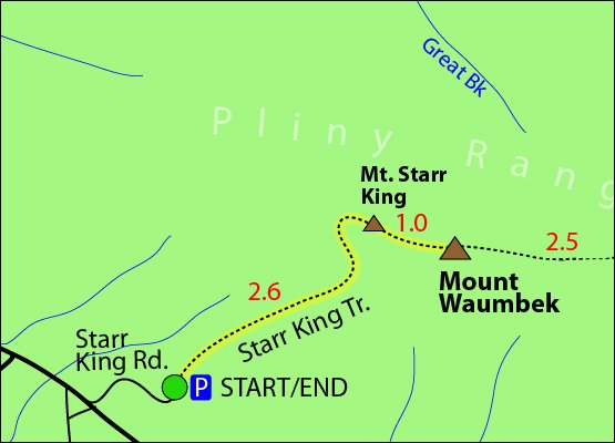
From the trailhead parking lot, follow the Starr King Trail for 2.6 miles until you reach the summit of Mount Starr King. To continue on, keep hiking along the Starr King Trail for roughly 1 more mile until you reach the summit of Mount Waumbek. To descend, simply retrace your steps to return to the parking lot where you began.
Traverse option
York Pond Trail, Kilkenny Ridge Trail
Many hikers choose to do a traverse with Mount Waumbek, Mount Starr King, North Weeks Mountain, South Weeks Mountain and Middle Weeks Mountain. Start the traverse on the York Pond Trail for 0.2 miles where you will come to a junction with the Bunnell Notch Trail. Here, you will stay left on the York Pond Trail and and continue for another 2.2 miles where you will then reach a junction with the Kilkenny Ridge Trail. Here, take a left onto the Kilkenny Ridge Trail and continue for roughly 1.2 miles until you reach the summit of North Weeks Mountain. There are no views from this summit. You will keep hiking along the Kilkenny Ridge Trail for another 2.3 miles, while passing over Middle Weeks Mountain, until you reach the summit of South Weeks Mountain. From here, hike another 2.5 miles on the Kilkenny Ridge Trail until you reach the summit of Mount Waumbek. From the summit of Waumbek, Mount Starr King is just one mile away. To descend, follow the Starr King Trail for 2.6 miles until you reach the Starr King Traillhead parking area.
Distance: 20.6 miles roundtrip
Duration (book time): 7 hours
Difficulty: Strenuous
Trail map

Hiking in winter
Mount Waumbek is often climbed in the winter time. The entire trail is wooded, and has no significant exposure above tree line. Though it is much smaller and less exposed than many other NH mountains, hiking in winter requires special skills and equipment. Always be prepared.
Camping and overnight hiking options
Primitive campsites are available at Unknown Pond that can only be reached by the Unknown Pond or Kilkenny Ridge Trail. Back country camping is permitted in this area, as long as you follow the Forest Service rules of the White Mountain National Forest. No camping above treeline, except in winter if there is more than two feet of snow on the ground. There is no camping allowed within 1/4 mile of huts, campsites, trailheads, or many roads.
Parking
The parking lot for the Starr King Trail is located on Starr King Road in Jefferson, New Hampshire.
The parking lot for the Unknown Pond Trail is located on the Berlin Fish Hatchery Property. *NOTE* There is a gate before the trailhead lot that has hours from 8am to 4pm. The gate may be closed otherwise.
Directions
To get to the The Starr King Trail parking area
The trailhead for the Starr King Trail is located right off Starr King Road (off Route 2) in Jefferson, New Hampshire. The dirt road is very bumpy and has several potholes and frost heaves the further you travel on it. Starr King Road is located about .4 miles east of Jefferson, between NH Routes 116 and Route 115. The parking lot is rather small and will hold about 10 cars.
To get to the The Unknown Pond Trail parking area
Take exit 35 off I-93 to merge onto US-3-N / Daniel Webster Highway towards Twin Mountain / Lancaster. Drive for 12.3 miles and turn right onto NH-115-N. Drive for 9.6 miles and turn right onto US-2 E / Presidential Highway. Drive 12.5 miles and turn left onto NH-16 N / Main Street. Drive 5 miles and turn left onto Green Street. Drive 0.3 miles and turn left onto 2nd Ave. Drive 463 feet and take your second left onto Madigan Street. Drive 374 feet and take your 1st right onto 3rd Avenue. Drive 0.2 miles and continue onto Wight Street. Drive 0.5 miles and continue onto NH-110 W / W Milan Road. Drive roughly 5 miles on York Pond Road, and stay right at the fork. Drive roughly 1.5 miles until you reach the parking lot on the right side of the road.
Current Weather Conditions
Berlin, NH
Additional photos

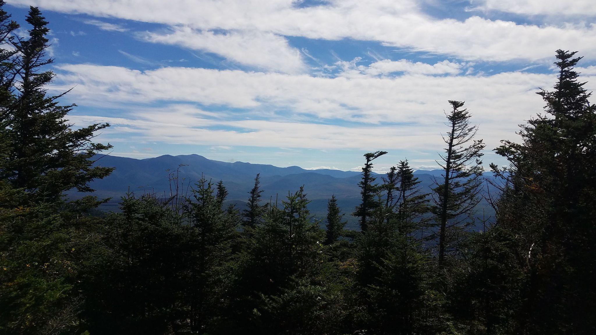
Mount Waumbek summit
