Mount Whiteface (4,019 feet) is the southern most NH 4000 footer. It is located in the Sandwich range, and is often combined with Mount Passaconaway (4,043). There are various routes up Mount Whiteface, but the most common is a 6.8 mile round trip.
Distance: 6.8 Miles (10.94 km)
Elevation: 4,019 Feet (1224.99 meters)
Elevation Gain: 3,111 Feet (917.75 meters)
Difficulty: Intermediate
Duration: 3-5 Hours
Blueberry Ledge Trail
This is the most popular trail up Whiteface, and for good reason. It features a gorgeous walk along the Wonalancet River. This is a 3.2 mile trail to the summit, making it a 6.4 mile round trip. Steep rock sections are near the top, require some hand over hand scrambling.
Dicey’s Mill Trail
The Dicey’s Mill Trail, is a slightly more difficult route up Whiteface, and it features a bridge-less river crossing that can present problems during high water. This is a 3.4 mile trail to the summit (6.8 round trip). You will have to turn left onto the Tom Wiggin trail to meet up with the blueberry ledge trail before the summit of Whiteface.
Passaconaway and Whiteface
The highlighted route below will summit both mountains and is 12.1 miles long. I highly recommend summiting both mountains. Passaconaway’s only good view is down a lookout trail, but it is a fantastic place to eat lunch.
Trail Map
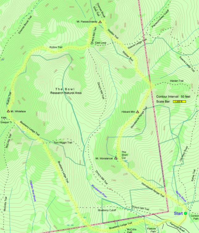
Map Courtesy of hikenewengland.com
Directions
Being the southernmost 4000 footers, Whiteface and Passaconaway are nice and close for many in the Lakes Region. Located in Ferncroft, NH, the trailhead isn’t right off the highway like many. Here are Google Maps directions:
Weather Forecast
Center Sandwich, NH
Tonight
A chance of rain showers between 10pm and 2am, then rain likely. Cloudy, with a low around 37. Southwest wind 10 to 15 mph, with gusts as high as 25 mph. Chance of precipitation is 60%. New rainfall amounts between a tenth and quarter of an inch possible.
Saturday
A chance of rain before 10am, then a slight chance of rain showers. Mostly cloudy, with a high near 49. West wind 10 to 15 mph, with gusts as high as 30 mph. Chance of precipitation is 40%. New rainfall amounts between a tenth and quarter of an inch possible.
Saturday Night
A slight chance of rain showers before 7pm. Partly cloudy, with a low around 31. West wind 10 to 15 mph, with gusts as high as 30 mph. Chance of precipitation is 20%.
Sunday
Mostly sunny, with a high near 46. West wind 10 to 15 mph, with gusts as high as 35 mph.
Sunday Night
Mostly clear, with a low around 32. West wind 15 to 20 mph, with gusts as high as 35 mph.
Monday
Sunny, with a high near 41.
Monday Night
Mostly clear, with a low around 28.
Additional Pictures

Standing on a ledge after the first rock scramble on Whiteface.
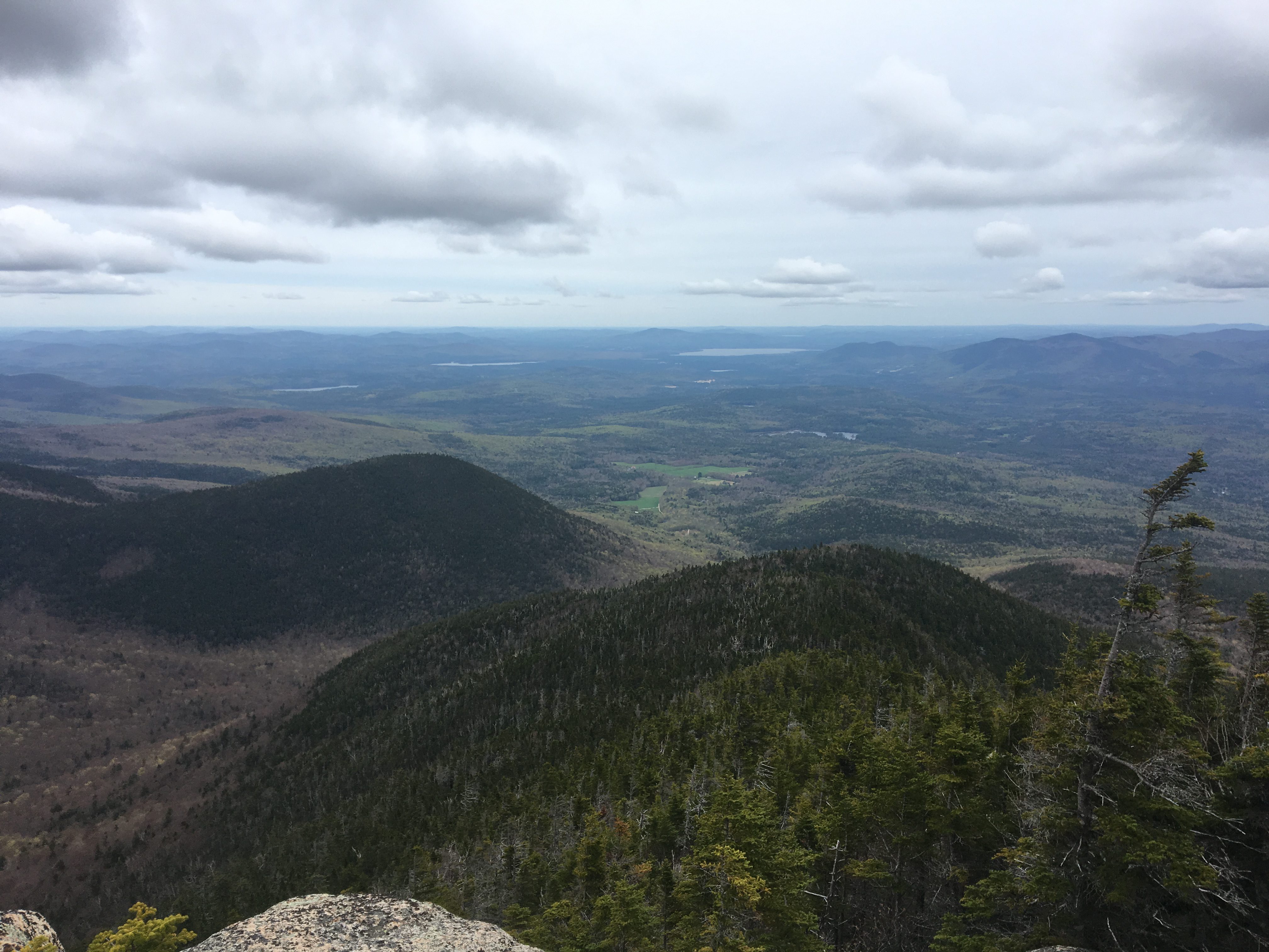
Southwestern Views from Whiteface
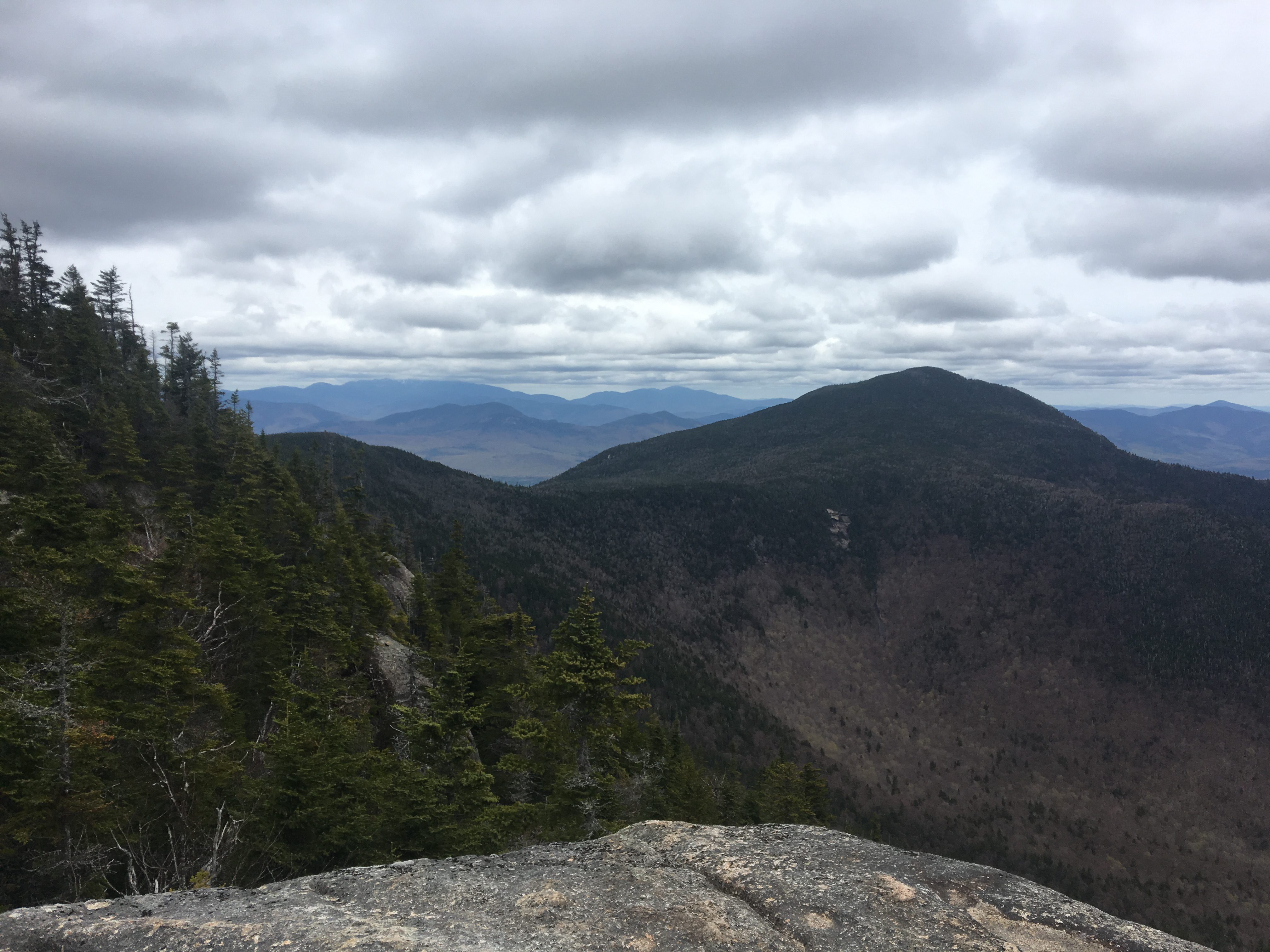
View of Mount Passaconaway from Whiteface
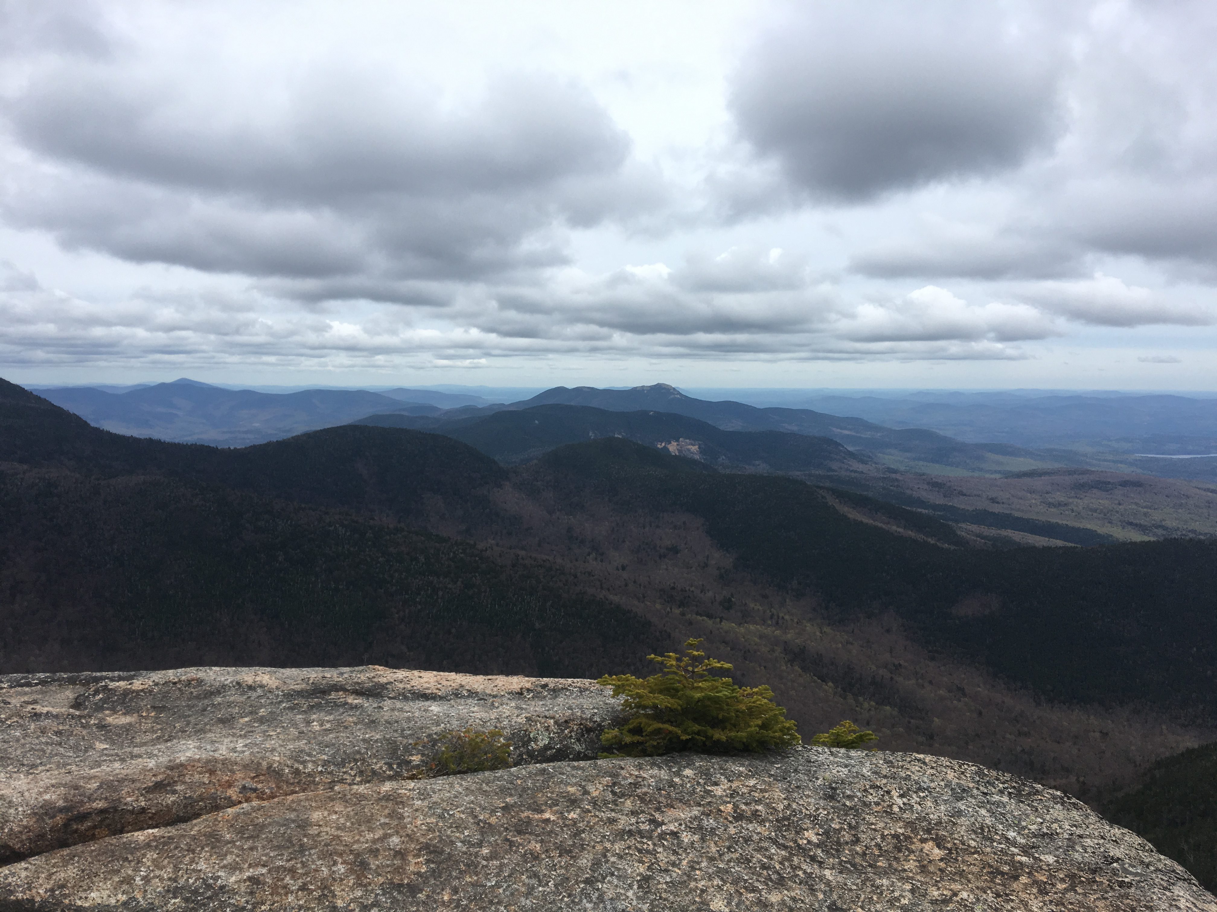
View of Mount Chocorua from Whiteface

View of Lake Winnipesaukee from Whiteface
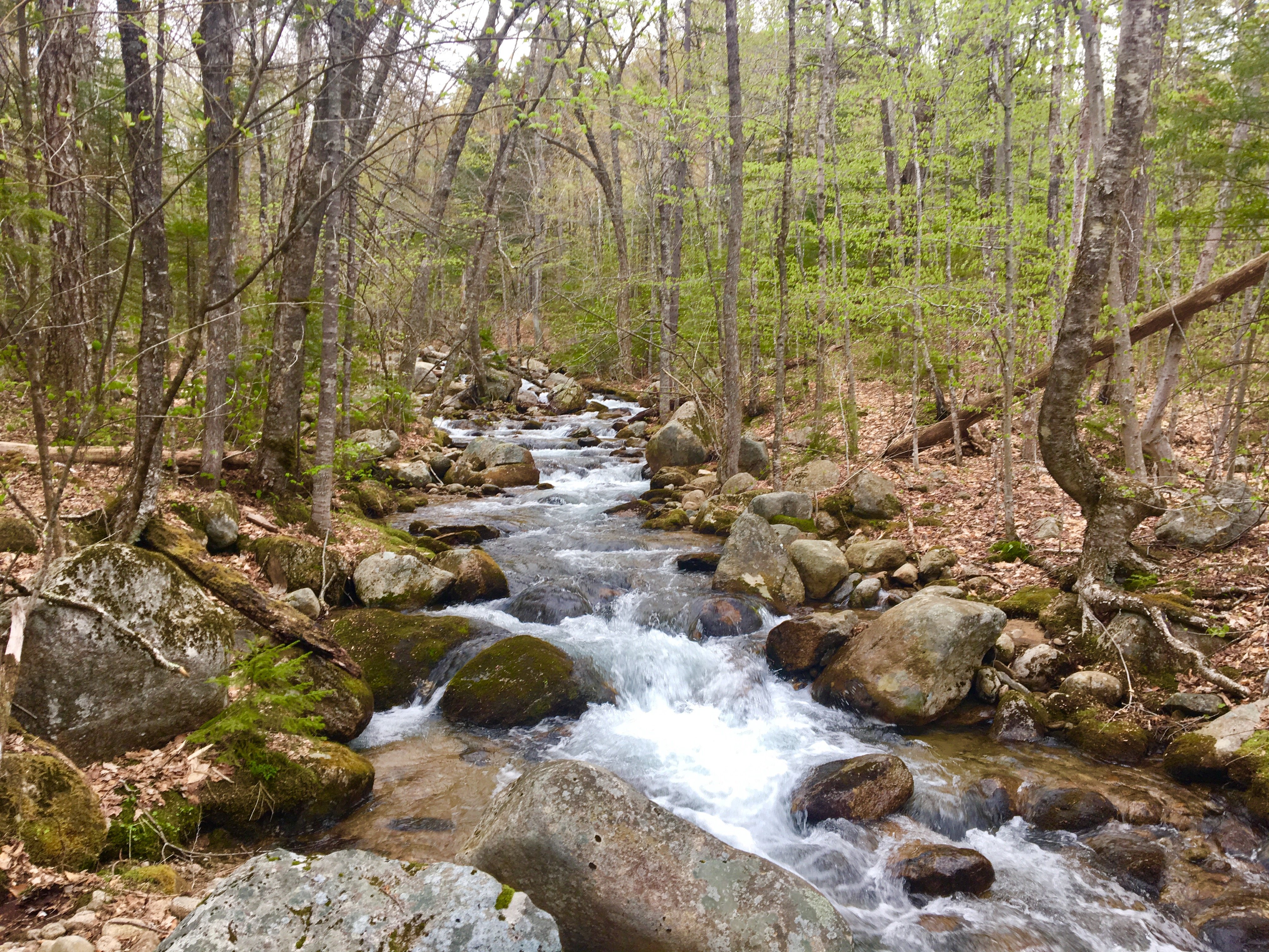
Wonalancet River
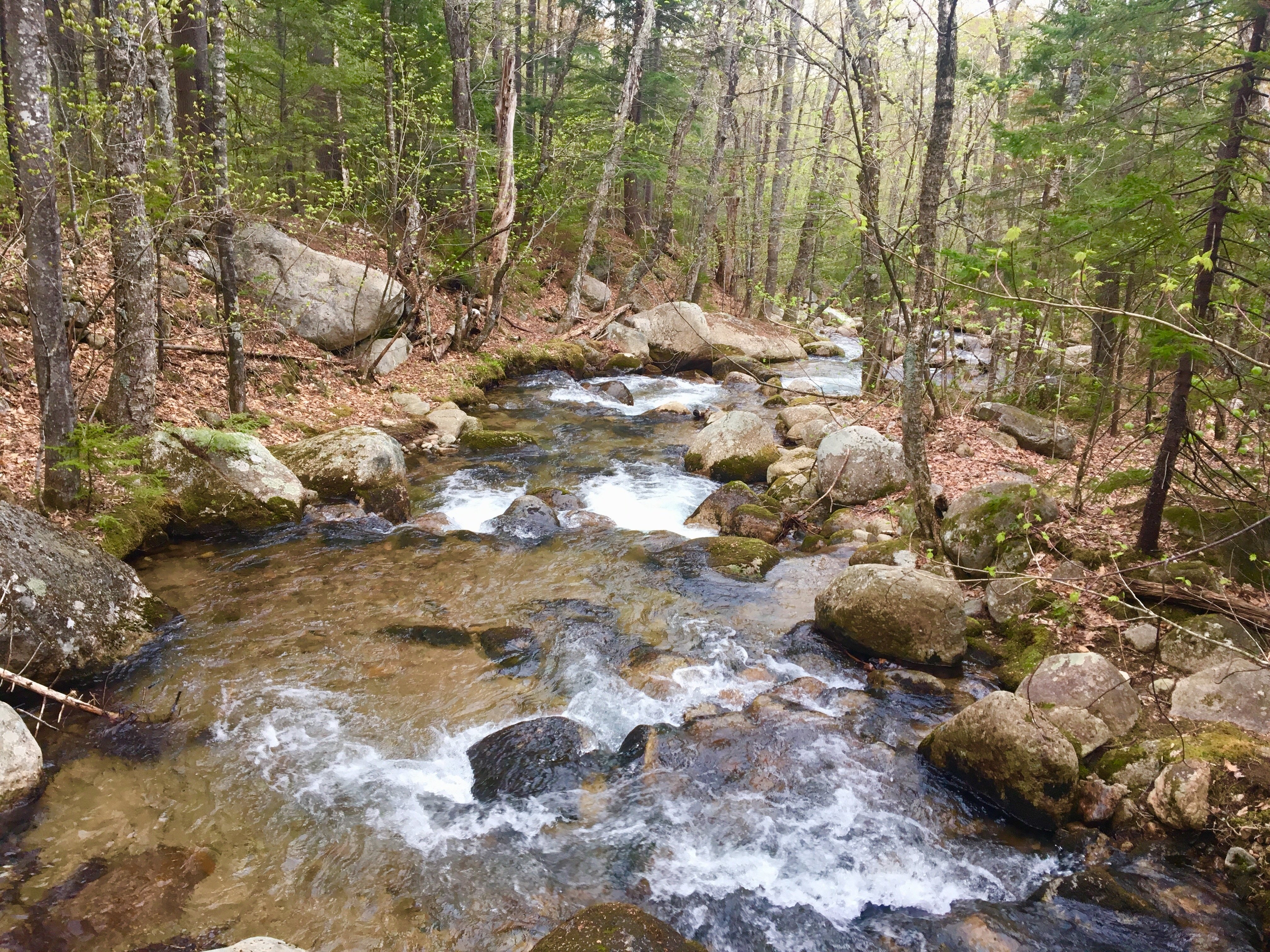
Wonalancet River
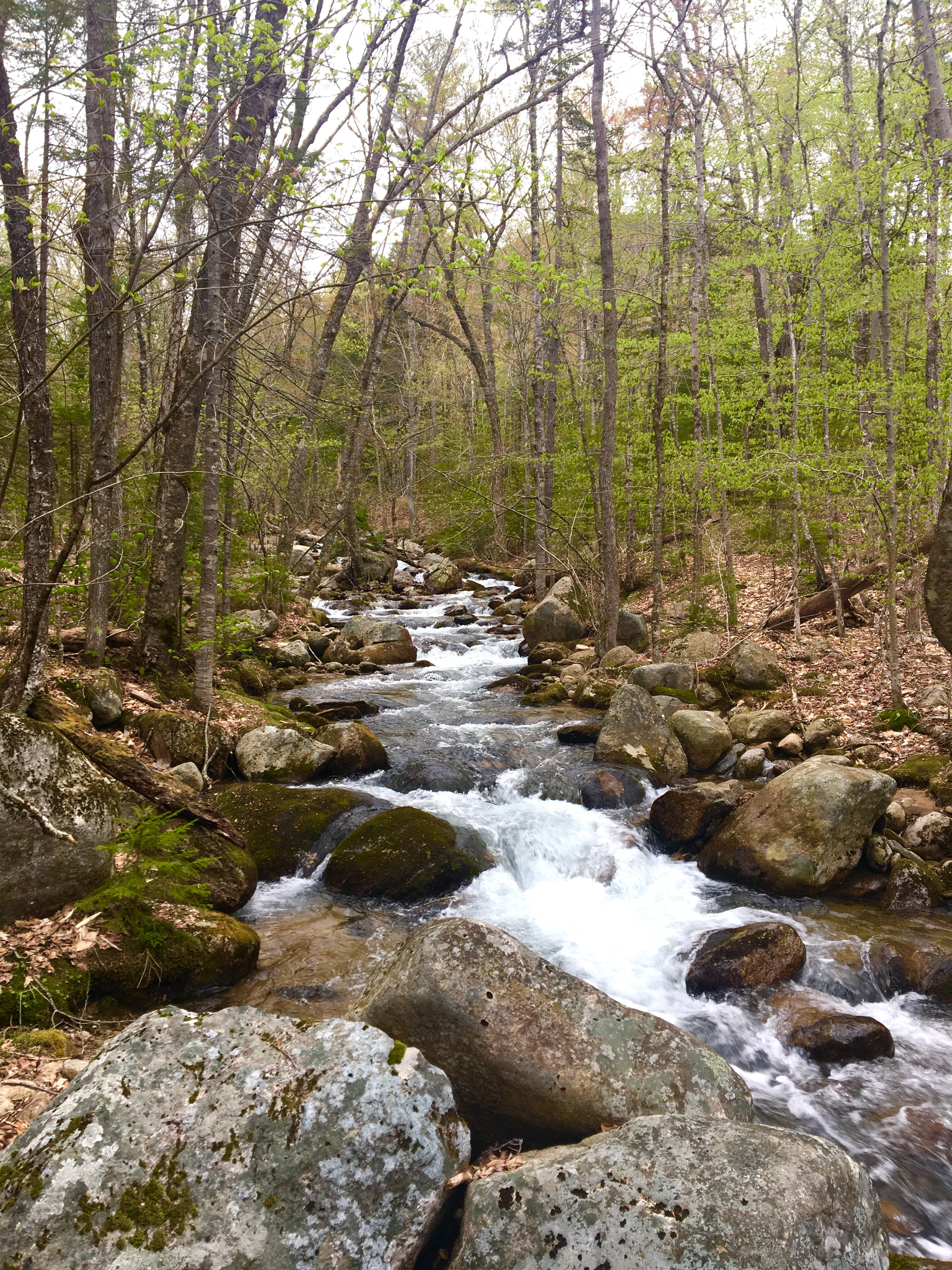
Wonalancet River
If you enjoyed this post, you might also enjoy reading about Hiking Mount Liberty via the Liberty Springs Trail

Max DesMarais is the founder of hikingandfishing.com. He has a passion for the outdoors and making outdoor education and adventure more accessible. Max is a published author for various outdoor adventure, travel, and marketing websites. He is an experienced hiker, backpacker, fly fisherman, backcountry skier, trail runner, and spends his free time in the outdoors. These adventures allow him to test gear, learn new skills, and experience new places so that he can educate others. Max grew up hiking all around New Hampshire and New England. He became obsessed with the New Hampshire mountains, and the NH 48, where he guided hikes and trail runs in the White Mountains. Since moving out west, Max has continued climbed all of the Colorado 14ers, is always testing gear, learning skills, gaining experience, and building his endurance for outdoor sports. You can read more about his experience here: hikingandfishing/about