Quandary peak is one of the shorter Colorado 14er hikes. In 3.3 miles, hikers ascend 3,370 feet to the summit, making for a steep incline for the majority of the hike. This is one of the better beginner 14er hikes, and is also a great option for those looking to test 14ers in the winter. The well traveled, well marked, and class 1 trail all lead to incredible views. Here’s everything you need to know.
Difficulty – Intermediate
Distance – 6.6 miles round trip (10.62 km)
Height – 14,265 feet (4,347.97 m)
Elevation gain – 3,370 feet (1,027.2 m)
Duration – 5 to 7 hours (book time)
Hike Class: Class 1
Seasons – Year-round (caution and experience needed in winter)
Trailhead Location – Kite Lake – 12,030 feet (directions below)
Need To Know Information:
- Quandary Peak now requires parking reservations or a shuttle. You can read about this, and get permits here: https://www.parkquandary.com/
- The parking reservation system is currently not year round, but they do not have dates published, so simply check the parking reservation site to determine if they are required during the time you plan on hiking. Reservations can be made up to 14 days in advance.
Trail Map
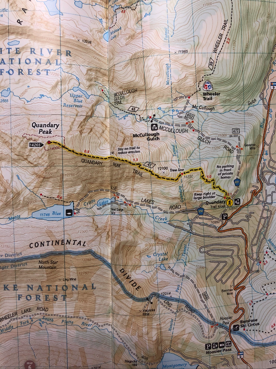
Quandary Peak Trail Map
Trails
Quandary Peak Trail | 6.6 Miles Roundtrip | 3,370 Feet Elevation Gain | Class 1
This is the most common route up Quandary Peak. It is one of the most common CO 14er trails due to close proximity to populations, and shorter mileage. Hikers will begin ascending steadily and quickly reach treeline 1.1 miles into the hike. The views from treeline until the summit are outstanding. This first 1.1 mile stretch is extremely well marked and traveled. The dirt path features steps and very easy walking.
For the next 1.3 miles, hikers continue to rise steadily and steeply. The trail remains high quality and easily traversable. It is the last mile where the ascent gets quite steep and remains until just shy of the summit. This part of the trail features a lot more rocks along the trail, making the terrain slightly more difficult as well.
Views from the summit are absolutely stunning. Hikers will retrace their steps back to the trailhead. The trail is easily recognizable when looking back where hikers began.
West Ridge Trail | 6 Miles Roundtrip | 2,650 Feet Elevation Gain | Class 3
The West Ridge is a less common route, and features much more difficult hiking. Hikers begin at the dam at the upper Blue Lake. The road is usually open in early June. When it is closed, hikers will have to park and hike up the road. Going along the right side of the dam, hikers will find the trail. This trail is only for hikers that are comfortable with class 3 hiking. We recommending checking out 14ers.com for this route.
Cristo Couloir | 4 Miles Roundtrip | 2,650 Feet Elevation Gain | Class 2
This route begins the same as the West Ridge trail and is also less traveled. This is a spring skiing route. Hikers can often ascend up a snowfield. This is more of a climbing/skiing route. We recommend checking out 14ers.com for this route.
Hiking in Winter
Quandary Peak is a fantastic winter hike option. The Class 1 trail is well traveled and well marked. Depending on snow conditions, microspikes or snowshoes will suffice. The avalanche risk on quandary is still moderate. Hikers should avoid during high avalanche risk times. Be sure to check conditions beforehand.
Camping Information
Quandary does not have campsites at the trailhead. Hikers can find campgrounds in nearby towns. Since this is a quick hike, local campgrounds within a half hour work just fine. There are also dispersed sites past the trailhead further up McCullough Gulch road.
Directions & Parking
This parking area is open year round. Keep in mind, this is a busy hike, so spots and spots along the road fill up very fast. Leave very early, or go on weekdays to avoid the largest crowds.
Current Weather Conditions
Here is a detailed forecast for the next 4 days:
Blue River, CO
Tonight
Mostly clear, with a low around 24. West southwest wind 12 to 16 mph, with gusts as high as 25 mph.
Thursday
Snow showers and a slight chance of thunderstorms after noon. Partly sunny. High near 35, with temperatures falling to around 25 in the afternoon. West southwest wind 9 to 14 mph, with gusts as high as 25 mph. Chance of precipitation is 80%. New snow accumulation of less than one inch possible.
Thursday Night
Snow showers likely and a slight chance of thunderstorms. Cloudy. Low around 19, with temperatures rising to around 22 overnight. West northwest wind 16 to 35 mph, with gusts as high as 52 mph. Chance of precipitation is 70%. New snow accumulation of 2 to 4 inches possible.
Friday
A chance of snow showers before noon, then snow showers and a slight chance of thunderstorms. Cloudy, with a high near 29. West northwest wind 14 to 33 mph, with gusts as high as 51 mph. Chance of precipitation is 90%. New snow accumulation of 1 to 2 inches possible.
Friday Night
Snow showers and a chance of thunderstorms. Cloudy, with a low around 18. Southwest wind 10 to 14 mph, with gusts as high as 22 mph. Chance of precipitation is 90%. New snow accumulation of 3 to 5 inches possible.
Saturday
Snow showers before 9am, then snow showers and a chance of thunderstorms. Cloudy, with a high near 23. Chance of precipitation is 100%. New snow accumulation of 7 to 11 inches possible.
Saturday Night
Snow showers and a slight chance of thunderstorms. Cloudy, with a low around 19. Chance of precipitation is 90%. New snow accumulation of 3 to 5 inches possible.
Additional Pictures
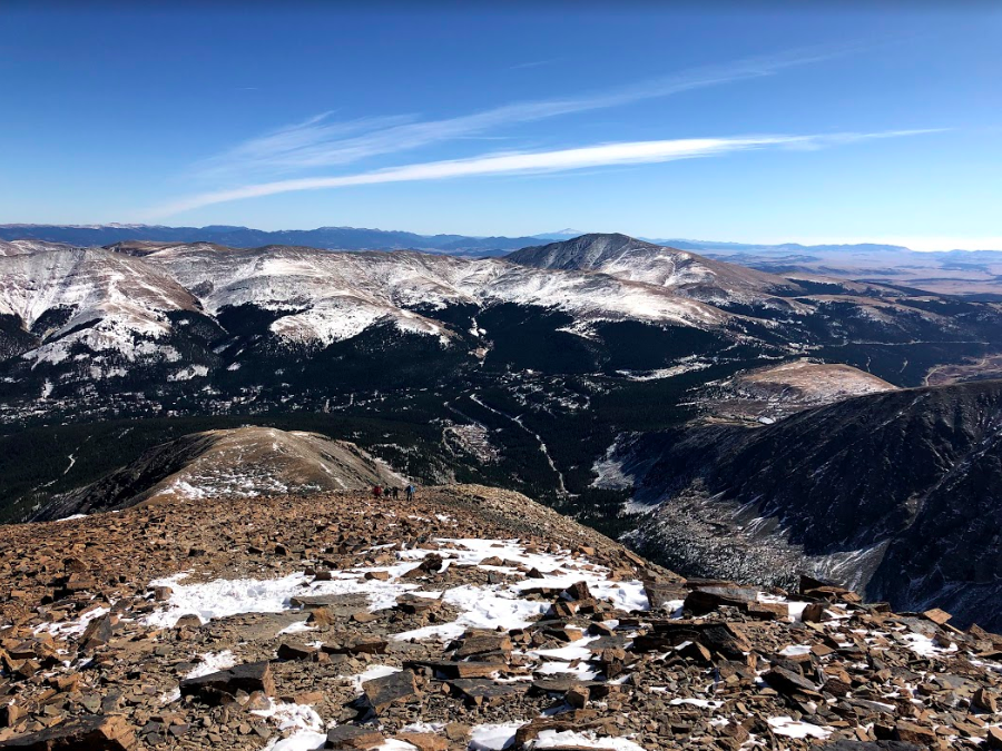
Looking Back along Quandary Peak Trail
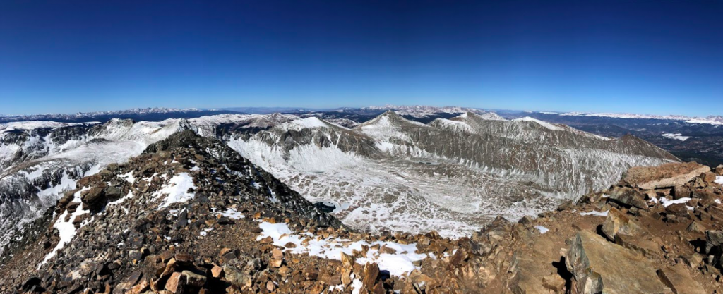
Quandary Peak Summit Pano Views
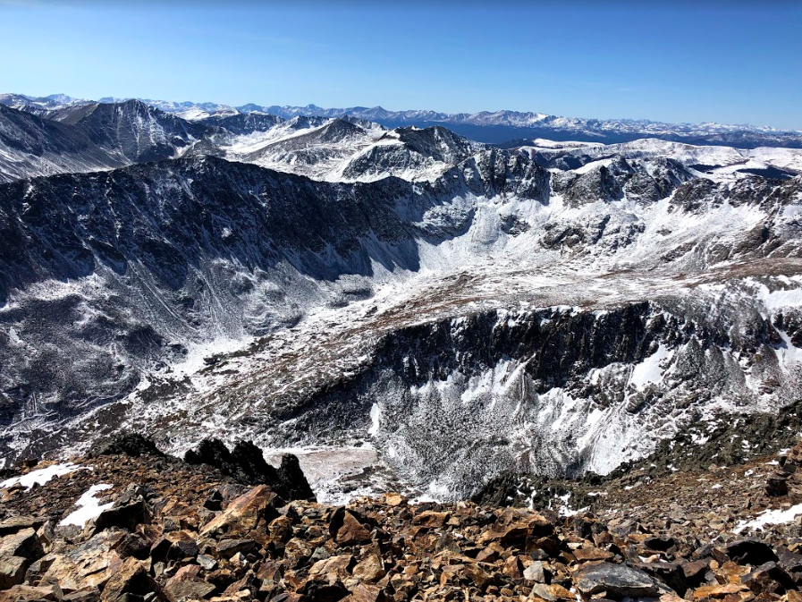
Quandary Peak Summit Views
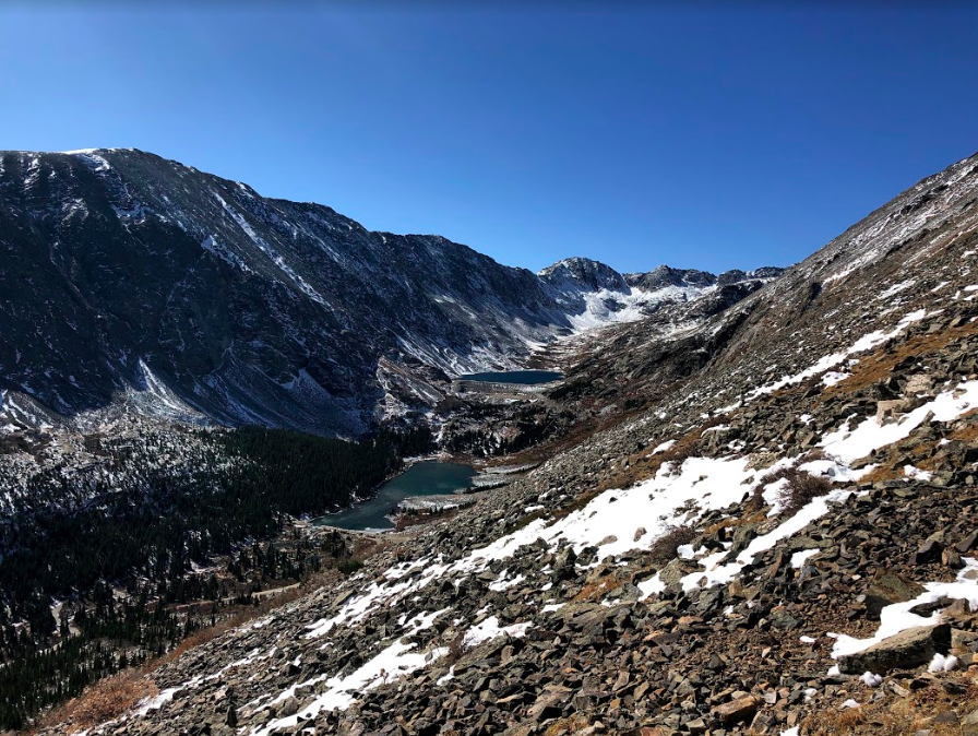
Views shortly after breaking treeline on Quandary Peak Trail

Max DesMarais is the founder of hikingandfishing.com. He has a passion for the outdoors and making outdoor education and adventure more accessible. Max is a published author for various outdoor adventure, travel, and marketing websites. He is an experienced hiker, backpacker, fly fisherman, backcountry skier, trail runner, and spends his free time in the outdoors. These adventures allow him to test gear, learn new skills, and experience new places so that he can educate others. Max grew up hiking all around New Hampshire and New England. He became obsessed with the New Hampshire mountains, and the NH 48, where he guided hikes and trail runs in the White Mountains. Since moving out west, Max has continued climbed all of the Colorado 14ers, is always testing gear, learning skills, gaining experience, and building his endurance for outdoor sports. You can read more about his experience here: hikingandfishing/about