Mount Lafayette is the tallest mountain of Franconia Ridge at 5,249 feet. It features some of the best views in the entire state, multiple trails, an AMC hut, and gorgeous waterfalls. With easy access right of I-93, Lafayette also happens to be one of the most popular hikes in the state, but you can avoid the crowds if you can handle cold weather, visit during the weekdays, or get to an early start.
As the tallest mountain in the Franconia Range, it is often hiked with the entire, or a piece of Franconia Ridge. It is frequently summited with Mount Lincoln.
Your Quick Navigation:
Trail Maps | Trail Descriptions | Directions & Parking | Current Weather | Hiking in Winter
Height: 5,249 feet (1,600 m)
Length: 8.5 miles (13.68 km)
Duration: 3-6 hours
Difficulty: Strenuous
Elevation Gain: 3,600 feet (1,097 m)
Trail Map
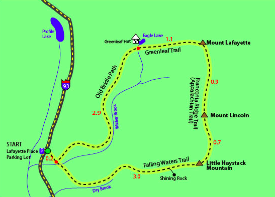
Map Courtesy of 4000footers.com
Trails
Old Bridle Path – 8.5 miles round trip – 3,600 feet elevation gain
The old Bridle Path is a 2.9 mile trail that quickly ascends up to Greenleaf Hut. It connects with the Greenleaf Trail 1.1 miles from the summit of Lafayette. It is about .2 miles from tree line, but you get exposed along a ridge that gives fantastic views to the summit of Lafayette.
Falling Waters Trail – 9.6 miles round trip – 3,800 feet elevation gain
The Falling Waters Trail is a common trail for those hiking just Mount Lincoln, or doing a loop hike. This trail features stunning waterfalls (hence the name) that hikers can take a quick dip in. Beware that the falls get very busy in summer months.
The highlighted route above shows a very common loop that includes Little Haystack Mountain and Mount Lincoln. This will add mileage to your hike, but a unique perspective of Franconia Ridge.
The Falling Waters Trail gets quite steep around 1.5 miles into the hike. The terrain gets quite rocky, making for a more difficult footing than most trails. Many choose to ascend this side if they have trouble descending on boulder type sections.
Old Bridle Path and Falling Waters Trail Loop – 8.9 miles – 3,900 feet elevation gain
This is a loop option to combine both of the most popular routes up to Franconia Ridge. This will allow hikers to experience both 4,000 foot summits, the waterfalls along the falling waters trail, and the Greenleaf AMC hut.
Looking for more? Check out our complete guide on each of the mountains on the ridge, or our full guide to Franconia Ridge: Mount Lincoln, Mount Liberty, Mount Flume
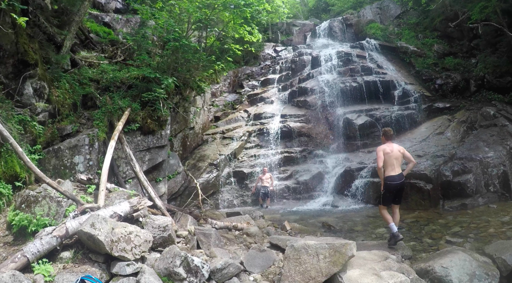
Waterfall on the Falling Waters Trail
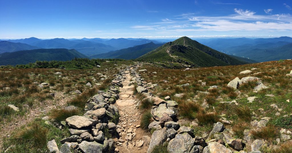
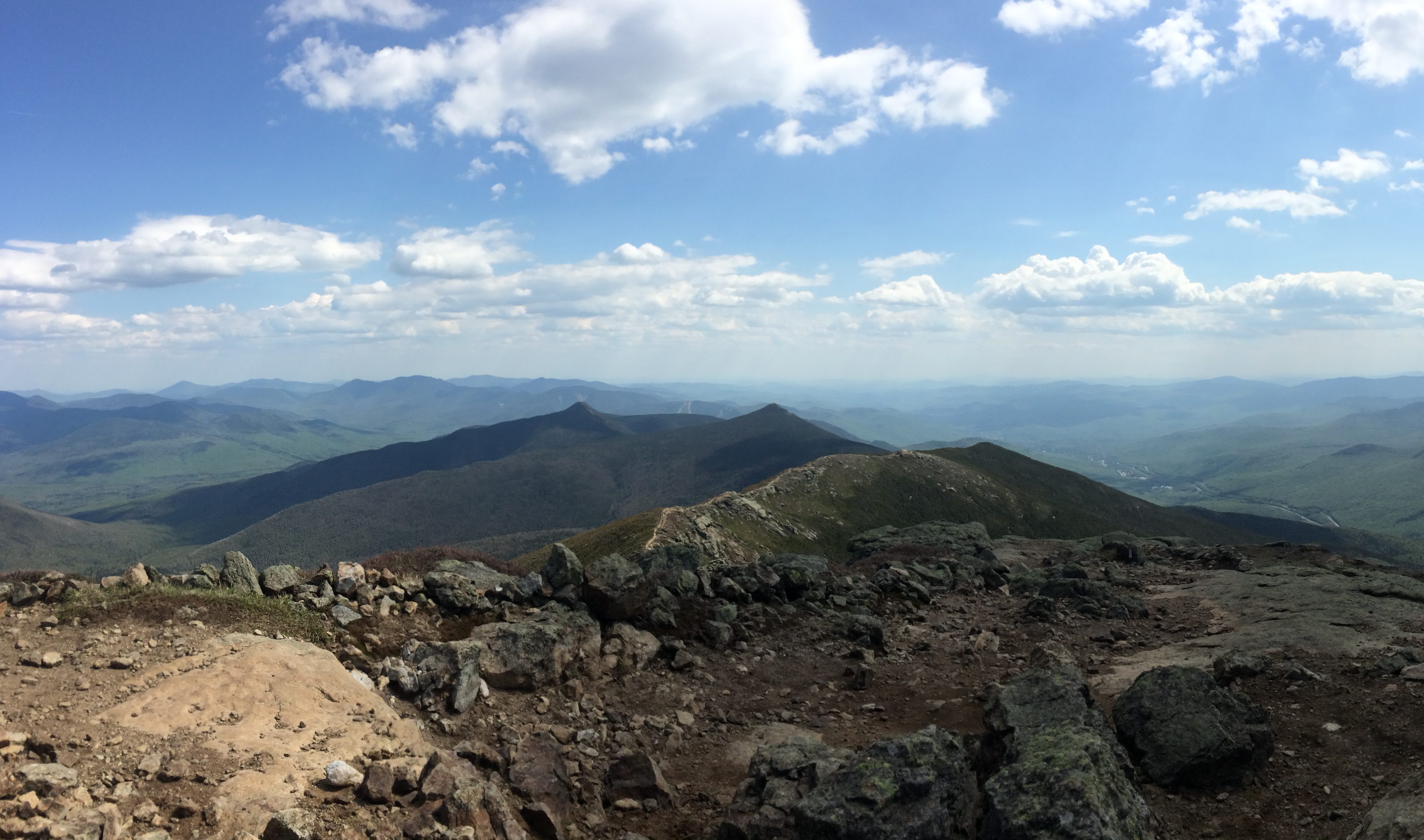
Views of Franconia Ridge
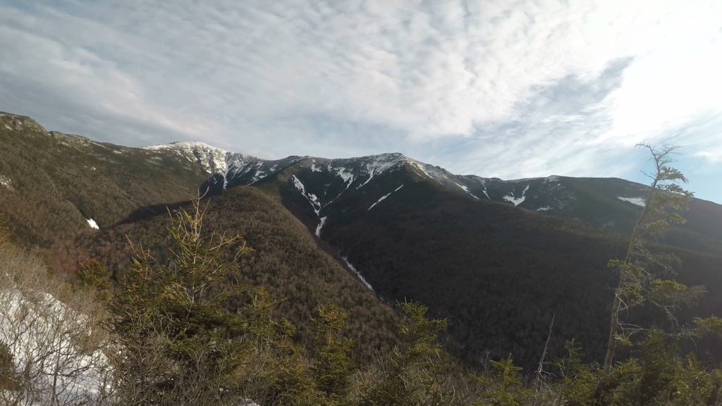
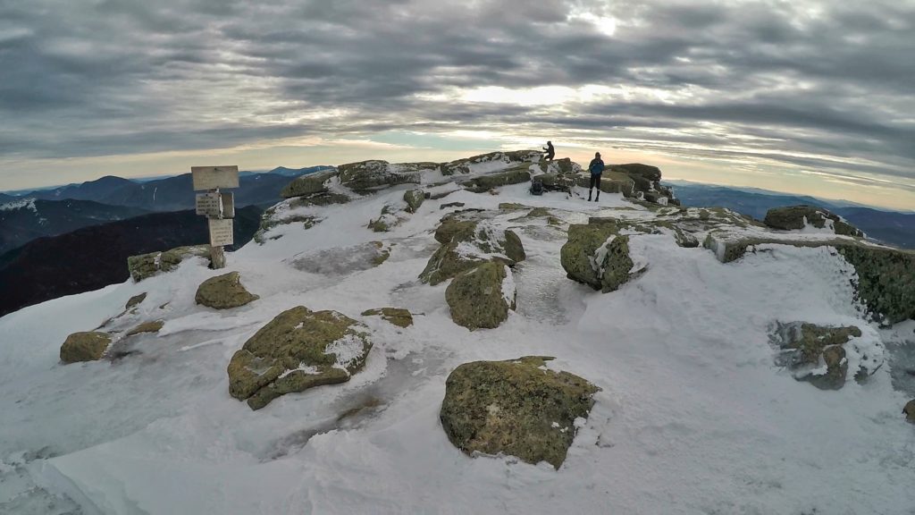
Winter Hiking Mount Lafayette
Winter hiking Mount Lafayette often requires microspikes or crampons. Many stretches of the ascent feature steep and icy sections that are dangerous without the proper traction. Hikers quickly ascend above treeline, making it essential to have the proper winter hiking gear and clothing. With this being said, Mount Lafayette is a stunning hike in all 4 seasons. Because this is well traveled, hikers can often get away without snowshoes, however after snowfall, or during warmer times when the snowpack is melting, it is recommended to bring snowshoes.
The parking lot is plowed in all seasons, and is still frequently hiked in the winter.
Solo hiking in the whites can be dangerous, especially in the winter. For the most part, there isn’t much danger, but the key is to be prepared for some nasty weather, and to make sure you could safely stay on the mountain a lot longer than your intentions may be. Most of the people getting in trouble in NH, simply underestimate the severity of potential weather, and don’t take the proper precautions to be safe.
Directions and Parking
There is a lot of parking space on both sides of I-93 at Lafayette Place Parking area and Lafayette campground. Arrive early as this is the most busy section of the White Mountains. People used to overflow park on I-93 when it was not legal. Now, overflow parking, and a shuttle to the trailhead is located at Cannon Mountain just a couple miles down the road.
Trail Conditions
All trails to the summit are well traveled. Summer conditions are almost always fine. Winter can experience significant ice and snow buildup.
Weather Forecast
Lincoln, NH
This Afternoon
Mostly cloudy, with a high near 41. South wind 15 to 20 mph, with gusts as high as 35 mph.
Tonight
A chance of rain showers between 10pm and 2am, then a chance of rain. Cloudy, with a low around 34. Southwest wind 20 to 30 mph, with gusts as high as 45 mph. Chance of precipitation is 50%. New rainfall amounts less than a tenth of an inch possible.
Saturday
A chance of rain before 8am, then a slight chance of rain showers between 1pm and 2pm, then a chance of rain and snow showers. Mostly cloudy, with a high near 39. West wind 15 to 20 mph, with gusts as high as 40 mph. Chance of precipitation is 40%. New rainfall amounts between a tenth and quarter of an inch possible.
Saturday Night
A chance of rain and snow showers before 7pm. Partly cloudy, with a low around 27. West wind 20 to 25 mph, with gusts as high as 45 mph. Chance of precipitation is 30%.
Sunday
Mostly sunny, with a high near 38. West wind 25 to 35 mph, with gusts as high as 55 mph.
Sunday Night
Partly cloudy, with a low around 25.
Monday
Sunny, with a high near 32.

Max DesMarais is the founder of hikingandfishing.com. He has a passion for the outdoors and making outdoor education and adventure more accessible. Max is a published author for various outdoor adventure, travel, and marketing websites. He is an experienced hiker, backpacker, fly fisherman, backcountry skier, trail runner, and spends his free time in the outdoors. These adventures allow him to test gear, learn new skills, and experience new places so that he can educate others. Max grew up hiking all around New Hampshire and New England. He became obsessed with the New Hampshire mountains, and the NH 48, where he guided hikes and trail runs in the White Mountains. Since moving out west, Max has continued climbed all of the Colorado 14ers, is always testing gear, learning skills, gaining experience, and building his endurance for outdoor sports. You can read more about his experience here: hikingandfishing/about