Huron Peak is a 14,003 foot mountain in the Sawatch Rang of Colorado. Below we will cover each of the trail options, information about camping, roads, trail maps and more to help you get hiking.
Distance –10.4 miles round trip (16.7 km)
Height – 14,003 feet (4,268.1 m)
Elevation gain – 3,950 feet (1,203.96 m)
Duration – 6 to 8 hours (book time)
Difficulty – Strenuous
Class: Class 2 Hike
Seasons – Year-round (caution and experience needed in winter – see below)
Trailhead Location – Huron Peak Trailhead – 10,260 feet (directions below)
Trails
North Huron Trail (2WD Vehicle): 10.4 Miles Round Trip | 3,950 Feet Elevation Gain | Class 2
This is the most common route up Mount Huron. It features stunning views early on, is well maintained, well traveled, and features many switchbacks that ease the difficulty of this hike overall.
Beginning at the 2WD trailhead hikers will have an easy 1.9 mile trek with slight incline towards the 4WD trailhead. Hikers stay to the right on this road at the junction marking where hikers and drivers should continue to Huron Peak.
Once reaching the second trailhead, hikers bear left towards Huron Peak (a sign marks the way). The first .3 miles is relatively flat, then hikers begin ascending through the forest via switchbacks. 1.3 miles later, hikers will break treeline. Here the views towards the west of Virginia Peak, and other thirteeners are stunning.
The trail grade lightens for the next half mile until after hikers cross a basin where the summit is in sight. The last mile of the hike features substantial elevation gain rising 1,423 feet in 1 mile to the summit. Hikers then retrace their steps back to the trailhead.
North Huron Trail (4WD Vehicle): 6.6 Miles Round Trip | 3,610 Feet Elevation Gain | Class 2
This route is the same as above, but hikers can choose to drive to the 4WD trailhead, cutting out 1.9 miles each way, and 340 feet of elevation gain.
Road Conditions: This road’s hardest sections are at the beginning, though it has several difficult areas throughout the 2 miles. A 4WD vehicle with good clearance will be able to handle this. 2WD vehicles, or even some 4WD vehicles with low clearance should likely park at the 2WD trailhead to avoid any vehicle damage, or getting stuck.
North Ridge From Lulu Gulch: 8.4 Miles Round Trip | 3,980 Feet Elevation Gain | Class 2
This trail option is slightly longer than the 2WD trailhead option, but is considered a bit more scenic as you have more ridgeline walking, and better views of Huron’s east face.
This is a great loop option to combine with the standard route.
We recommend checking out the info on this route on 14ers.com here: https://www.14ers.com/route.php?route=huro4&peak=Huron+Peak
Trail Map
The below map shows the standard route, mileage markers, elevation gain, and surrounding trails and peaks.
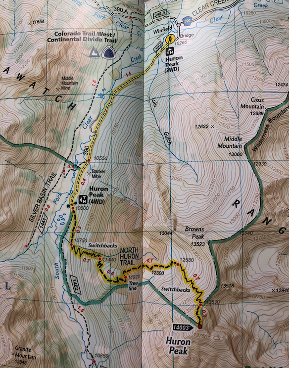
Huron Peak Trail Map
Hiking Huron Peak in Winter
Either route can be accomplished in winter. Of course, the right gear and preparation is needed to summit Huron in winter.
The road to the trailhead is plowed during winter, but can easily be impossible to travel for certain vehicles at certain times. We recommend checking road conditions before making the trip.
Both routes also cross avalanche prone areas for small portions of the hike. It is therefore necessary to check trip reports, avalanche conditions, and most importantly, the conditions while you are at the scene to make a determination whether to continue on or not. Some information on current conditions can be found here: https://avalanche.state.co.us/
Camping At Near Huron Peak
Huron Peak features nearly endless camping areas. There are dispersed campsites along along 390 heading towards the trailhead, and many sites right at the 2WD trailhead as well as the 4WD trailhead. Hikers will have no shortage of options. This is a highly trafficked camping area, so we recommend arriving early to claim your spot.
Some of the most beautiful spots are located near the 4WD trailhead in the meadows where clear creek runs through and the views.
Many of the sites are located near Clear Creek where you can easily filter water.
Current weather conditions:
Here is the detailed weather forecast for the next few days. We highly recommend you check out the mountain forecast for this region the morning of your hike.
Twin Lakes, CO
Tonight
Blowing snow and a chance of snow showers and a slight chance of thunderstorms. Mostly cloudy, with a low around 4. Wind chill values as low as -17. West wind 20 to 40 mph, with gusts as high as 55 mph. Chance of precipitation is 40%. New snow accumulation of less than half an inch possible.
Wednesday
Partly sunny, with a high near 23. Wind chill values as low as -17. West northwest wind 15 to 25 mph.
Wednesday Night
Mostly cloudy, with a low around 12. Wind chill values as low as 0. North northwest wind 5 to 15 mph.
Thursday
A slight chance of snow showers before noon, then a chance of snow showers and a chance of thunderstorms. Mostly cloudy, with a high near 27. East southeast wind 5 to 15 mph. Chance of precipitation is 40%. New snow accumulation of around one inch possible.
Thursday Night
A chance of snow showers and a chance of thunderstorms. Mostly cloudy, with a low around 18. Southeast wind 10 to 15 mph. Chance of precipitation is 40%. New snow accumulation of 1 to 2 inches possible.
Friday
A slight chance of snow showers before noon, then a chance of snow showers and a chance of thunderstorms. Mostly cloudy, with a high near 32. South southwest wind around 10 mph. Chance of precipitation is 50%. New snow accumulation of around one inch possible.
Friday Night
A chance of snow showers and a slight chance of thunderstorms before midnight. Mostly cloudy, with a low around 19. West wind around 10 mph. Chance of precipitation is 30%. New snow accumulation of less than half an inch possible.
Directions & Parking
Directions to Huron Peak Trailhead (Clear Creek Trailhead)
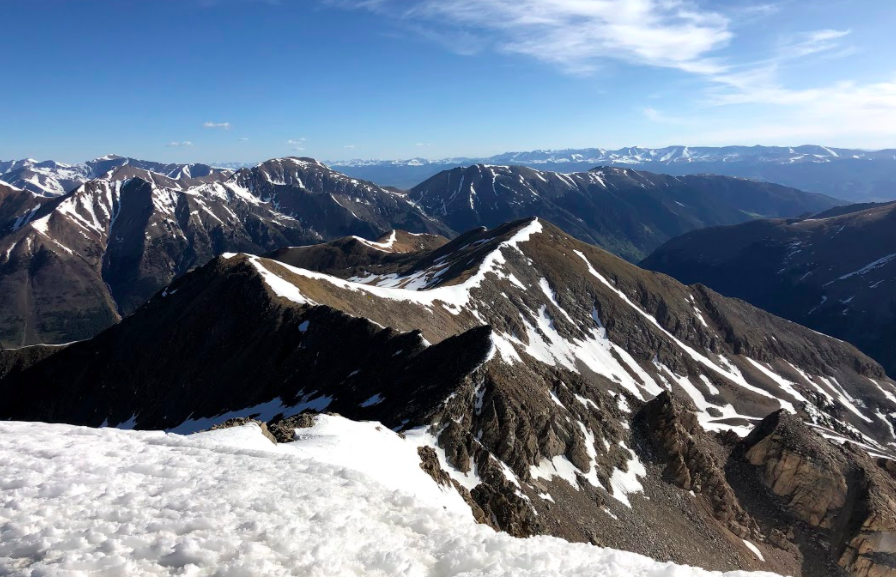
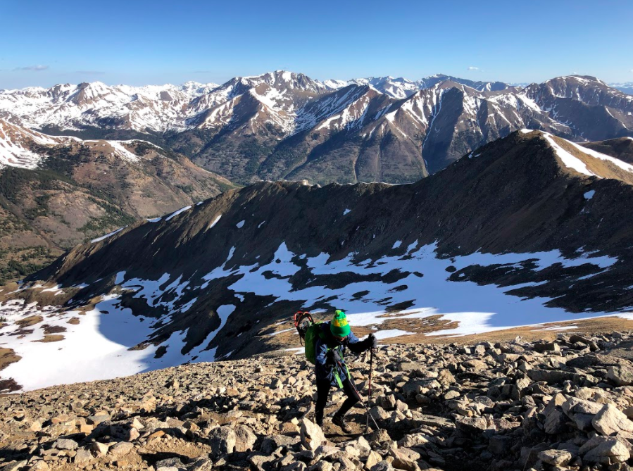
Additional Pictures
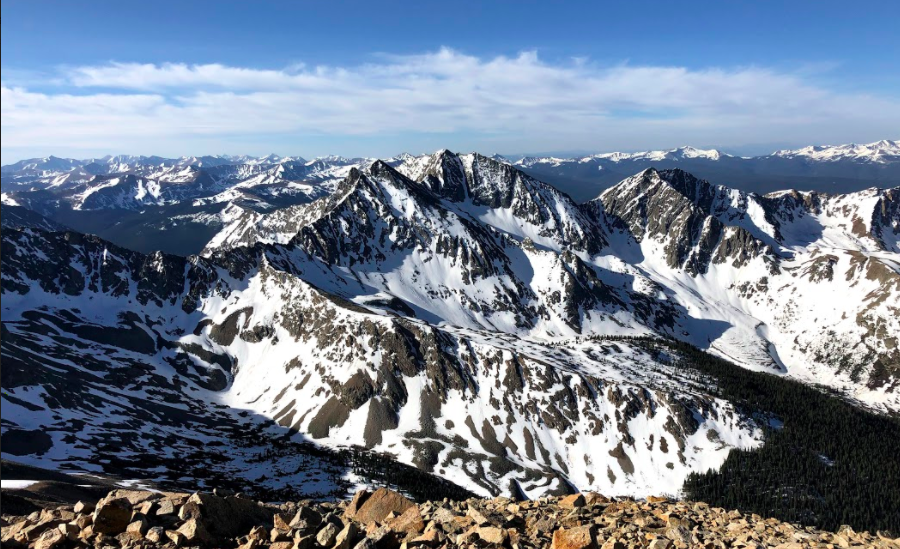
Huron Peak Views
Huron Peak Views of Browns Peak
Views Near Summit of Huron Peak
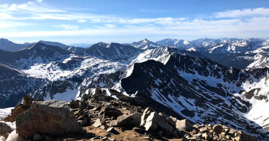
Huron Peak Summit Views
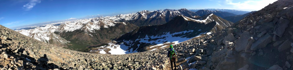
Huron Panorama

Max DesMarais is the founder of hikingandfishing.com. He has a passion for the outdoors and making outdoor education and adventure more accessible. Max is a published author for various outdoor adventure, travel, and marketing websites. He is an experienced hiker, backpacker, fly fisherman, backcountry skier, trail runner, and spends his free time in the outdoors. These adventures allow him to test gear, learn new skills, and experience new places so that he can educate others. Max grew up hiking all around New Hampshire and New England. He became obsessed with the New Hampshire mountains, and the NH 48, where he guided hikes and trail runs in the White Mountains. Since moving out west, Max has continued climbed all of the Colorado 14ers, is always testing gear, learning skills, gaining experience, and building his endurance for outdoor sports. You can read more about his experience here: hikingandfishing/about