The Queen’s Garden Trail is one of the highest trafficked trails in Bryce Canyon National Park for a good reason. It features incredibly unique rock formations and views that will leave you wondering how this place could have possibly been formed. Here, we will give you all the information you need to hike this trail.
Distance: 4.49 Miles Round Trip (7.23 km)
Elevation Gain: 1,378 feet (430.0 meters)
Difficulty: Intermediate
Duration (Hike Time): 3-4 hours
Trail Options
There are three common options for completing the Queen’s Garden trail. An out and back, and two loop trail options. We recommend doing the Queen’s Garden and the entire Navajo Loop trail in one hike, but have highlighted all options below.
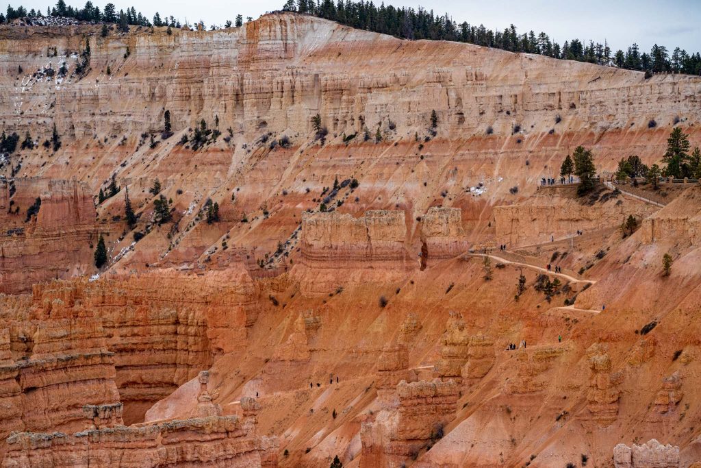
The trails on each loop are well traveled, well maintained, and well marked, are easy to follow, and have extremely beautiful views. The hardest parts of the hike are the beginning and end when hikers take switchbacks to drop into the canyon, or to rise back up to the trailheads.
Queen’s Garden Trail Out & Back – From Sunrise Point Parking Lot – 4.00 Miles – 1,095 Feet Elevation Gain
Hikers can choose to hike the Queen’s Garden Trail out and back, but we recommend that you combine this into a loop with the Navajo Loop Trail to experience the best of Bryce Canyon. This out and back is simple, easy to follow, has a lot of other people on it, but contains fantastic views.
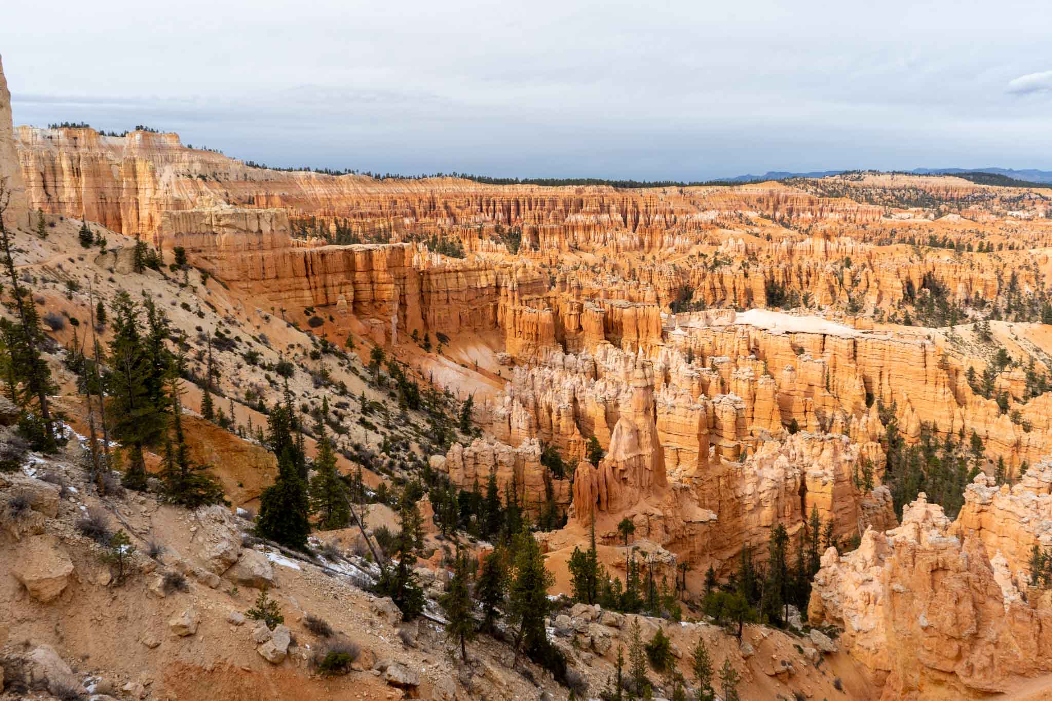
The Queen’s Garden Trail is filled with stunning rock formation, tunnels for hikers, switchbacks, red rocks, white rocks, and just incredible views in general. (See Pictures Below)
Queen’s Garden Trail & Navajo Loop Trail With Wall Street – 4.49 Miles – 1,378 Feet Elevation Gain
When open, we highly suggest that hikers go do the entire Navajo Loop when also hiking the Queen’s Garden. The order you choose to complete these is totally up to you, and doesn’t change the difficulty or experience of your trip. We just recommend doing it all! Wall Street often closes in winter months, so take advantage of seeing it if it is open.
The Wall Street Section of this hike features slot canyon like walking with gorgeous rock walls that tower over you in a very narrow section.
Hikers will also find a lot of beauty at the two bridges section (on map) and the switchbacks heading back up the Navajo Loop Trail.
Queen’s Garden Trail & Navajo Loop Trail Without Wall Street – 3.1 Miles – 882 Feet Elevation Gain
This route would simply be one part of the Navajo Loop Trail, without Wall Street, and the entire Queen’s Garden Trail. We only recommend this route if the Wall Street section of the Navajo Loop is closed.
Other Trail Options
Hikers can choose to start from any location in Bryce Canyon National park and access just about ever piece of the park. We simply have highlighted the most common routes for this hike. Feel free to make your own path if needed.
Trail Map
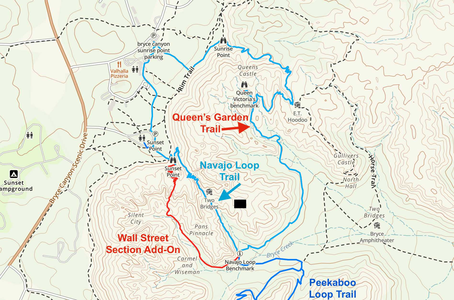
Queen’s Garden & Navajo Loop Trail Map
Weather Forecast
Here is a detailed weather forecast for the next 4 days:
Tropic, UT
Tonight
Mostly cloudy. Low around 40, with temperatures rising to around 42 overnight. South wind 25 to 32 mph.
Sunday
Patchy blowing dust before 9am, then patchy blowing dust and a slight chance of rain and snow showers between 9am and noon, then patchy blowing dust and a chance of rain and snow showers. Mostly sunny. High near 50, with temperatures falling to around 44 in the afternoon. South southwest wind around 37 mph, with gusts as high as 53 mph. Chance of precipitation is 40%.
Sunday Night
Partly cloudy, with a low around 21. Wind chill values as low as 8. West northwest wind 17 to 30 mph.
Monday
Sunny, with a high near 53. West northwest wind 16 to 25 mph.
Monday Night
Mostly clear, with a low around 29. West wind 17 to 25 mph, with gusts as high as 36 mph.
Tuesday
Sunny, with a high near 54.
Tuesday Night
Clear, with a low around 23.
Parking, Directions & Shuttle System
All lots in this park are quite large, but they do fill up. During peak time, you’ll be utilizing the shuttle system. During off season, you likely can find a spot to park your car, but even the large lots can fill up.
Shuttle System:
The shuttle system can be read about here: https://www.nps.gov/brca/planyourvisit/shuttle.htm
Directions to Sunrise Point Parking Lot:
Directions to Sunset Point Parking Lot:
Additional Pictures
Queen’s Garden Trail Views
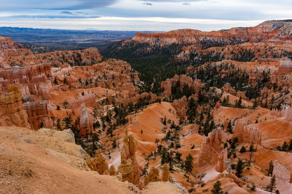
Sunrise Point Views Near Beginning of Queen’s Garden Trail
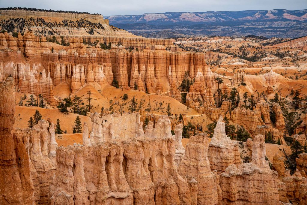
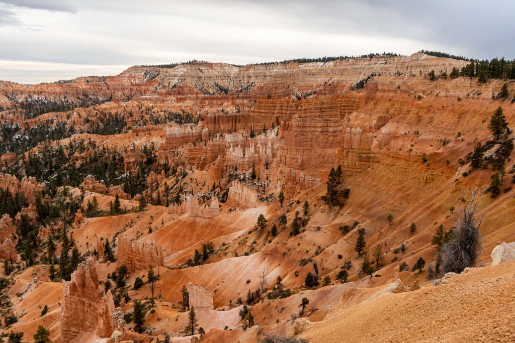
Views of the Queen’s Garden Trail
Views of Navajo Loop Trail From Queen’s Garden Trail
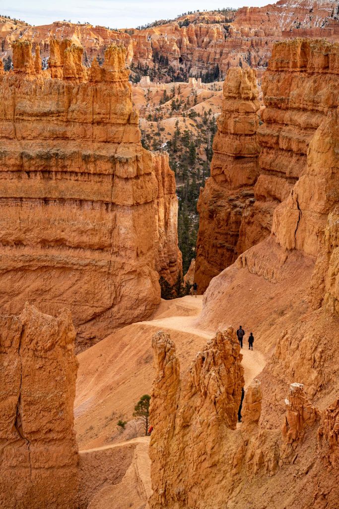
Navajo Loop Trail Views

Max DesMarais is the founder of hikingandfishing.com. He has a passion for the outdoors and making outdoor education and adventure more accessible. Max is a published author for various outdoor adventure, travel, and marketing websites. He is an experienced hiker, backpacker, fly fisherman, backcountry skier, trail runner, and spends his free time in the outdoors. These adventures allow him to test gear, learn new skills, and experience new places so that he can educate others. Max grew up hiking all around New Hampshire and New England. He became obsessed with the New Hampshire mountains, and the NH 48, where he guided hikes and trail runs in the White Mountains. Since moving out west, Max has continued climbed all of the Colorado 14ers, is always testing gear, learning skills, gaining experience, and building his endurance for outdoor sports. You can read more about his experience here: hikingandfishing/about
Cold, But Gorgeous
Winter meant very few people, and stunning views! Love the colors mixed with a bit of snow! Trails in perfect conditions.