San Luis Peak is known as one of the most remote 14ers in Colorado. It isn’t heavily trafficked, but it has two common and simple routes to the summit that feature incredible views. In this article, we will give you everything you need to know to hike San Luis Peak via either common trailhead option.
Distance – 10.96 miles round trip (17.64 km)
Height – 14,014 feet (4,271.47 m)
Elevation gain – 3,957 feet (1,206.1 meters)
Duration – 7 – 9 hours (book time dependant upon trailhead start)
Difficulty – Strenuous
Class: Class 1 Hike
Seasons – This hike can be completed in all seasons, but winter is especially difficult, and dangerous. Roads to trailheads close in winter.
Trailhead Location – West Willow Creek Trailhead (11,507 Feet) | Stewart Creek Trailhead (10,480)
Quick Navigation:
Routes | Trail Map | Camping Info | Weather | Directions | Pictures
Need To Know Information
-
- The final 1.73 miles of road to the West Willow Creek Trailhead is class 3 road that requires a 4wd vehicle.
- The dirt road leading to Stewart Creek trailhead features two river crossings with cement slabs that require decent vehicle clearance.
- Read about the rules and regulations for camping and pets in the La Garita Wilderness here.
- There is tons of available free dispersed camping on the road leading to either trailhead.
- The road to the Stewart Creek Trailhead is closed in winter, but hikers can drive to Equity Mine or in winter (sometimes) via the West Willow Creek Trailhead. Avalanche danger is a concern.
Hiking Route Options
Both routes to the summit are simple, class 1 routes where route finding difficulty, exposure, and rockfall dangers are all at a minimum when compared to most 14ers.
West Willow Creek Trailhead | 10.96 Miles Round Trip (17.64 km) – 3,957 Feet Elevation Gain (1,206.1 meters) | Class 1
Hikers without 4wd vehicles will need to park 1.7 miles from the trailhead, gain an 558, and descend 141 feet to reach the 4wd trailhead. The reason this isn’t the standard route is due to the fact that hikers need to drop about 700 feet of elevation that they have to regain on the way back, and the 4wd trailhead adds mileage and elevation gain to the overall hike. Directions are explained below.
Hikers begin hiking north out of the parking area towards a bulge that can be seen on the ridge to the northeast. The trail quickly makes a few small and easy stream crossings and begins heading up towards the ridge. The trail is well traveled and easy to follow. It stays to the left of the steep gully, and angles just to the right of a bulge / summit along the ridge. Your goal is to summit the ridge the the right of the rocky bulge.
Once reaching the saddle / ridge, search for the trail that drops off the north end of the ridge. The trail connects with the Continental Divide Trail just below this ridge. Turn right on the Continental Divide Trail. From here, you will see that you have to descend further, head into the valley, ascend a ridge between you and the final ridge to San Luis, descend, and ascend once again. While this seems brutal, the trail is well maintained, features gradual gains, and the miles go by relatively quickly. Simply follow the trail, and stay on the route that heads towards the summit. There are a couple false summits once on the final ridge.
Stewart Creek Trailhead | 12.8 Miles Round Trip (20.60 km) – 3,840 Feet Elevation Gain (1,179.4 meters) | Class 1
This is considered the standard route up San Luis Peak. The trail is well traveled and easy to follow from this trailhead as it follows along Stewart Creek. About 3 miles in, during certain months, the trail may be difficult to follow due to willows or tree falls, but hikers still should be able to remain on track. A little over 4 miles in, hikers reach treeline, where the trail switchbacks up to the ridge. Once hitting the ridge, the trail is easy to follow.
Trail Map
Stewart Creek Trailhead = Purple | West Willow Creek Trail = Red
San Luis Peak Trail Map
Camping For San Luis Peak
There is tons of dispersed and free camping along the road leading to the trailheads. Additionally, hikers often sleep in cars at the trailhead. There is also dispersed camping allowed on the hike. You can read about the rules and regulations for the La Garita Wilderness here.
Current Weather Conditions:
Here is the detailed weather forecast for the next few days. We highly recommend you check out the mountain forecast for this peak the morning of your hike.
Cathedral, CO
Tonight
Partly cloudy, with a low around 22. West southwest wind 20 to 30 mph.
Tuesday
Sunny, with a high near 39. West wind 25 to 30 mph.
Tuesday Night
Mostly clear, with a low around 24. West southwest wind 20 to 30 mph.
Wednesday
A slight chance of snow showers and a slight chance of thunderstorms after noon. Sunny, with a high near 38. West southwest wind 20 to 40 mph. Chance of precipitation is 20%.
Wednesday Night
A slight chance of snow showers and a slight chance of thunderstorms before 3am. Partly cloudy, with a low around 17. West southwest wind 15 to 40 mph. Chance of precipitation is 20%.
Thursday
A chance of snow showers. Sunny, with a high near 29. West wind 15 to 30 mph, with gusts as high as 40 mph. Chance of precipitation is 30%. New snow accumulation of less than half an inch possible.
Thursday Night
A slight chance of snow showers. Mostly clear, with a low around 16. West southwest wind 15 to 20 mph. Chance of precipitation is 20%.
Directions & Parking
4wd vehicles are recommended for both routes. 2wd vehicles can be used to get within 2 miles of the West Willow Creek Trailhead.
Directions to West Willow Creek Trailhead:
Directions To Stewart Creek Trailhead
Additional Pictures
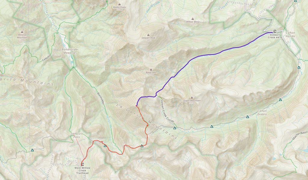
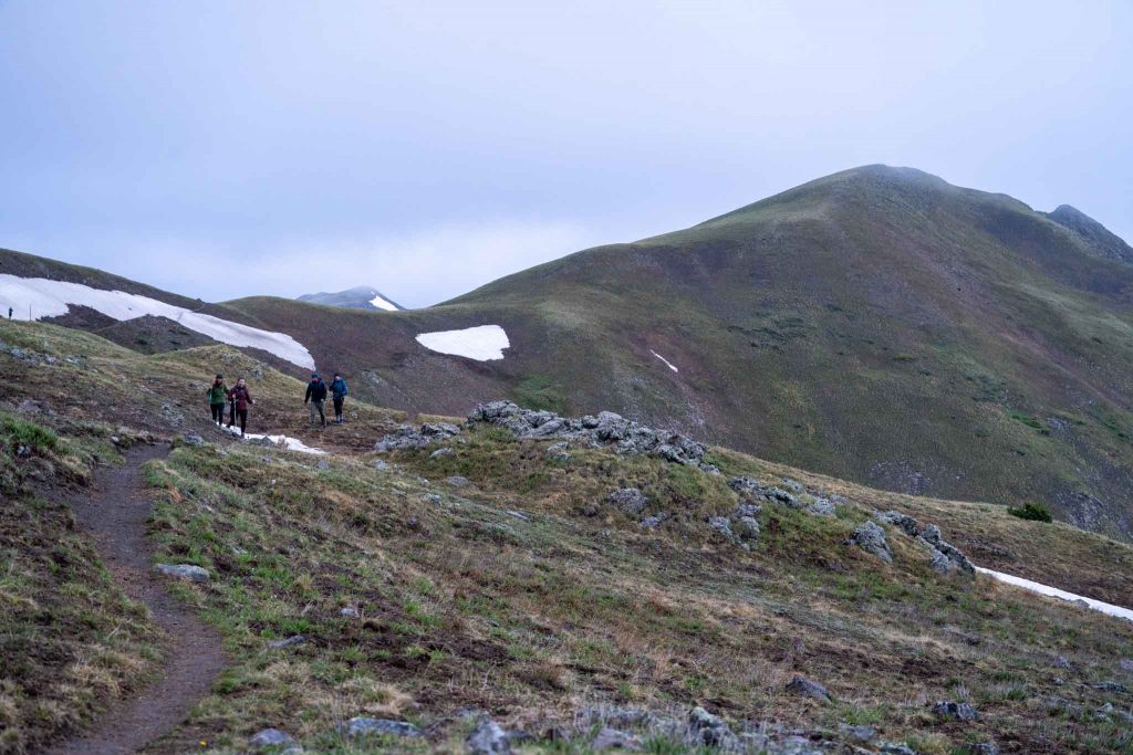
Views near 12,500 feet heading towards the final ridge.
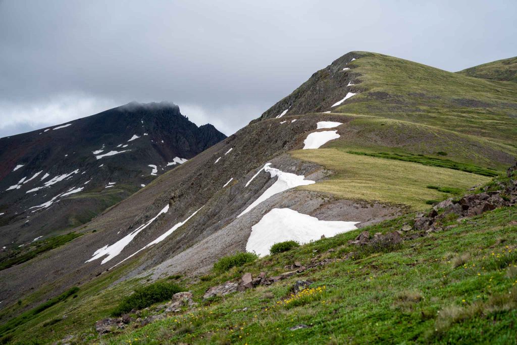
View near 13,000 feet heading up the final ridge to summit via Willow Creek trailhead.
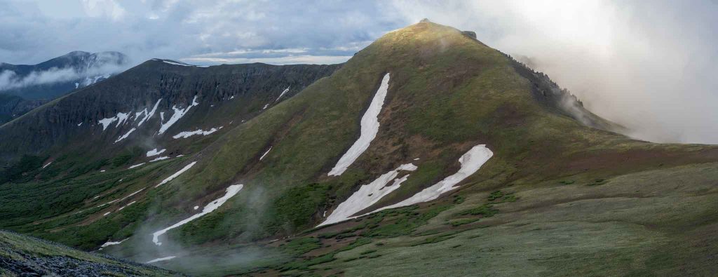
Nearing ridge before summit
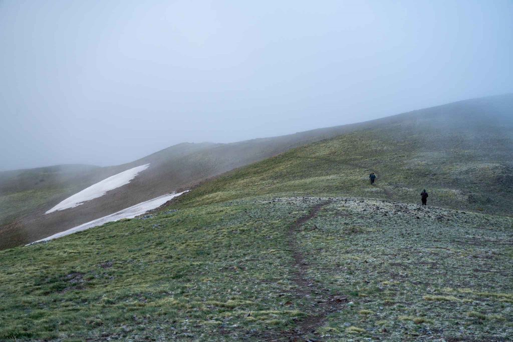
Continental divide trail from Willow Creek approach.

Max DesMarais is the founder of hikingandfishing.com. He has a passion for the outdoors and making outdoor education and adventure more accessible. Max is a published author for various outdoor adventure, travel, and marketing websites. He is an experienced hiker, backpacker, fly fisherman, backcountry skier, trail runner, and spends his free time in the outdoors. These adventures allow him to test gear, learn new skills, and experience new places so that he can educate others. Max grew up hiking all around New Hampshire and New England. He became obsessed with the New Hampshire mountains, and the NH 48, where he guided hikes and trail runs in the White Mountains. Since moving out west, Max has continued climbed all of the Colorado 14ers, is always testing gear, learning skills, gaining experience, and building his endurance for outdoor sports. You can read more about his experience here: hikingandfishing/about