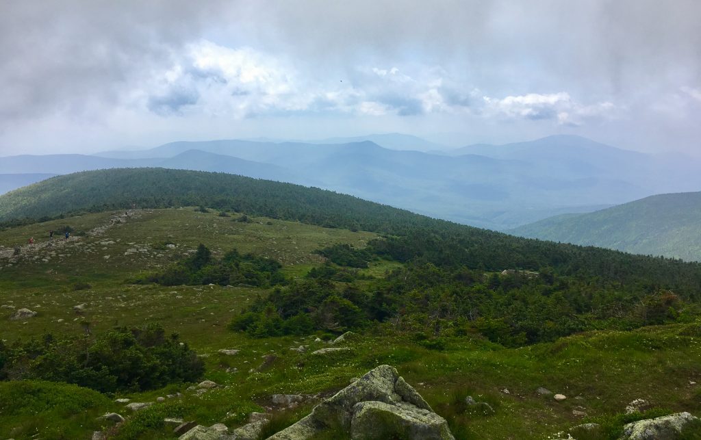
Mount Moosilauke has a cool name, and even better views. There are various ways to reach the summit, with every option being a bit unique. The exposed summit gives hikers 360 degrees of breathtaking views of NH’s White Mountains.
Quick Navigation:
Trail Options | Trail Map | Directions | Hiking In Winter | Weather | Pictures
Elevation: 4,802 Feet (1463.65 m)
Rating: Difficult
Distance: 7.6 miles (12.23 km)
Location: Grafton County, New Hampshire
Hike Time: 4-7 hours
Elevation Gain: 2,506 feet (763.83 m)
Video by Joseph Getts: View the rest of Getts Wild YouTube channel here
Trails
Beaver Brook Trail (Part of AT) | 7.6 miles round trip | 3,100 feet elevation gain
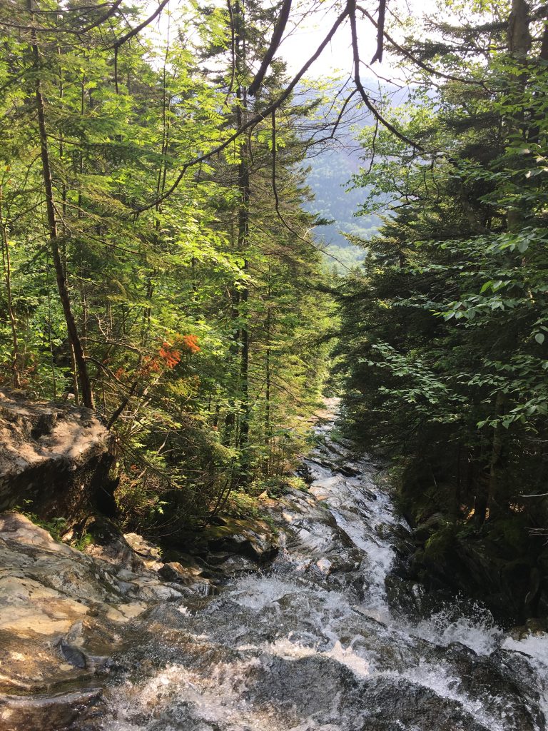
This is one of the most common trails with easy access right off of Route 112. It features many steep sections along the way and is considered very difficult. This trail features tons of beautiful waterfalls. Please take caution during wet times, and be especially cautious with proper traction during winter months (directions below).
Glencliff Trail (Part of AT) | 8.2 miles round trip | 3,300 feet elevation gain
This trail begins off of High Street in Warren, NH. It features a few steep sections along the way and is consider difficult. (directions below)
Gorge Brook Trail | 7.2 miles round trip | 2,550 feet elevation gain
This trail can be accessed by the Moosilauke Ravine Lodge (a road that is closed during the winter). This is one of the shorter routes up Moosilauke as long as Ravine Lodge road is opened. Directions Click Here
Moosilauke and Carriage Road Trail | 10.2 miles round trip | 3,100 feet elevation gain
This trail is accessed at the end of Breezy Point Road and features a lot of cross country skiing trails. This is one of the more gradual incline routes to the summit of Moosilauke, though it is longer in mileage than other options. Directions click here
This is the recommended winter route.
Trail Maps
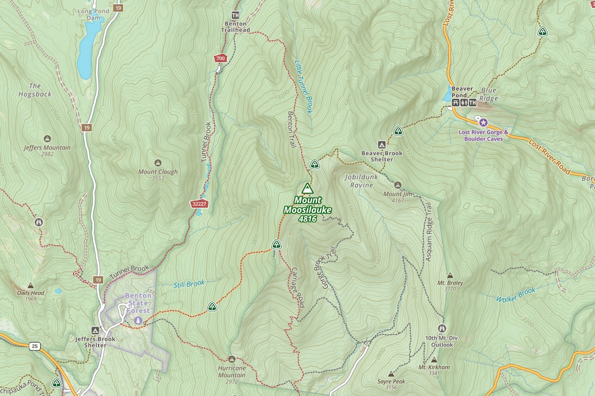
Click to enlarge
Glencliff, Gorge Brook and Moosilauke Trail Map:
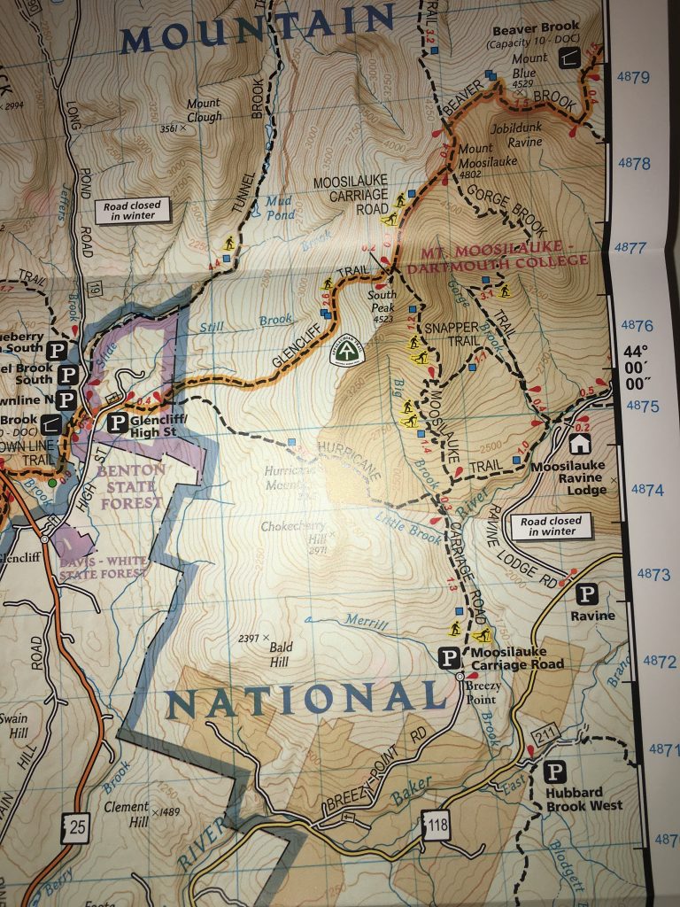
Map Courtesy of National Geographic’s White Mountain National forest Map. Buy Here.
Directions
To Beaver Brook Trailhead
To Glencliff Trailhead
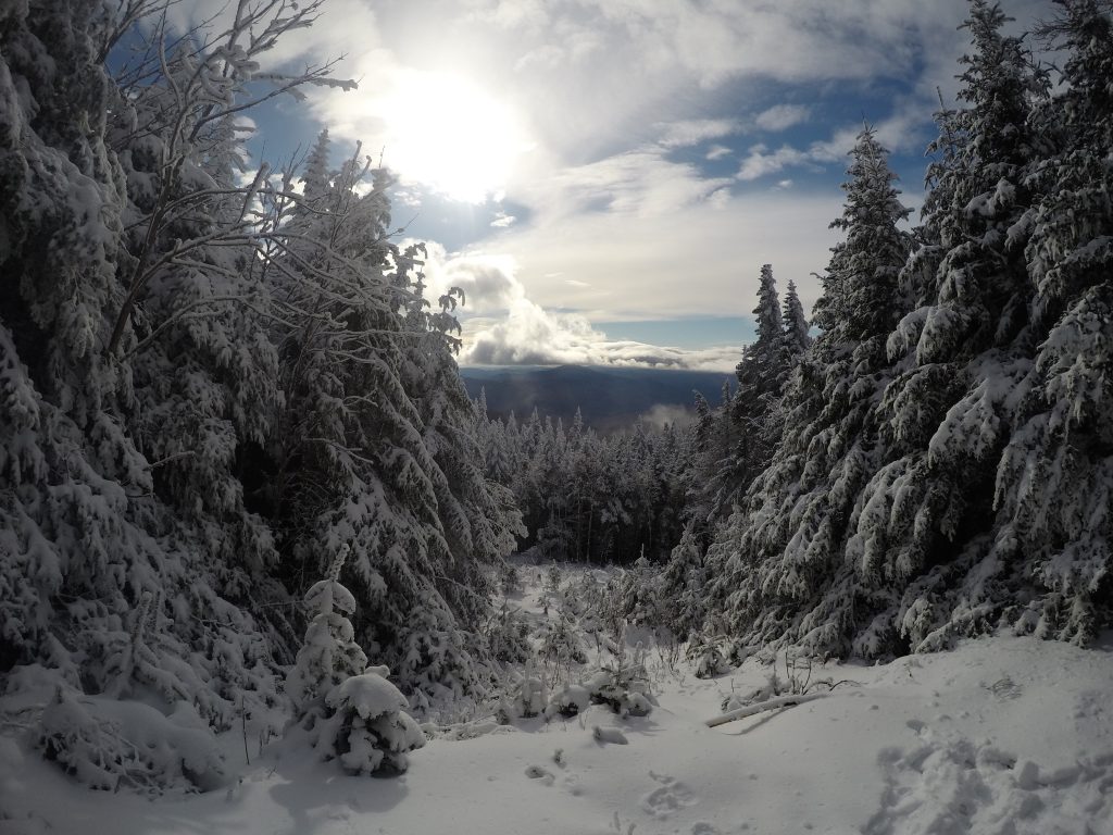
Moosilauke in Winter
Moosilauke is an incredible winter hike. The winds can be crazy, and good views are often hard to come by, but it is a fantastic experience with the right equipment.
We recommend the Carriage road approach for winter months.
Weather Forecast
North Woodstock, NH
Overnight
Patchy fog. Cloudy, with a low around 46. Southeast wind around 10 mph.
Thursday
Patchy fog before 7am, then a chance of rain showers. Mostly cloudy, with a high near 56. Southeast wind around 10 mph. Chance of precipitation is 30%.
Thursday Night
A slight chance of rain showers before 9pm. Partly cloudy, with a low around 47. Southeast wind 5 to 10 mph. Chance of precipitation is 20%.
Friday
Partly sunny, with a high near 60. Southeast wind 10 to 15 mph, with gusts as high as 25 mph.
Friday Night
Mostly cloudy, with a low around 46. Southeast wind around 15 mph, with gusts as high as 25 mph.
Saturday
A slight chance of rain showers after 1pm. Mostly cloudy, with a high near 56.
Saturday Night
A slight chance of rain showers before 8pm. Mostly cloudy, with a low around 44.
Additional Pictures
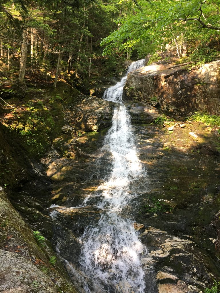
One of the many waterfalls along the Beaver Brook Trail

Max DesMarais is the founder of hikingandfishing.com. He has a passion for the outdoors and making outdoor education and adventure more accessible. Max is a published author for various outdoor adventure, travel, and marketing websites. He is an experienced hiker, backpacker, fly fisherman, backcountry skier, trail runner, and spends his free time in the outdoors. These adventures allow him to test gear, learn new skills, and experience new places so that he can educate others. Max grew up hiking all around New Hampshire and New England. He became obsessed with the New Hampshire mountains, and the NH 48, where he guided hikes and trail runs in the White Mountains. Since moving out west, Max has continued climbed all of the Colorado 14ers, is always testing gear, learning skills, gaining experience, and building his endurance for outdoor sports. You can read more about his experience here: hikingandfishing/about
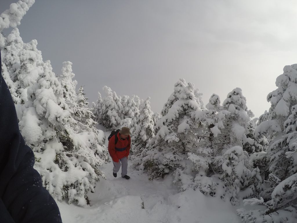
Winter Hike With Dad!
Lots of snow! Beautiful conditions on entire trail. Very windy up high, and visibility from the summit was low.
That said, amazing day. Trail was well packed down all the way to summit.