For those looking to take their Yosemite National Park adventure to the next level, hiking up to Clouds Rest is an absolute must. It features breathtaking 360-degree views, with Half Dome clear in site, this may be the best views in all of Yosemite National Park. In this article, we’ll cover everything you need to know before setting out on your Cloud’s Rest hike.
Quick Navigation:
Trail Map | Trails | Hiking In Winter | Camping | Directions | Pictures
Difficulty – Intermediate
Distance – 12.5 Miles Round Trip (20.12 km)
Height – 9,926 feet (2967.23 m)
Elevation gain – 3,100 feet (944.88 m)
Duration – 8-10 hours round trip
Hike Class: Class 2
Trailhead Location – Sunrise Lakes Trailhead (8,184)
Dogs – Not allowed
Need To Know Information
- A permit is required to enter Yosemite at many parts of the year: https://www.nps.gov/yose/planyourvisit/permitsandreservations.htmhttps://www.fs.usda.gov/recarea/arp/recarea/?recid=8080
- Additional permits are not required to hike this trail unless hikers are spending the night in backcountry camping zones..
- Tioga Pass Road is closed in winter, which makes this hike very tough to get to in the winter months. The road closure information can be found here.
Trail Map
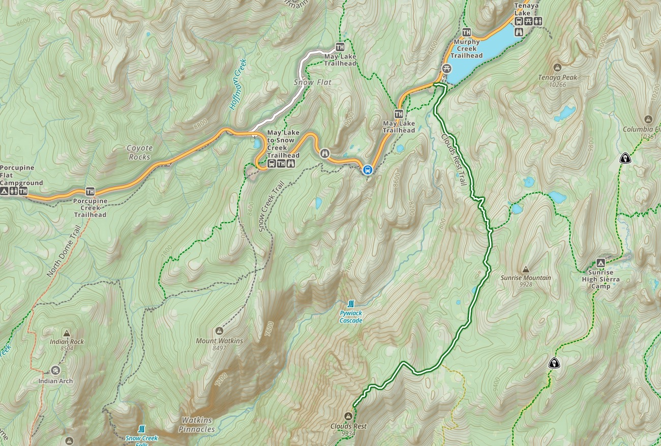
Routes
The main route to Clouds Rest is from Tioga Road, which is closed in winter often until late May or June. This route is significantly shorter than the alternative necessary when the road is closed from Yosemite Valley. Generally, this hike is only done from the valley as part of an overnight backpacking trip.
Cloud’s Rest From Sunrise Lake Trailhead
Distance – 12.5 Miles Round Trip (20.12 km)
Height – 9,926 feet (2967.23 m)
Elevation gain – 3,100 feet (944.88 m)
Duration – 8-10 hours round trip
Hikers begin at the trail by the bathrooms at the sunrise lake trailhead. They quickly hit a water crossing (Tenaya Creek) that has stone steps across the river, but often times, hikers will need to get their feet wet for this. Be prepared for that!
The trail is easy to follow, and well marked. The views along the way are pretty stellar and unique just about the entire time. This route requires both steep uphills and downhills in both directions.
Clouds Rest From Mist Trailhead
Distance: 18.04 Miles Round Trip (29.61 km)
Elevation Gain: 7,223 Feet (2201.57 m)
This is not the recommended route due to the very long hike required for a single day. That being said, it can be done, or this is an amazingly awesome starting point, or end point for an overnight trip (if you get wilderness permits).
Hikers will pass the amazing Vernal and Nevada Falls. They will also pass Little Yosemite Valley Campground, which would be a great place to stay to turn this into a backpacking trip.
Hiking in Winter
Refer to trail closures and winter hiking info here.
Camping Information
Nearby lodging and campground information can be found here.
And getting backcountry/wilderness camping permit info can be found here.
Weather
Here is a detailed weather forecast for the area:
Yosemite Valley, CA
Today
Sunny. High near 46, with temperatures falling to around 43 in the afternoon. Wind chill values as low as 31. South southwest wind 5 to 15 mph.
Tonight
Mostly clear, with a low around 31. Wind chill values as low as 24. East northeast wind 5 to 10 mph.
Wednesday
Sunny. High near 45, with temperatures falling to around 43 in the afternoon. Wind chill values as low as 25. North northwest wind around 10 mph.
Wednesday Night
Mostly clear, with a low around 31. Wind chill values as low as 24. East northeast wind 5 to 10 mph.
Thursday
Sunny, with a high near 46. Southwest wind 5 to 15 mph, with gusts as high as 25 mph.
Thursday Night
Mostly clear, with a low around 31. North wind 10 to 15 mph, with gusts as high as 25 mph.
Friday
Sunny, with a high near 47. South southwest wind around 10 mph, with gusts as high as 20 mph.
Directions
Directions to Sunrise Lake Trailhead:
Additional Pictures
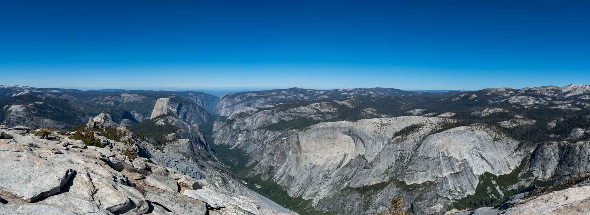
Cloud’s Rest summit views
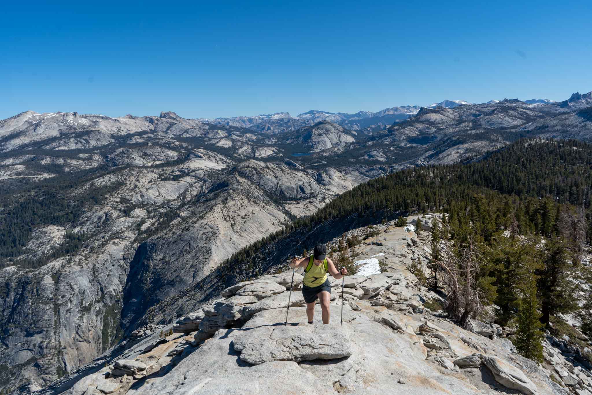
The final ridge heading to the summit of Cloud’s Rest

Tenaya Lake

Max DesMarais is the founder of hikingandfishing.com. He has a passion for the outdoors and making outdoor education and adventure more accessible. Max is a published author for various outdoor adventure, travel, and marketing websites. He is an experienced hiker, backpacker, fly fisherman, backcountry skier, trail runner, and spends his free time in the outdoors. These adventures allow him to test gear, learn new skills, and experience new places so that he can educate others. Max grew up hiking all around New Hampshire and New England. He became obsessed with the New Hampshire mountains, and the NH 48, where he guided hikes and trail runs in the White Mountains. Since moving out west, Max has continued climbed all of the Colorado 14ers, is always testing gear, learning skills, gaining experience, and building his endurance for outdoor sports. You can read more about his experience here: hikingandfishing/about