Mount Carrigain (4,682 feet) is one of the most popular of the NH 48 due to its outstanding 360 degree views, and gorgeous ridge line trail. This 10 mile hike is worth it before you even hit the summit. A fire tower at the summit gives hikers an incredible view of nearly all of the 4000 footers. There are a few trail options that we will discuss below.
Quick Navigation:
Trail Options | Trail Map | Winter Hiking | Directions | Weather | Pictures
Height: 4,682 feet (1,427.1 m)
Length: 10 miles round trip (16.09 km)
Rating: Difficult
Duration: 5-8 hours
Elevation Gain: 3,250 feet (990.6 m)
Video by Joseph Getts of Getts Wild
Trails
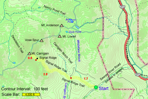
Signal Ridge Trail – 10 miles
This is the most popular route up Carrigain. This 10 mile round trip trail starts off Sawyer road, and features amazing views from Signal Ridge. The first two miles of the hike don’t feature much elevation gain, but the final three miles get more difficult. This trail features 3,220 feet of elevation gain from Sawyer Road to the summit. Keep in mind that Sawyer road is not maintained in winter. When the road is closed you will have to walk an extra 2.1 miles each way. Adding 4.2 miles to your hike. The link to check road status is below.
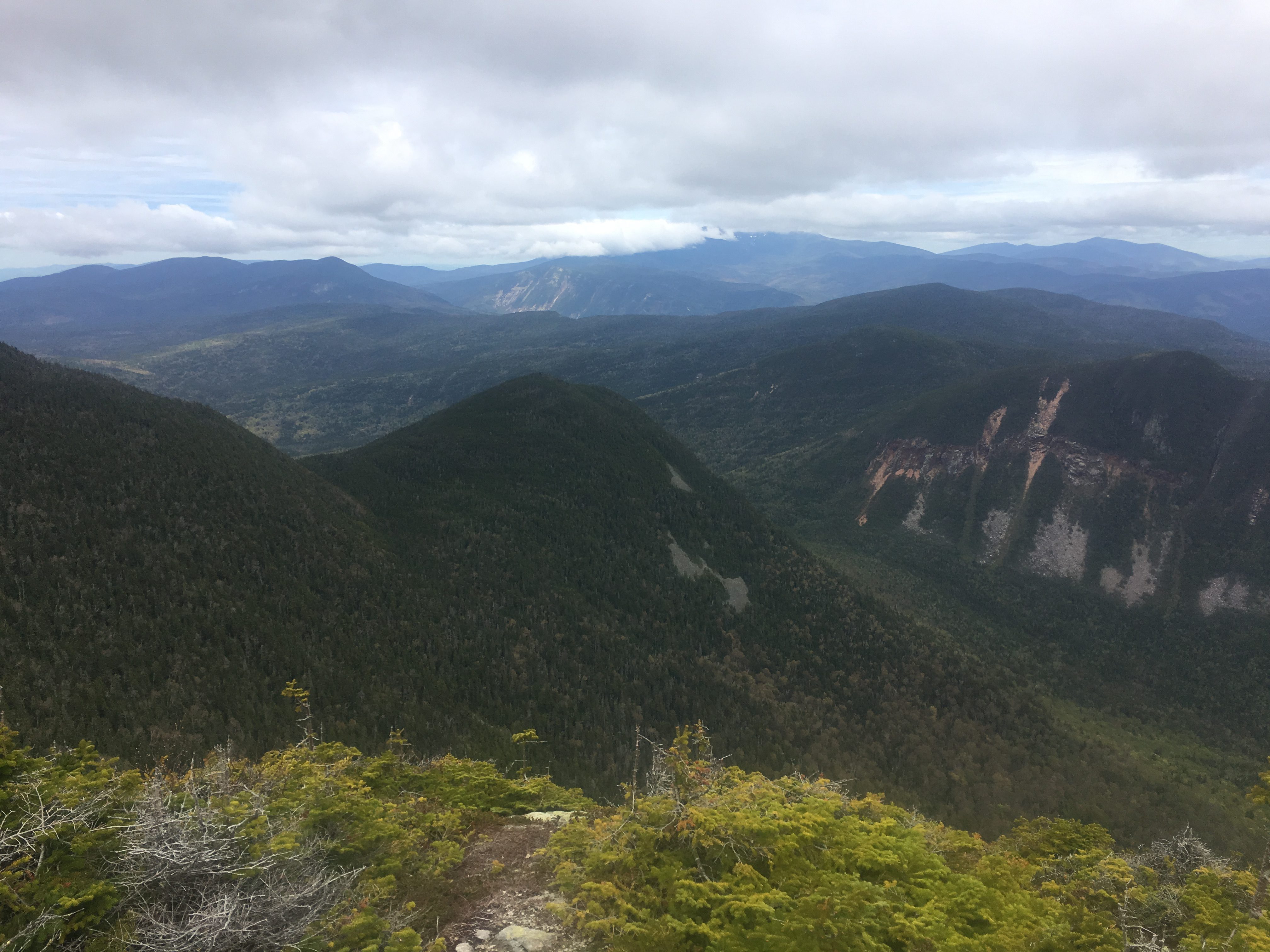
Once hikers ascend to Signal Ridge, they get incredible views, and a few fantastic places to sit for lunch. Hikers are exposed to the elements on the ridge, but the views of the Whites are outstanding.
During rainy times, or spring when water levels can get high, the stream crossing early on in the hike can be difficult. Some may want to remove boots to wade across.
Trail Map – Signal Ridge
Desolation Trail
The desolation trail is a far less traveled option and features a 1.9 mile very steep section up the other side of Mt. Carrigain. You can access this trail from the signal ridge trail. You can also take the Nancy Pond Trail to the Desolation Trail. You can see directions to this trail below.
Winter Hiking Mount Carrigain
Carrigain is a great option for winter hiking, but keep in mind that Sawyer Road is closed in Winter adding around 4 miles to your winter hike. Most of the hike is gradual and consistent gain. In winter, you should also have either Microspikes or Snowshoes for Carrigain on you. Snowshoes are recommended in times of high snow, especially after recent snowfall.
To Signal Ridge Trailhead on Sawyer Road. Sawyer Road can be shut down in winter meaning you will have to park at the beginning of the road where there is a parking lot. Making you have to park just off of 302. Check this website for road closage: https://www.fs.usda.gov/detailfull/whitemountain/home/?cid=stelprdb5183538
Want to take a look at mount Carrigain from the distance? Zeacliff has some awesome views. Read about Zealand Mountain
Directions
To Signal Ridge Trailhead:
Directions to Nancy Pond Trailhead
Weather Forecast
Bartlett, NH
This Afternoon
Mostly cloudy, with a high near 51. Southeast wind around 5 mph.
Tonight
Patchy fog and a slight chance of drizzle after midnight. Mostly cloudy, with a low around 37. Southeast wind 5 to 15 mph, with gusts as high as 25 mph.
Sunday
Patchy fog and a slight chance of drizzle before 8am, then rain. Mostly cloudy, with a high near 42. South wind 15 to 20 mph, with gusts as high as 35 mph. Chance of precipitation is 90%. New rainfall amounts between a tenth and quarter of an inch possible.
Sunday Night
Rain before 5am, then a chance of rain showers. Cloudy, with a low around 40. Southwest wind around 20 mph, with gusts as high as 40 mph. Chance of precipitation is 90%.
Monday
A chance of rain showers before 10am. Partly sunny, with a high near 57. West wind 10 to 20 mph, with gusts as high as 35 mph. Chance of precipitation is 40%.
Monday Night
Partly cloudy, with a low around 40.
Tuesday
Sunny, with a high near 58.
Additional Pictures:
Panoramic view from signal ridge
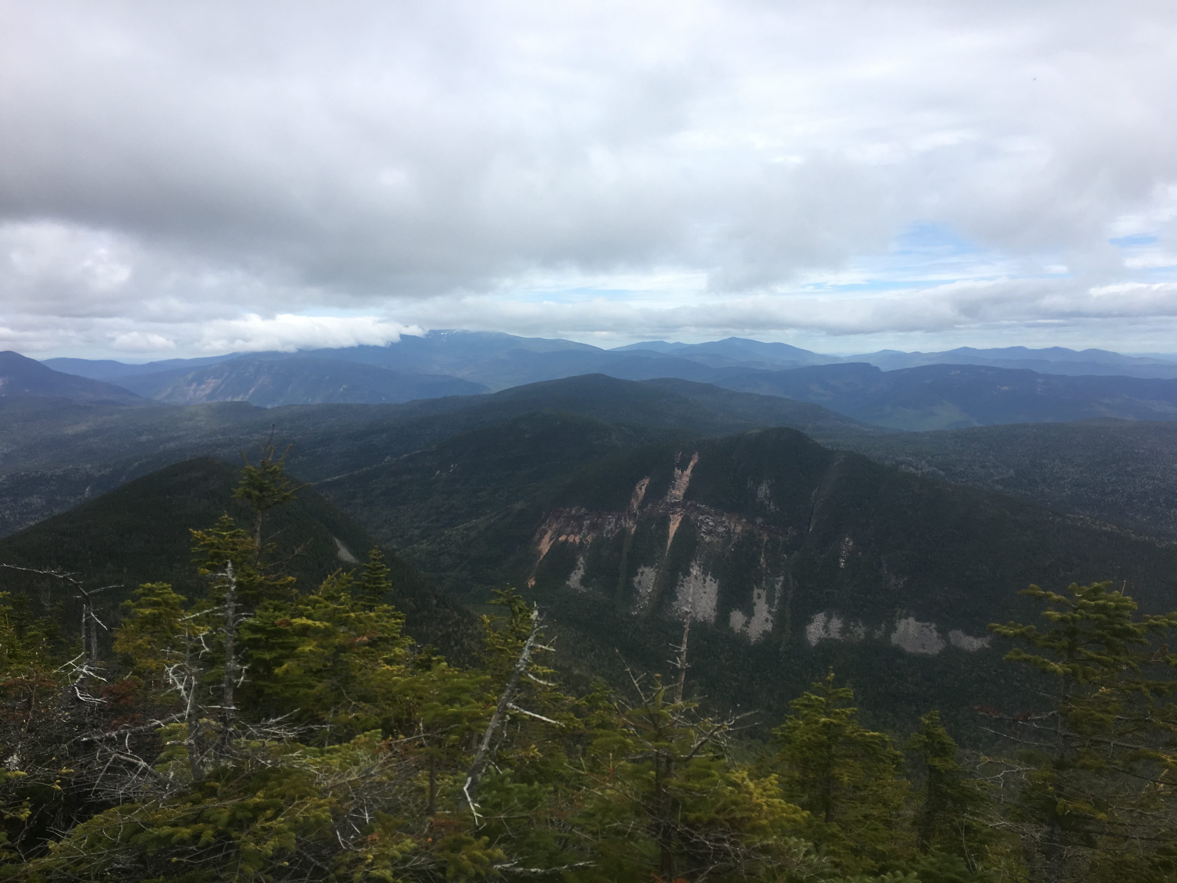
Mount Carrigain Summit View of Presidentials

Views Southeast

Max DesMarais is the founder of hikingandfishing.com. He has a passion for the outdoors and making outdoor education and adventure more accessible. Max is a published author for various outdoor adventure, travel, and marketing websites. He is an experienced hiker, backpacker, fly fisherman, backcountry skier, trail runner, and spends his free time in the outdoors. These adventures allow him to test gear, learn new skills, and experience new places so that he can educate others. Max grew up hiking all around New Hampshire and New England. He became obsessed with the New Hampshire mountains, and the NH 48, where he guided hikes and trail runs in the White Mountains. Since moving out west, Max has continued climbed all of the Colorado 14ers, is always testing gear, learning skills, gaining experience, and building his endurance for outdoor sports. You can read more about his experience here: hikingandfishing/about