Mount Hale is a 4,055 foot mountain located in the Twin Range in Bethlehem, New Hampshire, Grafton County in the White Mountains. The shortest trail to the summit of Mount Hale is by taking the Hale Brook Trail. Mount Hale is considered one of the easiest hikes out of all the 4,000 footers, though the summit lacks any views. The summit is an open circle field with a big cairn in the center. This is most often hiked with Mount Zealand.
Elevation: 4,055 feet
Elevation gain: 2,300 feet
Distance: 4.6 miles roundtrip
Duration (book time): 3 hours
Difficulty: Easy

Trails
Hale Brook Trail – 4.6 miles round trip – 2,300 feet of elevation gain
Begin hiking on the Hale Brook Trail for 2.3 miles until you reach the summit of Mount Hale. It is a fairly straight trail with no intersections or junctions. To get back to the parking lot where you started, simply retrace your steps and descend the Hale Brook Trail until you reach the trailhead sign. Though this hike lacks great summit views, it is actually quite nice. The trail goes along a river for quite some time which is gorgeous. And views can be seen looking back down the trail that are also fantastic.
Alternative routes
Lend-a-Hand Trail – 5.4 miles round trip – 1,300 feet of elevation gain
The only other maintained trail to the summit is the Lend-a-Hand Trail which begins at the AMC Zealand Falls Hut. This is also a common path taken when hikers are summiting both Mount Zealand and Hale.
Distance: 2.7 miles
Elevation gain: 1300 vertical feet
Hiking in winter
Zealand road is closed during the winter. Some hikers will choose to snowshoe up Zealand Road for a couple miles to access the trailhead. The road is easy to hike along, and Mount Hale by itself is one of the easiest 4,000 footers.
Camping and overnight hiking options
The closest campgrounds in the area are Zealand Campground, Sugarloaf I and Sugarloaf II, all located off of Zealand Road. Another place to stay when hiking Mount Hale is at the Zealand Falls Hut.
Backcountry camping is permitted, with restrictions such as: Unless otherwise posted, you may camp: Below treeline, at least 200 feet from the trail, at least 200 feet from all water sources, and at least a quarter of a mile from any road or hut.
Parking
The parking area for the Hale Brook trail is located on Zealand Road in Bethlehem, New Hampshire on the right side of the road.
*NOTE* Zealand Road is closed during winter.
Directions
To get to the Hale Brook Trail parking area
The parking lot for this hike is located on Zealand Road in Bethlehem, New Hampshire. It is roughly 2.5 miles up Zealand Road on the right hand side. You will pass by Sugarloaf Mountain campground before reaching the parking area. The trail begins to the right.
Current Weather Conditions
Mount Hale is a wooded and fairly low summit, so the conditions will be less severe and typically more similar to those in the valleys than to those on the high summit of Mount Washington. Always be prepared before heading out.
Bethlehem, NH
Today
Mostly sunny, with a high near 52. Northwest wind 10 to 20 mph, with gusts as high as 35 mph.
Tonight
A slight chance of rain showers after 5am. Mostly cloudy, with a low around 39. West wind 5 to 10 mph. Chance of precipitation is 20%.
Tuesday
A chance of rain showers. Mostly cloudy, with a high near 52. Southwest wind 5 to 10 mph. Chance of precipitation is 30%. New rainfall amounts less than a tenth of an inch possible.
Tuesday Night
Rain showers likely before 8pm, then rain likely between 8pm and 2am, then scattered rain showers. Cloudy, with a low around 38. Southeast wind 0 to 5 mph. Chance of precipitation is 70%.
Wednesday
Scattered rain showers. Mostly cloudy, with a high near 46. Southwest wind 0 to 5 mph. Chance of precipitation is 40%.
Wednesday Night
Scattered rain showers. Mostly cloudy, with a low around 40. Chance of precipitation is 30%.
Thursday
Scattered rain showers. Partly sunny, with a high near 54. Chance of precipitation is 30%.
Additional photos

Summit of Mount Hale
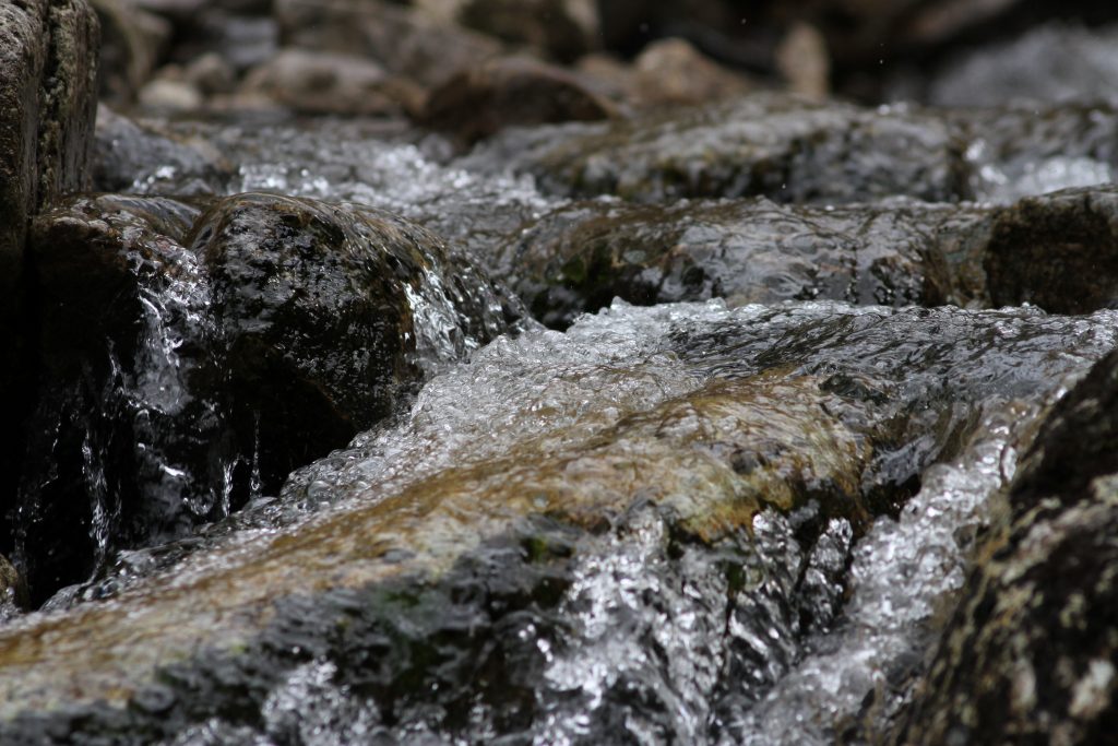
Mount Hale River Flows
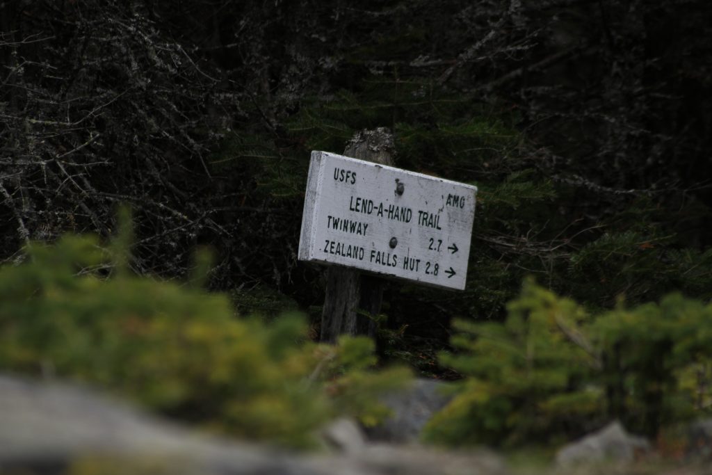
Mount Hale Trail Sign

Andrea is a writer, hiker, and adventurer from New England. She enjoys snowboarding, sunrise hikes, winter, night hiking, traveling, and photography.