Mount Colden is one of the more popular mountains in the High Peaks, being the 11th highest mountain in the Adirondack region. Colden has two main approaches, both beginning at the High Peaks Information Center. This is a long and strenuous loop with incredible views.
Elevation – 4,714 feet (1,437.7 meters)
Elevation gain – 2,535 feet (772.7 meters)
Distance – 6.3 miles one-way (10.1 km) via Lake Arnold Trail and 7.3 miles one-way (11.7 km) via Avalanche Pass
Difficulty – Strenuous
Duration (book time) – 10 to 12 hours
Trails
Colden via Lake Arnold Trail
(2,535 feet of elevation gain, 12.6 miles roundtrip, 10 to 12 hours book time)
The first 2.3 miles of this route is relatively easy and follows along the former site of Marcy Dam. From the dam, continue hiking towards Avalanche Camp at roughly 3.4 miles. Here you will make a left turn and begin climbing steeply until you reach Lake Arnold. At just shy of 3,800 feet, Lake Arnold is one of the highest bodies of water in the Adirondacks. At the lake, turn right and hike past the pond. From here, it is 1.4 miles to Colden’s summit. The rest of the terrain gets steep in sections, and continues to steadily climb until you reach the summit where excellent views await. To descend, simply retrace your steps the way you came until you reach the trailhead parking area where you began.
Colden via Avalanche Pass
(3,061 feet of elevation gain, 12.8 miles round-trip, 10 to 12 hours book time)
The longer approach to Colden cuts through Avalanche Pass, with some of the most incredible scenery in the entire Adirondack region. Hike along the Lake Arnold trail to Avalanche Camp, roughly 3.4 miles from the trailhead. Here, you will want to bear right and head towards Avalanche Pass. For a mile , the terrain gets incredibly steep, but it’s only a preview for what’s to come. The trail begins to flatten as it enters Avalanche Pass. At 4.4 miles, views of Avalanche Lake come into view. The terrain will become much more challenging, involving climbing up large boulders, numerous ladders, and lots of scrambling. Once you are past the lake, the trail begins to level out and descends to a register at the 5.8 mile mark. Turn left here and follow along the shore of Lake Colden. You will make one final turn on your left before you begin climbing 1,950 feet of steep, rugged terrain to reach the summit of Colden. To descend, simply retrace your steps (carefully) the way you came until you reach the trailhead parking lot where you began.
Trail Map

Camping And Overnight Hiking Options
There are plenty of backcountry camping in this area. The former site of Marcy Dam has numerous camping options, including a few tent sites and lean-to’s. There are other tent sites at Avalanche Camp, as well as in the Lake Colden and Lake Arnold area.
*NOTE* All campsites are first-come, first serve.
Parking
Both of the trailheads for Mount Colden begin at the High Peaks Information Center parking lot, near the Adirondak Loj. There is a fee required to use this lot. This is a common parking lot for hiking Algonquin Peak, Wright Peak, and Mount Marcy.
Directions
Leave Lake Placid on Route 73 and make a right turn onto Adirondack Loj Road. Follow the road until its end, and pay the fee at the booth before parking.
Weather Forecast
Here is a detailed weather forecast for the next four days:
Lake Placid, NY
Overnight
Mostly cloudy, with a low around 41. Southeast wind around 3 mph.
Friday
Partly sunny, with a high near 58. South wind around 5 mph.
Friday Night
A slight chance of rain showers after 4am. Mostly cloudy, with a low around 45. South wind 6 to 14 mph. Chance of precipitation is 20%.
Saturday
A slight chance of rain showers. Mostly cloudy, with a high near 54. South wind 7 to 14 mph.
Saturday Night
A chance of rain showers. Mostly cloudy, with a low around 42. South wind 15 to 20 mph. Chance of precipitation is 40%. New rainfall amounts less than a tenth of an inch possible.
Sunday
Rain showers likely. Cloudy, with a high near 46. South wind 20 to 25 mph. Chance of precipitation is 70%. New rainfall amounts between a tenth and quarter of an inch possible.
Sunday Night
Rain showers likely. Cloudy, with a low around 43. Southwest wind 16 to 24 mph. Chance of precipitation is 70%.
Additional Photos
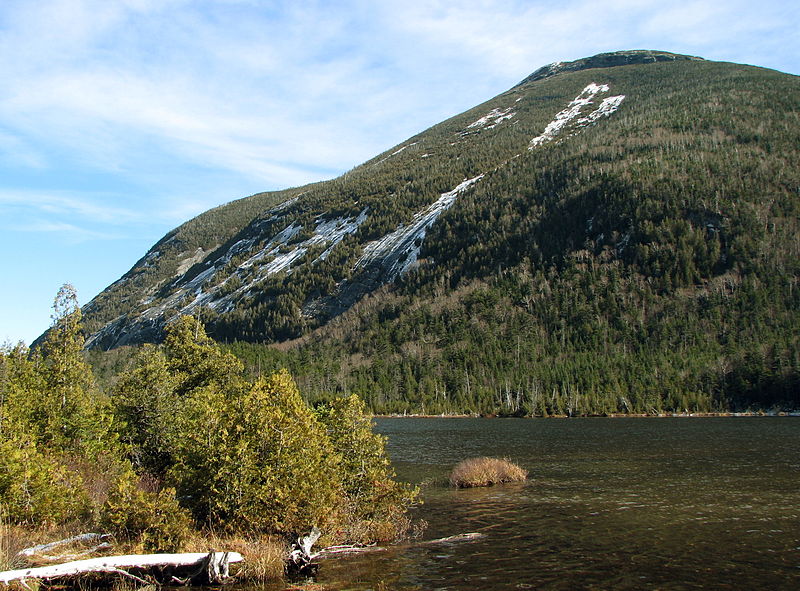
Photo credit: Wikipedia commons

Andrea is a writer, hiker, and adventurer from New England. She enjoys snowboarding, sunrise hikes, winter, night hiking, traveling, and photography.