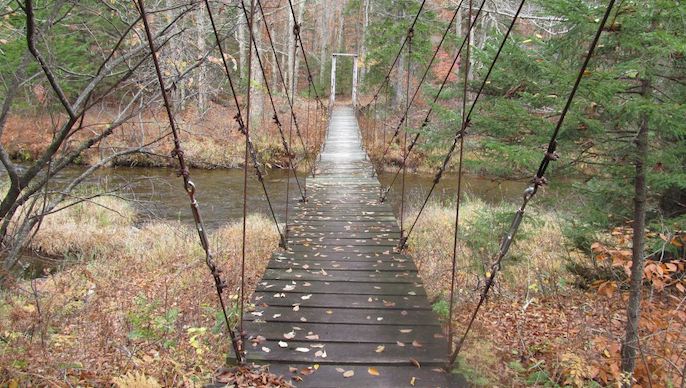
Beyond the bustling Big Apple, New York State is rife with outdoor activities. The state is home to the Adirondack and Catskill Mountains, gushing waterfalls, peak fall foliage, and miles and miles of trails. It’s one of the best places to go backpacking on the east coast.
Best Time to Backpack in New York
The best time to go backpacking in New York is September, October, and November. New York in the fall means perfect temperatures, no bugs, and foliage igniting the wilderness in golden-hour hues. Although each season is worthwhile to explore New York’s backcountry, prepare for road and campground closures in the winter, muddy conditions in the spring, and heat, bugs, and crowds in the summer.
Important Note
This article aims to provide knowledge for getting outside in New York State. We have listed common and well-traveled backpacking trails. Although this is not a complete list, it’s a start to exploring the other hundreds of options in New York for backpacking. Every trailhead, 46er, and lean-to is an adventure. Some of the best backpacking trips in New York evolve from studying maps of the sprawling state and mapping your own miles and route. Don’t let this list limit you!
New York Backpacking Trip Map
In an effort to make it easier to see where the trailheads are located within the state of New York, we have created a map to help you pick you next great adventure:
Best Backpacking Trails in New York
Cranberry Lake 50
Location: Wanakena, New York
Trailhead: Cranberry Lake 50 Trailhead
Elevation Gain: 4,071 feet (1,241 meters)
Difficulty: Moderate – Hard
Distance: 50 miles (80 kilometers)
Length: 4+ days
Type: Loop
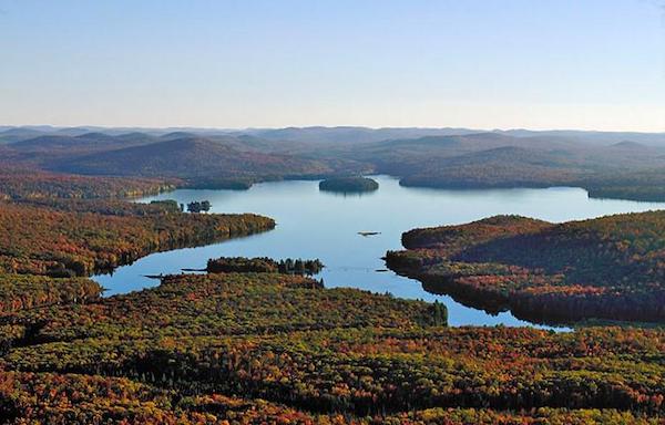
Cranberry Lake and the Cranberry Lake 50 Loop are in Adirondack Park. Adirondack Park is a National Historic Landmark and a 6-million-acre wilderness area that spans larger than Yosemite, Yellowstone, and Grand Canyon National Parks combined. It is the largest protected area in the continental United States, according to the Adirondack Council.
Backpacking the Cranberry Lake 50 is the perfect way to experience this unique wilderness. The trail meanders through old-growth forests, ponds, meadows, and the community of Wanakena. Be on the lookout for Beaver Dam crossings. There is no shortage of campsites. If you’re lucky, you can snag prime waterfront real estate.
Consider the High Falls Loop for a shorter walk through the woods.
Read More About This Hike Here
You can also find a great map here.
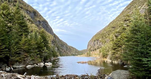
Avalanche Lake to Mount Marcy Loop
Location: Lake Placid, New York
Trailhead: Adirondack Loj
Elevation Gain: 3,802 feet (1,159 meters)
Difficulty: Hard
Distance: 20 miles (32 kilometers)
Length: 2+ days
Type: Loop
Mount Marcy is the highest peak in the state of New York. It sits at 5,344 feet of elevation with sprawling views of the other peaks in the High Peaks Wilderness Area of the Adirondack Mountains.
There are various ways to hike and backpack Mount Marcy. The Avalanche Lake to Mount Marcy Loop guides you along Avalanche Lake, Lake Colden, and Lake Tear of the Clouds. Lake Tear of the Clouds is where the Hudson River begins – connecting Upstate New York to New York City. Be prepared for an adventure with catwalks hugging rock walls suspended over the water, ladders, and rock scrambling.
There are ample opportunities for camping and lean-tos along the way. Campsites are designated by yellow markers on trees, while the lean-tos are dispersed near Marcy Dam and Lake Colden. Although you can approach and backpack Mount Marcy in various ways, this is a great trail to experience the area and set up a base camp to hike the other High Peaks in the area.
Read More About This Hike Here
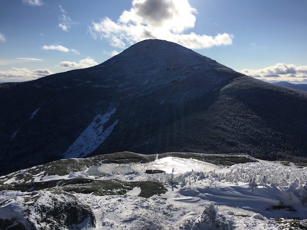
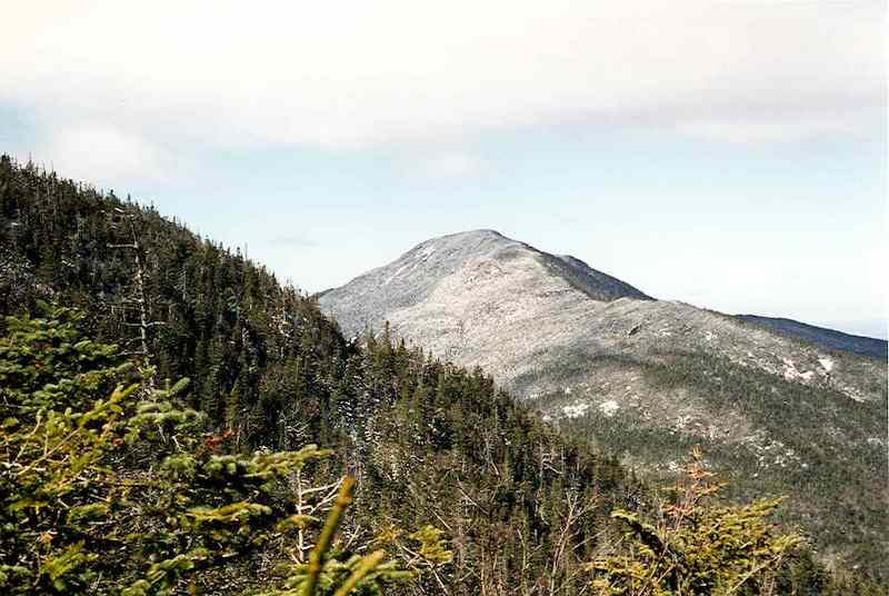
Algonquin Peak
Location: Lake Placid, New York
Trailhead: Adirondack Loj
Elevation Gain: 3,641 feet (1110 meters)
Difficulty: Hard
Distance: 8.4 miles (13.5 kilometers)
Length: 1-2 days
Type: Out & Back
Algonquin Peak is the second-highest peak in New York State, behind Mount Marcy. It’s home in the MacIntrye Range and nearby Wright Peak. The summit invites hikers and backpackers to 360-degree views of Mount Marcy, Mount Colden, Lake Colden, and other areas of the High Peaks Wilderness. If you’re on the hunt for the 46, then you can bag Wright and Iroquois Peaks from here too.
Like other backpacking trails in this High Peaks region, the trail will begin at Van Hoevenberg Trailhead. There are plenty of options for lean-tos and primitive camping so you can set up a basecamp and explore the area. Algonquin Peak can be accessed via Indian Pass Trail, Avalanche Pass, and even Mount Marcy. Be prepared for large slabs of rock and slippery conditions depending on the season.
Read More About This Hike Here
Western High Peaks Loop
Location: Tupper Lake, New York
Trailhead: Seward Trailhead
Elevation Gain: 6,473 feet (1,973 meters)
Difficulty: Hard
Distance: 21.5 miles (35 kilometers)
Length: 2-3 days
Type: Out & Back
Are you on the 46er quest? Do you want to avoid the Adirondack crowds in the summer? Do you love a challenging backpack adventure?
If you answered yes to all of these questions, then set your sights on the Western High Peaks region of the Adirondacks. This area is home to Seward, Donaldson, Emmons, and Seymour Mountains. They pierce the sky over 4,000 feet in elevation and loom over the western Adirondacks and areas like Tupper Lake and Saranac Lake.
The trail is long, remote, and riddled with fallen trees, mud, and rock scrambles. The challenge is worth it for the never-ending sea of green across Upstate New York. Ward Brook and Blueberry lean-tos are ideal basecamps to tackle the Western High Peaks Loop. You will need at least two days and one night to connect the Sewards with Seymour Mountain.
Read More About This Hike Here
Northville-Placid Trail
Location: Northville, New York (southern terminus)/Lake Placid, New York (northern terminus)
Trailhead: Northville Trailhead
Elevation Gain: 14,015 feet (4,272 meters)
Difficulty: Hard
Distance: 133 miles (214 kilometers)
Length: 17+ days
Type: Point-to-Point
Like the Cranberry Lake 50, the Northville-Placid Trail (NPT) winds through Adirondack Park in New York. Although this trail was created in 1923 by the Adirondack Mountain Club, the Schenectady Chapter calls this thru-hike “one of the most interesting and perhaps least known features of the Adirondack Mountains region.”
The NPT rolls along valleys and lowlands in the High Peaks Wilderness and the West Canada Lakes Wilderness. With ponds, streams, lakes, and wetlands, there is no lack of water (or mud). There is also access to camping and lean-tos along the way.
Read More About This Hike Here
Devil’s Path East to West
Location: Elka Park, New York
Trailhead: Devil’s Path Trailhead
Elevation Gain: 8,093 feet (2,467 meters)
Difficulty: Hard
Distance: 21.8 miles (35 kilometers)
Length: 2+ days
Type: Point-to-Point
Devil’s Path is the most challenging hike in New York State. It lies in the Catskill Mountains and traverses Indian Head, Twin, Sugarloaf, Plateau, and West Kill Mountain. In some areas, Hikers must downclimb and rock scramble between peaks as the terrain dips into steep notches. Devil’s Path rewards hikers with tree-framed views of the rolling landscape. Plus, this backpacking trip is only two hours from New York City.
Primitive camping is permitted on trail below 3,500 feet and at least 150 feet away from water sources. You will find Devil’s Kitchen, Devil’s Acre, Mink Hollow, and Diamond Notch lean-tos along the way.
Resources:
Read More About This Hike Here
And more here.
Escarpment Trail
Location: Haines Falls, New York
Trailhead: Scutt Road Trailhead
Elevation Gain: 5,006 feet (1526 meters)
Difficulty: Hard
Distance: 21.9 miles (35 kilometers)
Length: 2+ days
Type: Point-to-Point
Backpacking the Escarpment Trail is a must-do in the Catskills. Located in the Windham-Blackhead Mountain Range Wilderness, the trail climbs multiple peaks in the Catskills, including Blackhead, Windham High Peak, Thomas Cole, Black Dome, Acra Point, and Burnt Knob. With views of the idyllic Hudson Valley and the Catskills, backpacking the Escarpment Trail is one of the most beautiful adventures in New York State.
Camping options abound along the Escarpment Trail. Batavia Kill and Elm Ridge are lean-tos near trail, while there are backcountry spots too. Check out the rim of North Mountain. You can also make a reservation to set up at North-South Lake Campground, but you cannot camp anywhere within the campground’s boundary without a reservation.
Be prepared to carry water. This trail faces drought issues during the height of the summer.
Read More About This Hike Here
South Taconic Trail – North
Location: Copake Falls, New York
Trailhead: Taconic State Park
Elevation Gain: 2,073 feet (632 meters)
Difficulty: Hard
Length: 8.5 miles (14 kilometers)
Type: Out & Back
The South Taconic Trail is in Taconic State Park. Taconic State Park and the South Taconic Trail borders New York, Massachusetts, and Connecticut. It’s home to Alander and Brace Mountains, Bash Bish Waterfalls, summits, and views of New York’s farmland.
This trail goes beyond the 8.5 miles into the bordering states, but the New York section features Catamount Mountain Ski Resort, Sunset Rock, Prospect Hill, and primitive camping. Without much foot traffic, this is the perfect backpacking route to escape the summer crowds.
You can also extend this hike to the full Taconic Crest Trail which is 38 miles with over 7,500 feet of gain. This full trail will take you from New York, through a portion of Massachusetts, and into Vermont.
Read More About This Hike Here
Shawangunk Ridge Trail
Location: Port Jervis, New York
Trailhead: High Point State Park
Elevation Gain: 10,446 feet (3184 meters)
Difficulty: Moderate
Distance: 68.4 miles (110 kilometers)
Length: 9+ days
Type: Point-to-Point
Starting in New Jersey’s High Point State Park along the Appalachian Trail the Shawangunk Ridge Trail (SRT) runs north to New York through the southern Shawangunks, Sam’s Point Preserve, Minnewaska State Park, and the Mohonk Preserve. The trail follows the Shawangunk Ridge with views of the Catskills, terrain painted with Shawangunk rock, and access to a watchtower, rumored to be the subject of Bob Dylan’s “All Along the Watchtower.”
If you are northbound, backcountry and paid camping options abound before Highway 52, but be prepared for a lack of options into Minnewaska State Park and the Mohonk Preserve. Although, there are nearby campgrounds and towns.
Read More About This Hike Here
Appalachian Trail (New York State Section)
Location: South East New York
Trailhead: Longhouse Drive
Elevation Gain: 17,474 feet (5326 meters)
Difficulty: Hard
Distance: 93 miles (150 kilometers)
Length: 12+ days
Type: Point-to-Point
Ninety-three miles of the Appalachian Trail (AT) runs through New York. This is an ideal trail for a shakedown hike, people who live near New York City, and small adventures along the way. This portion of the Appalachian Trail goes by the Bellvale Farms Creamery, delis (in true New York fashion), a Zoo on the north side of Bear Mountain, and three state parks. Did you know as you hike, you can see the Manhattan Skyline in the distance?
The trail is known for large boulders and rock scrambles. The climbs and descents are intense but short. There are eight shelters throughout the New York Section of the AT. You can even have pizza delivered to Ralph’s Peak Hiker Cabin.
Read More About This Hike Here
Tips for Backpacking in New York
- Be bear aware and check bear canister requirements. In areas like the Adirondack High Peaks Wilderness, New York State requires the use of bear canisters from April to November. This protects backpackers and bear populations.
- New York is a wet, humid, and muddy state. Prepare for adverse conditions and bugs.
- Invest in a water filtration or purifying system for longer hikes.
- Watch out for ticks and wear light-colored clothing.
- Don’t just rely on lean-tos and pack a tent or hammock.
- Parking fills up quickly, plan ahead and arrive early.

Madeleine is a freelance writer and social media manager in the outdoor, gear, and travel space. She loves being buried in the snow, running single-track, and eating gummies next to high alpine lakes. When she’s not writing or traveling, you can find Madeleine in Telluride, Colorado romping around in the San Juans.