You’ll often find Grays and Torreys peak considered some of the best CO 14ers for those just getting into the higher elevation peaks. In about 9 miles, hikers can summit two, stunningly beautiful peaks with unreal views of the surrounding Rockies.
Grays & Torreys Combined
Difficulty – Strenuous
Distance – 8.35 miles round trip (13.44 km)
Height – 14,270 feet (4,349.5 m)
Elevation gain – 3,600 feet (1,097.3 m)
Duration – 6 to 9 hours (book time)
Seasons – Year-round (caution and experience needed in winter – see below)
Trailhead Location – End of Stevens Gulch Road – 11,259 feet (directions below)
Need to Know Information
Road to trailhead: The road to the end of Stevens Gulch road is extremely rough. Highly recommended to have a high clearance 4wd vehicle. Below Stevens Gulch road is a parking lot, this will add 2.8 miles and around 1,000 feet of elevation to your hike each way if you start here.
Camping: There are some dispersed campsites located at the upper trailhead.
Dogs: Allowed
Cell Service: Once hikers start ascending out of Steven’s Gulch, cell service does return. Though, do not rely on this.
Trail Map
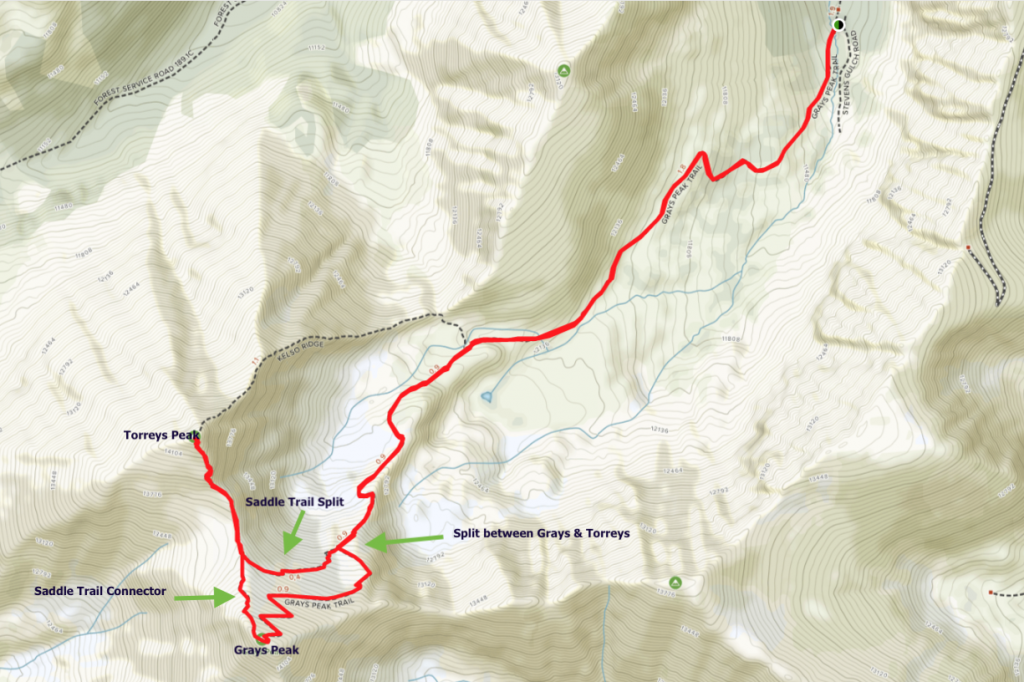
Trails
Hiking Just Grays Peak
Distance: 7 miles
Elevation Gain: 3,000 feet
Elevation: 14,270 feet (4,349.5 m)
Hiking Just Torreys Peak
Distance: 7.5 miles (11.27 km)
Elevation Gain: 3,000 feet (914.4 m)
Elevation: 14,267 feet (4,346.6 m)
Grays Peak Trail
Grays Peak Trail begins at the parking lot at the end of Stevens Gulch Road. Hikers immediately cross Stevens Gulch Creek via a bridge, and begin to climb up Stevens Gulch towards Grays and Torreys Peak. About .8-1.7 miles into hike, this trail is gradual, making it on the easier side, and a good place to move fast on the descent.
1.7 miles in, hikers will be at around 12,200 feet of elevation, where the trail begins to get much steeper.
2.8 miles in, hikers will reach the split between Grays Peak and Torreys Peak at 13,273 feet. Here hikers can choose which way to summit, though our opinion is that it is better to head towards Grays peak first. Please stay on trail, and avoid false paths or cut throughs. This trail has many switchbacks, but the loose rock off trail is best avoided.
3.7 miles in, hikers will reach Grays Peak (14,270). Continue beyond the summit rocks, and you will find a small trail sign that connects Grays and Torreys via the saddle. (saddle trail connector – details below)
4.1 miles in, hikers will reach the bottom of the saddle (13,757 feet) before starting to ascend back up to the summit of Torreys Peak.
4.4 miles in, hikers will hit the summit of Torreys Peak (14,267 feet). Retrace steps back towards the bottom of the saddle.
5.05 miles in, hikers will reach the saddle trail connector (details below) that will bring hikers back towards the split for Grays Peak and Torreys Peak.
5.55 miles in, hikers will reach the split, and continue downwards into Stevens Gulch.
8.35 miles in, hikers will be back at parking lot.
Saddle Trail Connector
The trail begins on the north end of the summit of Grays Peak. Hikers will find a small sign that isn’t visible until you stand just past the summit rocks. This trail contains a lot of loose rocks heading down, so be careful.
Saddle Trail Split
This trail connects hikers between the bottom of the saddle between both peaks, and the splitoff of where hikers choose to head up Grays, or up Torreys. Even in summer, there is small sections of snow to cross with a very steep slope. Be cautious on this section.
Kelso Ridge Trail – 6.75 miles round trip – Class 3 – 3,100 feet elevation gain.
This is not a common route for the average hiker. It takes a bit of scrambling, has a knifes edge section, and is only recommended for those with experience.
Hiking in Winter
This hike does have avalanche risk in winter and should be avoided during times where snow may be unstable. This is especially the case where the trail is close to Kelso Mountain (near the beginning), as this section is prone to avalanches that can reach the trail. It is recommended to take a more direct route through the gulch during times where snow may be unstable. Usually, Grays and Torreys will have trail conditions without much snow or ice until at least the third week in September.
Camping
Backcountry camping is allowed in this area. Read more about this here. There are a few dispersed campsites at the upper trailhead as well as a bathroom.
Directions & Parking
Winter months, many vehicles will not be able to reach the upper trailhead, adding 5.8 miles to the hike along Stevens Gulch Road. The road to the trailhead is a steep dirt road that is very rough. Caution is recommended for most vehicles.
Current Weather Conditions
Here is the next 4 day detailed forecast:
Montezuma, CO
Overnight
A chance of snow showers and a slight chance of thunderstorms. Cloudy, with a low around 18. Wind chill values as low as -1. West northwest wind around 30 mph, with gusts as high as 45 mph. Chance of precipitation is 50%. New snow accumulation of 1 to 2 inches possible.
Friday
Snow showers likely before 3pm, then snow showers and a slight chance of thunderstorms. Cloudy. High near 30, with temperatures falling to around 27 in the afternoon. West wind 13 to 30 mph, with gusts as high as 45 mph. Chance of precipitation is 90%. New snow accumulation of 1 to 2 inches possible.
Friday Night
Snow showers and a chance of thunderstorms. Cloudy. Low around 18, with temperatures rising to around 21 overnight. West wind 7 to 14 mph, with gusts as high as 18 mph. Chance of precipitation is 100%. New snow accumulation of 3 to 7 inches possible.
Saturday
Snow showers and a chance of thunderstorms. Cloudy, with a high near 23. East northeast wind 10 to 14 mph, with gusts as high as 21 mph. Chance of precipitation is 100%. New snow accumulation of 9 to 13 inches possible.
Saturday Night
Snow showers and a chance of thunderstorms. Cloudy, with a low around 16. North northwest wind 9 to 16 mph, with gusts as high as 24 mph. Chance of precipitation is 90%. New snow accumulation of 2 to 4 inches possible.
Sunday
Snow showers before noon, then snow showers and a chance of thunderstorms. Cloudy, with a high near 26. Chance of precipitation is 100%. New snow accumulation of 1 to 2 inches possible.
Sunday Night
A chance of snow showers and a slight chance of thunderstorms. Mostly cloudy, with a low around 17. Chance of precipitation is 50%. Little or no snow accumulation expected.
Pictures
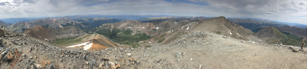
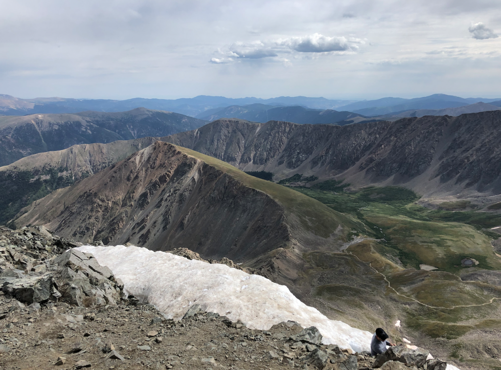
Grays Peak Summit Views
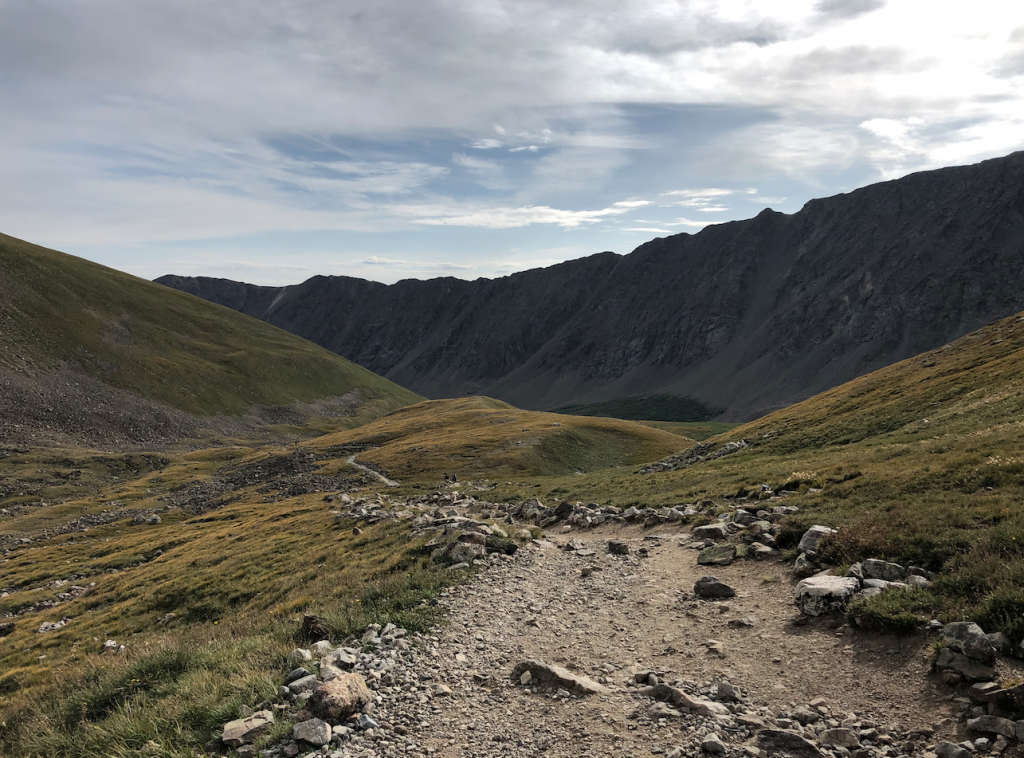
Stevens Gulch
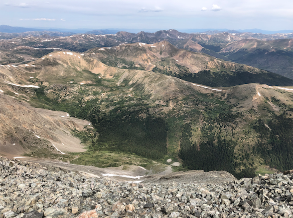
Summit of Grays Peak
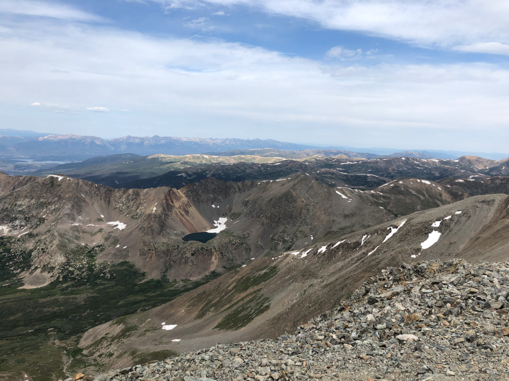
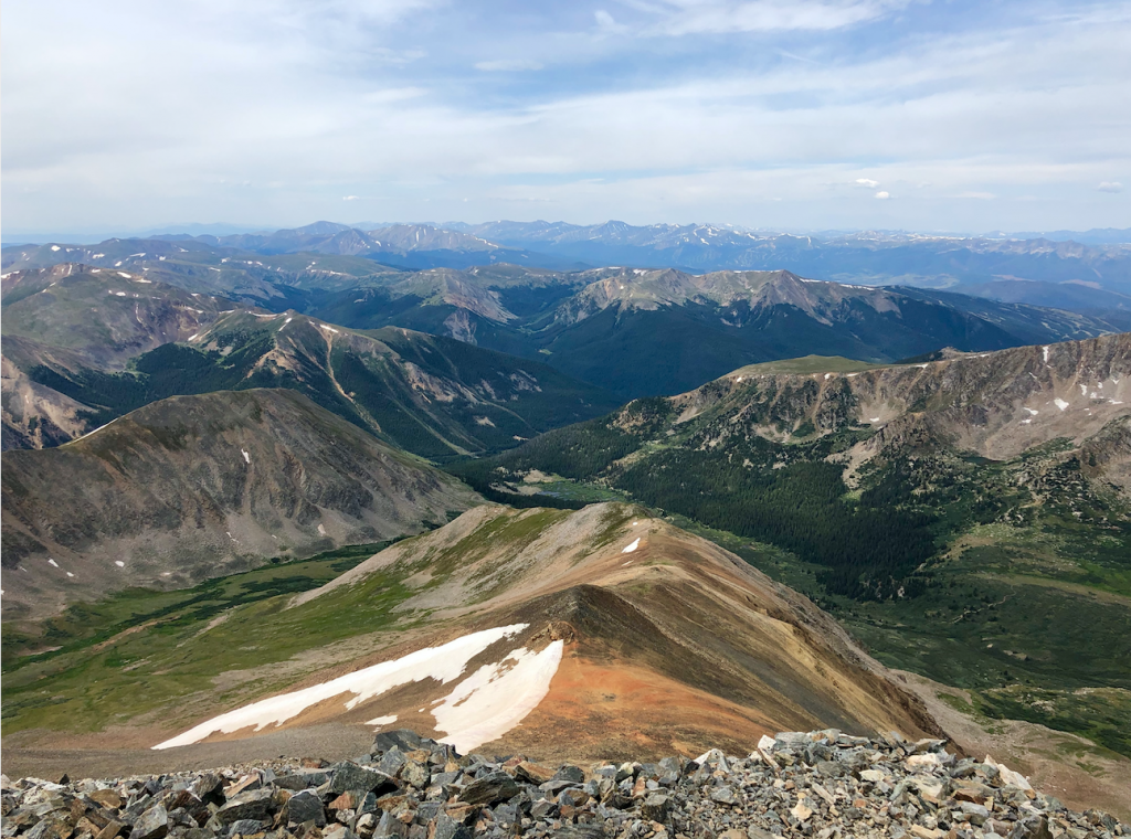
Torreys Peak Summit
Views from Grays Peak Summit
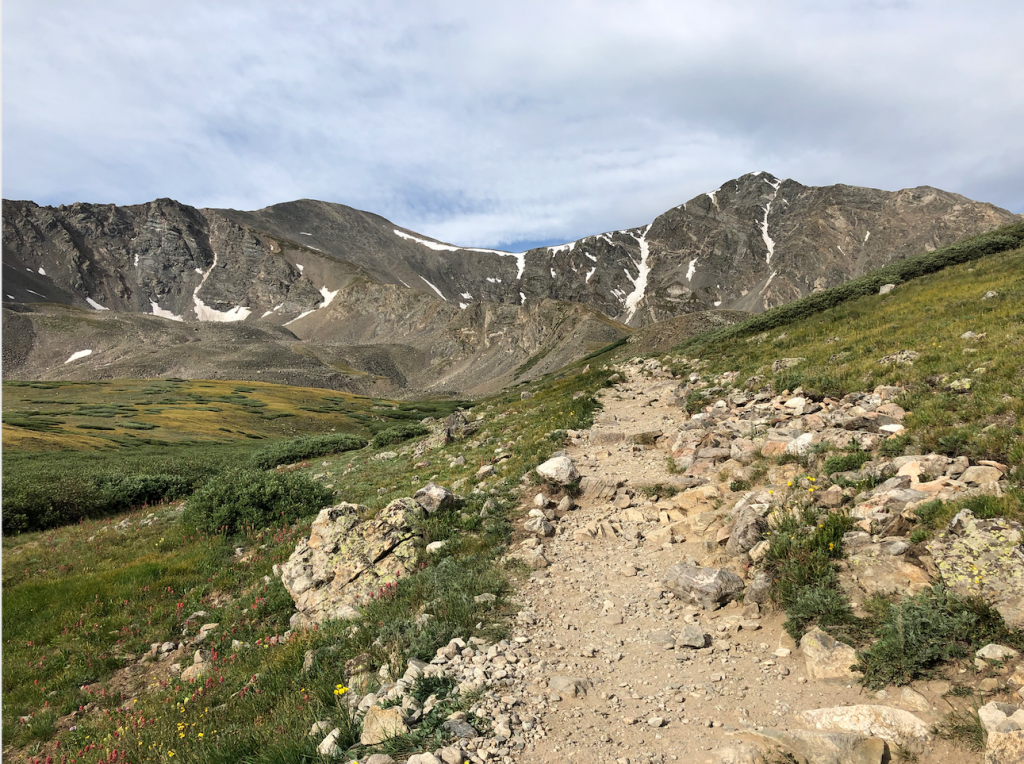
Views from Stevens Gulch of Grays & Torreys
Views from Torreys Peak

Max DesMarais is the founder of hikingandfishing.com. He has a passion for the outdoors and making outdoor education and adventure more accessible. Max is a published author for various outdoor adventure, travel, and marketing websites. He is an experienced hiker, backpacker, fly fisherman, backcountry skier, trail runner, and spends his free time in the outdoors. These adventures allow him to test gear, learn new skills, and experience new places so that he can educate others. Max grew up hiking all around New Hampshire and New England. He became obsessed with the New Hampshire mountains, and the NH 48, where he guided hikes and trail runs in the White Mountains. Since moving out west, Max has continued climbed all of the Colorado 14ers, is always testing gear, learning skills, gaining experience, and building his endurance for outdoor sports. You can read more about his experience here: hikingandfishing/about