Longs Peak is one of the most famous high peaks in the Colorado rockies. At 14,259 feet it is one of the most prominent peaks in Colorado. It is also the northernmost Colorado 14er and located within the Rocky Mountain National Park Wilderness. The mountain is named after Major Stephen Long, who in June 1820, led an expedition looking for Pikes Peak, and ended up naming Longs without even climbing it.
Quick Navigation:
Trail Map | Trails Options | Camping | Directions & Parking | Weather | Pictures
This hike has various ascent options, but 1 in particular is the most common route (we will highlight this route below, and mention the rest).
Height: 14,259 feet (4,346 meters)
Distance: 15 miles round trip (24.14 km)
Elevation Gain: 5,370 Feet (1636.8 meters)
Duration: 12 – 13 hours on average
Difficulty: Strenuous
Hike Class: Class 3 route after keyhole
Trailhead Elevation: 9,380 feet
Need To Know Information
- This hike is located within Rocky Mountain National Park, however you do not need a pass to get in as this doesn’t take you through an entrance gate for the Longs Peak Trailhead. A pass is needed for the Glacier Gorge Trailhead.
- Dogs are not allowed in RMNP and therefore are not allowed to Chasm Lake.
- Longs Peak is a difficult 14er with class 3 hiking and serious exposure. Past scrambling and class 3 experience is highly recommended.
Trail Map

Longs Peak Trail Map – Colorado
Trails
There are two main “hiking” trails to Longs peak that feature Class 1 and 2 hiking up until the Keyhole (a unique rock formation). The hike is considered class 3 after the keyhole. Below, each is shown. The East Longs Peak Trail is by far the more popular route. This hike is attempted an estimated 20,000 times per year by hikers with a less than 50% completion rate. Though this hike is difficult, and especially dangerous during poor weather, it is stunning, and doable for most intermediate to experienced hikers. Caution and good judgement is highly recommended. Most hikers are told to start by 6 a.m. at the latest.
East Longs Peak Trail: 15 miles Round Trip | 5,370 Feet Elevation Gain
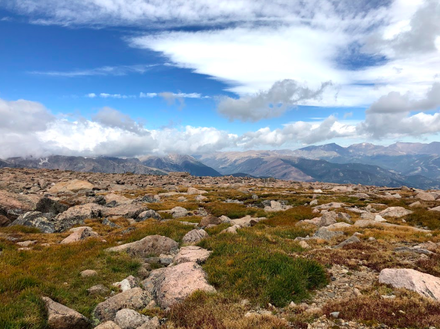
This trail begins at 9,380 feet on Longs Peak road (directions below). Hikers will begin hiking through some pretty forest gaining elevation at a steady pace. Hikers will break through tree line 2.5 miles into the hike. Here hikers will get outstanding views eastward to the flatlands, and towards Longs Peak.
Once breaking tree line, the views simply remain outstanding throughout this hike. 3.2 miles in, hikers reach the junction for Chasm lake (a must see). There is a privy at this intersection. Hikers will bear right to continue upwards and around Mount Lady Washington. Once ascending above the a ridge, the views into Rocky Mountain National Park are incredible.
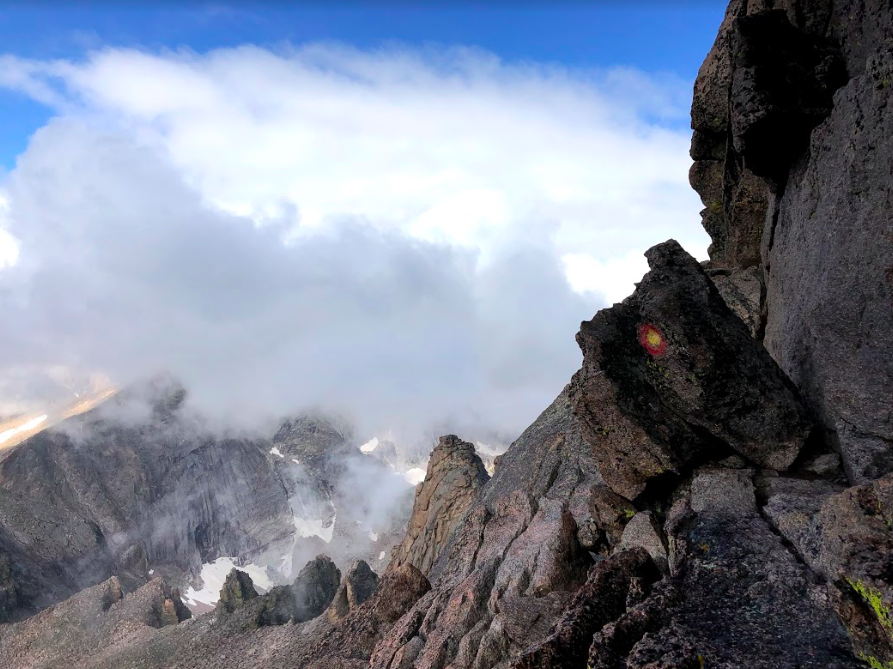
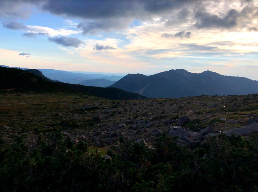
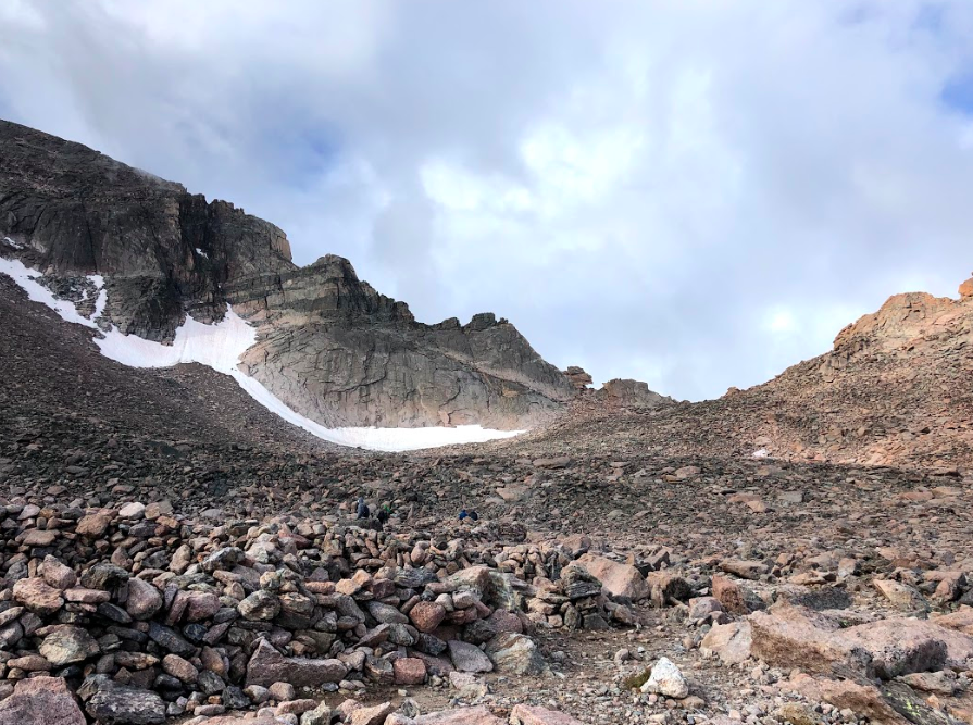
Just about 5 miles in, hikers will reach the boulder field. Some consider Boulder Field to be the most difficult part of the hike to Longs Peak (people that hate boulder hopping). There are big boulders and the hikers have to scramble over them before they reach the keyhole 6 miles into the hike. The boulder field has campsites (permit needed) and bathrooms for hikers. The views from the boulders are of course outstanding. Hikers will often stop at the Keyhole due to the trail becoming class 3 and significantly more dangerous beyond it.
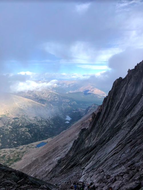
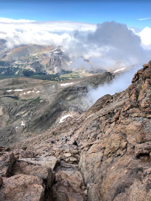
Beyond the Keyhole, hikers will experience large cliffs, slippery rock, loose rock, steep inclines, the chance for falling rock, but some of the most gorgeous views. Extreme caution must be taken here as wind, ice, falling rock, or rain significantly amplify the dangers of this hike. Beyond the keyhole are four well known sections to the summit, The Ledges, The trough, The Narrows, and The Homestretch.
Pictures of this trail can be found below.
It is advisable to start the hiking first thing in the morning before the dawn. This increases the chances to return before the afternoon as this time is known for frequent thunderstorms and lightning.
North Longs Peak Trail 9.5 miles each way | 5,200 Feet Elevation Gain
This hike begins at the Glacier Gorge parking area in Rocky Mountain National Park off of Bear Lake road (directions below). This is a gorgeous option to head up, and far less traveled after the first couple of miles. Once hikers reach Granite Pass, they meet up with the East Longs Peak trail and are only 1.8 miles from the keyhole.
Camping Information
If you are looking for a two-day hike, you can camp in the Boulder Fields. Permits to camp can be very hard to come by, but can be found here.
Many choose to stay at Longs Peak Campground to get started early in the morning. Information can be found here.
1.2 miles into the hike lies the Goblins Forest Backcountry Campground, which contains 6 tent sites. Information can be found here.
Directions and Parking
Directions to Longs Peak Trailhead:
To reach the Longs Peak trailhead, you need to start from the Estes Park and travel 10 miles on CO 7, towards the south. You will see a big National Park sign, take right from here towards the Longs Peak Campground. Climb up and towards the end turn left to reach the parking. You will need to procure a backcountry permit for overnight parking here.
There are no day hike parking fees here. There are bathrooms at the trailhead.
Directions to Glacier Gorge Trailhead
Glacier Gorge is within the park, and therefore a national parks pass is required to get through the gates.
Current Weather Conditions
Keyhole trail has much of its sections covered in the snow until mid-summer. It is best if you start your hike somewhere from late July to early September. It is important to check the daily weather forecast before you start the hike. The weather here changes frequently and you can experience winter-like conditions almost anytime.
Allenspark, CO
Overnight
Snow showers likely and a slight chance of thunderstorms. Cloudy, with a low around 20. West wind 26 to 30 mph, with gusts as high as 45 mph. Chance of precipitation is 60%. New snow accumulation of less than one inch possible.
Friday
A chance of snow showers before noon, then snow showers and a slight chance of thunderstorms. Mostly cloudy, with a high near 31. West wind 12 to 31 mph, with gusts as high as 47 mph. Chance of precipitation is 90%. New snow accumulation of 1 to 3 inches possible.
Friday Night
Snow showers and a chance of thunderstorms. Cloudy. Low around 19, with temperatures rising to around 21 overnight. West northwest wind 9 to 14 mph, with gusts as high as 21 mph. Chance of precipitation is 100%. New snow accumulation of 10 to 14 inches possible.
Saturday
Snow showers and a chance of thunderstorms. Cloudy, with a high near 21. East northeast wind 9 to 15 mph, with gusts as high as 22 mph. Chance of precipitation is 100%. New snow accumulation of 12 to 18 inches possible.
Saturday Night
Snow showers and a chance of thunderstorms. Cloudy, with a low around 16. North northwest wind around 14 mph, with gusts as high as 22 mph. Chance of precipitation is 90%. New snow accumulation of 3 to 5 inches possible.
Sunday
Snow showers before noon, then snow showers and a chance of thunderstorms. Cloudy, with a high near 24. Chance of precipitation is 100%. New snow accumulation of around one inch possible.
Sunday Night
A chance of snow showers before midnight. Mostly cloudy, with a low around 18. Chance of precipitation is 50%. Little or no snow accumulation expected.
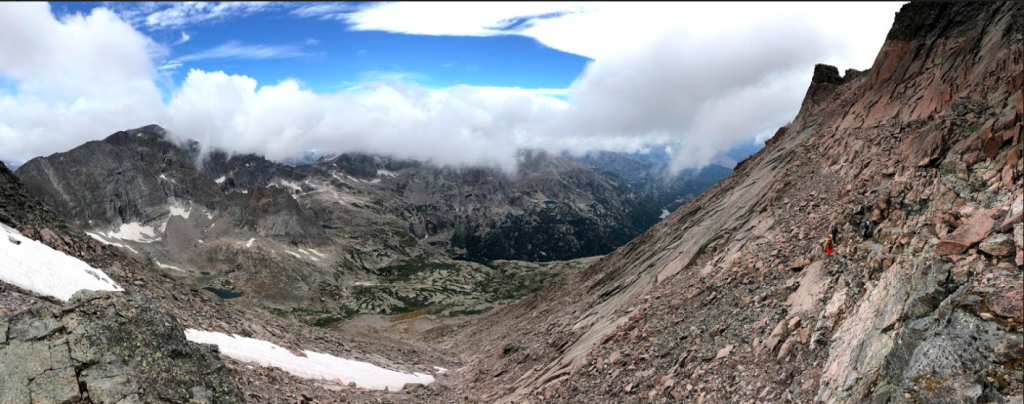
Additional Pictures

The Ledges – Just After Keyhole
Views Near Granite Pass
Views from The Narrows
The Trough
Views Just Above Treeline Views East
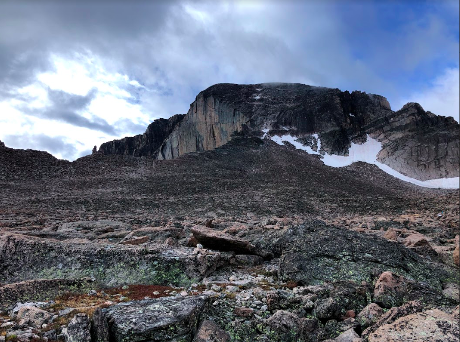
Boulder Field Views of Longs Peak
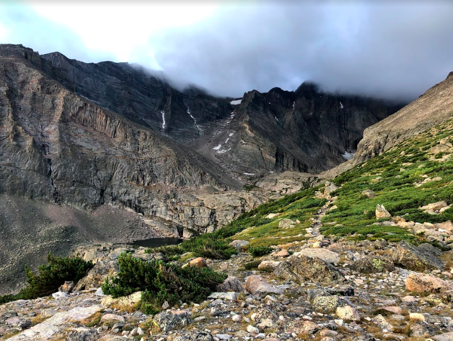
Views from Chasm Lake Junction
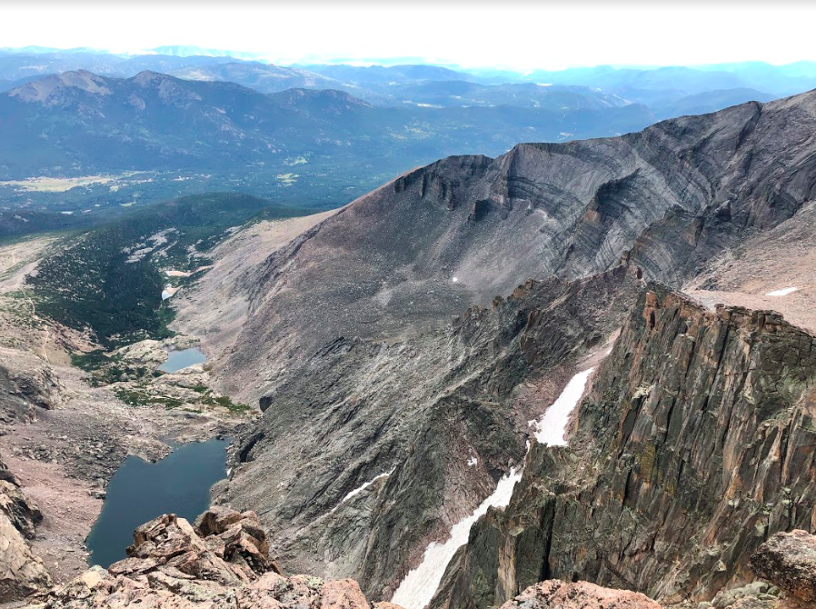
Chasm Lake From Summit of Longs Peak
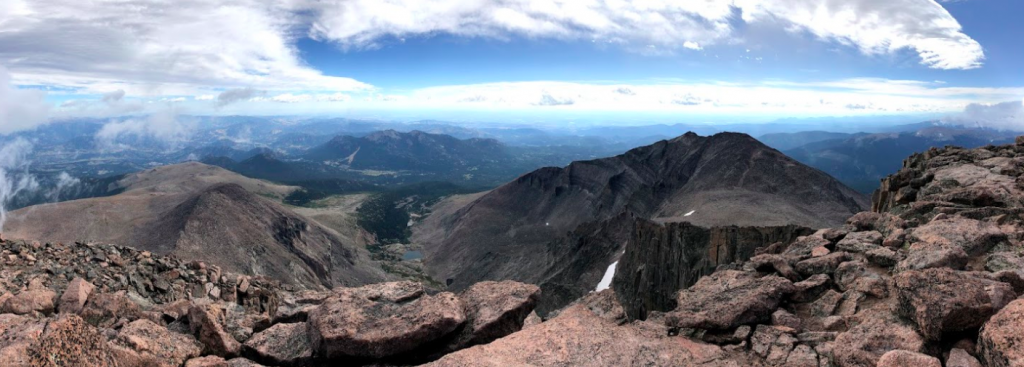
Longs Peak Summit Views
Trail Views from after the Keyhole
The Keyhole of Longs Peak

Looking up The Trough
The Homestretch

Max DesMarais is the founder of hikingandfishing.com. He has a passion for the outdoors and making outdoor education and adventure more accessible. Max is a published author for various outdoor adventure, travel, and marketing websites. He is an experienced hiker, backpacker, fly fisherman, backcountry skier, trail runner, and spends his free time in the outdoors. These adventures allow him to test gear, learn new skills, and experience new places so that he can educate others. Max grew up hiking all around New Hampshire and New England. He became obsessed with the New Hampshire mountains, and the NH 48, where he guided hikes and trail runs in the White Mountains. Since moving out west, Max has continued climbed all of the Colorado 14ers, is always testing gear, learning skills, gaining experience, and building his endurance for outdoor sports. You can read more about his experience here: hikingandfishing/about