Blanca Peak is a 14,345 foot peak in the Sangre De Cristo Mountains of Colorado. Hikers often combine this hike with Ellingwood Point (14,042 feet) and occasionally with Little Bear Peak. Here’s all the information you need to tackle this Colorado 14er and Ellingwood Point.
The below stats are based off of the higher up 2WD parking lot, you’ll find more stats and info for other trailheads, and having a high clearance 4WD vehicle.
Distance – 9.8 miles round trip (15.77 km)
Height – 14,345 feet (4,317.5 m)
Elevation gain – 4,217 feet (1,285.3 m)
Duration – 10-14 hours (book time)
Difficulty – Strenuous
Class: Class 2 Hike
Seasons – This hike can be completed in all seasons, but winter is especially difficult, and dangerous.
Trailhead Location – Lake Como Trailhead (8,770 Feet) or Zapata Falls Trailhead (9,080 Feet)
Need To Know Information
- Combining Blanca Peak with Little Bear Peak adds a lot of difficulty and risk. This will be discussed in a separate article.
- Ellingwood Point is not an official 14er, but is included in the 58 list.
- Hikers have two main options for starting points: Zapata Falls Trailhead, Lake Como Road Trailhead – We discuss these in detail below
- Hikers should have helmets for these peaks due to rockfall danger.
- These are really tough day hikes. Many choose to turn this into an overnight via camping at Lake Como or South Zapata Lake
- The type of vehicle you are driving will determine how high you can park on Lake Como road. Most cars can drive about 1.5 miles up before it gets rough. This is explained in more detail below.
Lake Como Road Routes
Blanca Peak Peak Via Lake Como Road (2WD Vehicle to 8,800 Feet) – 13.2 Miles Round Trip (21.24 km) – 5,614 Feet (1711.15 m) Total Elevation Gain – Class 2
If you park directly off of 150, and don’t travel down the road at all, add 3.11 miles each way and 1,170 feet of elevation gain.
This route is pretty simple all the way to Lake Como. Hikers are simply staying along the road the entire way. They will likely have ATVs pass them along the way. Once getting to Lake Como hikers continue on for .4 miles before reaching a junction. The right heads up Little Bear Peak, and the left continues towards Crater Lake.
Hikers will reach Crater Lake at 12,740 feet and will continue towards the saddle between Blanca and Ellingwood. Hikers will take switchbacks up towards the saddle before taking a right turn towards Blanca, or a left turn towards Ellingwood.
Rockfall danger is abundant after Crater Lake, and hikers should be extra cautious in these sections. All if this remains class 2.
The below two routes follow this same path, but we wanted to include the distance and elevations stats for you.
Blanca Peak Peak Via Lake Como Road (4WD Vehicle to 10,000 Feet) – 9.8 Miles Round Trip (15.77 km) – 4,217 Feet (1,285.3 m) Total Elevation Gain – Class 2
Many 4wd vehicles like 4runners and stock jeeps can make it up this high, but parking is definitely quite limited.
Blanca Peak Peak Via Lake Como Road (4WD Vehicle to Lake Como) – 5 Miles Round Trip (8.05 km) – 2,309 Feet (703.78 m) Total Elevation Gain – Class 2
Many 4wd vehicles like 4runners and stock jeeps can make it up this high, but parking is definitely quite limited. You may also make it to one of the pull offs somewhere between these two points. Simply be prepared to walk 100% of this.
Adding In Ellingwood Point
Ellingwood Point can easily be added to any of the routes from Lake Como road. Adding in from Lake Como road.
Adding in Ellingwood will add a total round trip of .8 miles and 531 feet total of elevation gain.
After Como Lake, hikers will reach a junction near the ridge saddle between Ellingwood and Blanca Peak. From here, hikers can choose to summit Ellingwood Point first, or Blanca Peak first. Simply head up to the summit, and make your way back down. The hiking is difficult, but views are stunning.
Zapata Falls Route
Zapata falls has a lower trailhead which any car can access. The upper trailhead is accessible by 2WD vehicles as well, but conditions could potentially change that on certain days, or during winter months.
If your car cannot make it up the road, you’ll add 1,300 feet and 7 miles round trip to the hike.
Ellingwood & Blanca Peak Via Zapata Falls Trail (Upper Trailhead) – 12.8 Miles Round Trip (20.60 km) – 6,249 Feet (1904.70 m) Elevation Gain – Class 3 Hike
This route is super fun, but more complex than the routes via Lake Como Road. It has tougher hiking and rockfall potential along the way.
Hikers begin heading towards Zapata Falls, but continue following the South Zapata Trail towards South Zapata Lake. This trail is easy to follow. The only junction of concern is with the North Fork Zapata trail, which hikers should not take. This is 2.2 miles into the hike.
Hikers continue gradually ascending towards South Zapata Lake. This is where the easy to follow trail stops. Hikers need to follow a specific route up to the saddle towards Ellingwood point, and need to take note of this to follow the same route back down. Hikers have taken the wrong route here and needed to be rescued, so following the proper route is essential.
We have included images below to help guide you through the proper route here. Their is also a great description of this route here.
Other Trail Options
Hikers often combine Little Bear and Blanca via a class 4 ridge route that connects the two summits. This is very difficult, dangerous, and has substantial exposure. This is not recommended without prior class 4+ experience. This will be discussed in a subsequent article, and not in this.
Trail Map
We created a Gaia GPS Map route for you on the Lake Como Road approach: https://www.gaiagps.com/public/AEIwon02BS4koDwFcbEl8KqR
We created a Gaia GPS Map route for you on the Zapata Falls Route Here: https://www.gaiagps.com/public/MF1RQLzsCCoT4Cm7PYU0aaDl
Here is a trail map as well for you (click to enlarge):
Hiking Blanca Peak In Winter
The preferred route in winter is via Lake Como road.
Camping For Blanca, Ellingwood & Little Bear
Simply put, there are a lot of camping options for these peaks. Dispersed camping is allowed just about anywhere as long as you follow Colorado rules. See about dispersed camping in the area here: https://www.fs.usda.gov/recarea/riogrande/recreation/hiking/recarea/?recid=29500&actid=50
For those looking to take the Zapata Falls trail, there is the Zapata Falls Campground with 23 individuals camping sites and 1 group site: https://www.fs.usda.gov/recarea/riogrande/recarea/?recid=74116
Hikers can also camp just about anywhere heading towards South Zapata Lake following dispersed camping rules: https://www.fs.usda.gov/recarea/riogrande/recreation/camping-cabins/recarea/?recid=29600&actid=51
Current Weather Conditions:
Here is the detailed weather forecast for the next few days. We highly recommend you check out the mountain forecast for this peak the morning of your hike.
Blanca, CO
Today
A slight chance of snow showers between 2pm and 3pm, then a chance of snow showers and a slight chance of thunderstorms. Mostly sunny, with a high near 38. West southwest wind around 20 mph, with gusts as high as 35 mph. Chance of precipitation is 30%.
Tonight
Snow showers likely and a slight chance of thunderstorms. Mostly cloudy, with a low around 20. Southwest wind 15 to 20 mph, with gusts as high as 35 mph. Chance of precipitation is 60%. New snow accumulation of 1 to 3 inches possible.
Saturday
Snow showers likely before 9am, then snow showers and a slight chance of thunderstorms. Mostly cloudy, with a high near 22. Southwest wind around 20 mph. Chance of precipitation is 80%. New snow accumulation of 3 to 5 inches possible.
Saturday Night
Snow showers likely and a slight chance of thunderstorms. Cloudy, with a low around 19. West southwest wind around 15 mph. Chance of precipitation is 60%. New snow accumulation of 1 to 2 inches possible.
Sunday
Snow showers and a chance of thunderstorms after noon. Mostly cloudy, with a high near 29. West wind around 15 mph. Chance of precipitation is 80%. New snow accumulation of less than one inch possible.
Sunday Night
A chance of snow showers and a chance of thunderstorms before midnight. Mostly cloudy, with a low around 18. West southwest wind around 15 mph. Chance of precipitation is 50%. New snow accumulation of less than one inch possible.
Monday
Sunny, with a high near 35. West southwest wind 15 to 20 mph.
Directions & Parking
The type of vehicle you are driving will determine how high you can park on Lake Como road. Most cars can drive about 1.5 miles on the road before it gets to difficult. 4WD SUVs and trucks can potentially make it 3.25 miles to 8,800 feet. There are parking pull offs at various points. The pull offs at 8,800 feet are popular and gets hikers within 4 miles of Lake Como.
A high-clearance, short length / small, 4WD vehicle may be able to drive to approximately 10,000 feet. An ATV or modified vehicle/crawler can get to Lake Como if the driver is comfortable doing so and experienced.
All of these pull offs do not contain much parking. It is advised to not rely on this parking, and to arrive early to claim a spot. You may have to back track to find spots as this is a very popular road.
Note Of Caution: This road is dangerous past 10,000 feet.
Directions to Lake Como Road 2WD Parking:
Here is a pin at the 8,800 foot mark:
At the 10,000 Foot Mark:
At Lake Como:
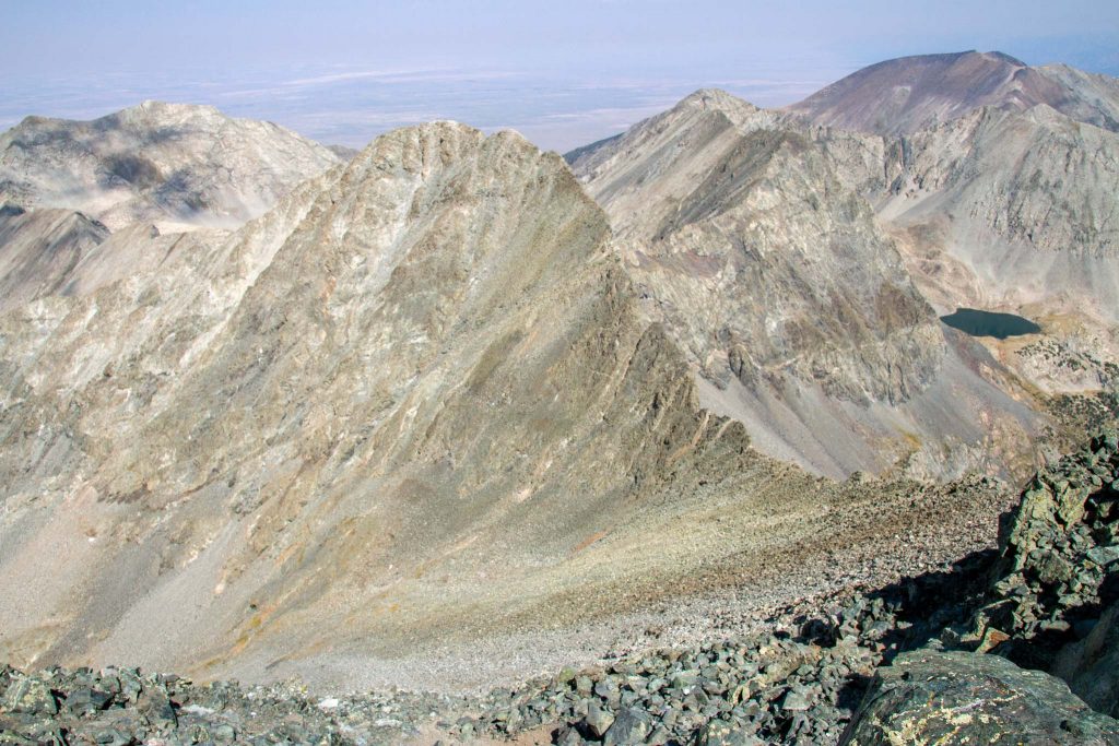
Additional Pictures
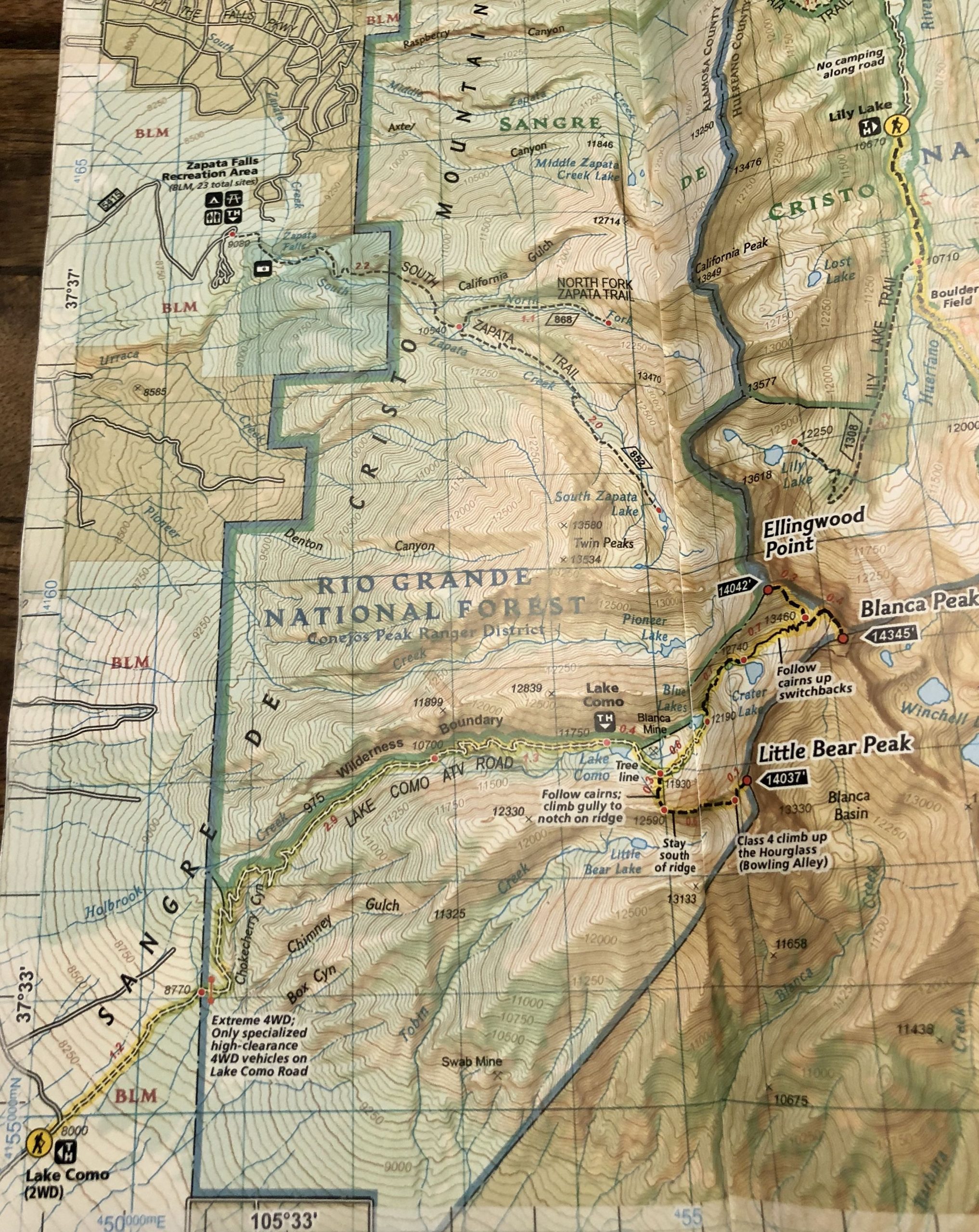
Lindsey From Ellingwood
Mount Lindsey in the distance
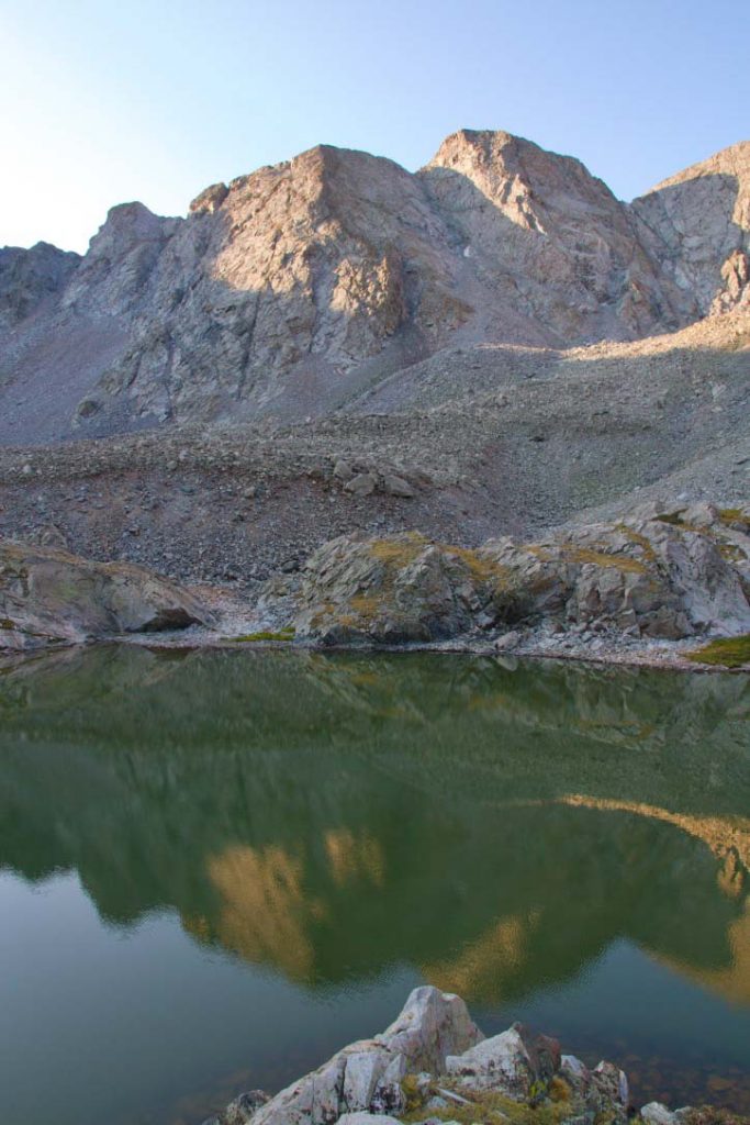
South Zapata Lake
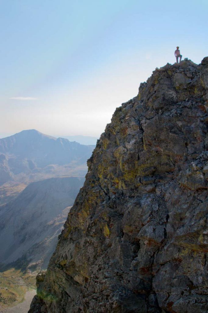
Ellingwood Point Near The Summit
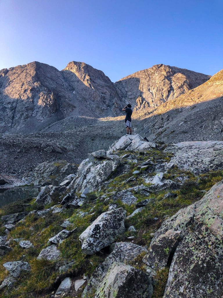
Views From South Zapata Lake
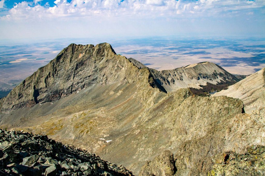
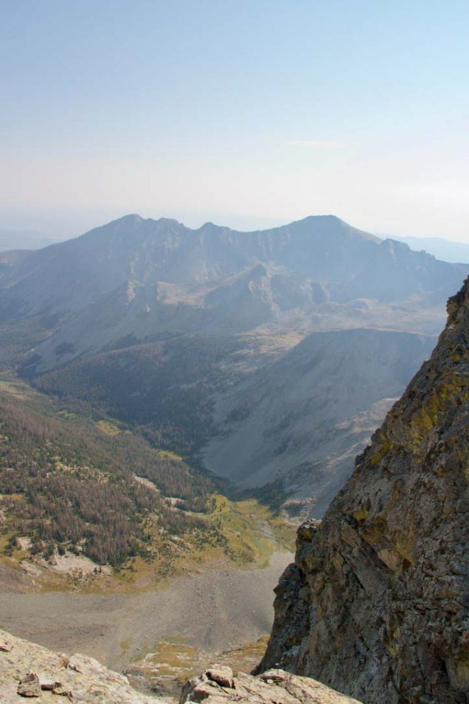
Little Bear from the summit of Blanca
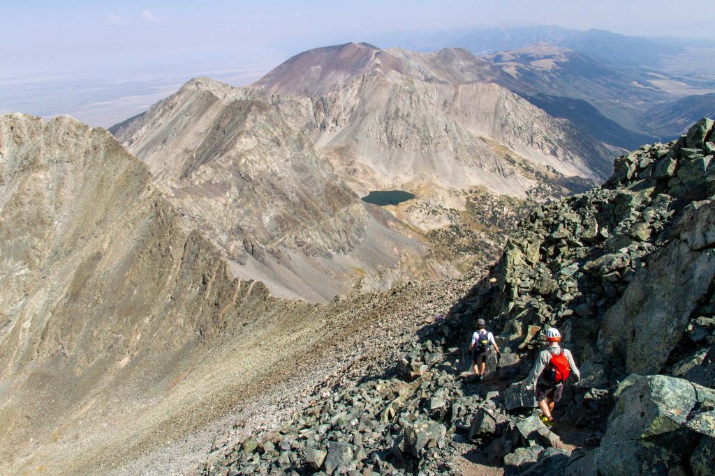
Heading back down from the Blanca Peak
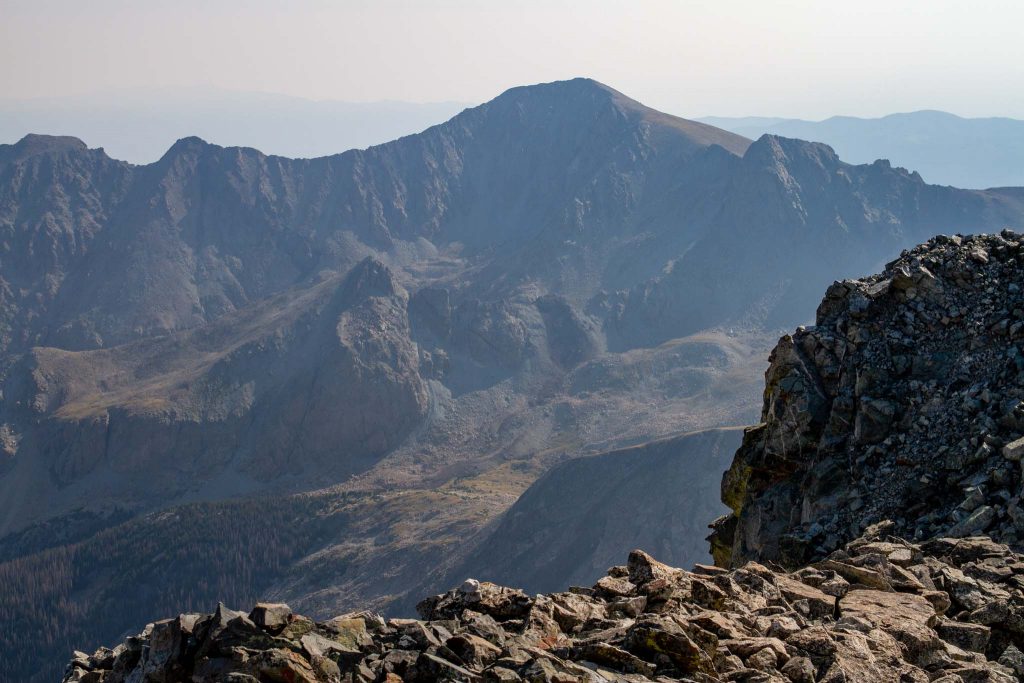
Ellingwood Point from Blanca
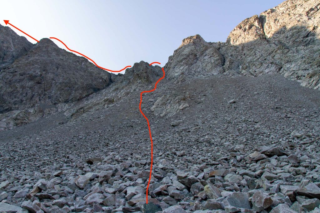
The Route From South Zapata Lake To Ellingwood

Max DesMarais is the founder of hikingandfishing.com. He has a passion for the outdoors and making outdoor education and adventure more accessible. Max is a published author for various outdoor adventure, travel, and marketing websites. He is an experienced hiker, backpacker, fly fisherman, backcountry skier, trail runner, and spends his free time in the outdoors. These adventures allow him to test gear, learn new skills, and experience new places so that he can educate others. Max grew up hiking all around New Hampshire and New England. He became obsessed with the New Hampshire mountains, and the NH 48, where he guided hikes and trail runs in the White Mountains. Since moving out west, Max has continued climbed all of the Colorado 14ers, is always testing gear, learning skills, gaining experience, and building his endurance for outdoor sports. You can read more about his experience here: hikingandfishing/about